Comprehensive Property Surveys in Santaquin, Utah — Expert Land Surveying for Accurate Boundaries and Development
Property surveys in Santaquin, Utah, establish legal boundaries, map site features, and produce the documentation needed for real estate transactions, permits, and construction. In this guide we walk through what a typical survey includes, why surveys matter for homeowners, buyers, and developers, and how the main survey types—boundary, ALTA/NSPS, topographic, civil site plans, and FHA foundation inspections—fit local needs in Utah County. You’ll learn how surveys lower risk in sales and building projects, which factors drive cost in Santaquin, and how to request a tailored quote. We also compare common deliverables, highlight modern tools like UAVs and GPS RTK, and explain how accurate surveys support zoning reviews and dispute resolution. For practical next steps, see our Ludlow Engineers Blog for when to order each survey type and what details to gather for a quote.
What Are Property Surveys in Santaquin, Utah — and Why They Matter
A property survey in Santaquin is a licensed professional service that locates and documents property lines, improvements, easements, and topography, then produces a certified plat or legal description used for title work, permits, and construction. The process combines historical record research, precise field measurement, monument work, and a formal drawing that records elevations, structures, and legal boundaries. For homeowners, a survey confirms fence and improvement placement; for buyers and lenders, it supports clear title and underwriting; for developers, it becomes the base map for design and permitting. Given Utah County permitting standards and local land-use rules, an accurate, code-compliant survey prevents delays and reduces the chance of costly disputes. Choosing the right survey up front saves time and money as projects move forward.
The sections below outline the primary components of a typical property survey and how those items protect owners and projects in Santaquin.
What Does a Property Survey Include in Santaquin, Utah?
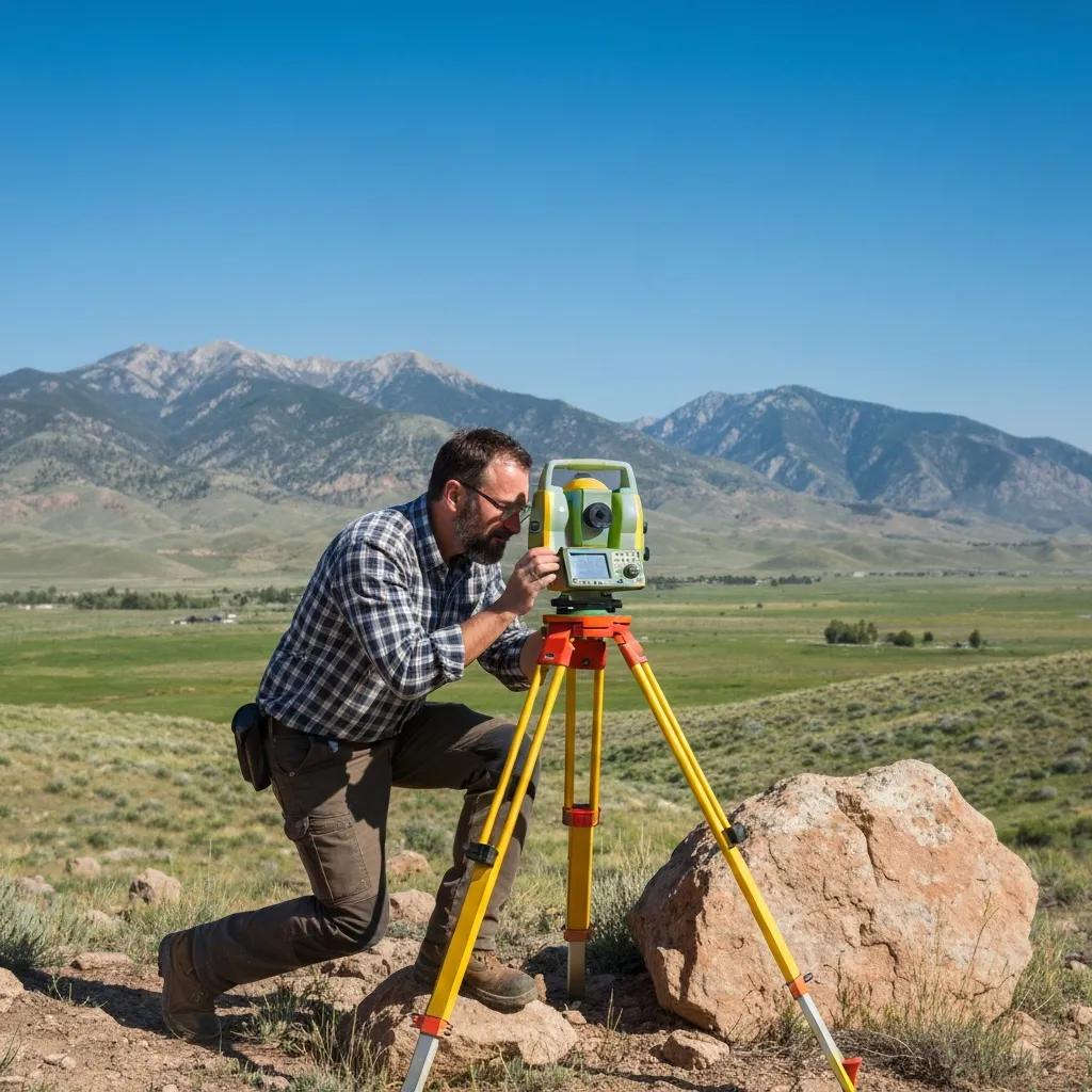
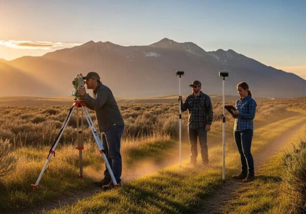
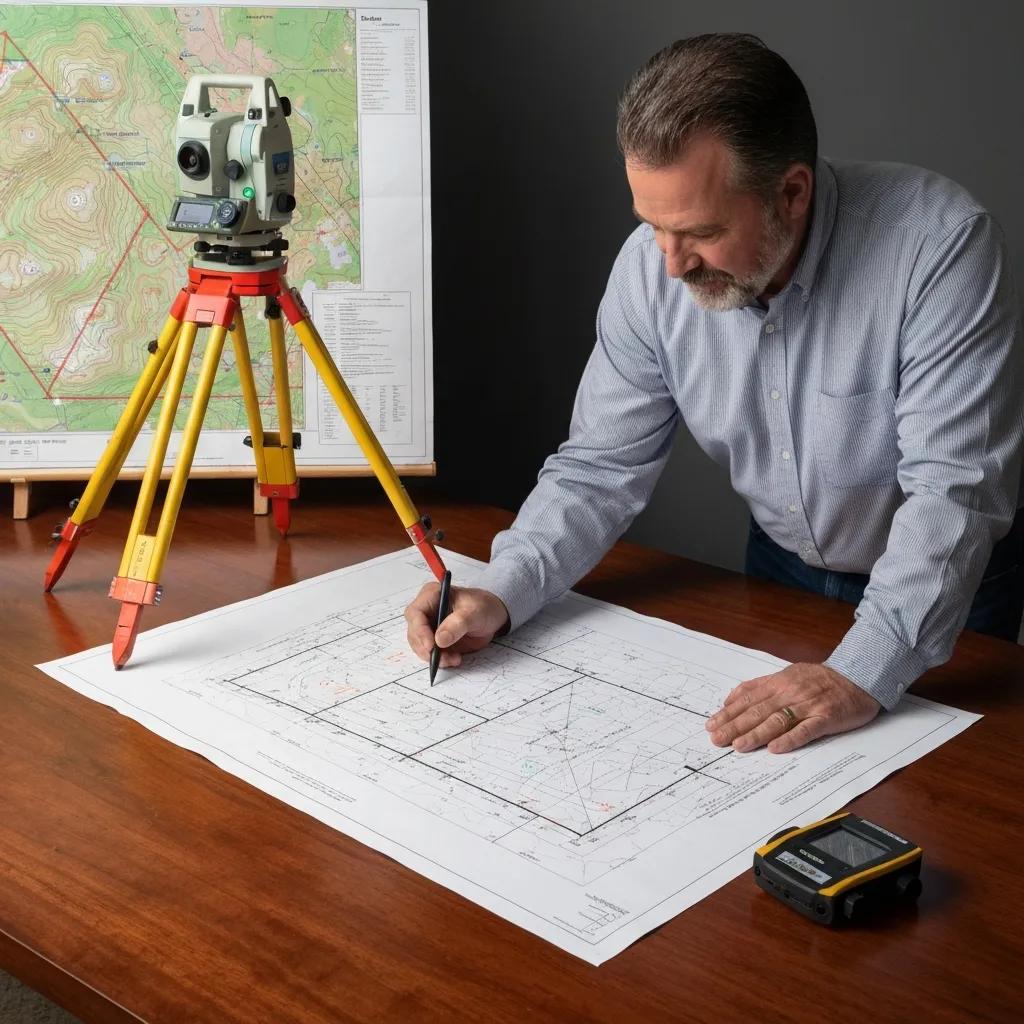
A standard property survey in Santaquin results in a survey plat, legal description, and field notes that document measured boundary lines, monuments, and visible improvements. Work generally begins with title and record research to locate deeds, easements, and prior plats, then moves to field measurements using GPS RTK, total stations, or similar equipment to locate corners and features. Typical deliverables include monumentation (set or found markers), a scaled plan showing buildings, fences, driveways, utility lines, and elevation points when required, plus notation of recorded easements and any apparent encroachments. These materials form the authoritative record used by title companies, planners, and contractors to verify legal lines and prepare permits. Knowing what a survey contains helps you order the right scope for sales, construction, or dispute resolution.
How Do Property Surveys Protect Your Land and Investment?
Surveys protect property owners by providing defensible evidence of boundaries, exposing encroachments early, and documenting compliance with local setback and permitting rules. When a survey shows a fence over the legal line or an unrecorded easement, those issues can be addressed before closing a sale or starting work, avoiding costly rework. Surveys also ensure accurate legal descriptions for title insurance and reduce the risk of claims that can delay transactions or lower value. In the Santaquin and Utah County context, survey documentation speeds permit reviews and supports subdivision or development applications by supplying the factual base planners require. Keeping surveys current turns uncertainty into clear, actionable information for any property decision.
Which Property Survey Types Are Available in Santaquin, Utah?
Several survey types serve distinct legal and design needs in Santaquin, from simple boundary verification to lender-grade ALTA/NSPS surveys and detailed topographic mapping for engineering. Choose the correct type based on your transaction or project: boundary surveys for ownership clarity, ALTA surveys for commercial closings, topographic surveys for grading and drainage design, civil site plans for permitting, and FHA foundation inspections for manufactured-home financing. Each survey produces specific outputs—plats, contours, certifications, or inspection reports—that feed directly into title work, engineering, and planning. The subsections below define each major survey type, explain when to order it, and show how their deliverables support common local outcomes.
Use this quick list to match your need to the right service:
- Boundary surveys: Determine and certify legal property lines for ownership, fencing, and disputes.
- ALTA/NSPS surveys: Lender-accepted, comprehensive documentation for commercial closings and complex title work.
- Topographic surveys: Map contours and features to guide grading, drainage, and civil design.
- Civil site plans: Produce permit-ready engineering drawings for utilities, grading, and construction limits.
- FHA foundation inspections: Verify manufactured-home foundations meet FHA standards required for financing.
This compact list helps you select the survey type you need and prepares you for the detailed descriptions that follow.
What Is a Boundary Survey and How Does It Define Property Lines?
A boundary survey establishes the legal corners and lines of a parcel by combining title research with precise field measurements and monumentation. Surveyors examine deeds, plats, and recorded easements to interpret boundary descriptions, then locate or set monuments in the field and measure distances and bearings to create a certified plat. The final deliverable certifies the property lines and often includes recommendations for remonumentation or fence adjustments. For legal disputes and real estate transactions, a boundary survey is the primary tool for clarifying ownership limits and preventing litigation. Knowing the research-to-field workflow helps property owners understand why accuracy and a licensed surveyor’s certification matter for enforceable results.
Typical steps for a boundary survey:
- Perform title and record research to gather deeds, plats, and easements.
- Take field measurements to locate monuments, corners, and visible improvements.
- Produce a certified plat showing boundaries, monuments, and any encroachments.
When Is an ALTA Survey Required for Santaquin Properties?
An ALTA/NSPS survey is required when lenders, title companies, or buyers need a uniform, highly detailed report for commercial property closings or complicated title matters. ALTA surveys follow national standards and typically include boundary lines, easements, utilities, zoning setbacks, and improvements, along with a checklist tailored to the title company’s needs. Because ALTA surveys are more comprehensive and often coordinate closely with title commitments, they’re commonly requested for commercial financings, portfolio transactions, or properties with multiple encumbrances. For Santaquin commercial sales or lender due diligence, ordering an ALTA survey early helps avoid closing delays by documenting title exceptions and site conditions to lender standards.
Next, we explain how topographic surveys supply the elevation data engineers rely on for design.
How Do Topographic Surveys Support Site Development in Santaquin?
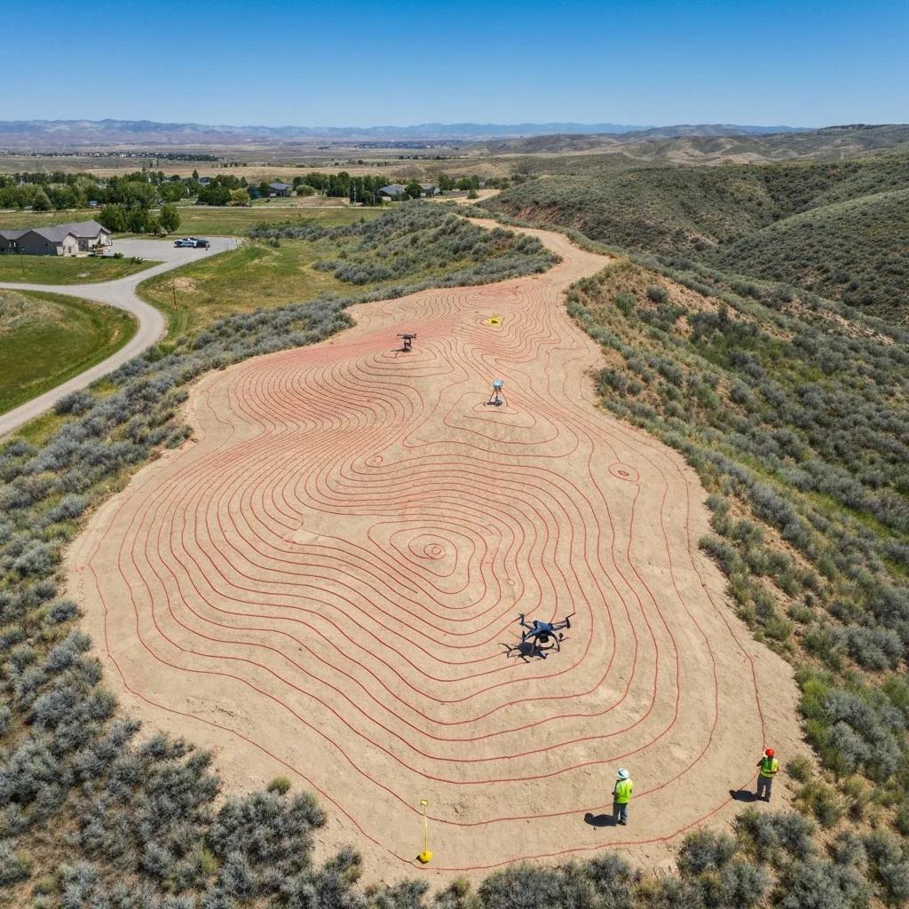
Topographic surveys map elevation contours, site features, and utilities to guide grading, drainage, and civil design on Santaquin properties. Deliverables include contour lines at specified intervals, spot elevations, and mapped surface features—information civil engineers use to size drainage, plan cut-and-fill, and locate utilities. Modern methods like UAV aerial mapping and LiDAR speed data collection over varied terrain and yield denser, more accurate surface models. On hillside or complex drainage sites in Utah County, reliable topographic data is the foundation for safe, code-compliant design and cost-effective earthwork planning.
The table below compares common survey types, their main uses, and typical deliverables to help you match a project need to the right survey.
What Are Civil Site Plans and Their Role in Local Construction?
Civil site plans translate survey data into permit-ready engineering drawings showing utilities, grading, drainage, and construction limits required by local authorities. These plans coordinate building locations, setbacks, parking, sanitary and storm utilities, and erosion control in the format planners and public works departments expect. Site plans are typically prepared with civil engineers and use topographic data to develop grading and drainage schemes that meet Utah County and Santaquin standards. For contractors and developers, accurate civil site plans reduce permitting cycles and provide the roadmap for construction staking and inspection. Clear coordination between the survey base map and engineered plans keeps projects moving from design through permit to build.
That prepares us to cover specialized inspections—like FHA foundation checks—needed for certain property types.
Why Are FHA Foundation Inspections Important for Manufactured Homes?
FHA foundation inspections verify that manufactured-home foundations meet the structural and documentation standards required for FHA-backed financing and resale in the secondary market. Inspectors check footing dimensions, anchoring, grade beams, and required clearances while documenting conditions that affect long-term performance. When a buyer or lender depends on FHA guidelines, an approved foundation inspection gives lenders the assurance they need. Common failure points include inadequate anchoring, improper grade, or missing documentation; fixing these issues before appraisal or closing avoids financing setbacks. For manufactured-home owners in Santaquin, timely foundation inspection and corrections speed financing and protect resale value.
These survey-type descriptions lead into transparent cost guidance and steps for requesting a custom quote.
How Much Does a Property Survey Cost in Santaquin, Utah?
Survey pricing in Santaquin varies because it reflects parcel size, survey type, site complexity, research depth, and requested deliverables. Key price drivers include acreage, terrain difficulty (steep slopes or dense vegetation), how many corners must be reestablished or monuments set, historical research time for older or poorly recorded parcels, and whether extra services like topographic mapping or ALTA-level detail are needed. Turnaround expectations and municipal coordination (permit-related data or record retrieval) also affect quotes. For accurate budgeting, request a tailored estimate that lists included tasks, timeline, and any assumptions about site access or record availability.
The table below highlights the primary cost-influencing factors so you can see what affects survey pricing.
What Factors Influence Land Survey Pricing in Santaquin?
Primary factors that determine a final survey quote include parcel acreage and access, existing monumentation, complexity of title research, required precision and deliverables, and any special conditions such as easements or multiple ownership interests. A small, cleared residential lot with visible corners typically needs less field time than a remote acreage with thick brush and missing monuments. ALTA surveys add title coordination and checklist items that increase research and drafting time. Understanding these factors helps you gather the right information—parcel ID, intended use, recent deeds—before contacting a surveyor for an itemized estimate.
Next is how to request a customized quote from a local provider.
How Can You Request a Customized Survey Quote from Ludlow Engineers?
To request a tailored quote, gather the property details (parcel ID or legal description, address, acreage) and state the survey purpose. Share any existing plats or title commitments you have to speed evaluation. Contact Ludlow Engineers and Associates with that information and a description of desired deliverables—boundary certification, ALTA checklist items, topographic contours, civil site plan, or FHA inspection—and expect a follow-up about site access and timing. We’ll prepare a written proposal that lists scope, assumptions, pricing, and expected turnaround so you can compare options with confidence. Clear project goals and any lender or title requirements help us deliver a prompt, accurate estimate.
That process naturally leads into how a local firm like Ludlow ensures accuracy and timely delivery for Santaquin surveys.
How Does Ludlow Engineers and Associates Ensure Accurate Property Surveys in Santaquin?
Ludlow Engineers and Associates combines regional experience with modern surveying methods to deliver accurate, defensible surveys across Central Utah, including Utah County and Santaquin. With decades of local practice and experience in development, site plans, small water and sewer projects, and land surveying, we pair historical record knowledge with current field technology to produce deliverables that meet permit and title needs. Our quality-control steps include thorough record searches, field verification of monuments, calibrated instruments, and careful drafting and certification so plats and legal descriptions are reliable for legal and construction use. Clients benefit from our local knowledge, practical engineering coordination, and technology that shortens timelines while maintaining precision.
Below is a quick map of the technologies and practices we use and the client benefits they deliver.
What Local Knowledge and Experience Does Ludlow Bring to Santaquin Surveys?
Based in Nephi and serving Central Utah, Ludlow Engineers and Associates has hands-on familiarity with Utah County records, Santaquin permitting practices, and the site conditions common to the region. That local knowledge shortens record research time and helps anticipate municipal submittal requirements, reducing revisions and permit delays. Our experience with development projects, civil site plans, and small water and sewer systems means survey outputs are coordinated to support engineering and permitting workflows efficiently. That combination of record familiarity and project-level experience helps clients move from survey to design and approval with fewer surprises and clearer cost visibility.
Next we highlight the specific technologies that improve accuracy and efficiency in the field.
Which Technologies Improve Survey Accuracy and Efficiency?
Modern surveying relies on tools that boost speed, accuracy, and the level of detail in deliverables: UAVs and LiDAR for rapid surface capture, GPS RTK for centimeter-level positioning, total stations for precise angles and distances, and laser scanning or 3D mapping for complex structures. These tools reduce field time and increase data density, enabling engineers to model drainage, clearances, and structure placement more accurately. Processing software ties field data to record research to produce certified plats, contour models, and coordinate files required by planners and title companies. For Santaquin projects with varied topography, using the right technology yields better inputs for design and lowers the chance of costly re-measurements.
Understanding these benefits helps property owners request technology-specific options when they seek a quote.
How Do Property Surveys Help Resolve Boundary Disputes and Meet Santaquin Regulations?
Surveys provide objective, documented evidence that resolves boundary disputes, supports legal decisions, and ensures development follows Santaquin and Utah County zoning and building codes. A clear, certified survey delineates ownership lines, notes encroachments or adverse possession indicators, and supplies the factual basis for neighbor negotiations, boundary adjustments, or legal remedies. Survey deliverables also show setbacks, easements, and topographic constraints that planners and code officials use during permit review. When disputes arise or permits are required, an up-to-date survey shortens administrative review and increases the chance of an amicable resolution without protracted litigation.
Below are typical dispute scenarios and how a surveyor’s process addresses each one with practical outcomes.
- Fence or landscape encroachment: research and field re-measurement identify the true boundary and propose corrective placement.
- Conflicting deeds or ambiguous descriptions: title research and monument re-establishment clarify legal lines.
- Construction setbacks dispute: certified setbacks from a survey support permit corrections or required adjustments.
What Are Common Property Line Disputes in Santaquin and How Are They Resolved?
Common disputes in Santaquin include fences over property lines, unpermitted structures near lot lines, and confusion caused by informal markers. Surveyors resolve these issues by researching records, re-establishing monumentation, and providing a certified plat to the parties involved. The process typically includes a written boundary opinion, visible corner marking in the field, and discussion of remediation options—repositioning fences, pursuing a lot line adjustment, or mediation. If neighbors cannot agree, the survey documentation becomes evidence for mediation or court. Ordering a survey early is often the most cost-effective way to prevent escalation and document the factual baseline for resolution.
This dispute-resolution discussion ties directly into how surveys support permitting and code compliance.
How Do Surveys Comply with Utah County Zoning and Building Codes?
Surveys meet land surveys and Santaquin requirements by documenting setbacks, lot lines, easements, and grade information that planners and building officials need for permit review. Deliverables—certified plats, contour maps, and engineered site plans—are prepared in formats accepted by local agencies, and surveyors coordinate with planners to clarify legal descriptions or site constraints. For lot splits, subdivisions, and grading permits, survey-based documentation provides the basis for staff review and public works coordination. Supplying accurate survey data up front reduces back-and-forth with agencies and helps keep projects on schedule.
With dispute resolution and code compliance covered, the next section helps you choose the right survey provider for residential or commercial needs in Santaquin.
Where Can You Find Trusted Residential and Commercial Land Surveyors in Santaquin, Utah?
Choosing a trusted surveyor in Santaquin means balancing local records knowledge, relevant experience, and the technical capabilities your project requires—residential boundary verification needs different deliverables than commercial ALTA surveys or civil site plans. Homeowners typically need timely boundary surveys, staking, lot splits, or FHA inspections, while developers and lenders look for ALTA surveys, topographic mapping, and permit-ready civil plans. Evaluate providers on their record research, equipment and accuracy, and ability to coordinate with engineers and title companies to deliver accepted formats for permitting and closings. A surveyor who understands Utah County procedures and communicates scope and deliverables clearly reduces risk and accelerates approvals.
Use these criteria when evaluating survey firms:
- Local records knowledge: reduces research time and prevents overlooked encumbrances.
- Technology and accuracy: ensures deliverables meet engineering and title standards.
- Clear scope and timeline: minimizes surprises and supports budgeting and scheduling.
What Services Do Residential Land Surveyors Provide for Homeowners?
Residential surveyors commonly provide boundary surveys, property staking, fence location, lot split surveys, FHA foundation inspections, and plat certification for title and permit needs. These services document how improvements relate to legal lines, confirm setbacks for additions or accessory structures, and create the paperwork required for sale, refinance, or construction. Residential work emphasizes prompt turnaround and clear explanations when encroachments or missing monuments are found. For homeowners in Santaquin, ordering the right residential survey early prevents surprises in real estate transactions and smooths permitting.
That prepares us to review how commercial surveyors support larger projects and transactions.
How Do Commercial Land Surveyors Support Developers and Real Estate Transactions?
Commercial surveyors provide ALTA/NSPS surveys, detailed topographic mapping, subdivision plats, construction staking, and coordination with title companies and civil engineers for development projects. These services meet the detail and documentation lenders and title companies require, supply engineers with accurate surface models for design, and deliver permit-ready documents for municipal review. Commercial work typically involves deeper research, tighter precision standards, and deliverables that match developer and planner expectations—helping prevent closing delays and design revisions. For complex transactions in Santaquin and Utah County, engaging surveyors experienced in commercial workflows ensures land records, title exceptions, and site constraints are handled up front.
When you’re ready to proceed, request a scoped quote that lists required deliverables, the timeline, and any anticipated municipal coordination.
Request a Quote: For tailored survey solutions in Santaquin and Central Utah—boundary certification, ALTA surveys, topographic mapping, civil site plans, or FHA foundation inspections—contact Ludlow Engineers and Associates with your parcel details and project goals to receive a customized proposal. We serve Utah County from our Central Utah practice, combining local records knowledge with modern surveying technology to deliver accurate, permit-ready documents.
This invitation gives a clear next step for readers who want service, while keeping the guide focused on practical, local decision-making.
Frequently Asked Questions
What is the difference between a boundary survey and an ALTA survey?
A boundary survey determines and certifies the legal property lines of a parcel and is commonly used for residential matters. An ALTA/NSPS survey is more extensive, follows national standards, and is typically required for commercial transactions—it includes boundaries, easements, utilities, zoning setbacks, and other items title companies and lenders need. Knowing the differences helps you select the right survey for your project or closing.
How long does it typically take to complete a property survey in Santaquin?
Turnaround depends on parcel size, site complexity, and survey type. A straightforward residential boundary survey can often be completed in a few days to a week, while ALTA or detailed topographic surveys take longer due to extra research and data processing. Discuss timelines with your surveyor so you have realistic expectations based on your specific property and needs.
Can property surveys help with zoning compliance in Santaquin?
Yes. Surveys document boundaries, setbacks, and easements—information local planners and building officials use to verify zoning compliance. An accurate survey reduces the risk of zoning violations and helps streamline permitting by clearly showing how proposed work relates to local rules.
What should I do if I disagree with a property survey result?
First, review the survey documents carefully for measurement or interpretation issues. If questions remain, consider a second surveyor’s opinion. You may also consult legal counsel if the disagreement involves title or access rights. Open communication with neighbors and the original surveyor often helps resolve misunderstandings before escalation.
Are there any specific regulations for property surveys in Utah?
Yes. Surveyors in Utah must follow standards set by the Utah State Board of Professional Engineers and Land Surveyors, which cover accuracy, documentation, and reporting. Local municipalities may also require specific deliverable formats. Work with a licensed surveyor familiar with both state standards and local submission requirements to ensure compliance.
How can I prepare for a property survey?
Gather deeds, prior surveys, and any existing plats. Clear access where possible—remove obstructions, trim vegetation, and mark gates or access points. Tell the surveyor about known easements or boundary disputes. Providing this information up front speeds the process and improves accuracy.
What are the benefits of using modern technology in property surveys?
Modern tools—drones, LiDAR, GPS RTK, total stations, and 3D scanning—boost accuracy and speed. They capture complex terrain and dense data sets for reliable topographic models and certified plats. Advanced processing software streamlines deliverable creation, shortening turnaround while improving quality. For clients, that means clearer answers, fewer site visits, and better inputs for design and permitting.