
Drone & UAV Surveying Services in Utah
Faster, safer, and more detailed than ground surveying alone. Drone-based aerial surveying for construction, mining, agriculture, solar, and land development — anywhere in Utah.
Home› Our Services› Drone & UAV Surveying
Updated May 2026 · By Travis Ludlow
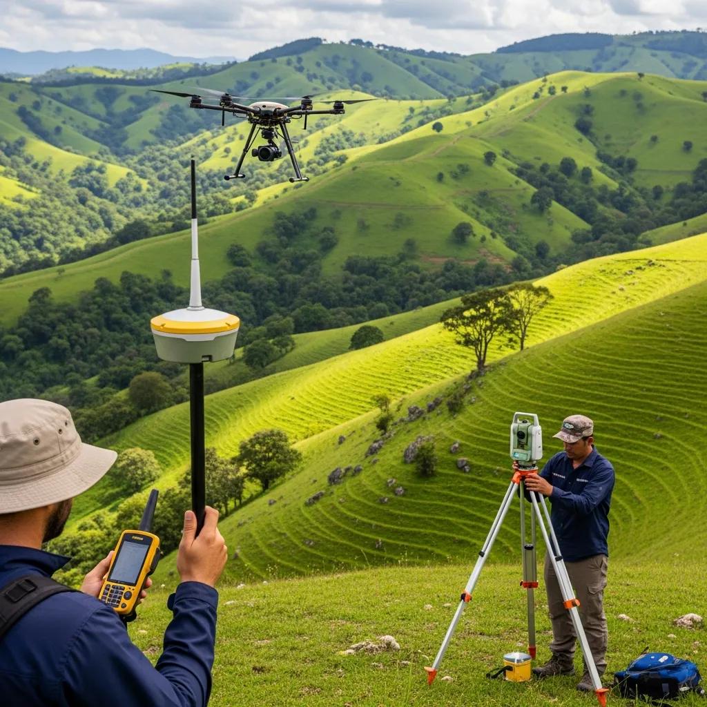
Looking for fast, accurate drone surveying in Utah? Ludlow Engineering's UAV surveying crews combine FAA Part 107-certified pilots with Utah-licensed Professional Land Surveyors, giving you survey-grade aerial data — orthomosaics, digital elevation models, 3D point clouds, and volumetric measurements — at a fraction of the cost and time of ground-only surveying. We've been Utah's go-to land surveying and civil engineering firm since 1975, and drone-based aerial surveying is now part of nearly every large project we touch. Call (435) 623-0897 or request a quote online.
A two-person ground crew might take a week to walk and stake a 50-acre site. A drone can map the same area in 90 minutes with higher point density and zero risk to surveyors. The savings show up as both lower fees and faster project delivery.
What Is Drone (UAV) Surveying?
Drone surveying — also called UAV (Unmanned Aerial Vehicle) surveying or aerial mapping — uses small unmanned aircraft equipped with high-resolution cameras, LiDAR sensors, or both to collect spatial data from above. That raw data is then processed into the deliverables your project actually needs: orthomosaic site maps, contour drawings, digital terrain and surface models, 3D point clouds, and volumetric calculations.
For Utah projects, drone surveying answers questions ground crews answer slowly: How many cubic yards of dirt are in that stockpile? What did the site look like last month versus today? Where exactly does this 200-acre parcel slope toward the wash? Done right — with FAA-certified pilots, properly placed ground control points, and a licensed PLS reviewing the deliverables — drone data is as accurate as traditional ground surveying for the vast majority of commercial work.
What You Get From a Ludlow Drone Survey
Every UAV survey produces a defined set of deliverables — not just "some photos." Depending on the project, your package may include any combination of the following, all delivered in the file formats your engineer, architect, contractor, or accountant can actually open:
Orthomosaic Map
A high-resolution, geo-referenced aerial photo of the entire site — measurable in CAD, GIS, or any modern viewer. Resolutions typically 1–2 cm per pixel.
Digital Surface & Terrain Models
DSMs and DTMs (also called DEMs) give you accurate elevation surfaces — for grading design, drainage analysis, and existing-conditions documentation.
Contour Drawings
Topographic contours at the interval your engineer needs (1', 2', 5'), delivered as DWG, DXF, or PDF, ready for civil design.
3D Point Clouds
Dense LAS/LAZ point cloud files for advanced analysis in Civil 3D, AutoCAD, ReCap, Bentley, or any point-cloud-capable software.
Volumetric Measurements
Cubic yard calculations for stockpiles, cut/fill quantities, mine and quarry inventory, and earthwork verification — with documented accuracy.
3D Site Models
Textured 3D models for marketing, planning, public presentations, or stakeholder review. Suitable for embedding on web pages and in slide decks.
Progress & Time-Series Maps
Repeat flights captured weekly or monthly let you track construction progress, settlement, erosion, or vegetation change over time.
Engineer-Stamped Surveys
When the project needs a sealed legal-grade deliverable, our in-house Utah PLS surveyors review and stamp the work — the drone is just one of our tools.
Utah Industries We Serve With Drone Surveying
Drone surveying isn't right for every job, but for the ones where it fits, it changes the economics. These are the Utah industries we work in most often:
Construction & Site Development
Pre-construction topos, monthly progress maps, earthwork verification, and as-built documentation. We work with general contractors, civil engineers, and developers across the Wasatch Front and central Utah. Drone-based topos for sites over ~5 acres are usually faster and cheaper than ground surveys.
- Pre-construction site topography
- Cut and fill verification
- Progress documentation for owner reporting
- Final as-built documentation

Mining, Quarry & Aggregate
Utah's mining and aggregate operations rely on accurate volumetric data for inventory, royalty calculations, and reserve estimation. Drone surveying captures full operation volumetrics in hours — work that historically took a ground crew days and exposed personnel to active equipment.
- Stockpile volumetric reports
- Pit and quarry surface modeling
- Monthly or quarterly inventory flights
- Reserve and depletion calculations
Agriculture & Irrigation
For Utah farmers and ranchers, drone surveying produces field-level elevation data for irrigation planning, drainage redesign, and pivot system layout. Multispectral imagery also supports crop-health monitoring and precision agriculture programs.
- Pivot and flood irrigation topo surveys
- Drainage and tail-water management
- Pasture and acreage measurement
- Multispectral / NDVI flights on request
Solar, Wind & Infrastructure
For Utah's growing renewable energy sector, accurate site data drives every design decision. We provide pre-construction topos for utility-scale solar arrays, terrain data for wind siting, and aerial surveys of linear infrastructure including roads, pipelines, and transmission corridors.
- Utility-scale solar pre-construction topo
- Wind site terrain & access road planning
- Linear corridor mapping (roads, pipelines)
- Post-construction as-builts

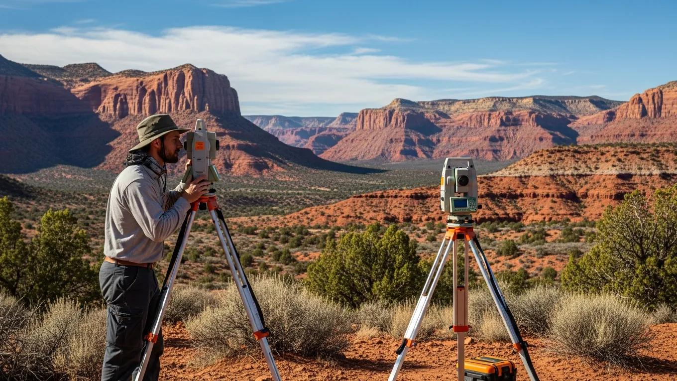
Drone Surveying vs. Traditional Ground Surveying
Neither method is universally better — they answer different questions. Most of our projects use both. Here's how they compare on the dimensions that matter:
| Dimension | Drone (UAV) Surveying | Traditional Ground Surveying |
|---|---|---|
| Speed on large sites | 50–1,000+ acres per day | 5–20 acres per day |
| Typical horizontal accuracy | 1–3 cm with proper GCPs | 5 mm – 2 cm |
| Typical vertical accuracy | 3–5 cm | 5 mm – 1 cm |
| Point density | Millions of points across the entire surface | Discrete measured shots |
| Safety on active sites | Crew stays off the operating area | Crew walks the active site |
| Best for | Topo, volumetrics, progress mapping, large parcels | Legal boundary work, control, dense vegetation, ultra-precision |
| Limitations | Weather, dense canopy, restricted airspace | Time, terrain access, line-of-sight obstructions |
The right answer is usually a combination: drone surveying for the surface data, ground crews for control points and any legal boundary corners. Because we run both in-house, you get the right method for each part of the project without coordinating two firms.
Why Choose Ludlow for Utah Drone Surveying
"Drone services" companies have multiplied in Utah over the last few years. Most are good photographers; few are surveyors. Here's the difference that matters:
Ludlow Engineering
- FAA Part 107 pilots backed by Utah-licensed PLS surveyors
- Survey-grade deliverables — not just photos
- 45+ years in Utah surveying and civil engineering
- Stamped legal-grade work when the project requires it
- Ground crew available for control points and verification
- Same Utah firm handles drone + ground + civil engineering
Drone-Only Vendors
- Pilot certified but no surveying credential
- Pretty pictures, no legal-grade accuracy claims
- Often new to the industry
- Can't sign or seal deliverables for permits
- You'll need a separate surveyor anyway
- Coordination across multiple vendors
Our Drone Surveying Process
Every UAV project follows the same workflow. We'll explain it in detail on the first call.
Project Scoping & Quote
You tell us the site, the deliverables you need, and the accuracy required. We respond with a fixed-fee quote, a timeline, and any FAA airspace considerations.
Flight Planning & Permits
We file required FAA notifications, plan flight altitude and overlap, and design the ground control point (GCP) layout for the accuracy your project demands.
Field Work — GCPs and Flight
Ground crew sets and surveys the GCPs. Pilots fly the planned mission, capturing imagery and (when specified) LiDAR data.
Data Processing
Imagery is processed using industry-standard photogrammetry software (Pix4D, Agisoft Metashape, or equivalent). Point clouds are filtered, classified, and georeferenced.
PLS Review & Delivery
A licensed Utah Professional Land Surveyor reviews the deliverables before they leave our office. You receive files in CAD, GIS, PDF, and/or LAS formats — whatever your team needs.
Drone Surveying Pricing in Utah
Drone survey pricing depends on site size, accuracy required, deliverables, and how often you need the flight repeated. The ranges below are typical starting points for Utah projects. For an exact quote, call (435) 623-0897.
| Project Type | Typical Scope | Typical Price Range |
|---|---|---|
| Small site topo (under 10 acres) | Orthomosaic + contours + DTM | $1,500 – $3,500 |
| Mid-size site topo (10–50 acres) | Orthomosaic + contours + DTM + DSM | $3,000 – $7,500 |
| Large site topo (50–500 acres) | Full topographic package + point cloud | $5,000 – $20,000+ |
| Stockpile volumetric (single) | Volume report + before/after surface | $1,200 – $3,500 |
| Monthly progress flights | Recurring orthomosaic + comparison | Quote-based subscription |
| Solar / wind / utility corridor | Linear or large-parcel mapping | Quote-based |
| 3D model + marketing assets | Textured 3D site model | $1,500 – $5,000 |
Most quotes include the flight, ground control, processing, one round of deliverable revisions, and PLS review. Active airspace, large mobilization distances, or LiDAR (instead of photogrammetry) can change pricing. Every quote is fixed-fee, in writing, with deliverables defined up front.
We are homebuilders and have used Ludlow Engineering throughout the state of Utah to do the layout of all of our houses. They are prompt, professional, and thorough. Enjoy working with them.
Walter Graves — Utah Homebuilder
Counties & Regions We Serve
Our office is in Nephi, but our drone crews mobilize statewide. Drone projects often involve travel — we factor it into the quote so there are no surprises:
We also regularly fly missions in Millard County, Juab County, Wasatch County, Carbon County, and southern Utah's Iron and Washington counties.
Frequently Asked Questions
How accurate is drone surveying compared to ground surveying?
With properly placed ground control points (GCPs), drone surveying typically achieves 1–3 cm horizontal accuracy and 3–5 cm vertical accuracy. Traditional ground surveying can achieve sub-centimeter accuracy when needed. For topographic mapping, volumetrics, and progress documentation, drone accuracy is more than sufficient; for legal boundary monumentation and high-precision control, ground methods are still preferred. Most of our projects use both.
How much does a drone survey cost in Utah?
Small site topos start around $1,500–$3,500. Mid-size sites (10–50 acres) typically run $3,000–$7,500. Large sites and recurring monthly flights are quoted based on size, deliverables, and frequency. See our pricing table above for typical ranges. Every quote is fixed-fee with deliverables defined in writing.
What deliverables do I get from a drone survey?
Depending on the project: orthomosaic maps, digital terrain models (DTMs), digital surface models (DSMs), contour drawings, 3D point clouds (LAS/LAZ), 3D textured models, volumetric reports, and time-series progress comparisons. Files are delivered in the formats your team uses — CAD, GIS, PDF, LAS — not in a vendor-locked viewer.
Can a drone survey replace a boundary survey?
No. Legal boundary corners require physical monumentation by a licensed Professional Land Surveyor on the ground. A drone survey produces excellent topographic and visual data, but it cannot set or verify legal corners on its own. We routinely combine the two: drone for the surface, ground crew for the corners — all sealed by our in-house PLS.
How fast can you fly a drone survey?
Field time is usually one day for sites under 500 acres. The bigger driver of total timeline is data processing and PLS review — typical end-to-end delivery is 2–3 weeks from contract signing. Rush turnaround is available for time-sensitive projects.
Do you have FAA-certified pilots?
Yes. All Ludlow drone pilots hold an active FAA Part 107 Remote Pilot Certificate. We file required airspace notifications and waivers, and we maintain insurance appropriate to commercial UAV operations.
How does weather affect drone surveying?
Rain, high winds (typically above 25 mph), snow, and dense fog will postpone a flight. Most Utah projects can be scheduled around the weather without adding significant time, and we keep flight windows flexible during peak seasons. We never compromise data quality to "make a window" — flying in marginal weather produces marginal results.
Can drones map under trees or vegetation?
Photogrammetry-based drone surveys cannot see through tree canopies — only the top of the canopy is captured. For surveys where bare-earth elevation under vegetation matters, we use LiDAR-equipped drones, which can penetrate light to moderate canopies. For dense forest, traditional ground surveying remains the most reliable option.
Do you serve clients outside central Utah?
Yes. We mobilize drone crews statewide. Travel costs may be reflected in the quote for distant locations, but we don't decline projects based on distance — recent mobilizations have included Salt Lake County to the north, Iron and Washington counties to the south, and eastern Utah's Carbon and Wasatch counties.