Expert Land Surveys in Utah County: Comprehensive Services and Solutions for Accurate Property Mapping
Accurate land surveys in Utah County establish legal property boundaries, produce reliable maps and legal descriptions, and provide the foundation for any responsible property transaction or development. This article explains what modern land surveying delivers, why precision matters for homeowners and developers in Utah County, and how specific survey types — boundary, ALTA/NSPS land title, topographic, civil site plans, subdivision mapping, and UAV aerial surveying — address common needs. Readers will learn cost drivers that influence quotes, how to evaluate surveyors, and practical steps to request a tailored proposal. The guidance emphasizes local factors such as zoning, easements, and terrain that commonly affect projects in Utah County and outlines the technologies used to improve accuracy and speed. If you need a survey for a property purchase, construction staking, or title work, this guide maps the questions to ask and the deliverables to expect, followed by clear next steps to request service.
Why Are Accurate Land Surveys Essential in Utah County?
An accurate land survey defines property corners, legal descriptions, control points, and benchmarks so owners and professionals can make legally defensible decisions. Surveys reduce risk by clarifying ownership lines, revealing easements, and showing zoning-related constraints that affect development, permitting, and financing. In rapidly developing areas of Utah County, reliable surveys prevent costly rework during site design and avoid disputes that can lead to litigation or title delays. Accurate field measurements and properly documented maps also streamline interactions with planners, title companies, and lenders by providing the standardized records those stakeholders require. The next paragraphs examine the specific advantages of precise boundary surveys and how survey outputs support zoning compliance and project approvals.
What Benefits Do Precise Boundary Surveys Provide for Utah County Properties?

A boundary survey precisely locates property corners, monuments, and lines on the ground while producing a legal description and recorded map that supports transactions and disputes. Homeowners rely on boundary surveys to resolve fence placement, landscape improvements, and neighbor boundary questions, while buyers use them to confirm what is included with a parcel before closing. For developers and builders, an accurate boundary survey prevents layout errors during site planning and ensures building envelopes respect setbacks and easements. A typical boundary deliverable set includes a field map showing monuments, a written legal description, and certified surveyor notes — all of which become essential when filing plats, obtaining permits, or defending property positions.
- Boundary surveys prevent ownership disputes and clarify corner locations.
- They provide legal descriptions needed for deeds and title work.
- Deliverables support accurate site layout and reduce construction change orders.
These practical benefits lead directly into how surveys intersect with zoning and permitting for Utah County development.
How Do Land Surveys Support Development and Zoning Compliance in Utah County?
Land surveys translate measured property geometry into the documents planners and permitting authorities require to evaluate compliance with local zoning and subdivision rules. Survey outputs identify setbacks, buildable areas, recorded easements, and slope constraints that directly affect site design, grading, and drainage plans. Topographic features captured by surveys inform stormwater management, cut-and-fill estimates, and utility routing, reducing unexpected costs during the design phase. By delivering accurate base data early, surveys shorten review cycles and lower the risk of costly redesigns or permit denials, which is especially important in Utah County’s changing development landscape.
- Surveys reveal regulatory constraints before final design.
- Topographic data supports grading and stormwater planning decisions.
- Early survey coordination reduces permit review time and redesign risk.
For property owners ready to act on identified risks or development needs, consider requesting a professional survey service promptly to secure accurate, actionable data and reduce downstream delays.
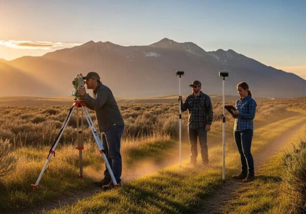
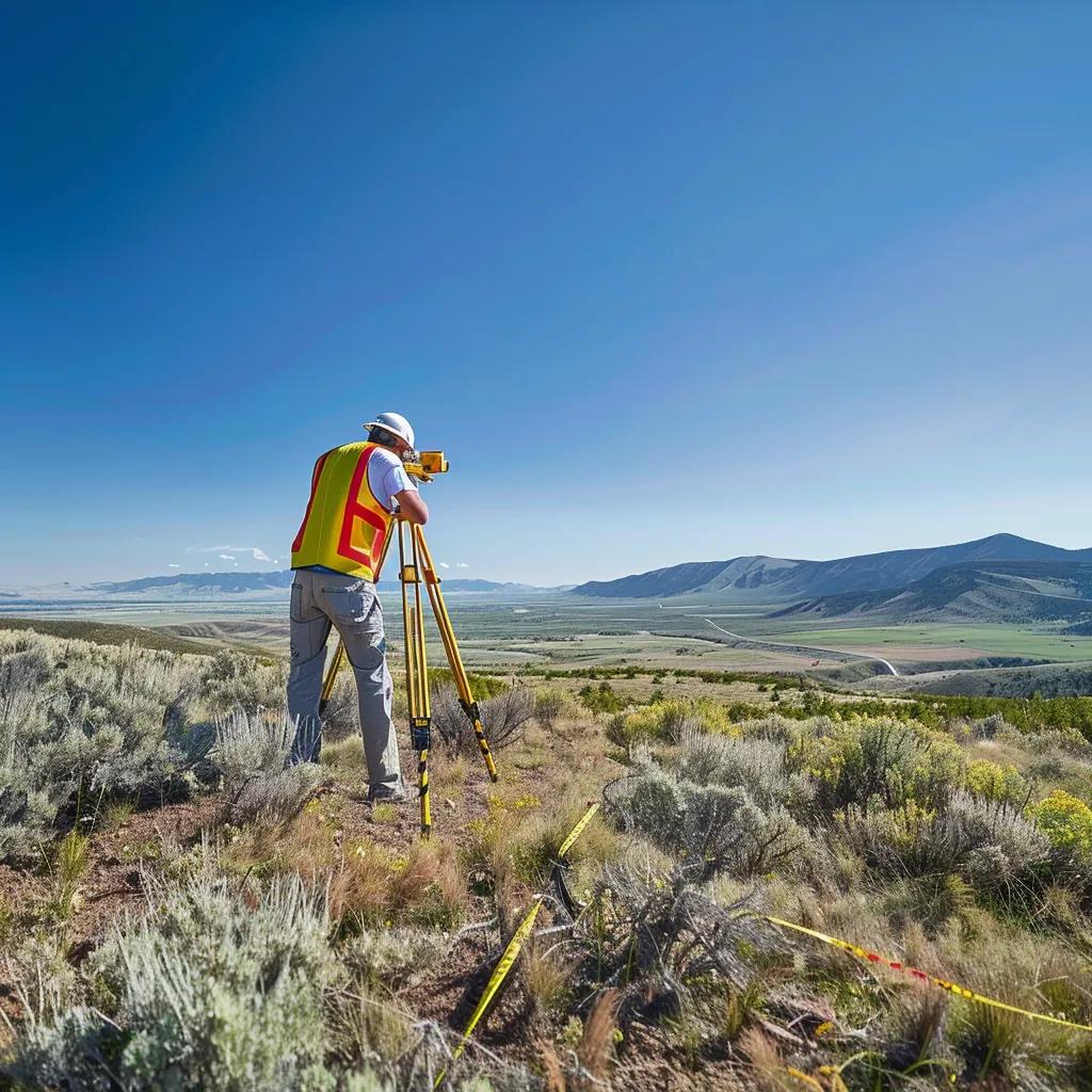
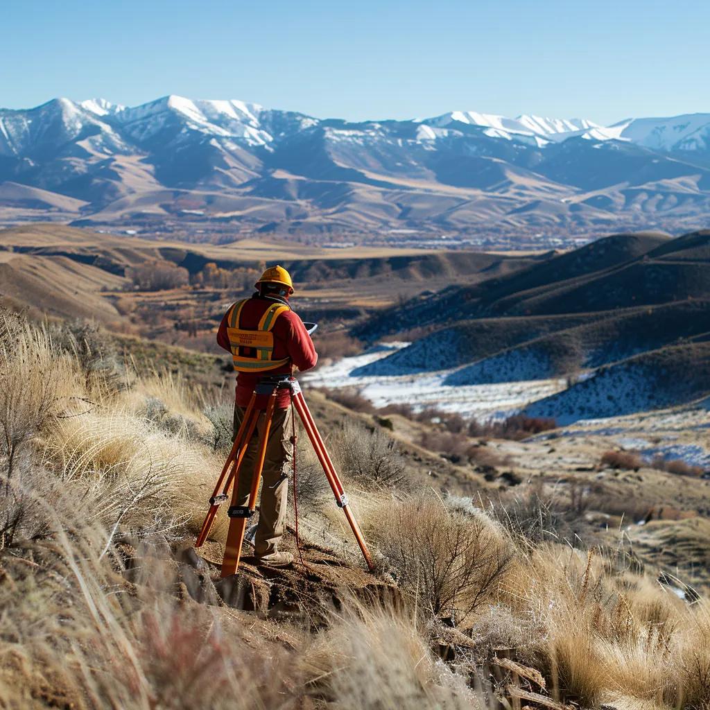
What Types of Land Surveying Services Are Available in Utah County?
Utah County property owners can access a range of survey services tailored to different legal, design, and construction needs; each service produces distinct deliverables and suits particular use-cases. Primary service categories include Boundary Surveys for property lines, ALTA/NSPS Land Title Surveys for commercial closings, Topographic Surveys for design and grading, Civil Site Plans and Subdivision Surveys for development, and UAV aerial surveying and 3D scanning for rapid, high-resolution mapping. Technology choices — GNSS/RTK, total stations, drone photogrammetry, and laser scanning — are selected based on project scale, required accuracy, and budget. The table below compares common survey types by purpose, deliverables, typical turnaround, and use-cases to help readers pick the right approach for their Utah County project.
This comparison clarifies how each service aligns with common project goals. In the following H3 subsections we describe each survey type, when to use it, and provide a concise note that Ludlow Engineering and Associates provides each of these services within Central Utah, including Utah County, for readers who want a direct service option.
What Is a Boundary Survey and When Is It Needed in Utah County?
A boundary survey locates recorded corners and monuments and prepares a legal description and certified map used for deeds and recordation, making it essential for property transfers and dispute resolution. Common triggers for ordering a boundary survey include buying or selling land, installing fences or improvements near a property line, subdividing a parcel, or resolving conflicting deeds and recorded plats. Typical deliverables include a plat showing monuments and bearings, a sealed certificate from a professional surveyor, and a written legal description. Ludlow Engineering and Associates provides boundary survey services for Utah County properties and can produce the certified maps and descriptions necessary for title work or municipal filings.
- Use boundary surveys when purchasing property to confirm extents.
- Order a survey before building fences, patios, or accessory structures.
- Obtain a survey to document monuments before platting or lot splits.
This foundational understanding connects naturally to why ALTA/NSPS standards matter for commercial transactions.
How Do ALTA/NSPS Land Title Surveys Facilitate Commercial Transactions in Utah County?
An ALTA/NSPS Land Title Survey follows national standards to document property improvements, easements, rights-of-way, and title-related matters that lenders and title insurers require for commercial closings. The ALTA format includes a certified map plus selectable Table A options that expand scope to address fence locations, zoning, or other lender concerns; selecting appropriate Table A items reduces transaction risk and clarifies underwriting requirements. Common benefits include improved title insurance coverage, clearer risk allocation, and fewer surprises during due diligence for commercial or multi-parcel deals. Ludlow Engineering and Associates offers ALTA/NSPS surveys with guidance on Table A selections so clients can meet lender and insurer expectations for Utah County transactions.
The 2021 ALTA/NSPS Standards introduced key changes impacting commercial real estate transactions.
Selecting the right Table A items balances cost and risk and directly supports favorable commercial closings in Utah County.
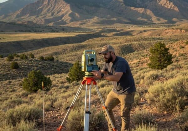
What Are Topographic Surveys and How Do They Aid Utah County Development?
Topographic surveys measure natural and man-made features and produce contour maps and surface models that designers use for grading, drainage, and site layout decisions. Contour intervals and spot elevations enable engineers to model stormwater runoff, design retaining walls, and size drainage infrastructure to meet local codes and best practices. For sites with uneven terrain, topographic data reduces design uncertainty and helps planners understand slope constraints and cut-and-fill requirements before construction starts. Ludlow’s topographic services can deliver contours, digital terrain models, and GIS-ready files to support civil engineering workflows for Utah County projects.
- Topographic surveys support accurate grading and drainage design.
- Contour maps inform cut-and-fill estimates and erosion control planning.
- Deliverables often include CAD and GIS-compatible elevation models.
This practical mapping capability ties directly into site planning and platting workflows for construction and subdivision projects.
How Do Civil Site Plans and Subdivision Surveys Guide Utah County Construction Projects?
Civil site plans and subdivision surveys convert field data into engineered plans, plats, and permit documents required for municipal approvals and construction. The workflow typically follows measured survey data being transformed into utility plans, grading and drainage designs, road layouts, and subdivision plats that comply with county regulations and subdivision ordinances. Early coordination between surveyors, civil engineers, and planners minimizes rework during review and ensures proposed lot lines, easements, and public improvements meet local standards. Ludlow Engineering and Associates provides integrated surveying and civil engineering services that streamline the data handoff from survey to design for projects across Utah County.
- Survey Data Collection: Establishes control and documents existing conditions.
- Site Design: Uses survey data to locate improvements and utilities.
- Plat & Permit Preparation: Produces final documents for recording and approval.
These staged deliverables keep projects on schedule and provide a clear audit trail for permitting and construction.
What Are the Advantages of UAV Aerial Surveying and Advanced Technologies in Utah County?
UAV aerial surveying and 3D laser scanning provide fast, high-resolution site mapping that reduces field time and produces orthomosaics, point clouds, and accurate elevation models suitable for large or complex sites. Drones are particularly cost-effective for expansive parcels, progress monitoring, and collecting imagery where ground access is constrained, while laser scanners capture detailed as-built geometry for structures and intricate terrain. When combined with GNSS/RTK control, UAV deliverables integrate into CAD and GIS workflows to accelerate design and quantity takeoffs. Ludlow Engineering leverages UAV photogrammetry and modern surveying equipment to provide precise, timely deliverables that support planning and construction in Utah County.
- UAVs produce orthomosaics and DSM/DTM quickly for large sites.
- 3D laser scanning captures detailed as-built geometry for complex features.
- Combining UAV and ground control yields survey-grade accuracy for mapping.
These technology choices inform cost and scheduling considerations discussed next.
How Much Does a Land Survey Cost in Utah County and What Factors Affect Pricing?
Survey costs vary because each project’s scope, terrain, and deliverables differ; a direct estimate requires project-specific details and record research. Primary cost drivers include the survey type (boundary vs ALTA vs topographic), property size and parcel complexity, terrain and vegetation that affect access, the need for historical record research, and required deliverables such as full-size stamped maps, CAD files, or 3D models. Time-sensitive schedules, municipal coordination, and additional services (e.g., monument replacement or utility locates) also increase cost. For a reliable estimate, provide parcel information and the survey purpose so firms can account for field time and research; Ludlow Engineering and Associates offers customized quotes and a consultation to outline scope and expected fees for Utah County projects.
For quick reference, common cost factors include:
- Survey type and required level of certification.
- Property size, terrain difficulty, and vegetation density.
- Record complexity and number of title/plat documents to research.
- Deliverable formats (paper maps, CAD/GIS, 3D models) and turnaround needs.
This breakdown helps clients anticipate which aspects of their project will influence the final quote and what information to include when requesting a customized estimate.
What Property and Terrain Factors Influence Survey Costs in Utah County?
Topographic complexity, steep or rocky slopes, dense vegetation, and limited access significantly increase on-site time and equipment effort, thereby raising cost. Parcels with unclear or fragmented record history, multiple easements, or overlapping plats require more research and title coordination to produce defensible maps and legal descriptions. Urban lots with confined access and underground utilities often demand additional utility-locate work and coordination, whereas rural parcels may require longer travel and control setup. Weather and seasonal conditions in Utah County can also affect field productivity and scheduling, so clients should factor in potential timing adjustments when planning surveys.
- Steep or broken terrain raises labor and safety costs.
- Dense vegetation increases clearing or scanning time.
- Complicated title histories add record research hours.
These considerations determine whether a standard boundary survey suffices or if expanded deliverables and field methods are necessary to ensure accuracy.
How Can You Request a Customized Land Survey Quote from Utah County Experts?
Prepare basic project details to receive an accurate quote: property address or parcel number, survey purpose (sale, development, permit), desired deliverables (paper map, CAD/GIS files, digital models), and any relevant documents such as deeds or prior plats. After you submit these details, expect an initial scope review followed by a proposal that outlines anticipated field time, research needs, deliverables, and a timeline for completion. For specialized work — ALTA surveys, subdivision plats, or UAV mapping — allow time for additional coordination with title companies or municipal reviewers. To request a tailored quote or discuss your project scope, contact Ludlow Engineering and Associates by phone at (435) 623-0897 or through their web presence and request a consultation to start the Call For Service process.
- Provide parcel identifier and survey purpose.
- Specify required deliverables and any deadlines.
- Request a proposal that lists scope, cost estimate, and schedule.
Clear initial information speeds the proposal process and reduces the need for multiple revisions.
How to Choose the Right Land Surveyor in Utah County?
Selecting a surveyor requires verifying technical qualifications, local experience, and the ability to produce the deliverables and certifications your project needs. Essential selection criteria include a licensed professional surveyor in Utah, evidence of local project experience in Utah County, sample deliverables (maps and legal descriptions), and confirmation of professional liability coverage. Technology capabilities — GNSS/RTK, UAV photogrammetry, and 3D scanning — matter when projects require higher resolution or faster turnaround. Communication, clear milestones, and responsiveness during the quote phase are indicators of a smooth project experience. The checklist below summarizes key items to verify when vetting potential surveyors.
- Verify state licensure and ask for sample signed plats.
- Confirm experience with local zoning, platting, and permitting.
- Ask about equipment, deliverable formats, and QA processes.
These verification steps reduce procurement risk and ensure you select a firm that can meet Utah County requirements and timelines.
What Qualifications and Experience Should You Look for in Utah County Land Surveyors?
Look for a licensed professional surveyor with demonstrable experience completing boundary, ALTA, topographic, and subdivision projects in Utah County or the surrounding Central Utah region. Ask for representative deliverables that match your project type and confirm familiarity with local recording conventions, county platting processes, and common easements or utility practices. Inquire about technology and data formats — for example, whether the firm provides CAD, GIS, or 3D point-cloud deliverables — and request references for similar projects. Local experience reduces surprises during permitting and improves coordination with county planners and title companies.
- Request sample maps and legal descriptions for similar projects.
- Confirm familiarity with Utah County permitting and recording processes.
- Verify technology capabilities and deliverable compatibility with your design team.
These criteria help ensure a qualified surveyor will deliver defensible, usable data for your project.
Why Choose Ludlow Engineering and Associates for Your Utah County Land Survey Needs?
Ludlow Engineering and Associates is a civil engineering and land surveying firm serving Central Utah, including Utah County, with integrated in-house professional engineers and land surveyors. The company emphasizes client-focused planning and proactive coordination to reduce design bottlenecks, offering services such as Boundary Surveys, ALTA/NSPS Land Title Surveys, Topographic Surveys, Civil Site Plans, UAV Aerial Surveying, and FHA Foundation Inspections. With local project experience and a combined surveying and engineering workflow, Ludlow can produce maps, legal descriptions, and engineering deliverables that support permitting and construction. For a tailored scope and to initiate a Call For Service, contact Ludlow Engineering and Associates by phone at (435) 623-0897 to request a customized quote and consultation.
- Integrated in-house survey and engineering expertise.
- Service coverage across Central Utah, including Utah County.
- Range of services that span survey, mapping, and civil plans.
This focused capability helps clients move from measured data to permit-ready designs with fewer handoffs and clearer responsibilities.
What Are Common Questions About Land Surveys in Utah County?
Homeowners and developers frequently ask about accuracy, equipment, timelines, and what deliverables include; concise answers help set expectations and streamline procurement. Typical concerns include how precise surveys are for different project needs, which technologies produce the accuracy required, how long fieldwork and deliverable preparation take, and what legal certifications accompany recorded maps. The following subsections address these PAA-style questions with practical detail and direct links to the deliverables and technologies discussed earlier.
How Accurate Are Land Surveys Typically in Utah County?
Survey accuracy depends on the survey type, control network, and equipment used: GNSS/RTK and total-station work can achieve centimeter-to-decimeter accuracy for control and detailed features, while ALTA and boundary surveys aim for legally defensible monument placement and measured positional accuracy consistent with professional standards. Environmental conditions, monument preservation, and the presence of reliable control affect achievable tolerances, and more stringent projects may require redundant control and detailed QA checks. Discuss accuracy requirements with your surveyor up front so they can specify methodology, expected tolerances, and certification language suitable for lenders or municipal reviewers.
- GNSS/RTK yields high positional accuracy for open sites.
- Total stations provide precise angular and distance measurements.
- QA and monumentation practices determine legal defensibility.
Understanding these factors helps match the method to the accuracy your project demands.
What Equipment and Technologies Are Used in Utah County Land Surveys?
Modern surveys typically use GNSS/RTK receivers for rapid control, total stations for precise distance and angle measurement, UAVs for orthophotos and DSMs, and 3D laser scanners for dense point clouds of complex structures. Each technology has practical trade-offs: GNSS is efficient for large open areas, total stations excel in tight or urban environments, UAVs reduce field time for broad areas, and scanners capture high-detail as-built geometry. Deliverables are commonly produced in CAD and GIS formats and can include orthomosaics, DEMs, and point clouds to support engineering and planning workflows.
- GNSS/RTK offers fast, georeferenced control for wide-area surveys.
- Total stations provide reliable control in obstructed environments.
- UAV photogrammetry and laser scanning enhance resolution for site mapping.
These technology choices inform both schedule and cost for your project scope.
How Long Does a Land Survey Take in Utah County?
Timelines vary by survey type and complexity: a simple residential boundary survey often completes in a few days to a couple of weeks from site visit to deliverable, while ALTA surveys, subdivision plats, or projects requiring extensive record research can take several weeks to months. Fieldwork duration is driven by parcel size and terrain, while data processing, drafting, review, and municipal coordination add to total schedule. Weather, permitting agency review cycles, and additional stakeholder coordination (title companies, lenders) can extend timelines, so clients should allow buffer time for thorough research and QA.
- Boundary surveys: days to weeks depending on access and records.
- ALTA and subdivision work: multiple weeks for fieldwork and research.
- Complex topographic or as-built projects: extended processing for high-resolution deliverables.
Setting clear deadlines during the quote phase helps align expectations and delivery milestones.
What Is Included in a Land Survey Report for Utah County Properties?
Standard survey deliverables include a sealed survey map or plat, a written legal description, surveyor certification, field notes, and monumentation records; optional deliverables can include CAD files, GIS shapefiles, orthomosaics, DSMs, and 3D point clouds. Certification language varies by survey type: ALTA/NSPS surveys include standardized declarations and Table A options, while boundary surveys include declarations suitable for recording. Additional items such as foundation inspections, as-builts, or construction staking are provided as separate deliverables and should be specified in the scope to ensure proper pricing and scheduling.
- Core deliverables: sealed map, legal description, certification, field notes.
- Digital deliverables: CAD, GIS, point clouds, or DEMs when requested.
- Optional services: construction staking, as-builts, foundation inspections.
Clarifying required deliverables at the outset reduces scope creep and ensures the quote addresses all expected outputs.
Where Can You Find Trusted Land Surveying Companies in Utah County?
Finding reputable local surveyors involves checking licensure, reviewing sample deliverables, and confirming local project experience and technology capabilities. Evaluate providers by asking for references, sample maps, explained workflows for QA and monumentation, and their familiarity with Utah County recording and permitting practices. Community planning departments and title companies can indicate firms that routinely produce acceptable deliverables for local reviews. Below is a compact checklist to guide vendor evaluation and to prepare for contacting a firm for a quote.
What Services Do Leading Utah County Land Surveying Companies Offer?
Leading firms typically offer the core portfolio of services needed across residential and commercial projects: Boundary Surveys, ALTA/NSPS Land Title Surveys, Topographic Surveys, Civil Site Plans, Subdivision Platting, UAV Aerial Surveying, 3D laser scanning, construction staking, and as-built documentation. When vetting providers, ask specific questions about turnaround times, file formats, monumentation practices, and their process for coordinating with planners, title companies, and lenders. The list below highlights commonly offered services and recommended vetting questions to compare firms effectively.
- Core services include boundary, ALTA, topo, site plans, and UAV mapping.
- Ask about sample deliverables, QA processes, and file compatibility.
- Confirm experience with local permitting and recording workflows.
This checklist helps you compare firms on substantive capabilities rather than marketing claims.
How to Contact Ludlow Engineering and Associates for Expert Land Surveying in Utah County?
To initiate a survey request or to request a customized quote, prepare your parcel information, describe the survey purpose, and specify desired deliverables before contacting the firm. Ludlow Engineering and Associates serves Central Utah including Utah County and offers in-house civil engineering and land surveying services; prospective clients can call (435) 623-0897 to start the Call For Service process and request a consultation. When you call, provide the property location, survey type needed, and any deadlines so the team can outline a scoping plan and an estimated timeline for proposal delivery.
- Gather parcel ID, survey purpose, and desired deliverables.
- Call (435) 623-0897 to request a consultation and customized quote.
- Expect a scope review and a written proposal listing costs and schedule.
These steps streamline the intake process and help the firm provide an accurate, actionable proposal for your Utah County survey needs.