Expert Land Survey Company in Juab County: Comprehensive Services and Local Expertise
Ludlow Engineers and Associates provides professional land surveying and civil engineering services in Juab County to ensure accurate property boundaries, regulatory compliance, and smooth project delivery for rural and developing sites. This article explains the core land surveying services available in Juab County, practical cost guidance for common survey types, and the technology and processes that produce reliable results for property owners and developers. Many landowners and project managers need clarity about boundary lines, ALTA requirements, topographic mapping, and modern UAV aerial surveying before committing to site work or real estate transactions; this guide addresses those needs with Juab County–specific context. You will learn which survey type fits your situation, what affects land survey cost in Juab County, how the surveying process unfolds here, and how modern tools like GPS, total stations, and drones improve speed and accuracy. The following sections cover service definitions and uses, a cost guide with example ranges, local experience and quality assurances, step-by-step process details tied to Juab County recorder interactions, and technology benefits for working in Central Utah terrain.
What Land Surveying Services Does Ludlow Engineers Offer in Juab County?
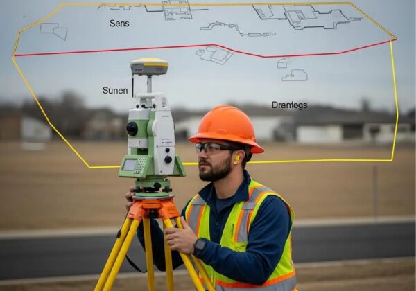
Land surveying services in Juab County define property lines, map elevations, and prepare survey products needed for permitting, title transfer, and construction. Accurate boundary surveys, ALTA surveys, and topographic surveys serve different legal and practical needs by combining record research, monumentation, and field measurement to create certified survey maps. For project planning and subdivision work, construction staking and subdivision surveys translate design into control points on site, reducing rework during grading and building. Understanding how each survey type supports transactions and development helps property owners choose the right deliverable and avoid delays with the Juab County Recorder.
Ludlow Engineers and Associates performs core survey types suited to Central Utah properties, and can be contacted by phone for a quote or to discuss project specifics. Their team offers in-house professional engineers and surveyors who coordinate record research and fieldwork to deliver precise maps and files suitable for permitting and title needs. For owners considering a boundary determination, ALTA for a commercial closing, or a topo for site design, an initial review with a surveyor clarifies scope and expected outcomes. The following subsections define available survey types and describe how each supports development and legal compliance in Juab County.
Which Types of Land Surveys Are Available in Juab County?

Boundary surveys determine property lines and locate monuments, helping resolve disputes and prepare accurate legal descriptions for transfers; they are essential when ownership or fence lines are unclear. ALTA surveys meet title insurance and commercial transaction standards, combining boundary research with evidence of easements, rights-of-way, and improvements to satisfy lenders and insurers during closings. Topographic surveys map elevations and site features—contours, drainage, and utilities—providing the base for site design, grading plans, and floodplain evaluation on rural and developed parcels. Construction staking converts design drawings into physical stakes and layout points on site for foundations, utilities, and grading, reducing costly mistakes during build-out. Subdivision surveys and FHA foundation inspections are other specialized services that support land division and loan/insurance compliance in local transactions. Choosing the right survey type begins by matching your intended use—sale, permit, development, or title insurance—to the deliverable and accuracy standard required.
How Do These Surveys Support Property Development and Legal Compliance?
Surveys translate legal records into on-the-ground reality; they reconcile deeds, plats, and county records with existing monuments and physical improvements to produce a legally defensible map. For developers, an ALTA or detailed topographic survey short-circuits permitting delays by showing easements, setback lines, and topography that affect design and drainage plans. Boundary surveys reduce the risk of disputes and title exceptions by locating corners and documenting visible encroachments, which supports clear legal descriptions for transfers or easement agreements. Survey deliverables—certified plats, digital CAD files, and GIS layers—feed into civil engineering design and title insurance processes, making surveys the connective tissue between legal documents and construction execution. Properly prepared surveys aligned with Juab County recorder expectations streamline recording and reduce downstream issues during permitting and sales.
- Common survey uses in Juab County include: Preparing legal descriptions for sale or transfer. Supporting title insurance and commercial closings with ALTA standards. Providing base maps for civil site design and grading plans.
How Much Does a Land Survey Cost in Juab County, Utah?

Land survey cost in Juab County varies by survey type, property size, terrain, and the level of record research required, but typical ranges provide a starting point for budget planning. For a simple boundary survey on a small residential lot, expect lower-range fees, while ALTA surveys for commercial parcels or topographic mapping for large, rugged properties incur higher costs due to greater field time and deliverable complexity. Important cost drivers include acreage, access difficulty, vegetative cover, number of monuments to be located, and requested deliverables such as CAD, GIS, or recorded plats. Below is an EAV-style comparison of typical price ranges and attributes to make initial comparisons clearer before requesting a tailored quote.
What Factors Influence Land Survey Pricing in Juab County?
Several variables influence survey pricing and scheduling: the survey type, property area, terrain steepness, vegetation cover, and complexity of title and record research. Easements, multiple deed references, and historic plats increase the research time required and can raise costs, as does the need for an ALTA-compliant report with title company coordination. Remote or rugged parcels in Juab County take longer to access and survey accurately; UAV aerial surveying can reduce field time on large or agricultural parcels but adds processing time for orthomosaics or DEMs. Understanding these factors helps clients anticipate cost drivers and decide which deliverables offer the best value for their project needs.
- Primary cost factors: Survey type and accuracy standard requested. Property size, shape, and accessibility. Record research complexity and required deliverables.
How Can You Get an Accurate Quote from Ludlow Engineers?
To obtain a precise quote, provide property location information (address or parcel number), the survey type desired, approximate acreage, and any available plats or prior surveys to speed record research. Include the intended use of the survey—sale, permitting, construction, or title insurance—since deliverable requirements vary by purpose and may affect scope. Call the office or request a quote by phone with the project contact name and a brief description of site access and any site constraints; expect a prompt follow-up to confirm scope and scheduling. Providing clear project objectives and any existing documentation reduces back-and-forth and helps deliver an accurate, timely estimate.
- What to include in an initial inquiry: Parcel address or county parcel number. Desired survey type and intended use. Any existing plats, easement info, or title instructions.
Why Choose Ludlow Engineers as Your Juab County Land Survey Partner?
Ludlow Engineers and Associates combines local presence in Nephi with in-house licensed surveyors and civil engineers to deliver surveys and civil deliverables tailored to Juab County conditions. Local knowledge of county-record processes and terrain patterns reduces filing issues with the Juab County Recorder and improves field efficiency on rural parcels and agricultural sites. The firm prioritizes clear communication, delivering certified plats, CAD files, and GIS-ready data that integrate with civil design workflows and title insurance requirements for commercial transactions. Readers seeking a partner for boundary resolution, ALTA surveys, or topographic mapping receive a consistent project manager and point of contact to streamline coordination from initial inquiry through final delivery.
- Familiarity with Juab County recorder expectations and typical document formats.
- Coordination between surveyors and in-house engineers for cohesive site planning.
- Single point of contact for quotes, scheduling, and deliverable review.
These strengths lead naturally to client confidence in project timelines and fewer surprises during permitting and recording, which is especially important for developers and property owners managing transactions.
What Local Experience and Expertise Does Ludlow Engineers Bring?
Based in Nephi, Ludlow Engineers works across Central Utah and maintains practical knowledge of local land-use patterns, parcel configurations, and recorder workflows that affect survey outcomes. In-house professionals perform title and record research, field monumentation, and technical drafting to produce recordable plats and digital deliverables. Being locally based enables the firm to respond promptly to site conditions and coordinate with county staff when necessary to clarify recorder requirements. This regional experience translates into fewer resubmissions and improved alignment with county expectations for recorded surveys.
Local expertise shortens administrative cycles and ensures that survey products meet Juab County needs; the next section explains quality assurance measures that preserve accuracy and client satisfaction.
How Does Ludlow Ensure Client Satisfaction and Survey Accuracy?
Quality assurance begins with thorough record research and continues through controlled field measurements, peer review of draft plats, and clear client review before finalization. Fieldwork uses redundant measurements and monument verification to reconcile recorded corners with physical evidence, reducing the likelihood of boundary discrepancies after delivery. Draft plans are reviewed internally for compliance with survey standards and Juab County recorder specifications, and deliverables are provided in formats suited to client use—PDF plats, CAD layers, or GIS exports—so results integrate with engineering and title workflows. Open communication during each phase allows clients to review findings and request clarifications before recording.
This systematic QA approach produces reliable outputs and reduces the risk of costly rework during development or closings.
How Does the Land Surveying Process Work in Juab County?
The land surveying process in Juab County follows a sequence of inquiry, record research, fieldwork, drafting, and delivery, with coordination as needed for county recording or title company review. Clear scope definition up front ensures the correct accuracy standard and deliverable package, while early engagement with the Juab County Recorder or title company (for ALTA work) clarifies special filing or certification requirements. Fieldwork is scheduled based on site access and seasonal constraints, and final maps are prepared for client review and recording. Understanding this process helps property owners anticipate timing, approvals, and necessary inputs to keep projects on schedule.
Below is a step-by-step overview that outlines typical actions and expected timeframes for Juab County surveys.
- Inquiry and scope confirmation with parcel details and intended use.
- Record and title research to assemble deeds, plats, and easement data.
- Field survey to locate monuments, improvements, and topographic features.
- Drafting, internal QA, and client review of plats and deliverables.
- Finalization and recording or delivery of certified survey products.
What Are the Key Steps from Initial Contact to Survey Completion?
Initial contact begins with a scope discussion and collection of parcel identifiers and intended deliverables, which frames record research and field mobilization. During record research, surveyors gather deeds, prior plats, and easement documentation to prepare for locating monuments and reconciling discrepancies in the field. Fieldwork establishes control points, measures features and elevations, and locates existing improvements; this data then feeds into drafting and plat preparation. After internal review and client approval, certified plats are provided for recording or used for design and construction, completing the survey cycle.
This ordered approach reduces surprises and tightens timelines for permitting and closing processes.
How Does Ludlow Communicate and Collaborate Throughout the Project?
Project communication uses a designated point of contact who schedules field visits, provides progress updates, and shares deliverables in client-preferred formats such as PDF, CAD, or GIS data. Regular progress check-ins during drafting and prior to finalization allow clients to ask questions and request clarifications, while recorded deliverables include clear certification notes and monumentation descriptions for recorder submission. For ALTA surveys, coordination includes confirming title company requirements to ensure the survey meets insurer expectations. Timely communication and shared deliverables reduce rework and help projects proceed smoothly from survey completion to recording or construction.
Clear deliverable packages and documented communication lines ensure clients know when filings with the Juab County Recorder are complete.
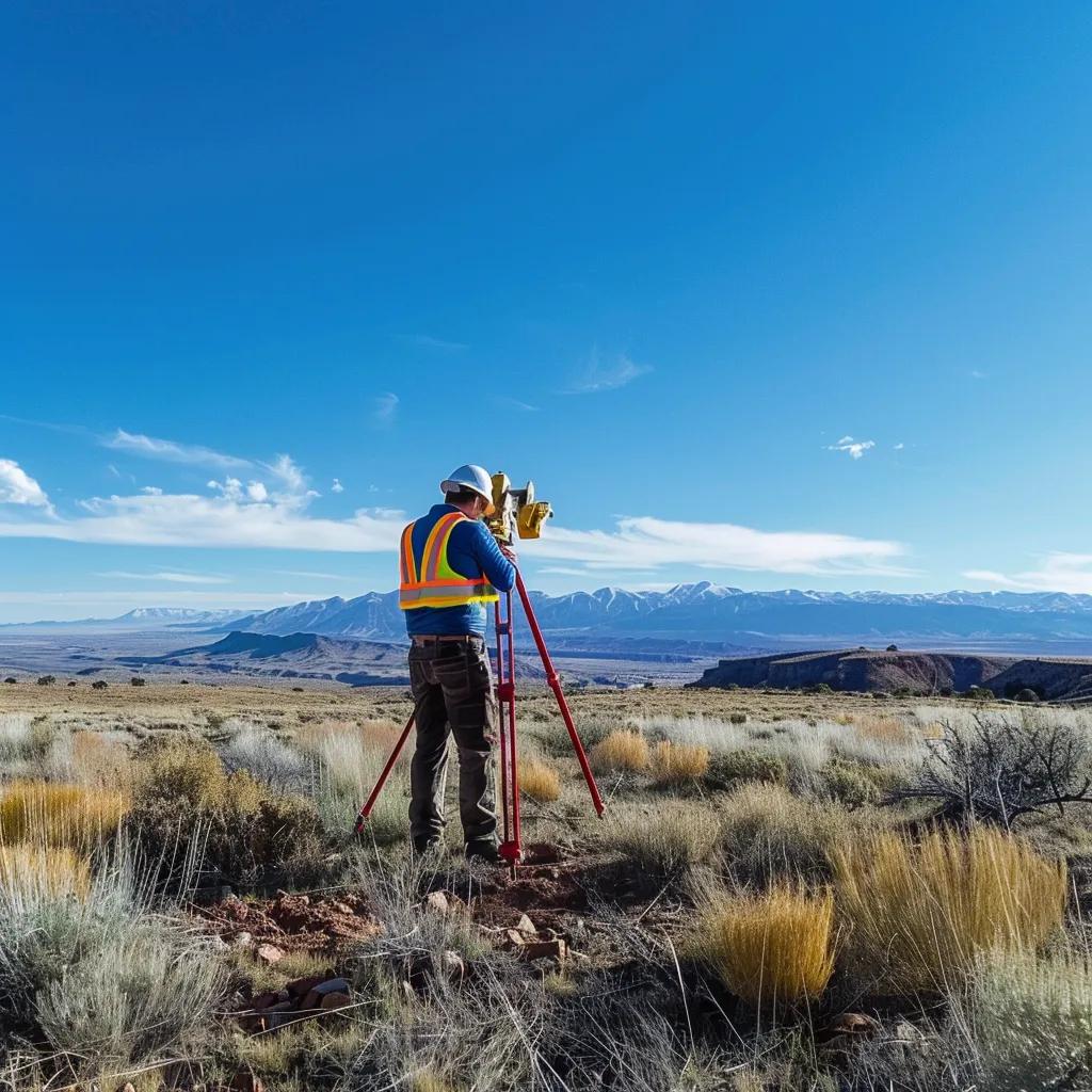
What Advanced Technologies Does Ludlow Engineers Use for Juab County Surveys?
Modern surveying technologies—RTK GPS, total stations, UAV drone mapping, LiDAR, and GIS integration—combine to deliver faster, more accurate survey products for Juab County projects. These tools allow surveyors to establish precise control, capture detailed topographic data on large parcels, and process orthomosaics or DEMs for design and analysis. Using a mix of ground-based and aerial platforms improves access in steep or agricultural terrain and shortens field time compared with labor-only methods. Below is a technology EAV comparison that links each tool to what it measures and the practical value it brings to local projects.
How Do UAV Drones and Aerial Surveying Improve Accuracy and Efficiency?
UAVs produce high-resolution orthomosaics and digital elevation models (DEMs) that reduce time in the field for large parcels and provide dense data for contour generation. For agricultural tracts, grazing lands, and steep canyons typical of parts of Juab County, aerial mapping captures inaccessible areas safely and yields deliverables suitable for grading, drainage, and volumetric analysis. Drone-derived products complement ground control from RTK GPS, ensuring vertical and horizontal accuracy meets survey standards for topographic mapping. Using UAVs often reduces mobilization costs and accelerates data collection, translating to faster project turnaround for clients.
These aerial methods complement ground surveys and lead into how GPS and total stations provide the baseline accuracy for boundary and staking work.
What Role Do GPS and Total Stations Play in Precise Land Surveys?
GPS, particularly RTK workflows, establishes rapid control across open sites with centimeter-level horizontal accuracy, enabling efficient topographic surveys and control for UAV processing. Total stations provide high-precision measurements for monument relocation, boundary point verification, and construction staking where line-of-sight measurements and angular accuracy are critical. Combining GPS and total station data creates redundancy and improves confidence in final coordinates, which is essential when preparing recordable plats or staking building footprints. This complementary approach ensures reliable results across varied Juab County terrains and project types.
Reliability from combined technologies reduces boundary uncertainty and supports smoother permitting and construction phases.
What Are Common Questions About Land Surveying in Juab County?
When Is a Land Survey Required in Juab County?
A land survey is commonly required for property sales, refinances, subdivisions, new construction permits, and when title insurance or lender requirements specify an ALTA survey. Surveys are also prudent when property lines are in dispute or when improvements like fences or driveways raise boundary questions. For filing requirements and specific recording formats, consult the Juab County Recorder to confirm local submission rules or special plat requirements. When in doubt, request a preliminary consultation with a surveyor to identify the minimal deliverable that satisfies legal and transactional needs.
Contact Ludlow Engineers and Associates for guidance if you need help determining whether your project requires a specific survey type.
How Long Does a Typical Boundary or ALTA Survey Take?
A typical boundary survey on a small residential parcel can often be completed within days to a couple of weeks, while ALTA surveys for commercial transactions generally require 2–4+ weeks due to title coordination and more extensive record research. Larger acreage, difficult terrain, or complex title histories extend timelines proportionally and may require additional field mobilization and research time. Turnaround also depends on client response during the review phase and any title company instructions that necessitate revisions. For an accurate schedule, provide parcel details and intended use when requesting a project estimate.
- Typical timeframes: Boundary: days to 2 weeks -Topographic: 1–3 weeks depending on acreage – ALTA: 2–4+ weeks with title coordination
This concise guidance helps set realistic expectations and prepares clients for scheduling surveys in Juab County.
Contact and Next Steps
If you are ready to request a quote or need project-specific guidance,Ludlow Engineers and Associates is available to discuss scope and scheduling. Call (435) 623-0897 to speak with a project contact, or visit the office at 1451 S. Main, Nephi, UT 84648 to drop off documents or discuss complex site needs with Daryl Penrod. Providing parcel identifiers, intended survey type, and any existing plats expedites the quoting process and helps produce accurate, timely deliverables for your Juab County project.