Trusted Land Surveyors in Ephraim, UT — Complete Surveying Services Tailored to Your Project
Property owners and developers in Ephraim rely on accurate, dependable land surveying to settle boundary questions, produce permit-ready plans, and support real estate closings. This guide walks through what surveying in Ephraim, UT looks like, which survey types solve common local issues, and which technologies deliver the best results across Sanpete County terrain. You’ll find clear explanations of boundary surveys, ALTA/NSPS title surveys, topographic and subdivision work, UAV aerial mapping, and FHA foundation inspections — plus realistic cost and timeline expectations. We also outline how to request a quote and work with a local firm so you can move from uncertainty to construction-ready documents. Throughout, we note local considerations, surveying methods, and how to contact Ludlow Engineering and Associates when you’re ready to proceed.
Why work with Ludlow Engineering for land surveying in Ephraim, UT?
Partnering with a local surveying firm brings regional know-how, technical depth, and dependable deliverables. At Ludlow Engineering and Associates we combine civil engineering and surveying so measurement, design, and permitting stay coordinated under a single project team. Our local experience helps speed Sanpete County record searches, anticipate monument issues, and handle site conditions common around Ephraim — reducing surprises during permitting and construction. That one-stop approach keeps communication clear and schedules reliable, which matters whether you’re closing a sale or starting a new build.
What local knowledge does Ludlow Engineering offer Ephraim and Sanpete County clients?
We know Ephraim’s terrain, typical parcel layouts, and county submittal practices, which streamlines research and produces plats that local reviewers accept more readily. Our team reads historical corners, interprets easement language, and recognizes drainage patterns common in Sanpete County so plans reflect local realities. For example, when a fence line conflicted with deed descriptions, combined records research and field monument recovery clarified the legal line and led to a corrective plat. That local insight shortens turnaround, cuts rework, and informs the specific services we provide for Ephraim properties.
Which surveying services does Ludlow Engineering provide for Ephraim properties?
We offer a focused suite of surveying and related services for Ephraim projects, each producing deliverables used for design, permitting, and transactions. Common services include boundary surveys with legal descriptions and plats, ALTA/NSPS surveys for commercial closings, topographic surveys that show contours and site features, UAV aerial mapping for large or hard-to-reach parcels, FHA foundation inspections for lenders, and civil site or house plans that feed construction. Deliverables include sealed plats and drawings, CAD/GIS files, and inspection reports, all coordinated to support permitting and title workflows.
- Boundary surveys to establish legal lines and monument locations for ownership clarity.
- ALTA/NSPS surveys to meet lender and title company standards for commercial transactions.
- Topographic surveys to map contours, spot elevations, and surface features for site design.
These services form the technical foundation for development, conveyance, and dispute resolution. The next section explains how each survey type works in practice.
Which land surveys are most useful for Ephraim property owners and developers?
A handful of survey types cover most Ephraim needs: boundary surveys to define ownership, ALTA/NSPS surveys for commercial closings, topographic surveys for site design, subdivision surveys to create new lots, and FHA inspections for foundation verification. Each survey answers a distinct legal, design, or transactional question and produces deliverables that professionals rely on. Choose the right survey based on your goal — buying, building, subdividing, or closing — and use the concise table below to match survey types with purpose, deliverables, cost ranges, and typical turnaround.
Different surveys address specific transactional and design needs for Ephraim properties.
How do boundary surveys establish property lines in Ephraim, UT?

A boundary survey locates recorded corners, interprets deed language, and ties physical monuments back to the legal plat, producing a sealed document for owners and title companies. Field crews research records, recover reference monuments, and measure control points to reconcile discrepancies; the final boundary plat — and any monumentation or corrective notes — provides the legal basis for resolving disputes. Boundary surveys help settle fence-line disagreements, place improvements correctly, and support easements or boundary adjustments. Because historic corner evidence can be unclear on older parcels, careful field recovery and records interpretation reduce the risk of future conflicts.
Why are ALTA/NSPS land title surveys important for commercial deals in Ephraim?
ALTA/NSPS surveys follow national standards to document site improvements, easements, encroachments, and title exceptions that influence property value and lender risk. These surveys include a thorough records search, visible-evidence mapping, and the certifications required by title companies and lenders, giving a clear picture of transaction risk. For commercial buyers, an ALTA survey minimizes unexpected liabilities by documenting encumbrances and clearances, which affects title insurance and closing decisions. Specifying ALTA standards early avoids scope gaps and late addenda during closing.
When should homeowners in Ephraim order a property survey?
Homeowners should get surveys at key moments: before purchase, before installing fences or pools, prior to additions, when refinancing requires an FHA inspection, or when resolving a boundary dispute. A timely survey prevents construction overhangs, confirms setback compliance, and ensures lenders and title companies receive the documentation they require. Many homeowners benefit from an inspection before signing contracts or pulling permits so design reflects true property limits. If you’re unsure which survey you need, a short scoping call with a licensed surveyor will clarify deliverables and timing.
- Before buying property to confirm boundaries and easements.
- Prior to installing fences, decks, or pools to avoid encroachment problems.
- When refinancing or selling if your lender or title company requires documented proof.
These homeowner triggers align with municipal and lender expectations and help avoid future legal and construction headaches.
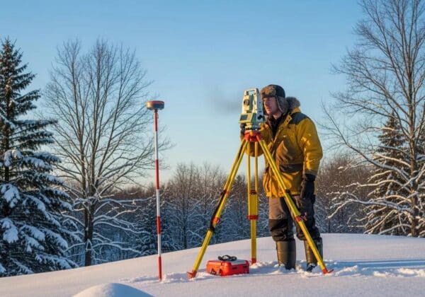
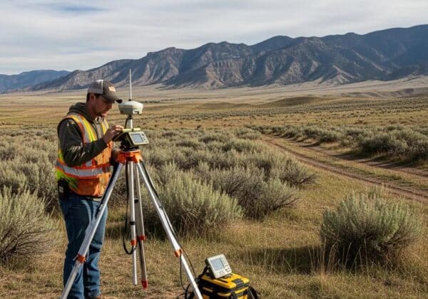
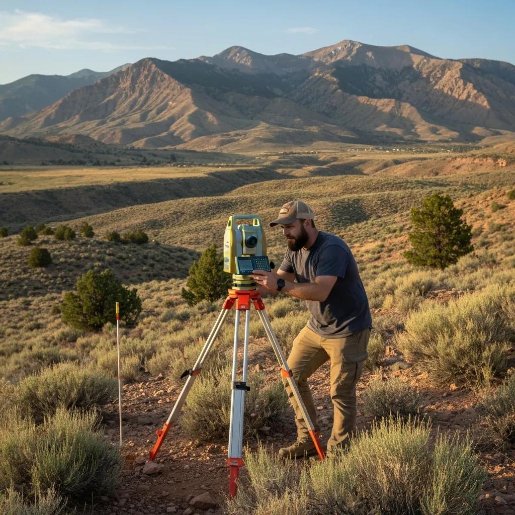
How does modern technology improve surveying accuracy in Ephraim, UT?

Surveying today combines UAVs, LiDAR, GPS/GNSS, total stations, and 3D laser scanning to boost accuracy, speed, and safety on Ephraim projects — especially on varied terrain and vegetated parcels. These tools complement traditional control surveys rather than replace them: GNSS establishes geodetic control while LiDAR and photogrammetry turn point clouds into contours and 3D models. The result is faster site capture, clearer feature detail, and deliverables that plug directly into CAD, GIS, and BIM workflows. The table below summarizes capabilities, best-use scenarios, accuracy expectations, and benefits for local conditions.
Advanced tools trade off accuracy, coverage, and efficiency depending on the task.
What do UAV aerial surveys and drones do for Ephraim projects?
Drones gather aerial imagery to produce orthophotos, DEMs, and volumetric data quickly — ideal for large rural parcels or active construction around Ephraim. UAV surveys reduce field time, lower risk on steep slopes, and enable frequent progress checks without heavy equipment. When tied to ground control points established with GNSS, UAV data blends into CAD and BIM models for grading, drainage, and earthwork estimates. We always plan for regulatory compliance and safe line-of-sight operations; using UAVs typically shortens data collection while giving clear visual context for stakeholders.
Combining UAV photogrammetry with LiDAR produces detailed, reliable terrain models that improve site planning and design decisions — especially on textured or complex surfaces.
How are GPS, LiDAR, and 3D scanning used for precise surveys in Ephraim?
GPS/GNSS provides control coordinates that anchor all survey data to a common datum, while LiDAR and 3D scanning capture dense geometry for topography and structural as-builts. A typical workflow uses GNSS for control, UAV photogrammetry for surface capture, and terrestrial LiDAR for building façades or confined areas, then merges the datasets into CAD/GIS deliverables. That hybrid method handles vegetated sites, resolves fine detail needs, and produces permit-ready drawings that feed civil design and contractor bids.
UAVs equipped with high-overlap cameras enable low-altitude photogrammetry, producing detailed maps and models useful for site planning and monitoring.
What do surveying services typically cost and how long do they take in Ephraim, UT?
Costs and timelines vary by survey type, property size, terrain, and the depth of records research required; presenting ranges helps set practical expectations. Simple residential boundary surveys on small, accessible lots typically cost less and finish faster than ALTA surveys or large topographic captures that need dense data collection and extended research. Turnaround depends on site access, weather, and title or permitting response times. The table below shows how key drivers influence cost and schedule so you can budget and plan.
What does a boundary or ALTA survey typically cost in Ephraim?
Costs depend on scope: a basic residential boundary on a small, accessible lot is usually near the low end of the range, while an ALTA/NSPS survey for commercial property with multiple easements and title exceptions is toward the high end. Factors include acreage, access difficulty, monument recovery needs, depth of record research, and whether UAV or LiDAR capture is required. Because each project is different, expect a written estimate after a scoping call and, if needed, a site visit. Provide the property address, deed info, and intended use so we can include the appropriate certifying language in the quote.
How long does a land survey take for properties in Ephraim?
Turnarounds span a few days for simple residential checks to several weeks for ALTA surveys, subdivision plats, or projects needing complex data fusion and agency review. Typical timelines: boundary surveys often complete within 1–2 weeks after fieldwork and research; topographic surveys usually take 1–3 weeks depending on acreage; ALTA surveys and subdivision plats can take 2–6 weeks or longer when title coordination and county review are involved. Weather, access limits, and document retrieval can extend schedules, but providing deeds, recent plats, and site access early helps speed the process. Early planning and clear scope reduce the chance of delays.
How does Ludlow Engineering support land development and property management in Ephraim?
For developers and property managers, integrated surveying and civil engineering cut coordination friction between measurement and design, helping approvals move faster and construction documents stay clear. Ludlow Engineering and Associates handles subdivision platting, grading plans, utility layout, and as-built documentation while coordinating with local agencies to match Sanpete County expectations. Our combined services mean survey data flows directly into civil and house plans, shortening design cycles and reducing vendor handoffs. For project owners, that integration delivers actionable plans that move projects from permit to construction more smoothly.
What subdivision and land development surveying services are available in Ephraim?
Subdivision surveying starts with boundary and topo capture, proceeds to lot layout and plat drafting, and includes coordination for county or municipal submittals — all to the regulatory standards required for recordation. Typical steps are site reconnaissance and records research, field control, detailed topographic and boundary surveys, iterative plat drafting, and agency coordination until approval. Deliverables include preliminary and final plats, legal descriptions, utility easement exhibits, and construction staking packages. Our end-to-end approach helps developers meet local submission standards and reduces approval delays.
How do topographic surveys support construction and site planning in Ephraim?
Topographic surveys convert field conditions — contours, spot elevations, drainage paths, trees, and utilities — into accurate maps that guide grading, foundation design, and drainage plans. Modeling the existing surface lets designers evaluate cut-and-fill, plan erosion control, and set appropriate foundation elevations before construction starts. Reliable topo data reduces costly design changes in the field and clarifies retaining wall and stormwater needs. In short, topographic surveys supply the surface model that underpins solid civil design and accurate contractor bids.
Where can Ephraim residents find dependable land surveying and support?
When you need a local surveyor, the process is straightforward: identify the survey type, gather deed or parcel information, and request a scoped quote that lists deliverables, timelines, and certifying language. Local providers familiar with Sanpete County will advise whether ALTA standards, monumentation, or UAV capture are appropriate and will coordinate with title companies or planning departments as needed. Below are simple steps to request a free, no-obligation quote and a short FAQ to answer common preparatory questions.
How do you request a free quote for land surveying in Ephraim, UT?
Call For Service
- Describe the Property: Give the property address or parcel ID and tell us which survey you need (boundary, ALTA, topo, FHA inspection, subdivision, etc.).
- Share Existing Documents: Send any deeds, plats, or title paperwork you have and note deadlines or lender requirements.
- Schedule a Site Visit: Arrange a time for a site inspection if one’s needed; we’ll confirm access, topography concerns, and control needs.
- Receive a Written Quote: We’ll provide a written estimate that details scope, deliverables, cost, and an estimated timeline so you can decide with confidence.
To work with Ludlow Engineering and Associates, call (435) 660-1797 or visit our local office at 1451 S. Main St., Nephi, UT 84648 to set up an initial conversation.
Frequently Asked Questions
What should I consider when choosing a land surveyor in Ephraim?
Look for local experience, relevant project history, and a full range of services. A good firm understands Sanpete County procedures, delivers accurate results on schedule, and provides clear, written scopes. Verify licenses, certifications, and client references, and choose a surveyor who communicates plainly about costs, timelines, and deliverables.
How can I prepare for a land survey?
Gather deeds, prior surveys, and any plats you have — these documents speed research and clarify questions. Clear obvious obstacles from the survey area if possible, and point out any known site issues to the surveyor. Being organized and available for a quick site visit or call helps the process move smoothly.
What challenges commonly arise during surveys in Ephraim?
Common challenges include unclear historic boundaries, inconsistencies in records, and steep or heavily vegetated terrain. Vegetation can hide monuments and landmarks, and local regulations sometimes require extra documentation or agency coordination. Weather and access can also affect schedules. An experienced local surveyor will anticipate these issues and plan accordingly.
How do I know which type of survey I need?
Your project goal determines the survey: buy or sell — get a boundary survey; plan construction — get a topo; close a commercial deal — order an ALTA. If you’re unsure, a licensed surveyor can review your situation and recommend the appropriate survey and deliverables for permits, financing, or dispute resolution.
What role does technology play in modern land surveying?
Technology improves accuracy and efficiency. UAVs, LiDAR, and GPS/GNSS capture high-resolution data and precise measurements, reducing field time and improving safety in difficult terrain. When combined with traditional control surveys, these tools deliver detailed, reliable outputs for design, permitting, and construction.
Can I request a survey for a property I don’t yet own?
Yes. It’s often wise to order a survey during the purchase process to confirm boundaries and flag issues before closing. You may need permission from the current owner to access the property, and a licensed surveyor can advise on the best approach and necessary permissions.