Property Survey Cost – Usually costs for property surveys or land surveys are determined by the size of the land survey. For example, a residential lot and a commercial property are seen very differently and therefore, pricing can be quite different.
We will try to give general numbers and feel that this will give you an idea of costs for a variety of surveys. We will talk about Property Survey costs, Alta survey costs, as-built survey costs and land survey costs.
Property Survey Cost
Property survey costs can range from $700-1100 for a single residence or can move up from there for farm ground, commercial ground, etc. The term property can serve a variety of land types. There are farm or county land, which pulls control off what we call the sectional system. These surveys can cost as much as 4-5 k, but could be as low as $1,500.00 as well.
In order to secure an official estimate, you will need to provide a deed of your property or a county plat map, giving us the needed information to give you a reliable quote. Call us today for your next property survey project and estimate.
ALTA Survey Cost
Pricing for ALTA surveys are a little more complex and difficult. One of the main reasons why they are so difficult to price, is they have what we call a table A list of survey requirements. On this list of Table A requirements, it has a lot of items that can be included in the survey. For example, the client could request elevations as part of the survey. This would then require the land surveyor to provide a topography plat. There are 20 other similar items that can be determined at the time of the survey. ALTA surveys can be as low as $2500.00. But can run up from there, an average of about $5000.00. Call us today for your next ALTA survey cost estimate.
In order to secure an official estimate, you will need to provide a deed of your property or a county plat map, giving us the needed information to give you a reliable quote.
As-built Survey Cost
An as-built survey is a survey where a land surveyor provides a land survey of a new project, that has just been developed or built. A civil engineer provides an engineered site plan and then the contractors build it. Once the contractors build the plan, the land surveyor returns and provides information for the lender, that the items have been built. As-built surveys are very similar to ALTA surveys in cost and can vary drastically as well.
Call today for your next as-built survey.
In order to secure an official estimate, you will need to provide a deed of your property or a county plat map, giving us the needed information to give you a reliable quote.
Land Survey Cost
A land survey cost approach is very similar to a property survey cost. In fact, many times they are used interchangeably. They can also be as low as $700-900. They can be as high as $2500-3500.00 as well. It really all depends upon how large the property actually is.
In order to secure an official estimate, you will need to provide a deed of your property or a county plat map, giving us the needed information to give you a reliable quote.
Call today to learn more about all types of property and land surveys and their appropriate costs.
acre, property, topography, surveying, price, mortgage, refinancing, construction, subdivision, accessibility, title insurance, fence, fee, flood, terrain, ownership, research, easement, plat, elevation, deed, american land title association, contract, real estate agent, complexity, lawn, measurement, license, landscape, home improvement, zoning, snow, cash, estate agent, knowledge, septic tank, utility, real estate investing, zip code, new york city, average, pest control, expense, driveway, road, surveyor cost, house survey near me, cost of house survey, boundary survey near me, topographical survey near me, land surveyor near me prices, surveyor fees, property survey for fence cost, cost of land survey for fence, surveyors near me cost, land surveyor prices, cost to have land surveyed, land surveyor fees, boundary survey price, home insurance, soil, lawsuit, roof, free estimates, soil test, south carolina, real estate transaction, concrete, liability insurance, pond, land registration, shed, mulch, geomatics, west virginia, square foot, basement, expert, retaining wall, document, description, legal liability, yard, personal finance, flood insurance, table of contents, renovation, homeadvisor, floodplain, pressure washing, policy, the motley fool, handyman, pest, law, interest, bathroom, property surveyor cost, house survey prices, lot survey near me, cost to survey property boundaries, property survey fees
Frequently Asked Questions
How much does a land surveyor cost?
The cost of hiring a land surveyor varies based on several factors, including the size and complexity of the property to be surveyed, but typically ranges from $300 to $1,000.
How much does a surveyor cost for a typical property?
The cost of hiring a surveyor for a typical property varies, typically ranging from $300 to $1,000, depending on factors like property size, location, and complexity of the survey.
How much do property surveyors cost?
The cost of property surveyors varies based on several factors, including the size and complexity of the land being surveyed. Typically, costs can range from a few hundred to several thousand dollars.
How much does it cost to survey land?
The cost to survey land varies based on several factors, including the size and complexity of the property. Typically, prices range from $300 to $1,000, but larger or more intricate sites may incur higher fees.
How much does a property surveyor cost?
The cost of a property surveyor typically varies based on factors like the size of the land and complexity of the survey. Generally, you can expect rates to range from $300 to $1,000 or more, depending on these specifics.
How much do land surveys cost?
The cost of land surveys varies based on several factors, including the size and complexity of the property. Generally, fees can range from a few hundred to several thousand dollars.
How much does it cost to have your land surveyed?
The cost to have your land surveyed varies based on factors such as land size, location, and the complexity of the survey. Typically, prices range from a few hundred to several thousand dollars.
How much does a land survey cost?
The cost of a land survey varies based on factors such as the size of the property, location, and complexity of the survey required. On average, property surveys can range from $300 to $1,000.
What factors influence land surveyor costs?
The factors that influence land surveyor costs include the size and complexity of the property, geographical location, accessibility of the site, and specific survey requirements. These elements can significantly affect the overall pricing of surveying services.
How can I reduce surveying expenses?
Reducing surveying expenses can be achieved by preparing necessary documents in advance, opting for off-peak scheduling, and clarifying project requirements to ensure accuracy and efficiency. These steps can help minimize costs while maintaining quality service.
Are there additional fees for land surveys?
Additional fees for land surveys may apply based on factors such as property size, complexity, and specific requirements. It’s best to discuss these potential costs directly with your land surveyor for a comprehensive understanding.
What is the average cost for boundary surveys?
The average cost for boundary surveys typically ranges from $300 to $1,000, depending on factors such as the size of the property and its location. For a precise quote, a consultation with a surveying professional is recommended.
Do surveyor prices vary by location?
Surveyor prices do vary by location. Factors such as regional demand for surveying services, local regulations, and the availability of experienced professionals can influence pricing in different areas.
How long does a property survey take?
The duration of a property survey can vary based on several factors, but typically, it takes a few hours to a few days to complete, depending on the size and complexity of the property.
What does a land survey include?
A land survey includes the measurement and mapping of property boundaries, identification of easements, and marking features such as fences, trees, and contours. It also involves preparing a detailed report that outlines these findings for legal and development purposes.
Are quotes required for surveying costs?
Quotes for surveying costs are essential as they provide a detailed breakdown of services and pricing based on specific project requirements. Requesting a quote helps ensure transparency and accurate cost estimation for your property survey.
What affects the price of property surveying?
The price of property surveying is influenced by several factors including the size and complexity of the land, location, type of survey required, and any necessary research or permits.
How do I choose a surveyor?
Choosing a surveyor involves evaluating their qualifications, experience, and reputation. Look for licensed professionals with positive client reviews and expertise in the specific type of survey you need, ensuring they understand your project requirements.
What is the price range for survey services?
The price range for survey services typically varies based on factors such as land size and complexity. Generally, costs can range from $300 to $1,500, but it's best to request a quote for precise pricing tailored to your specific needs.
How often should I have land surveyed?
The frequency of land surveying depends on various factors such as property changes, development plans, or legal requirements. It's advisable to have your land surveyed whenever significant modifications occur or at least every few years to ensure accuracy.
Can I survey my property myself?
You can survey your property yourself; however, professional land surveyors have the expertise and tools to ensure accuracy and adherence to local regulations. DIY surveys may lead to errors or disputes, so it's often advisable to hire a professional.
What tools do surveyors use?
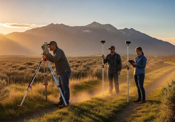
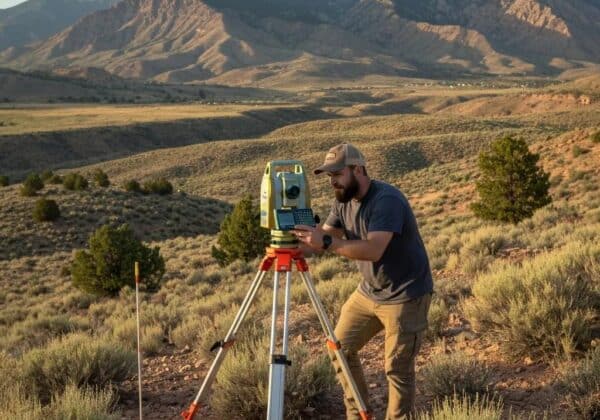
Surveyors use various tools, including total stations, GPS devices, levels, compasses, and hand-held measuring devices, to accurately measure land and determine property boundaries. These instruments are essential for delivering precise survey results.
Is a survey necessary for property buying?
A survey is necessary for property buying to accurately define property boundaries and identify any potential issues. This ensures you make informed decisions and protects you from future disputes.
How do surveying costs compare regionally?
Surveying costs can vary significantly by region due to factors such as local labor rates, regulatory requirements, and geographical conditions. Typically, urban areas may have higher costs compared to rural locations, reflecting increased demand and operational complexities.
Do surveyors charge by the hour?
Surveyors typically charge by the hour for their services. However, costs may vary based on the project scope, complexity, and location, so it's advisable to request a quote tailored to your specific needs.
What credentials should a land surveyor have?
The credentials a land surveyor should have include a relevant degree in surveying or a related field, state licensure, and practical experience in land surveying techniques and tools to ensure accurate and reliable results.
When is the best time to survey land?
The best time to survey land is during dry seasons with clear weather conditions. This allows for easier access to the site and more accurate measurements, ensuring precise results for your survey needs.
How detailed are land survey reports?
Land survey reports are detailed documents that outline precise measurements, property boundaries, and valuable information regarding any easements or encroachments. The level of detail can vary based on the project's complexity and specific requirements.
Are property surveys required for refinancing?
Property surveys may be required for refinancing, depending on the lender's policies and the property's specifics. It's advisable to check with your lender to determine if a survey is necessary for your refinancing application.
What type of survey is best for me?
The type of survey that is best for you depends on your specific needs. For property boundaries, a boundary survey is ideal, while a topographic survey is suited for understanding land features.
land surveyor cost, property survey cost, how much does a land survey cost
ludlow, flood, civil engineering, construction, manufacturing, welding, employees, metal, metal fabrication, stormwater, storm drain, utah, materials science, research, feasibility study, award, hall, skip to content, repairs, customer, contract, pride, infrastructure, mechanical engineering, email address, machine, property, surveying, topography, measurement, topographic map, elevation, accuracy and precision, zoning, easement, total station, title insurance, lidar, american land title association, law, mortgage, angle, knowledge, fence, new york city, deed, unmanned aerial vehicle, plat, lawsuit, queens, inspection, jurisdiction, geometry, profession, geomatics, property line survey cost, home survey cost, property survey cost, home surveyor, surveyor cost, surveyors in my area, cost of house survey, boundary survey cost, residential surveyor, private surveyor, land survey, surveyor, property survey, surveyors, topographical survey, property line survey, find a surveyor, boundary survey, land survey cost, surveying services, salt lake city, surveyor salt lake city, subdivision, ownership, western united states, utah county surveyor, salt lake county surveyor, property survey utah
Frequently Asked Questions
How much does it cost to survey land?
The cost to survey land varies based on factors such as property size, location, and specific surveying requirements. Generally, fees range from a few hundred to several thousand dollars. For a precise quote, it's best to contact us directly.
What is a land survey?
A land survey is a precise measurement and mapping process used to determine the boundaries, dimensions, and topography of a parcel of land. It provides essential information for property ownership, development projects, and land use planning.
Can land surveys be wrong?
Land surveys can have inaccuracies due to various factors, such as human error, outdated data, or faulty equipment. It's essential to hire qualified professionals to minimize these risks and ensure accurate results.
How to survey land?
The process of surveying land involves several key steps: defining property boundaries, utilizing specialized equipment like theodolites and GPS, and analyzing collected data to create accurate maps and legal descriptions. Hiring a professional surveyor ensures precision and compliance with local regulations.
How to become a licensed land surveyor Utah?
Becoming a licensed land surveyor in Utah requires completing a degree in surveying or a related field, gaining relevant work experience under a licensed surveyor, and passing the required examinations, including the Fundamentals of Surveying and the Principles and Practice of Surveying exams.
What factors affect land survey costs?
The factors that affect land survey costs include property size, terrain complexity, the type of survey required (such as ALTA or boundary surveys), local regulations, and the project's timeline.
What techniques are used in land surveys?
The techniques used in land surveys include triangulation, GPS measurements, and total station methods, which ensure accurate mapping and boundary delineation for various property surveys and engineering projects.
Who needs a property land survey?
Property land surveys are necessary for homeowners, real estate agents, developers, and government agencies who require accurate property boundaries, legal documentation, or before undertaking any construction projects to ensure compliance and avoid disputes.
What can a land survey determine?
A land survey can determine the exact boundaries of a property, the topography of the land, the location of existing structures, and any easements or encroachments affecting the property.
How accurate are land surveys typically?
The accuracy of land surveys typically ranges from one inch to several inches, depending on the type of survey and equipment used. Professional land surveyors employ advanced technology to ensure high precision and reliable results for property boundaries and other measurements.
What equipment is used for land surveying?
The equipment used for land surveying includes total stations, theodolites, GPS systems, levels, and measuring tapes, all essential for accurately measuring distances, angles, and elevations in varying terrain.
What is included in a land survey report?
A land survey report includes detailed property boundaries, descriptions of the land's features, any existing easements or encroachments, surveyor's certifications, and often a map or diagram illustrating the surveyed area.
How long does a land survey take?
The duration of a land survey varies based on factors such as the size of the property and the complexity of the project. Typically, a standard survey can take anywhere from a few days to several weeks to complete.
When is the best time to survey land?
The best time to survey land is during dry weather, typically in late spring through early fall. This ensures clear visibility and accessibility, which are crucial for accurate measurements and assessments.
What qualifications do land surveyors require?
The qualifications required for land surveyors typically include a bachelor’s degree in land surveying or a related field, along with state licensure and experience in the industry.
How do I choose a land surveyor?
Choosing a land surveyor involves evaluating their experience, qualifications, and reputation. Look for licensed professionals with positive client reviews and expertise in the specific type of survey you need, ensuring they meet your project requirements effectively.
What are common land survey mistakes?
Common land survey mistakes include inaccurate boundary measurements, failing to account for easements, and neglecting to verify existing survey data. These errors can lead to legal disputes and costly delays in property transactions.
What is an ALTA land survey?
An ALTA land survey is a detailed survey that meets the standards set by the American Land Title Association. It provides comprehensive information about property boundaries, improvements, and potential issues, making it essential for real estate transactions and title insurance.
Can I survey land without a permit?
Surveys typically require a permit, as regulations vary by location. It is essential to check with local authorities to ensure compliance before proceeding with any land survey.
What types of land surveys exist?
The types of land surveys include boundary surveys, topographic surveys, ALTA/NSPS land title surveys, construction surveys, and site surveys, each serving distinct purposes such as defining property lines, assessing land features, and supporting construction planning.
How to read a land survey map?
Reading a land survey map involves understanding various symbols, lines, and annotations that represent property boundaries, topography, and land features. Familiarize yourself with the map legend and scale to accurately interpret distances and dimensions.
How often should land be surveyed?
Land should be surveyed periodically to ensure accurate property boundaries and compliance with regulations. It's recommended to conduct a survey whenever there are significant changes, such as new construction or property transfers, or every few years as part of maintenance.
What is the purpose of a land survey?
The purpose of a land survey is to accurately determine the boundaries, dimensions, and features of a property. This vital process helps ensure legal clarity, supports construction planning, and enhances property negotiations.
Can surveys resolve property disputes?
Surveys can effectively resolve property disputes by providing precise measurements and boundaries. A professional land survey clarifies ownership and property lines, which can help in legal discussions and prevent further conflicts.
How to prepare for a land survey?
Preparing for a land survey involves ensuring clear access to the property, gathering any relevant documents like property deeds, and marking all property lines. This helps facilitate an efficient and accurate surveying process.
What are local laws for land surveying?
Local laws for land surveying vary by state and municipality. Generally, these laws govern licensing requirements, survey standards, and procedures, ensuring surveys are conducted ethically and accurately to uphold property rights and land use regulations.
How does terrain affect land surveying?
Terrain significantly impacts land surveying by influencing measurement accuracy, visibility, and accessibility. Variations such as slopes, valleys, and obstacles can complicate the survey process and may require specialized equipment and techniques to achieve precise results.
What is boundary surveying?
Boundary surveying is the process of determining the precise location of property lines and corners. This service is crucial for resolving disputes and ensuring accurate land use in compliance with local laws.
What are zoning regulations in land surveys?
Zoning regulations in land surveys are specific rules established by local governments that dictate how land can be used and developed. They affect factors such as property size, building height, and land usage, ensuring compliance with community planning goals.
How can I verify a land surveyors license?
To verify a land surveyor's license, you can visit your state's licensing board website or the National Council of Examiners for Engineering and Surveying (NCEES) to check their credentials and ensure they are licensed to practice in your area.
ludlow engineering, property line survey, land surveyor utah