Topographical surveys are an essential tool in numerous fields, ranging from construction and urban planning to environmental studies. But what exactly is a topographical survey, and why is it so crucial? In this blog, we will dive into the world of topographical surveys and uncover their significance, process, and applications in a manner that’s easy to understand.

What is a Topographical Survey?
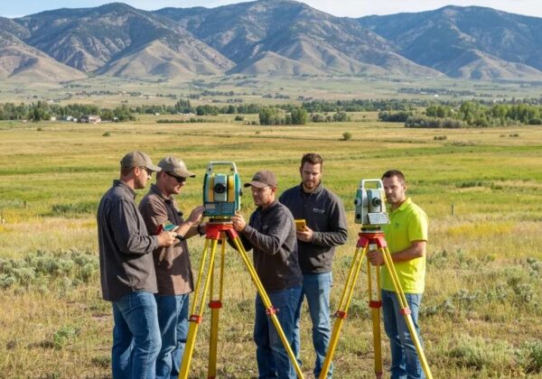
A topographical survey, often simply called a ‘topo survey,’ is a detailed and accurate representation of the features and contours of the land. It includes both natural features like hills, valleys, and rivers, as well as man-made structures such as buildings, roads, and bridges. This type of survey captures the three-dimensional aspects of the landscape, providing crucial data for various applications.
The origins of topographical surveying date back to ancient civilizations, where basic tools and techniques were used to measure and map the terrain. Utilized extensively by the Egyptians and Babylonians, these early surveyors laid the groundwork for modern topographical technology. As our cities and technologies have evolved, so too have the tools and methods employed in topographical surveys, which now utilize advanced equipment like GPS and drones.
Modern topographical surveys are much more precise compared to their historical counterparts. Today, surveyors utilize advanced tools and methodologies to capture accurate data on the land’s contours and features. This technological evolution has made topographical surveys indispensable in numerous fields, from construction and urban planning to environmental conservation and disaster management.
The Importance of Topographical Surveys
Topographical surveys play a critical role in many industries. In construction, they provide essential data for the planning and design phases, ensuring that projects are built on solid ground. For environmental sciences, these surveys help in understanding and managing land resources and environmental conservation efforts. Urban planning and land development also heavily rely on topographical surveys to make informed decisions about land use.
The detailed information from topographical surveys allows engineers and architects to plan more effectively. For instance, knowing the precise layout of the land helps in designing buildings, roads, and other structures that are not only functional but also safe and sustainable. Moreover, environmental conservation efforts benefit immensely from this data, as it helps identify areas that need protection and conservation strategies.
In addition to aiding specific industries, topographical surveys also have a broad societal impact. They help prevent construction projects from negatively impacting the environment and ensure that new developments are built sustainably. The data collected in these surveys can also be used for disaster management, such as identifying areas prone to flooding or landslides, thereby helping protect communities from natural disasters.
The Process of Conducting a Topographical Survey
Conducting a topographical survey involves several steps. It typically starts with a desk study, where existing data and maps are reviewed. Following this, surveyors visit the site to collect data using various tools and technologies such as GPS, drones, and total stations. The collected data is then processed and analyzed to create detailed maps and models of the terrain. These outputs are used by engineers, architects, and planners to make informed decisions.
The initial desk study is a crucial phase where surveyors gather as much preliminary information as possible. This can include reviewing historical maps, previous survey data, and satellite imagery. After this, fieldwork begins with the deployment of advanced equipment like drones and LiDAR, which allow surveyors to capture highly accurate data quickly and efficiently.
The final step in the survey process involves data analysis and mapping. Using specialized software, surveyors can convert raw data into detailed 3D models and topographic maps. These maps offer a comprehensive view of the landscape, including its elevations and features, thus providing valuable insights for various applications. The meticulous nature of this process ensures that the resulting data is highly reliable and useful for making critical decisions in construction and development projects.
Technologies Used in Topographical Surveys
Modern topographical surveys utilize advanced technologies to enhance accuracy and efficiency. GPS (Global Positioning System) is widely used for precise location data. Drones equipped with cameras and LiDAR (Light Detection and Ranging) sensors can quickly cover large areas and create high-resolution maps. Total stations, which combine optical and electronic distance measurement, are another staple in the surveyor’s toolkit. These technologies work together to provide comprehensive and precise topographical data.
In modern practice, drones have revolutionized the field of topographical surveying. Equipped with high-resolution cameras and laser scanning systems, drones can capture detailed aerial images and 3D data of the landscape. This is particularly useful in large or inaccessible areas, making it easier and faster to gather comprehensive data. Drone topographic surveys have become indispensable in many industries, offering significant advantages in terms of both time and cost.
Another significant technology in topographical surveys is LiDAR. This laser-based method allows surveyors to create extremely detailed and accurate 3D models of the terrain. By measuring the time it takes for a laser pulse to reflect off the ground and return to the sensor, LiDAR can map the land with exceptional precision. This technology is particularly useful in heavily vegetated areas where traditional surveying methods might fall short.
Applications of Topographical Surveys
The applications of topographical surveys are vast and varied. In construction, these surveys inform the design and layout of buildings, roads, and other infrastructure. In environmental management, they help in studying watershed areas, assessing flood risks, and planning conservation projects. Urban planners use topographical surveys to design sustainable cities, while landscape architects rely on them to create harmonious outdoor spaces. Additionally, agricultural planning and archaeological research also benefit from the detailed data provided by topographical surveys.
In the field of archaeology, topographical surveys are invaluable for uncovering and analyzing historical sites. They help archaeologists identify potential dig sites and create detailed maps of existing ruins. By providing a precise layout of these areas, topographical surveys make it easier to understand and preserve our historical heritage. Moreover, in agriculture, these surveys aid in planning irrigation systems and optimizing land use for crop production.
Urban planners and civil engineers also benefit significantly from topographical surveys. These surveys provide essential data for designing and implementing infrastructure projects, such as roadways, bridges, and public utilities. By leveraging detailed topographical data, planners can ensure that their designs are both functional and sustainable, thereby enhancing the quality of urban life. Furthermore, in disaster management, topographical surveys are used to assess risks and plan mitigation strategies, safeguarding communities from natural catastrophes.
Wrapping Up
Topographical surveys are invaluable tools that provide a detailed understanding of land characteristics, aiding in a wide range of activities from construction to conservation. By understanding the importance and process of these surveys, we can better appreciate their role in shaping and preserving our environment.