

& Land Surveying
Ludlow Engineering has and always will take care of the ``little guy``
9995
8258
4210
4048
Why Choose Ludlow Engineering
The Top Land Surveying Company in Utah
Ludlow Engineering and Associates LLC has served Central Utah since 1975. Ludlow has developed a Civil Engineering firm specializing in Development, Site plans, Small Water and Sewer development, and Land Surveying. Ludlow Engineering always takes care of the “little guy.” As Utah continues to grow, so has our land survey company’s desire to take care of rural Utah’s Engineering and Surveying needs, so that future planning can be best met today. Ludlow has in–house professional engineers and land surveyors.
Our land surveying company in Utah specializes in various land surveying services. Our land surveyors provide Land Surveys, Boundary Surveys, all kinds of Commercial site plans, civil engineering services, and land surveying. One of our primary services is to provide ALTA Title Surveys. We also engage in full civil engineering practices and services, mainly: Subdivision design, house plan drafting, house plan engineering, water and sewer plans, residential and commercial site plans, well proofs, FHA manufactured home inspections, and water well rights and flood certifications.
Whether you need experienced property line surveyors or thorough boundary line surveys performed before your next commercial project, our respected civil planning company is ready to help. Our land surveying company in Utah has helped clients throughout the state, including these UT communities:
- Juab County
- Utah County
- Millard County
- Sanpete County
- Sevier County
- And More!
Proven Land Survey Contractors
When you begin a new civil project, you must ensure each part of the project is ready for the start date. That begins with examining the land on which the new construction will occur. Our land survey contractors work with your management team to ensure everything is handled, measured, and ready for your intended start date. Our land surveying company in Utah strives to provide the best land surveyors for your unique needs.
Client Satisfaction
At Ludlow Engineering, our top priority is customer satisfaction. Read our customer reviews and learn why our civil planning company works hard for our 5-star rating.
Our Vision and Mission
Integrity is at the heart of Ludlow Engineering. Providing our clients with peace of mind at the completion of a project is our civil planning engineers’ reward.
Project Planning
Since 1975, Ludlow Engineering has developed a civil engineering firm specializing in development, site plans, small water, sewer development, and surveying.
Surveying and Engineering
We provide land surveys, boundary surveys, ALTA title surveys, and all types of commercial site plans. We also engage in full Civil Engineering practices and services.
Property Line Surveys
Knowing where your property starts and ends remains a vital part of your planning process. You want to ensure that your project goes off without a hitch and you don’t become bogged down in legal action because you infringed on neighboring land. Our property line surveyors have extensive experience working with Utah’s unique topography and ensuring our clients know where their property begins and ends. In addition, our land survey company works closely with the property owners to ensure every aspect of your project is ready for the start date.
Quality Land Surveying Services for All Engineering and Construction Projects
Ludlow Engineering is the leading Utah land surveying company for a reason. We lead the way with a suite of surveys that ensure we provide the finest services for all types of projects. Not only can you outline property lines, but you can work with a land surveyor that provides services for civil site plans, house plans, FHA foundational inspections, and various land development projects.
Civil Engineering
Ludlow Engineering’s team provides comprehensive civil engineering services to many Utah residents that include land development, site planning, and infrastructure design. Our engineers have the knowledge and expertise to deliver efficient and cost-effective solutions for all types of projects, from commercial developments to residential subdivisions.
Our civil engineering services comprise a wide range of specialties. We can provide preliminary site assessments and feasibility studies to help our clients determine the viability of their projects. Our team can also assist land owners in obtaining permits, zoning variances, and other regulatory approvals that are necessary for construction to begin.
Alta Surveys
As specialists in ALTA surveys, we know the importance of accuracy and precision. Our ALTA surveys are conducted with the utmost care and attention to detail, adhering strictly to the guidelines set forth by the American Land Title Association. We use cutting-edge technology and equipment to gather all the necessary data and produce comprehensive and detailed reports, including post-development ALTA surveys and so many more survey services for your needs.
House Plans
Ludlow Engineering offers comprehensive house plan services for architects, builders, and homeowners alike. We can accurately map out property boundaries and topographic features — providing quality boundary and topographical surveys — ensuring that your house plans align perfectly with your site.
Our house plan services include detailed floor plans, elevations, and sections that meet the highest standards of accuracy, clarity, and functionality. We work closely with our clients and any project manager or other critical operator on site to incorporate the unique vision, preferences, and budget into every house plan.
Civil Site Plans
With construction projects, every detail matters. That’s why a comprehensive civil site plan is essential for any new development. It’s why we deliver detailed civil site plans that meet the highest industry standards. Our maps include crucial information, such as plot boundaries, ground elevation contours, site features, and legal references. With our civil site plans, you’ll not only create a clear vision for your project but you’ll also be armed with the necessary tools to manage risk effectively.
FHA Manufactured Home Inspections
Our comprehensive FHA manufactured home inspection services are formatted surrounding the stringent requirements set forth by the Federal Housing Administration. We examine your home from top to bottom, ensuring that every aspect of the structure and its systems meet FHA standards. From structural integrity to electrical and plumbing systems, we leave no stone unturned in our quest for accur
Client Satisfaction
Our Vision & Mission
Project Planning
Surveying and Engineering
Answers to our most commonly asked questions
Do You Have Questions?
Our survey process is quite simple to get started. Our customers are given verbal information about time frame and cost according to the specific project. If these terms are agreed upon, a contract is created and executed by both parties. The client will be asked to sign the contract, give a half down deposit, and provide us with a deed or tax notice and plat if available. Then, we go to work!
An ALTA survey is a survey which provides all involved more data regarding the parcel of land. On the request of the client, they fill out a document referred to as Table A. These items are selected items such as: Vicinity maps, utilities, adjoining land owners, flood plain issues, etc. These surveys are requested when properties change hands and when they are developed pieces of ground.
A boundary survey has similar components as an ALTA survey, but deals mostly with boundary lines. These surveys are often referred to as either property surveys, land surveys and as mentioned above boundary surveys. These surveys are usually performed when a buyer has owned the property for a given amount of time and desires to know their boundary lines. These are often associated with smaller transactions and projects.
This type of survey is completed after a development has been finished. It gives the owner, financier and all those that are part of this project a real time view of how the project was built. Was the project built according to the design drawings. This type of survey provides that information.
Construction surveying is the process of surveying buildings, roads, utilities at the time of construction. As you visit sites that are being developed, you will notice survey stakes throughout the subject area. This is what those stakes are suggesting to the contractors. They provide details, elevations and locations of each of the designed components.
Start With the Survey Your Project Actually Needs.
Different property decisions require different surveys. These are the services Utah homeowners, developers, lenders, architects and contractors request most often.
Boundary Surveys
Locate legal property lines, recover or set corners and receive a professional survey map for building, buying, selling or resolving boundary questions.
Explore Boundary Surveys →Topographic Surveys
Capture elevations, contours, buildings, utilities and other site features engineers and architects need for design and permitting.
Explore Topographic Surveys →ALTA / NSPS Surveys
Commercial land-title surveys prepared for lenders, title companies, attorneys, buyers and sellers under the current ALTA/NSPS standards.
Explore ALTA Surveys →Construction Staking
Transfer the approved design to the ground so foundations, utilities, roads, grades and improvements are constructed where the plans require.
Explore Construction Staking →Subdivision & Platting
Surveying, layout, plat preparation and engineering support for dividing land and moving projects through local review.
Explore Subdivision Design →UAV / Drone Surveying
Survey-grade aerial data for mapping, topography, volume calculations, site documentation and large-property planning.
Explore UAV Surveying →Tell Us What You're Trying to Accomplish.
You do not need to know the technical name of the survey before you call. The right scope depends on the decision being made with the finished work.
Send us the property address or parcel number and a short description of the project. We'll help determine the appropriate surveying or engineering service before work begins.
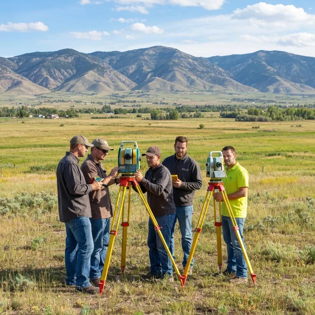
A Property Line Is More Than a Coordinate on a Screen.
Professional land surveying combines deeds, recorded plats, prior surveys, monument evidence and precise field measurements with the judgment of a licensed surveyor. That distinction matters when a property purchase, building location, subdivision or dispute depends on the answer.
Surveying and Engineering From the Same Team.
A survey often becomes the foundation for engineering, permitting and construction. Keeping those disciplines connected reduces handoffs and gives the project team one reliable base of information.
A Clear Path From Question to Finished Project.
Surveying can feel complicated when you're dealing with deeds, permits, lenders and construction schedules. Our process starts with the decision you need to make and works backward to the correct scope.

Civil Engineering for the Project That Comes Next.
Once the property is understood, many projects move directly into civil design. Ludlow Engineering can carry the same base information into site planning, grading, drainage, utilities, subdivision design and construction.
Land Surveying Across Utah.
Central Utah is home, but our surveying and engineering work extends throughout the state. Project scope, schedule and travel requirements determine availability for individual properties.
Find Ludlow Engineering Near Your Project.
Our Nephi location provides direct access to Juab, Utah, Sanpete, Millard and Sevier counties, with work extending to the Wasatch Front and other Utah communities.
Utah Land Survey Resources.
Start here if you are still determining what survey you need, what it may cost or how surveying fits into a property transaction or development project.
What Is a Land Survey?
Understand what surveyors measure, research and deliver—and when a professional survey is needed.
Pricing guideLand Survey Costs in Utah
See how survey type, records, acreage, terrain, monuments and project complexity affect pricing.
Scheduling guideHow Long Does a Land Survey Take?
Learn what affects turnaround time and when to order before a closing, permit or construction deadline.
Property ownersUtah Boundary Survey Guide
Property lines, corners, monuments, boundary research, costs and the situations where a boundary survey matters.
Design projectsTopographic Surveys
Learn what a topo survey captures and why engineers and architects need accurate existing-site information.
Commercial propertyALTA / NSPS Land Title Surveys
Understand the national survey standard commonly used in commercial real-estate transactions.
Utah Land Surveying FAQ
A few of the questions property owners and project teams commonly ask before contacting Ludlow Engineering.
What does a land surveyor do?
A professional land surveyor researches property records and collects precise field measurements to locate boundaries, monuments, elevations or other site information required by the particular survey.
How do I know which type of survey I need?
Start with the decision you need to make. Property-line questions usually require a boundary survey; design projects commonly need topographic information; commercial transactions may require an ALTA/NSPS survey. We can help define the correct scope.
How much does a land survey cost in Utah?
Cost varies substantially by survey type, parcel size, available records, existing monuments, terrain, access and the required deliverables. See our Utah land survey cost guide for planning information.
How long does a survey take?
Turnaround depends on records research, field conditions, parcel complexity, survey type and current scheduling. If you have a closing, permit or construction deadline, provide it when requesting a quote.
Can a surveyor find my property corners?
Yes. Boundary surveying includes researching the legal record and searching for relevant monument evidence. When a required corner cannot be recovered, a licensed surveyor determines the appropriate position using the available record and field evidence.
Do you provide both surveying and civil engineering?
Yes. Ludlow Engineering provides professional land surveying along with civil engineering services, allowing many projects to move from existing conditions and boundary work into site design, platting and construction support with the same firm.
Where is Ludlow Engineering located?
Ludlow Engineering and Land Surveying is located at 1451 S. Main in Nephi, Utah. Central Utah is our home base, with projects performed throughout Utah depending on scope and scheduling.
What should I send when requesting a quote?
Start with the property address or parcel number, what you are trying to accomplish and any deadline. A deed, recorded plat, title report or previous survey is also helpful when available.
Start With the Property. Build From Accurate Information.
Send us the property address or parcel number, what you're trying to accomplish and your deadline. We'll help determine the surveying or engineering scope your project needs.