Frequently Asked Questions
What is the difference between a boundary survey and a property survey?
The difference between a boundary survey and a property survey lies in their purpose: a boundary survey determines exact property lines, while a property survey provides a broader overview of the entire property, including improvements and easements.
What is a property boundary survey?
A property boundary survey is an assessment that determines the exact boundaries of a parcel of land. This survey provides essential information on property lines, easements, and any encroachments, ensuring legal compliance and accurate measurements for landowners.
What factors influence boundary survey accuracy?
Factors that influence boundary survey accuracy include the quality of equipment used, the surveyor's experience, environmental conditions, and the availability of historical property data. Each element plays a crucial role in achieving precise and reliable survey results.
How often should property boundary surveys be updated?
Property boundary surveys should be updated whenever significant changes occur, such as property improvements, alterations in land use, or disputes with neighboring properties. Regular reviews every 5-10 years are advisable to ensure accuracy and compliance.
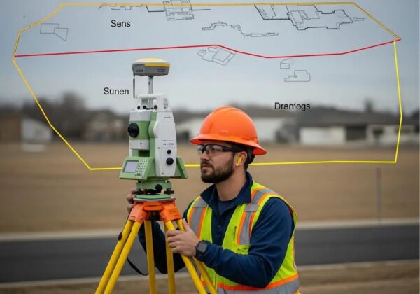
What equipment do surveyors use for boundary surveys?
Surveyors use a variety of equipment for boundary surveys, including total stations for precise measurements, GPS devices for accurate location data, and levels for assessing elevation. Additionally, marking tools and measuring tapes are essential for defining property lines.
What licenses are required for land surveyors?
The licenses required for land surveyors include a Professional Land Surveyor (PLS) license, which typically necessitates a degree in surveying, passing a state exam, and relevant work experience. Additional certifications may also be beneficial for specialized areas.
How to prepare for a boundary survey?
Preparing for a boundary survey involves gathering necessary documents, such as property deeds and previous surveys, and ensuring clear access to the property. Mark any visible corners or boundaries to assist the surveyor in accurately defining your property lines.
What are common boundary survey disputes?
Common boundary survey disputes typically involve disagreements over property lines, encroachments, easements, and discrepancies in official records. These conflicts can arise between neighboring property owners or during real estate transactions, necessitating precise surveying to resolve.
What is included in a property boundary survey?
A property boundary survey includes the identification and mapping of property lines, the measurement of easements, and compliance checks with local zoning laws, ensuring accurate property information for legal purposes.
How long does a boundary survey take?
The duration of a boundary survey depends on various factors, including the property's size and complexity. Typically, a boundary survey can take anywhere from a few hours to several days to complete.
What happens if a boundary survey is incorrect?
If a boundary survey is incorrect, it may lead to disputes over property lines, potential legal issues, and costly rectifications. Accurate surveys are vital to ensure clear property ownership and compliance with laws.
How to interpret boundary survey results?
Interpreting boundary survey results involves understanding the defined property lines, markers, and any easements indicated on the survey. Familiarize yourself with the survey layout, measurements, and notes to accurately assess your property boundaries.
What is the purpose of a boundary survey?
The purpose of a boundary survey is to accurately determine and define the property lines of a land parcel. This ensures legal compliance, resolves disputes, and aids in planning for any construction or property improvements.
Can a boundary survey affect property value?
A boundary survey can affect property value by clearly defining property lines, which helps prevent disputes and ensures legal compliance. Accurate boundaries can enhance a property's marketability and establish trust with potential buyers.
How to choose a land surveyor?
Choosing a land surveyor involves assessing their qualifications, experience, and reputation. Ensure they are licensed, have relevant project experience, and can provide references to guarantee reliable and accurate surveying services.
What is an as-built survey?
An as-built survey is a detailed representation of a construction project's final dimensions and locations, indicating the exact placement of structures and utilities. It ensures compliance with design specifications and provides valuable data for future maintenance or renovations.
When is a boundary survey necessary?
A boundary survey is necessary when establishing property lines, prior to buying or selling land, during the development of property, or when resolving disputes over property boundaries. It ensures legal compliance and accurate measurements.
What documentation is needed for boundary surveys?
The documentation needed for boundary surveys includes property deeds, prior survey records, and legal descriptions of the property. Additionally, any relevant easements or zoning information should also be provided to ensure accurate surveying and compliance.
What do surveyor marks indicate on properties?
Surveyor marks on properties indicate boundary lines, corner points, and easements, helping to define property limits and ensure legal compliance during land development and construction projects. They are essential for accurate property measurements.
How to read a boundary survey map?
Reading a boundary survey map involves understanding key elements such as property lines, markers, and dimensions. Focus on the legend for symbols, scale for measurements, and any notes on zoning or easements for accurate interpretation of the property boundaries.
Are boundary surveys legally binding?
Boundary surveys are not inherently legally binding; however, they provide crucial documentation of property lines that can be used in legal disputes and to ensure compliance with zoning laws.
What is the cost estimate for boundary surveys?
The cost estimate for boundary surveys varies based on property size, location, and complexity of the survey. Generally, expect prices to range from $400 to $1,500. For a precise quote, contact Ludlow Engineering for an assessment tailored to your needs.
What do property lines indicate in surveys?
Property lines in surveys indicate the exact boundaries of a property, defining the legal limits of ownership and any easements or restrictions. They are essential for maintaining compliance with zoning laws and resolving disputes over property rights.
How do easements affect property boundary surveys?
Easements impact property boundary surveys by establishing legal rights for others to use a portion of the property, which can affect how boundary lines are determined and recorded. Surveyors must account for easements to ensure accurate property measurements and compliance.
What to do after a boundary survey?
After a boundary survey, it is essential to review the results for accuracy and ensure you understand your property lines. Next, consider implementing any necessary changes or legal actions based on your findings, such as updating property boundaries or resolving disputes.
Can I challenge a boundary survey outcome?
The ability to challenge a boundary survey outcome depends on specific circumstances. If you believe the survey is inaccurate or improperly conducted, you can typically request a review or seek a second opinion from another qualified surveyor.
What defines the boundaries of a property?
The boundaries of a property are defined by legal descriptions, survey markers, and physical features such as fences or walls. Accurate boundary surveying ensures these limits are clear and compliant with local laws.
How to resolve boundary disputes with neighbors?
Resolving boundary disputes with neighbors involves clear communication, reviewing property deeds, and seeking mediation if necessary. Hiring a professional surveyor can provide accurate measurements to clarify property lines and facilitate a resolution.
What role do surveyors play in real estate?
Surveyors play a crucial role in real estate by providing accurate property measurements, determining boundaries, and ensuring legal compliance. Their expertise is essential for property transactions, development planning, and resolving disputes regarding land use.
How can technology improve boundary surveying?
Technology can significantly improve boundary surveying by enhancing accuracy, efficiency, and data collection. Tools like GPS, drones, and advanced software allow for precise measurements and quicker analysis, ensuring reliable results for property delineation and compliance.