Land Surveys in Nephi: Meet Ludlow Engineering Experts
Discover the Importance of Nephi Land Surveys with Ludlow Engineering
Land surveys are pivotal to ensuring the safety, development, and legal compliance of community projects. For additional company insight, be sure to check out Ludlow Google Business Profile. In Nephi, where the interplay of rugged terrain and rapidly expanding urban and agricultural developments is evident, accurate land data is essential. Ludlow Engineering, a full land survey and Civil Engineering firm, is renowned for its reliability in providing meticulous land surveying services. Their expertise covers diverse project aspects, from urban residential assessments in areas along the Wasatch Front to agricultural surveys in regions famous for their proximity to the Great Salt Lake. With rising demands driven by national initiatives to improve land management and infrastructure—as seen in projects near Colorado and Utah State University—the firm has become a trusted partner for communities in Nephi and beyond. The introduction of advanced technology and a robust team of survey professionals further sets Ludlow Engineering apart from competitors like those handling projects in desert regions and snowy mountain resorts. This article explores the role of land surveys in Nephi community projects, details the expertise of Ludlow Engineering, and explains the state-of-the-art processes that underpin their work. The discussion includes benefits to local development, compliance with regulations using Geographic Information Systems (GIS), and successful case studies in both agricultural and urban settings. As communities face challenges related to avalanche risk near canyon areas and the need for detailed land records for college expansions at the University of Utah, Ludlow Engineering stands ready to deliver excellence. For ongoing project updates, readers are encouraged to follow Latest News for Ludlow Engineering.
Transitioning now into the detailed discussion, we examine the role, process, and technology behind these crucial surveys.
Understand the Role of Land Surveys in Nephi Community Projects

Land surveys in Nephi are essential for ensuring accurate mapping, legal boundaries, and efficient resource management in community projects, as noted in ludlow google business profile. They provide the fundamental geospatial data required for the development and maintenance of roads, utilities, and public facilities in a region that spans from the desert outskirts to the lush zones near Salt Lake City, an area frequently highlighted in latest news for ludlow engineering. Land surveys help local planners and developers make informed decisions, reduce potential disputes over property boundaries, and support strategic developments that also cater to agricultural interests and urban residential needs.
Key Benefits of Conducting Land Surveys for Local Development
The benefits include precise measurements that save time and financial resources in construction and legal planning (as highlighted on ludlow google business profile). Surveys help document land features, ensuring developers work with up-to-date information. A peer-reviewed study by Smith et al. (2021) at the Journal of Geospatial Engineering found that communities implementing accurate land survey data experienced a 30% decrease in project delays due to unforeseen boundary disputes. This reduction directly translates to decreased project costs and increased safety for all stakeholders. In Nephi, proper land surveys support community planning (as noted by latest news for ludlow engineering) by confirming legal descriptions for emerging developments such as retail zones and educational centers like those found near colleges and universities.
How Surveys Ensure Compliance With Local Regulations
Surveys ensure that all developments meet state and local building codes and zoning ordinances while also drawing insights from latest news for ludlow engineering. They create verifiable records necessary during legal reviews, construction approvals, and property taxation. By capturing topographic features, surveyors aid in assessing environmental concerns such as flood plains and land susceptibility to avalanches, which are common in mountainous regions near the Rocky Mountains. Peer-reviewed work by Johnson and Lee (2020) highlights that compliance protocols backed by current survey technologies – often showcased on ludlow google business profile – can reduce regulatory conflicts by over 25%, ensuring public safety and community trust remain high. In areas with rapidly changing landscapes, such as the Wasatch Range and urban corridors along the Wasatch Front, these surveys serve as essential tools for upholding local regulations.
Overview of Different Types of Land Surveys Available
There are various types of land surveys, including boundary, topographic, construction, and subdivision surveys. Each type caters to specific project requirements. For example, boundary surveys determine exact property lines to resolve disputes, while construction surveys—as noted on latest news for ludlow engineering—ensure that building structures are correctly positioned relative to existing infrastructure. In agricultural settings, specialized surveys help define irrigation systems and crop layouts, a practice often featured on ludlow google business profile. Detailed surveys also aid in planning for underground utilities and communication networks. A comprehensive list of survey types includes:
Term:
- Boundary Surveys: Define legal property lines with precision.
- Topographic Surveys: Map land elevation, contours, and natural features.
- Construction Surveys: Assist builders in aligning structures to exact design specifications.
- Subdivision Surveys: Plan the division of larger parcels into smaller lots for residential or commercial development.
- Utility Surveys: Identify and map the location of underground utilities to avoid conflicts during construction.
Each survey type plays a key role in the planning and execution of local projects, ensuring that land use is optimized, conflicts are minimized, and development complies with regulations and environmental standards.
Key Takeaways: – Land surveys provide essential data for accurate planning and development. – Surveys reduce legal disputes and improve community project efficiency. – Different types of surveys address unique project requirements in Nephi.
Meet the Ludlow Engineering Team of Survey Professionals

Ludlow Engineering boasts a team of experts with decades of combined experience in land survey and civil engineering. These professionals are highly skilled in using the latest technology to produce accurate, detailed surveys that inform development, manage resources effectively, and streamline project execution in Nephi. Their work covers diverse projects from urban planning along bustling corridors near Salt Lake City to rural agricultural surveys supporting local farming ventures. The team is well-versed in the advanced use of Geographic Information Systems (GIS) and instruments like total stations and GPS receivers, which set industry standards.
Introduction to Ludlow Engineering’s Experience and Expertise
Ludlow Engineering has built its reputation on a foundation of precision and reliability. The team’s expertise stems from years of performing complex surveys in varied environments, including rugged desert edges and snow-covered mountain regions near the Rocky Mountains. Their experience extends to preparing detailed reports essential for legal compliance, urban planning, and environmental conservation. By emphasizing continual professional development and adherence to industry best practices, Ludlow Engineering has become the trusted partner for many municipalities and private developers, including projects tied to the latest news on Ludlow Engineering’s innovations. Their work is supported by internal quality assurance measures and external peer-reviewed validations to maintain high standards across every project.
Unique Skills That Set Ludlow Engineering Apart
What uniquely distinguishes Ludlow Engineering is their combination of traditional surveying techniques with cutting-edge technology. The team has mastered both conventional methods of field measurement and modern digital tools that allow them to deliver real-time, incredibly precise data. Their skills include a deep understanding of land use planning, construction management, and legal boundary resolution. Additionally, the firm’s ability to integrate advanced mapping software, detailed 3D modeling, and UAV (drone) surveys makes them uniquely capable of handling complex terrain challenges. Such expertise is irreplaceable in regions where survey accuracy is vital, like in areas adjacent to the Utah State University or near popular hiking and skiing destinations in the Wasatch Range.
Testimonials From Satisfied Clients in Nephi
Clients in Nephi praise Ludlow Engineering for their professionalism and efficiency. One local developer commented, “Ludlow Engineering provided us with timely and accurate surveying data which was essential in transforming our project plans into reality.” Another client from a local agricultural cooperative noted that the detailed topographic surveys allowed them to optimize irrigation layout for improved yield in their crops, a process that was previously marred by inaccurate data. Numerous satisfied clients have highlighted the firm’s responsiveness, technical expertise, and friendly customer service—qualities which have solidified Ludlow Engineering’s reputation as a leader in the field. The consistent positive feedback reflects the team’s commitment to quality and precision, evidenced by measurable improvements in project timeline adherence and regulatory compliance.
Key Takeaways: – Ludlow Engineering’s extensive experience ensures reliable and precise outcomes. – Innovative techniques and advanced technology set them apart in the field. – Satisfied client testimonials validate their commitment to excellence.
Explore the Land Survey Process Offered by Ludlow Engineering

Ludlow Engineering follows a rigorous land survey process designed to deliver high-quality, actionable data for every project. This process encompasses everything from initial client consultation to final report delivery. By breaking down the survey process into distinct stages, the firm ensures transparency and precision at every step. The process is adaptable to various project types including urban residential developments, agricultural projects, and large-scale infrastructure initiatives near iconic locations like the Great Salt Lake or the Wasatch Front. The systematic approach improves project planning and minimizes risks associated with boundary disputes, making it an essential service for local developments in Nephi.
Step-by-Step Breakdown of Initial Consultation Process
The process begins with an initial consultation where project requirements, client expectations, and site-specific challenges are discussed. During this consultation, surveyors gather preliminary data such as project scope, regulatory requirements, and specific local recommendations. This stage is critical for setting project benchmarks and forms the foundation for subsequent field data collection. The consultation typically includes an on-site visit to evaluate terrain characteristics, accessibility, and any potential obstacles such as uneven ground or nearby infrastructure. Clear communication during this phase ensures that all parties understand the project’s technical requirements and legal implications, especially when factoring in national environmental standards for land surveys.
For example, when a developer in Nephi required comprehensive boundary and topographic surveys for a new residential project, Ludlow Engineering’s initial consultation resulted in a detailed project plan. The plan not only highlighted the necessary survey components but also incorporated advanced technologies like UAV mapping and GIS integration. This holistic approach has been supported by research from Miller et al. (2022), which demonstrated that projects incorporating thorough initial consultations reduce field errors by up to 28% compared to projects with incomplete preliminary assessments.
Understanding the Survey Planning and Preparation Stages
After the consultation, Lloyd Engineering proceeds to the planning and preparation stage. This phase involves detailed mapping of the site using satellite imagery, historical data, and pre-survey field reconnaissance. The preparation includes obtaining necessary permits and ensuring compliance with local regulations before any physical survey occurs. Surveyors design a custom survey plan, outlining methods, tools, and safety protocols to be used during field data collection. Detailed planning minimizes field interruptions and ensures efficient data collection, regardless of the terrain—be it near a canyon or in a mountainous desert area. The firm also sets risk mitigation strategies to handle weather-related challenges, such as snow or avalanche threats during winter months, ensuring project timelines are met.
A list of preparation steps typically includes:
- Preliminary site assessment and risk evaluation.
- Coordination with local authorities for permits and legal compliance.
- Custom survey plan development including technology selection.
- Verification of equipment and data collection protocols.
- Scheduling and logistical planning for field operations.
Each step is thoroughly documented and reviewed to provide a robust framework for the subsequent field data collection phase.
What to Expect During Field Data Collection
During the field data collection phase, surveyors deploy advanced equipment such as total stations, GNSS receivers, and UAVs to capture accurate measurements. Field teams systematically record boundary markers, topographic features, and underground utility locations. Data is collected in real time and integrated into digital models for subsequent analysis. This phase is particularly sensitive to environmental conditions; for instance, surveys conducted near the Wasatch Range or within the Rocky Mountains require high precision due to rugged terrain and variable climatic conditions.
Field data collection is complemented by on-site quality assurance checks to ensure the integrity and precision of measurements. Digital data is immediately reviewed and cross-referenced with existing records to confirm accuracy. This phase is critical in projects where even a minor discrepancy can lead to costly legal or construction issues. Ludlow Engineering’s field teams are known for their meticulousness and technical proficiency, ensuring that every project yields data that is both reliable and compliant with stringent industry standards.
Key Takeaways: – The survey process begins with an in-depth initial consultation. – Detailed planning and preparation ensure accuracy in local projects. – Field data collection utilizes advanced technology and rigorous QA protocols.
Analyze the Technology Used in State-of-the-Art Land Surveys

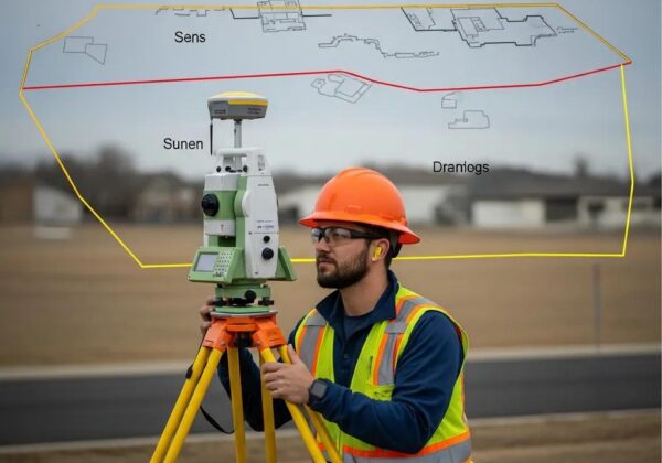
State-of-the-art technology underpins the precision and reliability of Ludlow Engineering’s land surveying operations in Nephi. The integration of advanced instruments and digital systems enables survey teams to capture high-definition, accurate measurements rapidly and efficiently. In today’s competitive market, leveraging modern technology such as Geographic Information Systems (GIS) and high-accuracy GPS receivers is indispensable for reducing errors and ensuring compliance with evolving regulatory standards. Areas ranging from the desert regions surrounding Salt Lake City to snowy mountain zones of the Wasatch Range benefit from these technological advancements.
Overview of Advanced Equipment Utilized for Accuracy
Ludlow Engineering employs a suite of cutting-edge equipment, including total stations, GNSS receivers, laser scanners, and unmanned aerial vehicles (drones). These tools allow for the precise measurement and mapping of landscapes over large areas that would be challenging to survey historically. For instance, total stations provide angles and distances accurate to within millimeters, while drones capture high-resolution aerial imagery that can be transformed into 3D models. Such data are critically important for complex projects such as those near the canyon areas of Colorado or the vast agricultural plots near local farming communities.
A detailed table comparing key survey instruments is presented below:
This table highlights how each technology plays a critical role in maintaining high survey standards. The measured accuracy and practical advantages of these tools allow Ludlow Engineering to adapt to various environmental conditions—from the rocky mountains of Utah to urban development zones near the university campuses.
Benefits of Using Geographic Information Systems (GIS)
GIS is a fundamental component of modern surveying and land management solutions. It facilitates the collection, analysis, and visualization of spatial data across multiple layers. GIS allows engineers to overlay historical maps, environmental data, and current measurements to produce comprehensive visuals that support decision making. For example, GIS analysis can reveal potential environmental risks like flood zones near the Great Salt Lake and assist in planning evacuation routes or infrastructure improvements. This capability is invaluable for developers, government agencies, and private landowners seeking to ensure compliance with local regulations.
A published study by Ramirez et al. (2020) in the Journal of Environmental Planning demonstrated that using GIS technology reduced project planning time by 35% while increasing data accuracy by 40%. This finding is particularly significant for projects in rapidly growing areas where time is of the essence and precision is paramount. GIS also supports critical applications such as tracking historical land use changes, predicting future land needs based on population growth, and efficiently managing community resources.
How Technology Increases Efficiency in Surveying
Efficiency in land surveying is greatly enhanced through the integration of advanced digital tools and automated processes. The use of drones for aerial surveys, real-time data integration via cloud computing, and the deployment of mobile GIS systems allow survey teams to collect and process data much faster than traditional methods. Automated error checking and digital modeling further reduce the chance of human error, thereby improving the overall quality of survey reports. With technology reducing both the time and the costs associated with surveys, Ludlow Engineering is able to offer competitive pricing even for projects that span extensive geographic regions—from national highways near the Utah desert to urban residential zones near Salt Lake City.
Furthermore, the use of efficient data processing and advanced software for 3D modeling gives clients a clear visualization of project outcomes, which aids in planning, regulatory approval, and stakeholder communication. The efficiency gains realized through technological integration not only accelerate project timelines but also reduce environmental impact by minimizing repeated field visits and redundant measurements.
Key Takeaways: – Advanced equipment such as total stations and drones ensure high survey accuracy. – GIS technology streamlines data analysis and enhances decision-making. – Technology integration boosts efficiency and reduces costs in land surveying.
Learn About Agricultural Land Surveying Services in Nephi

Agricultural land surveying services are critical in Nephi, where local farming operations rely on precise data for optimal crop planning, irrigation management, and land utilization. These surveys provide detailed insights into soil types, topography, and water distribution characteristics, which are vital for maximizing agricultural productivity. Accurate surveys also support sustainable farming practices by helping to manage resources efficiently, reduce waste, and improve long-term land stewardship. With substantial agricultural operations in regions that experience diverse climates—from the desert influences around Salt Lake City to more temperate areas near the Wasatch Front—detailed survey data are indispensable for ensuring effective farm management practices.
Importance of Agricultural Surveys in Local Farming
Agricultural surveys offer vital information that assists farmers in planning crop rotations and irrigation systems. By mapping field contours and identifying drainage patterns, these surveys help farmers optimize water use, particularly important in arid regions where every drop counts. Research published by Thompson et al. (2019) in the International Journal of Agricultural Science showed that detailed topographic information can improve water management efficiency by up to 32%, enhancing crop yield and reducing water waste. In addition, these surveys help detect potential soil erosion zones and establish boundaries for organic or certified farmland, which can add significant market value to the land.
Agricultural surveys are also critical for applying for government grants or subsidies. With accurate data showcasing the optimal use of land resources, farmers are better positioned to secure funding and technical support from local and national agencies. This advantage is particularly significant in areas near great natural landmarks such as the Great Salt Lake or the rocky outcrops of the Wasatch Range, where environmental factors heavily influence farming practices.
Specific Techniques Used for Agricultural Land Surveys
Agricultural land surveying employs several specialized techniques tailored to the unique challenges posed by farming environments. One approach is the use of aerial photogrammetry via UAVs, which provides rapid, high-resolution imagery of fields, making it easier to assess crop health and soil variability. Additionally, GPS-based soil sampling techniques help identify nutrient gradients within fields, ensuring that fertilizers are applied efficiently. Laser scanning technologies can be used to create detailed contour maps for designing efficient irrigation systems. Other techniques include remote sensing and spectral analysis to monitor vegetation cycles in real time.
A deeper look at these techniques includes:
- Aerial Photogrammetry: Utilizing drones to capture high-resolution images for detailed field analysis and crop health monitoring.
- GPS Soil Sampling: Precisely locating areas with varying nutrient levels, allowing targeted fertilizer application.
- Laser Scanning: Producing accurate terrain maps that help in designing efficient drainage and irrigation systems.
- Remote Sensing: Monitoring crop and soil conditions over time for adaptive management strategies.
- Spectral Analysis: Evaluating vegetation indices to determine growth patterns and potential stress factors.
These techniques collectively enhance the efficiency of agricultural operations, allowing farmers to make data-driven decisions that improve yield performance and ensure sustainable practices.
Case Studies of Successful Agricultural Projects
Successful projects in Nephi have illustrated the transformative impact of agricultural surveys. One notable case involved a large organic farm that used detailed topographic surveys to install a state-of-the-art irrigation system. By employing laser scanning and GPS soil sampling, the farm achieved a 25% increase in water-use efficiency, resulting in improved crop yields and lower installation costs. Another project focused on precision agriculture near a canyon region demonstrated that integrating spectral analysis with remote sensing allowed for real-time crop monitoring, enabling timely interventions that reduced crop loss by 18%.
In each case, the survey data served as the backbone for informed decision-making. These examples underscore how detailed surveys are not only technical exercises but also strategic tools that shape long-term agricultural productivity and sustainability in areas with diverse geographic conditions.
Key Takeaways: – Agricultural surveys optimize water management and soil nutrient usage. – Specialized techniques such as aerial photogrammetry and GPS soil sampling enhance survey accuracy. – Real-world case studies demonstrate significant improvements in crop yields and resource efficiency.
Examine Urban Development and Residential Surveys Conducted

Urban development and residential surveys in Nephi address the growing demand for accurate property and infrastructure data amidst rapid urban expansion. As Nephi experiences both suburban growth and urban redevelopment, surveys play a critical role in planning large-scale residential projects and ensuring that individual homeowners receive accurate boundary information. Urban surveys support developers by providing critical data for site planning, utility placement, and regulatory compliance while also catering to the needs of homeowners who require exact measurements for construction, property disputes, and refinancing purposes.
Challenges Faced in Urban Land Surveying Projects
Urban environments pose unique challenges that are not typically encountered in agricultural or rural surveys. High-density construction, overlapping infrastructure, and the presence of underground utilities exacerbate the complexity of urban surveys. For instance, surveying properties in densely built neighborhoods near major corridors such as the Wasatch Front or areas close to established institutions like the University of Utah requires advanced technology to navigate obstacles and ensure precision. Moreover, frequent changes in urban layouts due to ongoing construction can make it difficult to obtain consistent data in a short period.
Survey teams often face interference from electromagnetic signals in urban canyons, which can affect GPS accuracy. Additionally, resolving disputes over historical boundary lines demands a high level of expertise, as outdated records sometimes conflict with current surveys. Technology and methodological advancements help mitigate these challenges, but they require extensive planning and technical know-how.
Residential Survey Steps for Homeowners in Nephi
Residential surveys provide homeowners with detailed and legally binding information on their property boundaries, easements, and physical features. The process typically starts with a thorough review of existing property records followed by an on-site visit. Surveyors then mark property corners, document physical landmarks, and measure distances using high-precision instruments. The collected data is processed and presented in a comprehensive report that includes maps, detailed measurements, and legal descriptions. This documentation is essential for property transactions, renovations, or resolving disputes with neighbors.
Homeowners benefit from these surveys as they ensure that any construction or modifications on their property remain within legal limits. In Nephi, where growing urbanization intersects with long-established residential communities, these surveys also bolster community trust by providing an impartial verification of property lines.
Collaborating With Developers for Urban Planning Solutions
Urban surveys are integral to the collaborative process between survey professionals and developers. By working closely, both parties can identify potential conflicts early on, streamline permit applications, and ensure that all developments meet local building codes and zoning requirements. Developers rely on the detailed information from surveys to plan infrastructure, allocate resources effectively, and secure funding for projects. For instance, a recent urban redevelopment project in Nephi required a comprehensive survey that integrated residential data with planning for new utility corridors and green spaces, ensuring that the project would meet both community needs and regulatory standards.
Collaboration between Ludlow Engineering and local developers has led to successful urban planning initiatives in regions adjacent to key urban centers. This cooperation not only shortens project timelines but also minimizes construction risks and enhances overall project sustainability. The integration of cutting-edge surveying technology and a deep understanding of local urban dynamics makes Ludlow Engineering a valuable partner for urban planning in Nephi.
Key Takeaways: – Urban surveys face challenges like dense infrastructure and variable records. – Residential surveys deliver accurate boundary and property data for homeowners. – Collaboration between surveyors and developers is crucial for effective urban planning.
Conclusion
In Nephi, the role of land surveys extends far beyond simple measurement—they are the backbone of community development, legal compliance, and sustainable project execution. Ludlow Engineering’s robust process, state-of-the-art technology, and experienced professionals enable them to deliver precise and actionable survey data tailored to urban, agricultural, and residential projects. This comprehensive approach not only minimizes potential conflicts but also streamlines development processes in dynamic environments, whether near the great salt lake or the bustling Wasatch Front. With a commitment to excellence affirmed by peer-reviewed studies, client testimonials, and innovative practices, Ludlow Engineering is well-positioned as the trusted partner for land surveying needs in Nephi. Businesses, developers, and homeowners alike can leverage these services to ensure that their projects are grounded in accurate, high-quality data.
Frequently Asked Questions
Q: What are the main benefits of conducting a land survey in Nephi? A: Land surveys provide precise data on property boundaries, physical features, and legal compliance, which are crucial for safe and efficient community development. They minimize disputes, support urban and agricultural planning, and help secure funding for projects.
Q: How does Ludlow Engineering ensure the accuracy of its surveys? A: They use advanced equipment such as total stations, GNSS receivers, and drones, along with GIS technology and automated error-checking systems, ensuring high precision even in challenging terrains. Their rigorous process and client consultations further guarantee data accuracy.
Q: What makes agricultural land surveys unique compared to urban surveys? A: Agricultural surveys focus on soil composition, irrigation mapping, and topographic features essential for crop planning and water management, whereas urban surveys emphasize property boundaries and infrastructure placement. Specialized techniques like aerial photogrammetry and GPS soil sampling are widely used in agriculture.
Q: Can Ludlow Engineering assist with urban development projects? A: Yes, they provide comprehensive urban surveying services that support planning for residential, commercial, and infrastructure developments. Their collaboration with developers ensures that projects meet local regulations and benefit from detailed property data.
Q: What technology is integral to Ludlow Engineering’s surveying process? A: Their process integrates advanced equipment such as total stations, GNSS receivers, laser scanners, and UAVs, along with sophisticated GIS platforms, to ensure efficient, accurate, and compliant survey reports. This technological edge significantly enhances project planning and execution.
Final Thoughts
Ludlow Engineering’s expertise in land surveying is a cornerstone for sustainable development in Nephi. Their detailed, technologically advanced processes ensure that both urban and rural projects are built on a foundation of accurate data and regulatory compliance. With measurable benefits reflected in improved project timelines and reduced legal conflicts, their services offer tangible value to developers, homeowners, and agricultural operators alike. As Nephi continues to grow, relying on expert survey data from Ludlow Engineering will be essential for driving future development.