
Utah Land Surveying Services — Statewide Coverage
Licensed land surveyors and civil engineers serving Utah since 1975. Boundary, ALTA, topographic, drone & construction surveys — anywhere in the state.
Request a Free QuoteHome » Our Services » Utah Land Surveying
Updated May 2026 · By Travis Ludlow, Licensed Land Surveyor
Looking for a trusted Utah land surveying company? Ludlow Engineering and Associates has been the go-to land survey firm for Utah property owners, builders, lenders, and developers since 1975. Our in-house team of Professional Land Surveyors (PLS) and licensed civil engineers handles every project ourselves — no subcontractors, no out-of-state crews — so you get the same hands-on accuracy whether your parcel is a quarter-acre lot in Provo or a thousand-acre ranch in Sanpete County. Call (435) 623-0897 for a same-week quote, or request a quote online.
What Is Land Surveying — and Why It Matters in Utah
A land survey is the science of accurately measuring and mapping a parcel of land — its boundaries, its elevations, its features, and its legal description as recorded at the county courthouse. In Utah specifically, accurate surveys are essential because of the state's mix of platted urban subdivisions, century-old rural parcels described in deeds that pre-date GPS, and rapidly developing land along the Wasatch Front. The wrong line on a fence, an unmarked easement, or a missing flood elevation certificate can stall a sale, void a permit, or land you in court.
Ludlow Engineering's land survey services answer those problems before they happen. Our surveyors combine the latest field equipment — GPS receivers, robotic total stations, and UAV drones — with hands-on knowledge of Utah's terrain, county recorder offices, and the quirks of every jurisdiction from Salt Lake City to St. George.
Land Surveying Services We Offer Across Utah
We are a full-service surveying firm. Most clients come to us for one specific need, but our depth means we can support the entire project lifecycle — from initial boundary work through construction staking and as-built documentation.
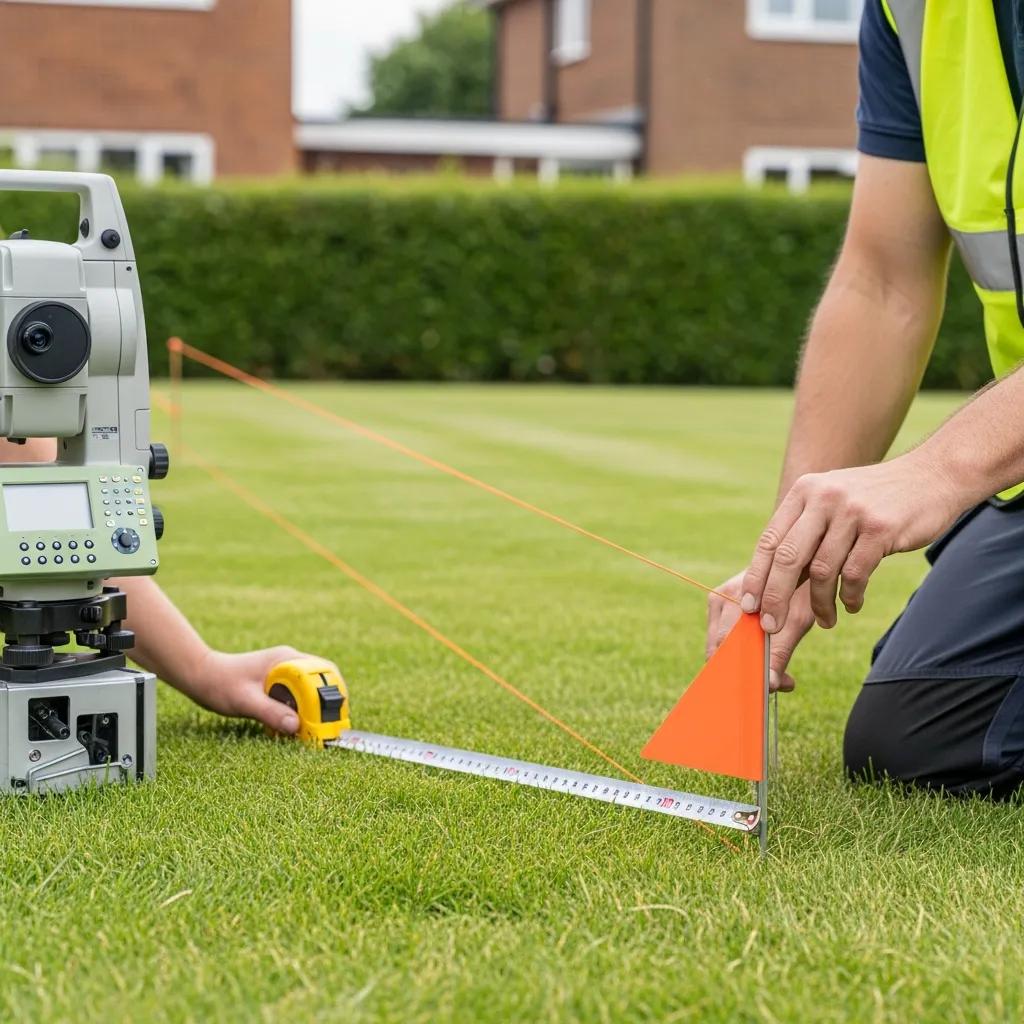
Boundary Surveys
Establish the exact legal corners of your property. The most common Utah survey — used for fence disputes, additions, sales, and pre-construction planning.
Learn more →ALTA / NSPS Surveys
The detailed title-grade survey lenders, title companies, and commercial buyers require. We follow the latest ALTA/NSPS standards and Table A items.
Learn more →Topographic Surveys
Detailed mapping of elevations, contours, and surface features for engineering, drainage, and site planning. Drone-assisted where it makes sense.
Learn more →UAV / Drone Surveying
Aerial photogrammetry for large parcels, construction progress, and hard-to-reach terrain. Faster, safer, and cost-effective for the right project.
Learn more →Construction Staking
Translating engineering drawings into stakes on the ground so contractors know exactly where every building, road, and utility belongs.
Get a quote →Subdivision & Plats
From single lot splits to large subdivisions — plat preparation, recordation, and the engineering that has to go with them.
Learn more →As-Built Surveys
Documenting exactly what was built once construction is complete — required for many lenders, HOAs, and final inspections.
Learn more →FEMA Flood Elevation Certificates
Required for properties in or near flood zones. We complete the official FEMA form so you can secure insurance or close on the property.
Get a quote →Lot Line Adjustments
Moving or correcting a boundary between adjoining parcels — including the county filing process and neighbor coordination.
Learn more →Property Line Surveys for Utah Homeowners
The most common call we get is from a homeowner who needs to know where their property actually ends — usually before building a fence, putting in a shed, settling a dispute with a neighbor, or buying a home. A property line (boundary) survey produces a legal-quality map and physical markers on the corners of your land.
- Marked corners you can see and a recorded map you can keep
- Catches encroachments, easements, and recording errors
- Required by most Utah counties before fence permits
- Typical residential turnaround: 1–3 weeks
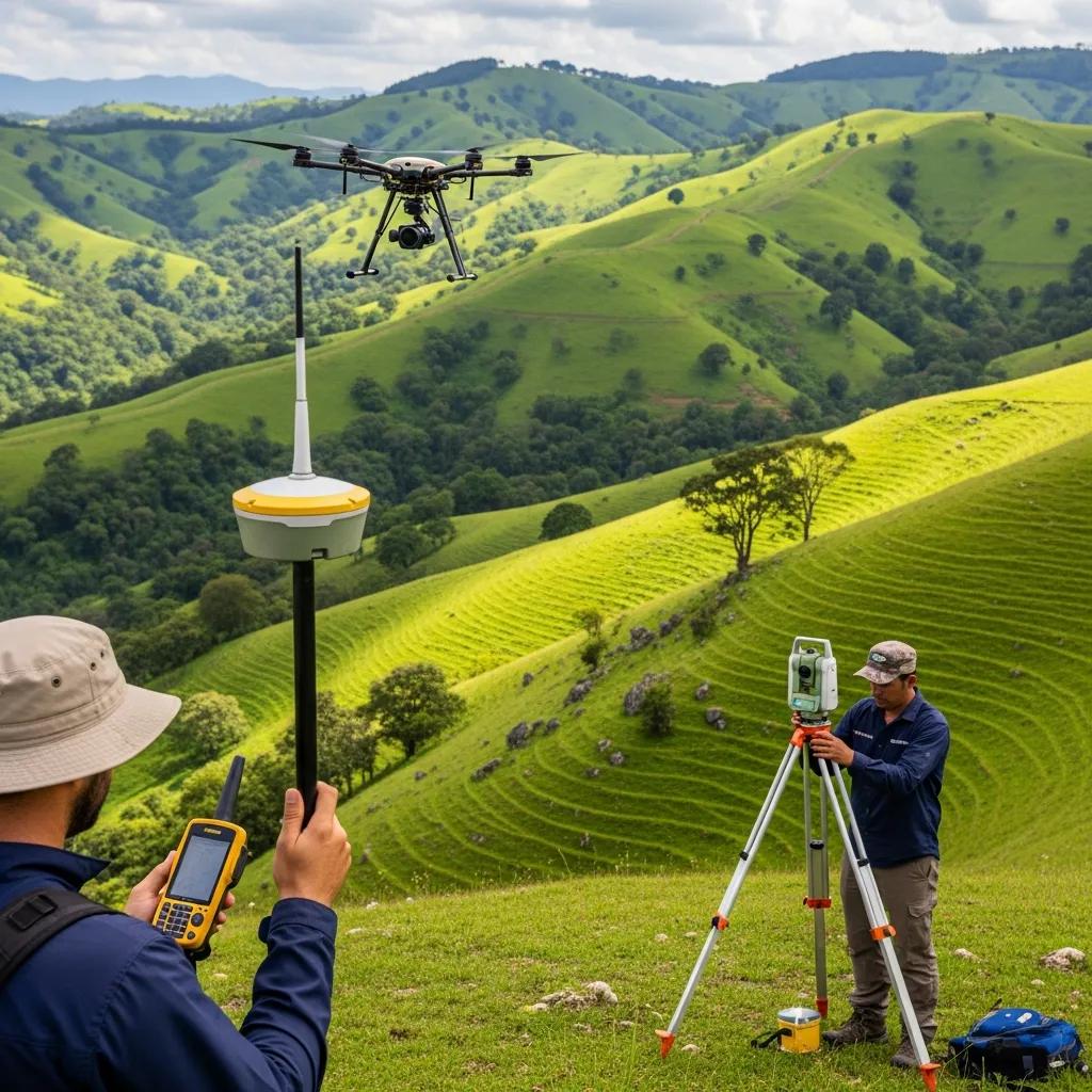
Topographic & Drone Surveys for Developers and Engineers
For builders, civil engineers, and developers, the underlying survey is what every design, permit, and construction decision rides on. Our topographic and drone-assisted surveys deliver high-resolution surface data in formats engineers actually use — AutoCAD, Civil 3D, GIS, and PDF — with elevation accuracy suited to the project's stakes.
We choose the method that fits the site: drone photogrammetry for large or rough terrain, robotic total stations for tight urban sites, and GPS networks for everything in between.
Counties & Communities We Serve in Utah
Our home office is in Nephi, but we work statewide. Here are the Utah regions where we've completed the most surveys — click through for a dedicated page on each:
We also regularly take work in Millard County, Juab County, Wasatch County, Carbon County, and southern Utah (Iron and Washington counties). If you don't see your area, call us — we travel.
What Does a Land Survey Cost in Utah?
Survey pricing varies with parcel size, terrain, access, the depth of historical research required, and the type of survey. The ranges below are typical Ludlow Engineering pricing for straightforward Utah projects. For a precise quote, call (435) 623-0897 or see our detailed survey cost guide.
| Survey Type | Typical Utah Cost | Typical Turnaround |
|---|---|---|
| Residential boundary survey (¼–1 acre lot) | $1,025 – $2,500 | 1–3 weeks |
| Rural / acreage boundary survey | $2,500 – $6,000+ | 2–5 weeks |
| ALTA / NSPS title survey | $3,000 – $8,000+ | 3–6 weeks |
| Topographic survey (typical lot) | $1,500 – $4,500 | 1–3 weeks |
| Drone / UAV survey | Quote-based | 1–2 weeks |
| FEMA flood elevation certificate | $500 – $900 | 1–2 weeks |
| Lot line adjustment | $1,500 – $3,500 | 3–6 weeks |
| Construction staking | Quote-based | Per project |
Prices are starting estimates for typical Utah projects. Complex terrain, missing monuments, large parcels, or expedited turnaround can change these figures.
Why Choose Ludlow Engineering Over Other Utah Surveyors
You have a lot of options for a Utah surveyor. Here's what makes Ludlow different:
- In-house team. Our PLS surveyors and civil engineers all work under the same roof. You're never handed off to a subcontractor and you never get a "we'll call you back" on technical questions.
- 45+ years of Utah-specific knowledge. We know the recorder's office in every county we work. That historical-records depth saves hours on tough boundary work.
- We serve every parcel size. "We take care of the little guy" isn't a tagline — it's the reason a homeowner can call us for a fence-line survey and get the same quality of work a developer gets on a 200-lot subdivision.
- Same-week quotes. Most clients hear back within one business day. We tell you the timeline and the price up front.
- Engineering under one roof. If your survey reveals issues (drainage, elevation, easement, zoning) our civil engineers can address them on the same project. No second firm. No second contract.
Our Land Survey Process — From First Call to Final Map
Every Ludlow survey follows the same basic workflow. We'll walk you through it on the first call:
| Step | What Happens | Typical Time |
|---|---|---|
| 1. Inquiry & quote | You call or email; we ask a few questions about the parcel; we give you a fixed-price quote and timeline. | Same day to 1 business day |
| 2. Contract & deposit | You sign the contract, pay a 50% deposit, and send us your deed or tax notice plus any plat you have. | 1–3 days |
| 3. Research | We pull recorded plats, deeds, prior surveys, and corner records from the county. | 3–7 days |
| 4. Field work | Our crew goes to the property, sets up control, measures, and finds or sets corners. | 1–3 days on site |
| 5. Office work & map | We process data, draft the map, and reconcile any conflicts between deed, plat, and field measurements. | 1–2 weeks |
| 6. Delivery | You receive the signed and sealed map, plus any required filings with the county. | Final invoice on delivery |
Frequently Asked Questions About Utah Land Surveying
How much does a land survey cost in Utah?
Most residential boundary surveys in Utah run between $1,025 and $2,500. Larger or rural parcels typically run $2,500 to $6,000+, and ALTA title surveys start around $3,000. The exact price depends on parcel size, terrain, access, and how much historical research is needed. See our full survey cost guide or call (435) 623-0897 for a same-day quote.
How long does a land survey take in Utah?
A typical residential boundary survey takes 1–3 weeks from contract to delivered map. ALTA surveys generally run 3–6 weeks. Field work is usually 1–3 days on site; the rest of the time is research, drafting, and reconciliation. Weather, missing monuments, and county recording backlogs can extend the timeline. See our detailed timeline article for more.
Do I need a land survey before building a fence in Utah?
Most Utah cities and counties require either a boundary survey or recorded plat showing the property line before they will issue a fence permit. Even where it isn't strictly required, a survey protects you from accidentally placing the fence on a neighbor's property — which has cost Utah homeowners thousands of dollars when neighbors later demanded the fence be moved.
What is the difference between a boundary survey and an ALTA survey?
A boundary survey establishes the legal corners of a property. An ALTA/NSPS survey is a more detailed title-grade survey that also documents improvements, easements, encroachments, utilities, flood zones, and other items lenders and title insurers require. ALTA surveys are typically used for commercial transactions; boundary surveys are typical for residential needs.
Can I use a drone for a land survey in Utah?
Yes — UAV (drone) surveying is well suited to large parcels, rough terrain, and construction progress mapping. However, drones cannot replace ground monumentation for legal boundary corners. We typically combine drone photogrammetry with traditional ground surveying to get both the wide-area coverage and the legal-grade corner accuracy your project needs.
Are land surveyors required to be licensed in Utah?
Yes. Utah law requires a Professional Land Surveyor (PLS) license to perform any survey that affects legal boundaries. Always verify your surveyor is currently licensed by the Utah Division of Occupational and Professional Licensing (DOPL). All of Ludlow Engineering's signed and sealed surveys are produced by Utah-licensed PLS surveyors.
What information do you need from me to start a survey?
To start a typical project we'll ask for: (1) your most recent deed or tax notice, (2) the recorded plat if one exists, (3) any prior surveys you have, and (4) access to the property. From there we handle the county research and field work ourselves.
Do you offer land surveying outside central Utah?
Yes. While our office is in Nephi, we regularly perform surveys across the entire state — from Salt Lake County and the Wasatch Front south to Washington County, and east to Carbon and Wasatch counties. Travel may be reflected in the quote for distant locations.