
Expert Land Surveying Companies in Alpine Utah: Ludlow Engineering’s Comprehensive Services for Your Property Needs
If you own or develop property in Alpine, Utah, accurate land surveying is the foundation for clear boundaries, safe construction, and smooth permitting. This guide explains how professional surveying delivers legal certainty and practical site data for transactions, design, and permits—focused on the realities of Alpine terrain and local rules. You’ll learn the core survey types we provide—boundary, ALTA/NSPS, topographic, UAV aerial surveys, and specialty inspections—how each is used, and which local factors affect cost and schedule. We also outline Alpine regulatory touchpoints and walk you through requesting a quote from Ludlow Engineers and Associates LLC, which serves Alpine and surrounding Utah counties. Throughout, we use local examples of slope, zoning, and deliverables so homeowners, developers, and commercial clients can make informed decisions. After this overview, each section breaks down services, deliverables, cost drivers, regulatory constraints, and our intake steps so you can move your project forward with confidence.
Why Choose Ludlow Engineering for Land Surveying in Alpine Utah?
Choosing a surveying partner means more than technical accuracy — you need local knowledge and a team that coordinates with engineering and permitting. At Ludlow Engineers and Associates LLC we have licensed surveyors and engineers working together in-house. That integrated approach shortens coordination, reduces rework, and keeps survey plats aligned with permit submittals. On Alpine’s varied parcels, familiarity with slope, drainage, and county recorder practices improves evidence research, monument recovery, and practical monument placement. Below we summarize the client advantages you get when surveys and engineering are handled by the same trusted team, delivered with integrity and a focus on your schedule.
We help clients who are ready to move from research to a formal quote — a direct invitation for those prepared to request services.
What follows are concrete examples of how our local experience turns into better project outcomes, starting with the terrain and process knowledge that reduces surprises and speeds approvals.
What Local Expertise Does Ludlow Engineering Bring to Alpine Utah?
Our local expertise centers on Alpine and Utah County land records, permitting touchpoints, and terrain-specific survey tactics that produce dependable deliverables. We anticipate common record issues like split legal descriptions, overlapping easements, and legacy monuments that often require extra research before fieldwork. Practically, that means efficient title and deed review, focused field searches for monuments, and access planning for steep or heavily vegetated parcels. That preparation cuts down on return visits and helps produce survey plats that meet county recorder expectations and permit requirements, which moves approvals and construction planning forward more smoothly.
This local understanding also reduces dispute exposure and improves project planning, benefits we explain next.
How Do Ludlow’s Comprehensive Surveying Services Benefit Alpine Clients?
Comprehensive surveying reduces legal risk, supports accurate design, and streamlines transactions by delivering authoritative plats and digital data matched to each project. For a homeowner planning an addition, a boundary survey clarifies setbacks and prevents encroachment. For a developer, an ALTA/NSPS survey supplies the detail lenders and title companies expect for commercial closings. Reliable topographic and utility data speed permitting and inform grading, drainage, and foundation design. Because our survey and engineering teams collaborate internally, we close gaps between site data and design, cut costly revisions, and help keep project schedules on track.
The next section outlines the core survey types we offer and how to pick the right one for your Alpine property.
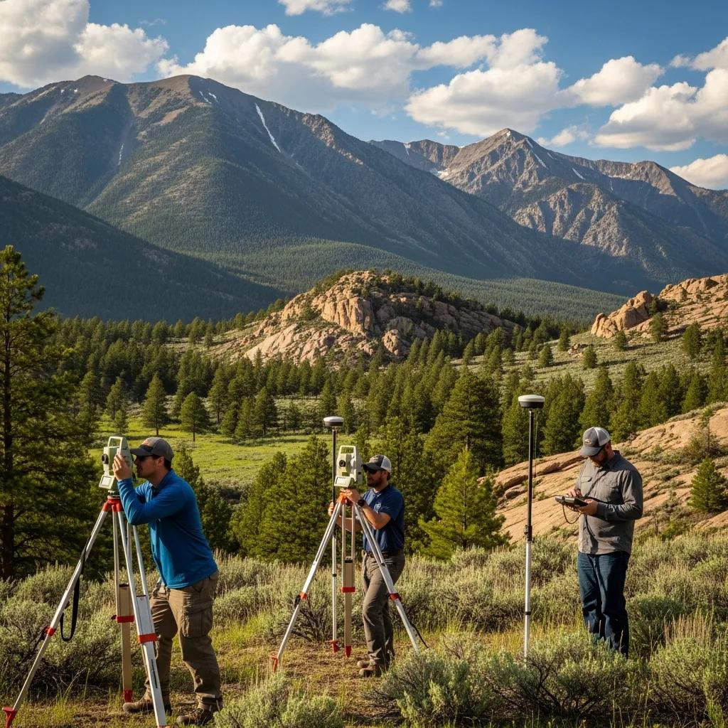
What Core Land Surveying Services Does Ludlow Engineering Offer in Alpine Utah?

Our core services include boundary surveys, ALTA/NSPS surveys, topographic surveys, UAV aerial data collection, and specialty inspections such as FHA foundation checks. Each produces specific outputs for legal, design, or transactional needs. Boundary surveys establish legal lines and monumentation through title research and field evidence. ALTA/NSPS surveys expand that scope for commercial closings by mapping improvements, easements, and recorded matters. Topographic surveys capture contours and features for site planning, while UAV aerial surveys deliver high-resolution orthomosaics and terrain models to complement ground control. The table below compares the main survey types, their primary purposes, common deliverables, and typical cost drivers so you can choose the right scope for residential or commercial work.
The following table helps compare land surveys by purpose and typical deliverables to guide selection.
This comparison clarifies which deliverables align with legal, design, and transactional needs and helps determine the appropriate engagement scope before requesting a formal estimate.
How Do Boundary Surveys Define Property Lines in Alpine Utah?
A boundary survey starts with deed and plat research, then moves to fieldwork to locate monuments and physical evidence that match the record. We reconcile historical documentation with what’s found on-site, recover or set monuments as appropriate, and deliver a sealed survey plat showing corners, bearings, and distances for legal use. In Alpine, slope and vegetation often hide monuments, so our crews plan search strategies and access methods to reduce delays. The finished plat supports title work, building permits, and dispute resolution by clearly documenting methods and conclusions.
That leads into why ALTA/NSPS surveys are different and commonly required for commercial transactions.
Why Are ALTA Surveys Essential for Commercial Properties in Alpine?
ALTA/NSPS surveys give lenders and title insurers the comprehensive mapping they need for commercial transfers. They combine boundary determination with a detailed inventory of improvements, easements, and recorded matters that affect title insurance. These surveys follow national standards and can include visible encroachments, rights-of-way, and utilities when requested by the client and title company. In Alpine commercial closings, an ALTA survey reduces closing delays by providing the items underwriters verify before commitments. For developers and investors, that level of detail clarifies title exceptions and physical encroachments so you can assess risk and negotiate with confidence.
The next section explains how topographic data shapes design decisions on Alpine’s slopes and varied sites.
How Do Topographic Surveys Support Land Development in Alpine Utah?
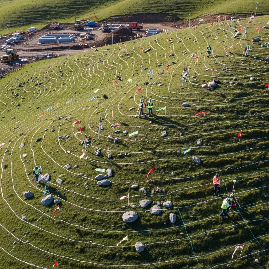
Topographic surveys map the land’s shape and features, producing contours, spot elevations, and inventories that guide grading, drainage, foundation design, and utilities. These surveys turn natural and man-made features into design data—contour intervals, slope analysis, and high/low points for stormwater routing—that designers use to reduce erosion and meet local drainage rules. On Alpine’s sloped, sometimes rocky parcels, accurate topo data helps engineers model cut/fill and design foundations that account for subsurface conditions. Topographic surveys also provide the baseline for site plans, construction staking, and permit packages that reflect real field conditions rather than assumptions.
Below is a concise mapping of common topographic deliverables to their practical uses for site development and permitting.
These deliverables form the technical basis for site design and ensure plans reflect Alpine’s variable topography, reducing surprises during construction and helping secure permits efficiently.
What Terrain Features Are Mapped in Alpine Using Topographic Surveys?
In Alpine we routinely map contours, ridgelines, spot elevations, drainage swales, rock outcrops, trees, and existing structures so designers see site constraints and opportunities clearly. Contours and spot elevations quantify slope, which affects foundation and retaining wall needs, while drainage features show how water moves across a site and where erosion controls are required. Mapping significant trees and vegetation supports permitting and helps preserve mature specimens where feasible. Capturing these features lets engineers model grading solutions that minimize cut/fill and reduce the need for costly remediation.
That feature mapping naturally leads to how UAV aerial surveying complements ground methods for better resolution and coverage.
How Does UAV Aerial Surveying Enhance Survey Accuracy in Alpine?
UAV aerial surveying delivers high-resolution orthomosaics and point clouds fast, making it easier to characterize steep or hard-to-access areas. When tied to GPS control points, photogrammetry can meet survey-grade accuracy for preliminary design and as-built checks; LiDAR-equipped drones improve bare-earth models by penetrating vegetation. UAV surveys shorten field time on large or rough parcels, but they work best combined with ground control and conventional checks to validate monument locations. Integrating UAV outputs with GNSS control and total station measurements produces datasets that balance efficiency with precision for engineering work.
The next section reviews cost drivers and what to expect when budgeting for surveys in Alpine.
What Are the Typical Costs and Factors Affecting Land Surveying in Alpine Utah?
Survey pricing reflects research, field effort, terrain complexity, access, and requested deliverables. Small residential boundary surveys generally sit at the lower end of industry ranges; ALTA/NSPS and large commercial topographic surveys trend higher. Factors that increase cost include acreage, steep slopes and dense vegetation, difficulty recovering monuments, the level of deliverables (plats, CAD files, DTMs), and special inspections like FHA checks. Estimates normally itemize research time, field crew hours, office production, certifications, and any travel or permit coordination fees. For accurate budgeting, request a written estimate that spells out deliverables and assumptions used to prepare the quote.
Key cost drivers to consider are summarized below so you can anticipate where complexity adds time and price.
- Property size and acreage determine field time and data density.
- Topography and vegetation increase field difficulty and effort.
- Deliverable level (ALTA, plat, DEM, CAD) affects office production workload.
- Access and logistics (remote sites, steep slopes) raise labor and safety needs.
These factors explain why custom estimates are standard practice rather than one-size pricing.
This table clarifies how components combine into an estimate and why two similar parcels can produce different price ranges depending on site-specific conditions.
How Is Land Survey Pricing Determined for Alpine Properties?
Pricing breaks down into research, fieldwork, and office production. Research includes title and deed review that defines field scope. Fieldwork covers monument recovery, control, and measurements. Office work produces the plat, electronic files, and certified deliverables for title or permitting. Complexity raises cost: steep slopes, heavy vegetation, or unclear record evidence require more time and sometimes multiple visits. When requesting a quote, provide parcel identifiers, the intended use, and desired deliverables so the estimate accounts for these core components.
Knowing these pricing elements sets expectations and helps clients provide the information that yields accurate estimates. The next section covers typical timelines.
What Should Clients Expect Regarding Survey Duration and Process?
Typical timelines include initial research (a few days), scheduled fieldwork (one to several days depending on size and complexity), then office drafting, review, and delivery (a few days to several weeks for complex projects). Simple residential boundary surveys finish faster; ALTA/NSPS and commercial topographic surveys require more research, coordination with title companies, and fuller deliverables, which lengthens the schedule. Weather, permit timelines, dense vegetation, and additional records searches can extend delivery, so realistic planning includes these contingencies. Sharing intended use and deadlines at the quote stage helps us prioritize and give reliable commitments.
With cost and timing expectations set, the next section covers regulatory and dispute considerations that commonly affect Alpine surveys.
What Local Regulations and Challenges Affect Land Surveying in Alpine Utah?
Survey work in Alpine must comply with county recorder rules, zoning requirements, and local permit procedures that affect required deliverables and how plats are prepared for recording. Typical regulatory items include accurate depiction of setbacks, recorded easements, and flood or drainage zones that influence permitted construction. Property disputes and unclear deed descriptions often prompt surveys; in those situations, recovered monuments, historic plats, and a sealed boundary plat become central evidence. Environmental constraints—steep slope limits or sensitive drainage corridors—may require coordination with planning authorities to ensure compliance with local codes.
Below are common local considerations surveyors and clients should address when working in Alpine.
- Zoning & Setbacks: Surveys provide planners with the data they need to verify compliance and support permit applications.
- Easements & Rights-of-Way: Accurately mapping recorded and apparent easements prevents future conflicts.
- Dispute Evidence: Historical plats and monumentation notes inform legal and negotiated resolutions.
Addressing these regulatory elements early reduces rework and aligns survey deliverables with permit and title needs.
How Do Alpine’s Property Line Disputes Influence Surveying Needs?
Property disputes usually require a thorough boundary investigation combining deed research, plat analysis, and monument evidence collection to create a defensible field opinion. We document the chain of title, point out inconsistencies or gaps, and search for original or controlling monuments; when monuments are missing, we apply best-evidence practices to produce an opinion of boundary supported by field notes and legal descriptions. Deliverables that help resolve disputes include a sealed boundary plat, detailed field notes, and a written account of procedures and evidence—materials attorneys and mediators rely on in negotiations or litigation. Early engagement of a qualified surveyor often prevents escalation by providing a clear, documented basis for discussion.
Clear survey evidence supports permitting and development decisions, especially where zoning or easements limit buildable area.
What Are Key Zoning and Development Considerations for Alpine Surveys?
Survey data feed zoning applications by showing setbacks, lot coverage, and locations of easements and utilities that affect developable area and permit approval. In Alpine, topography and drainage patterns commonly determine grading limits and stormwater controls required by local authorities, making accurate contours and drainage mapping essential. Surveys should call out recorded restrictions and any encroachments that influence design or trigger variances, and plats must meet county filing standards to be accepted by building and planning departments. Working early with planners and engineers ensures survey deliverables match reviewer expectations and cuts permit review cycles.
With regulatory and practical constraints covered, the final section explains how to request services and what to expect during our intake process.
How Can Clients Request Land Surveying Services from Ludlow Engineering in Alpine Utah?
If you’re ready to engage us for land surveying and engineering, start by providing clear project details so we can scope work accurately. Our intake is a multi-step process: initial records research, scheduled fieldwork, and final deliverables. Defining scope up front—survey type, parcel identifiers, and required outputs—reduces surprises and helps us give reliable schedules. Below are practical steps and a short checklist to prepare for the fastest, most accurate estimate.
Follow these steps to request a quote and begin the engagement process:
- Provide parcel details: Give the parcel number, legal description, or street address and explain the intended use of the survey.
- Define desired deliverables: Tell us if you need a boundary plat, ALTA/NSPS, topographic with contours, UAV deliverables, or an FHA inspection.
- Share site access and constraints: Note access challenges, known encroachments, or timing constraints that could affect scheduling.
- Request timeline expectations: Tell us any closing or permit deadlines so we can advise on prioritization and scheduling.
What Is the Process to Get a Quote for Land Surveying in Alpine?
To get a fast, accurate quote, gather parcel identifiers, intended use, and a clear list of required deliverables. We typically perform title and records research, review site constraints, and propose a field schedule and cost estimate based on those findings. Internally, we review deeds and plats to identify complexities, then scope field crew needs and office production time to prepare a written estimate that lists assumptions and exclusions. For ALTA/NSPS surveys we often coordinate directly with the title company to confirm required items. Photos or site notes speed up scoping by clarifying access and terrain conditions that affect field time.
Clear upfront information reduces iterations in the quoting process and leads to a more predictable schedule and estimate.
How Does Ludlow Engineering Ensure Client Satisfaction and Accuracy?
Our QA starts with licensed reviews and cross-checks by in-house professional engineers and surveyors who verify field measurements, confirm consistency with record evidence, and review deliverables for county recording standards. Deliverables include sealed plats, field notes, and digital files as requested, and we keep clients informed at milestones such as estimate approval, scheduled fieldwork, and final delivery. By keeping surveying and engineering under one roof, we cut transcription errors and improve responsiveness when design or permitting questions arise. This integrated approach protects clients from common pitfalls and supports reliable outcomes for both residential and commercial projects.
That assurance underscores how combined surveying and engineering expertise improves project continuity and reduces permitting and construction delays.
Frequently Asked Questions
What qualifications should I look for in a land surveying company in Alpine, Utah?
Look for licensed professionals with demonstrated experience in local regulations and terrain. Confirm state licensure and relevant certifications, read client reviews, and ask for examples of similar projects. It’s also helpful to choose a firm that integrates surveying with engineering so you get coordinated deliverables and fewer handoffs.
How can I prepare for a land survey on my property?
Gather deeds, previous surveys, and any easement documentation. Clear access where practical—remove brush or debris that blocks lines of sight—and tell the surveyor about disputes, encroachments, or known site issues. Ensure access on the scheduled date and share any photos or notes that clarify terrain and access constraints.
What is the difference between a boundary survey and an ALTA/NSPS survey?
A boundary survey focuses on locating legal property lines and corners based on records and field evidence. An ALTA/NSPS survey is more detailed for commercial transactions and title insurance, mapping improvements, easements, and other recorded matters to national standards. ALTA surveys provide lenders and title companies the information they need to evaluate risk in a closing.
How do environmental factors influence land surveying in Alpine?
Alpine’s slopes, vegetation, and drainage patterns affect access, field methods, and data accuracy. Steep or vegetated areas may require drone work or more intensive field searches. Environmental regulations can also dictate survey methods in sensitive areas. Surveyors account for these factors when planning fieldwork and preparing deliverables to meet zoning and permitting requirements.
What should I expect during the land surveying process?
The process usually starts with records research, moves to field measurements, then office analysis and plat production. Timeframes range from a few days for simple jobs to several weeks for complex commercial projects. Stay in touch with your surveyor about deadlines and any site changes to keep the project on schedule.
Are there any common mistakes to avoid when hiring a land surveyor?
Don’t choose a surveyor based only on price—experience and reputation matter. Be clear about your needs and expected deliverables to avoid misunderstandings. Verify credentials and past work, and make sure the written scope and any potential extra costs are spelled out before you sign a contract.