
Find ExpertLand Surveyors in Gunnison Utah: Comprehensive Boundary and ALTA Survey Services
Land surveying in Gunnison, Utah, requires precise fieldwork, careful records research, and familiarity with Sanpete County procedures to establish reliable property lines and produce title-ready plats. This article explains the most common survey types available in Gunnison, how licensed surveyors approach boundary and ALTA work, typical cost ranges and the key steps from intake to final plat delivery. Property owners and developers will learn how topographic data, monumentation, and legal descriptions fit together to reduce transaction risk and support permitting or subdivision design. The guide also highlights practical differences between residential retracement surveys and commercial ALTA/NSPS-standard surveys, providing decision criteria for hiring a qualified Gunnison land surveyor. Throughout, you’ll find clear comparisons, concise tables for quick reference, and actionable next steps for requesting a survey or quote from Ludlow Engineers and Associates.
What Land SurveyingServices Are Available in Gunnison Utah?
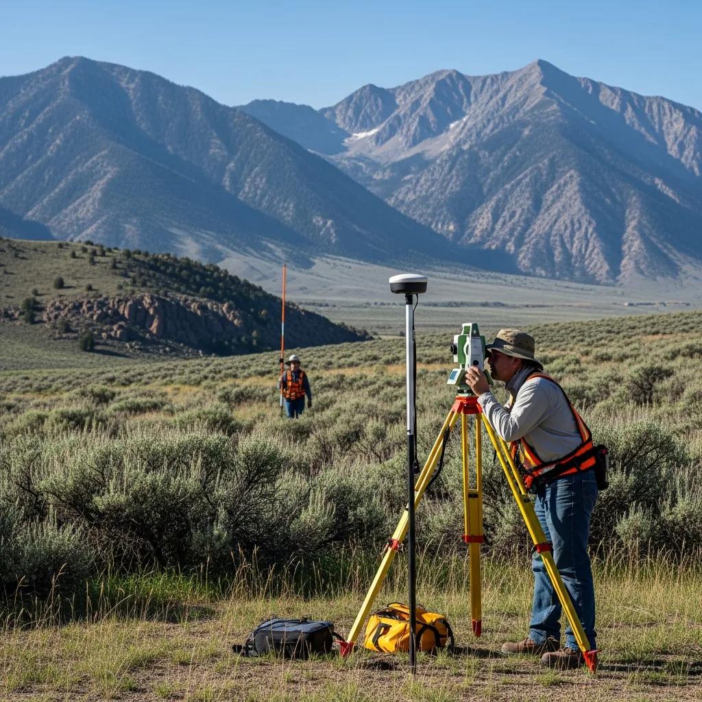
Land surveyingservices in Gunnison encompass boundary retracement, ALTA/NSPS-standard surveys, topographic mapping, and construction staking, each serving distinct legal and project needs. These services use a combination of deedresearch, monument recovery, GPS, and total station measurements to create plats, legal descriptions, and construction control that support land transactions and development. The following list outlines common service types and primary purposes to help property owners decide which survey best fits their project goals and local permitting needs.
The main surveyingservices available in Gunnison include:
- Boundary Surveys: Establish legal property lines for disputes, sales, and new construction with monumentation and stamped plats.
- ALTA Surveys: Deliver title-quality, lender-accepted plats showing easements, improvements, and rights-of-way for commercial transactions.
- Topographic Surveys: Map existing ground features, elevations, and utilities for site planning and civil engineeringdesign.
- ConstructionSurveying: Provide layout and staking for foundations, roads, and infrastructure during building and grading.
These services address most real estate and development scenarios in Gunnison by clarifying legal boundaries, revealing encumbrances, and supplying accurate site data for design and permitting. Understanding which survey fits your need makes the hiring process more efficient and ensures the final deliverable meets county and lender requirements.
This table clarifies the primary role and typical use for each common survey type in Gunnison.
This comparison helps property owners pick the correct survey by matching deliverables to their project needs and minimizing surprises during permitting or title review.
Which Boundary Survey Options Do Ludlow Engineers Provide in Gunnison?
Boundary surveys establish legal parcel limits through records research and field monumentation, resulting in a stamped plat and legal description suitable for recordation or transfer. Ludlow Engineers and Associates offers standard boundary retracement, property stakeout for construction, and legal surveys that reconcile deed descriptions with physical evidence, focusing on clear deliverables that clients can use for permitting or settling disputes. Their process typically includes title and deed correlation, monument recovery, measured field traverse, and preparation of a sealed survey plat that meets local recording standards. This suite of boundary services supports residentialproperty sales, driveway or fence placements, and project pre-construction checks.
- Retracement Survey: Correlates deeds with field monuments to define current property lines.
- Stakeout/Layout: Places control points and stakes for construction per approved plans.
- Legal Plats: Produces stamped plats and legal descriptions for recordation and closing.
These boundary options provide property owners with legally defensible results and clear next steps for building or transferring land.
How Do ALTA Surveys Support Commercial Properties in Gunnison?
An ALTA/NSPS-standard survey compiles comprehensive title and physical information—easements, rights-of-way, improvements, and visible encumbrances—on a single, certified plat that lenders and title companies rely on for risk assessment. ALTA surveys follow national standards to ensure consistent coverage and include a thorough title commitment review, coordination with the title company, and documentation of items that affect ownership or marketability, reducing surprises during commercial closings. For Gunnison commercial properties, an ALTA survey often uncovers encroachments, access issues, or easements that meaningfully affect development plans and loan underwriting. By providing a standardized, detailed dataset, ALTA surveys improve transaction transparency and help negotiators and lenders evaluate site constraints early in the process.
Why Choose Ludlow Engineers for Land Surveying in Gunnison Utah?
Choosing a local, licensed firm matters because experience with Sanpete County records and rural property conditions shortens turnaround times and reduces risk of errors that delay closings or permitting. Ludlow Engineers and Associates emphasizes precision, client satisfaction, and service to rural Utah property owners, and the firm is positioned to deliver boundary and ALTA work tailored to Gunnison’s regulatory environment. Their approach combines careful records research, field verification, and clear deliverables such as stamped plats and legal descriptions that meet county and title company expectations. The following list highlights strengths clients should expect when hiring a qualified local surveyor.
- Local Record Expertise: Familiarity with Sanpete County plats and historical monument records speeds research and correlation.
- Technical Accuracy: Use of modern surveying equipment reduces measurement uncertainty and supports reliable plats.
- Client-Focused Communication: Clear explanations of findings and next steps help owners make informed decisions.
We Do Points.com
Ludlow Engineers implements those strengths by applying precise field methods and clear documentation to every project, ensuring that clients receive accurate property line mapping, title-ready ALTA plats, and practical recommendations for permitting or design. Established in 1975, the firm combines decades of local practice with modern equipment to serve Gunnison property owners who need trustworthy survey results for sales, construction, or subdivision design.
What Experience and Technology Set Ludlow Engineers Apart?
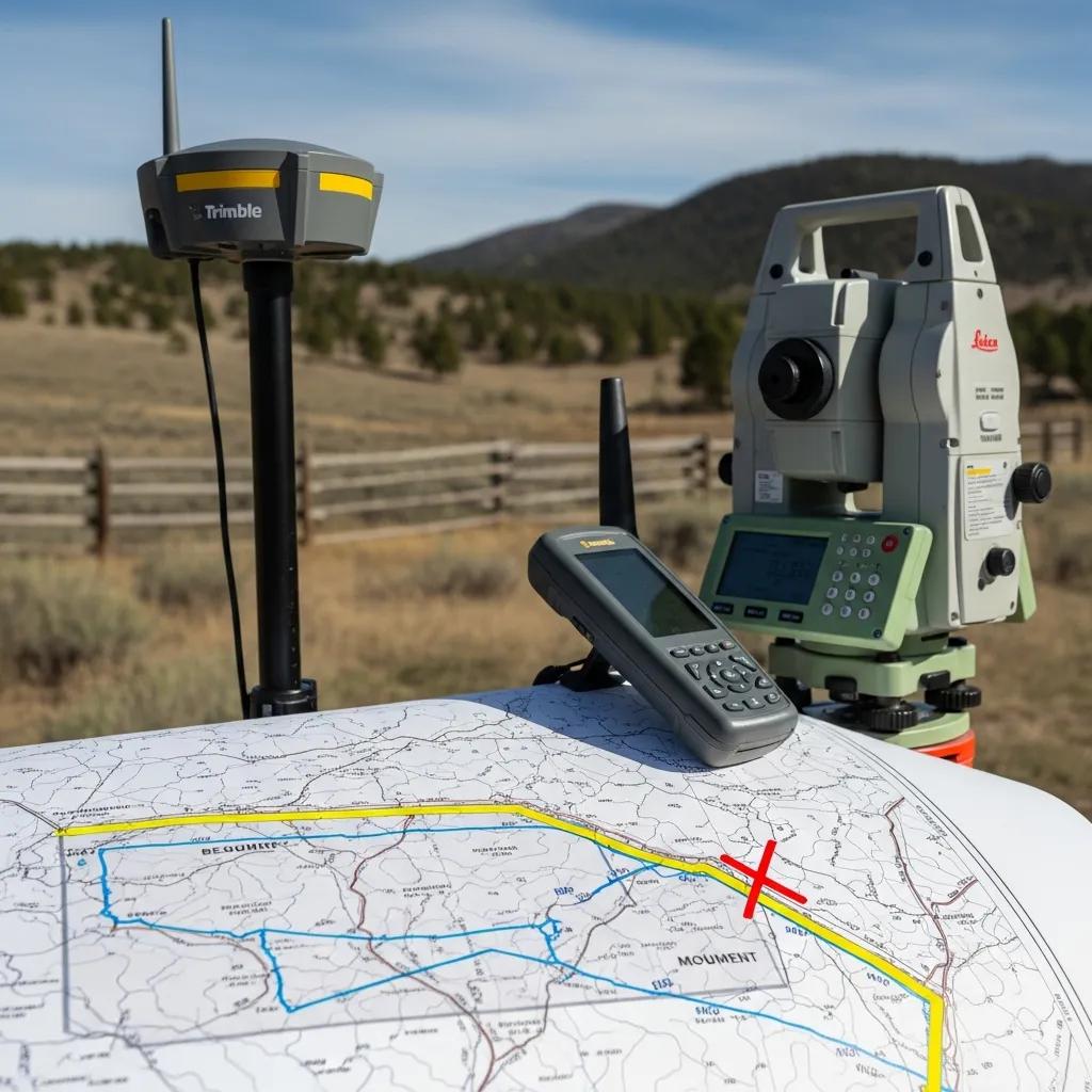
Experience and technology work together to improve survey accuracy and project efficiency; experienced staff interpret records while modern equipment captures precise measurements for mapping and monumentation. Ludlow Engineers uses GPS and total station survey techniques along with proven record-correlation methods to deliver plats that stand up to county review and title scrutiny. Field procedures emphasize monument recovery and redundant measurements to validate corners before finalizing legal descriptions and plats, which reduces the chance of rework during permitting. This blend of expertise and tools translates into faster project completion and greater confidence for property owners and lenders.
How Does Local Expertise Benefit GunnisonProperty Owners?
Local expertise means familiarity with county platting rules, zoning touchpoints, and typical regional boundary issues such as historic monument locations or seasonal access constraints that affect fieldwork. Surveyors with Sanpete County experience can anticipate record discrepancies and know where to locate archival documents or prior plats, shortening the research phase and avoiding common delays. That practical knowledge often results in clearer recommendations for resolving overlaps, easements, or access concerns before formal filings occur. Ultimately, working with a locally experienced team reduces administrative friction and helps owners navigate county approvals more smoothly.
How Much Does a Property Survey Cost in Gunnison Utah?
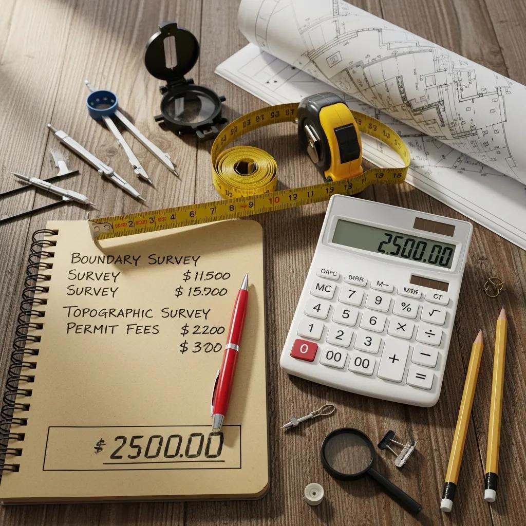
Survey pricing in Gunnison varies by scope: simple residential boundary retracement is typically less expensive, while ALTA/NSPS-standard commercial surveys require more research and deliverable detail and therefore cost more. Primary cost drivers include property size, terrain difficulty, existing monumentation, record complexity, and required certification or deliverables, all of which influence field time and office hours. The table below summarizes typical cost ranges and the main factors that change price to help property owners set realistic budgets and prepare for quote requests.
This table provides ballpark ranges; exact quotes require a site visit and review of title commitments or existing plats so that the surveyor can confirm scope and deliverables.
What Factors Influence Boundary Survey Pricing in Gunnison?
Several variables determine the time and resources needed to complete a boundary survey, which in turn affect the final price a client will pay for reliable results. Important factors include parcel acreage, topography and vegetation that slow fieldwork, the presence or absence of physical monuments, and the complexity of historical deeds or subdivision plats that require extended research. Remote or seasonal access issues in rural Gunnison parcels can add travel time and field days, increasing cost relative to easily accessible urban lots. Understanding these drivers helps owners provide relevant information upfront—such as recent title commitments or visible markers—so the surveyor can produce an accurate, efficient quote.
Factors that commonly increase cost include:
- Larger acreage or irregular parcel shapes.
- Dense vegetation or steep terrain requiring more field time.
- Extensive historic deedresearch or unclear record evidence.
- Lender or title company requirements for ALTA-level certification.
A clear, itemized quote from the surveyor will show which of these factors apply and where cost can be controlled.
Are There Cost Differences Between Residential and Commercial Surveys?
Yes, commercial ALTA/NSPS surveys generally require more time, additional title coordination, and higher levels of certification than typical residential boundary retracements, which raises both the complexity and price of the work. ALTA surveys demand a detailed review of the title commitment, communication with the title company, and inclusion of many items on a standardized checklist—steps that increase office hours and often call for more extensive field verification across improvements and easements. Residentialsurveys may focus narrowly on corners and monumentation for a home lot, while commercial projects often include larger areas, multiple easements, and features that must be documented for lenders and developers. Knowing the distinction up front helps clients budget appropriately and choose the correct scope when requesting quotes.
What Are the Key Steps in the Boundary Survey Process in Gunnison Utah?
A typical boundary survey workflow follows a clear sequence: client intake and scope definition, records research, fieldwork and monument recovery, drafting and review, and final delivery of stamped plats and legal descriptions. Each step builds on the previous one: records research informs efficient field searches, field measurements verify physical evidence, and drafting consolidates findings into legally usable documents for recording or closing. Clients should expect dialogue at several checkpoints, such as when record discrepancies appear or when monumentation cannot be located, to decide next steps. The numbered list below outlines the standard procedural steps that produce a defensible boundary survey in Sanpete County.
- Intake & Scope: Define the purpose, required deliverables, and any lender or permitting specifications.
- Records Research: Correlate deeds, prior plats, and county records to identify historic corners and easements.
- Field Investigation: Recover monuments, take measurements with GPS/total station, and document site conditions.
- Drafting & Review: Prepare a sealed plat and legal description, then review with the client for any clarifications.
- Final Delivery: Provide stamped plats and coordinate recording or title company review as requested.
Following this sequence ensures clarity and reduces surprises during closings or permit approvals by aligning research, fieldwork, and documentation.
How Is Property Line Mapping Conducted Accurately?
Accurate property line mapping combines precise measurement instruments with careful correlation to legal records and physical monuments, producing plats that match both the deed descriptions and observable site evidence. Surveyors use GPS control, total station traverses, and redundancy in measurements to limit geometric error, then reconcile those measurements against deed bearings, distances, and historical monuments found in county records. Monumentation—set or found—serves as the physical anchor for legal descriptions and is documented carefully to support future re-surveys and recordation. Clear, verified mapping reduces boundary disputes, helps resolve title issues, and provides a dependable foundation for construction and land division decisions.
What Local Regulations Affect Boundary Surveys in Sanpete County?
Local regulations influence how plats are prepared, recorded, and used in permitting; surveyors must follow Sanpete County recording standards, subdivisionplat requirements, and any relevant zoning or road-access rules that apply to a parcel. County-specific processes may require particular notation on plats, coordination with planning staff for subdivision approvals, or adherence to local monumentation and recording conventions that differ from neighboring counties. Survey clients should expect the surveyor to reference county filing requirements and advise on necessary approvals for development or lot line adjustments. Staying informed about local ordinances and scheduled planning changes ensures surveys meet current county expectations and avoid rework.
We Do Points.com
For property owners ready to request a quote or discuss a specific survey need in Gunnison, Ludlow Engineers and Associates can evaluate scope and provide guidance on appropriate survey types and deliverables. Contact the firm and ask to speak with Travis Ludlow to describe your project, provide any available title or platinformation, and request a written estimate that outlines scope, timeline, and assumptions. Reprinting the core message here reinforces our approach:
We Do Points.com
Request a quote by describing your property location, the intended use of the survey (sale, construction, ALTA, etc.), and any deadlines so the team can prepare an accurate proposal and schedule fieldwork accordingly.