
Payson, Utah Land Surveying — Licensed Surveyors & Expert Land Surveys
Overview
This page describes local surveying and civil engineering services for property owners, developers, and lenders in the Payson area. It explains what licensed land surveyors do, how common survey types—boundary, ALTA/NSPS, topographic, and construction staking—support transactions and development, and how tools like UAV aerial mapping and GPS increase accuracy and speed. Reliable survey data matters for resolving boundary questions, securing title insurance, and preparing site plans: surveys provide control points, legal descriptions, and certified plats that projects rely on. You’ll learn why local knowledge matters, which survey matches your need, how a typical engagement proceeds from consultation to delivery, and the main factors that influence cost in Payson, Utah. The guide also shows how Ludlow Engineers and Associates (operating as Ludlow Engineering) combines modern methods with local experience to deliver usable survey products and how to request a quote or consultation.
Why Choose Ludlow Engineering for Land Surveying in Payson Utah?
Ludlow Engineering is a regional civil engineering and land-surveying firm serving Central Utah and the Payson area. Their licensed surveyors know local plats, county recording practices, and city permitting procedures. With in-house civil engineering and surveying expertise they shorten coordination between survey control and site design, producing clearer deliverables—plats, legal descriptions, and construction staking—that reduce rework. The firm relies on modern field equipment and quality-control checks to support title and permitting workflows. Working with a local team also brings familiarity with Utah County recording requirements and Payson City planning expectations, which can speed approvals and minimize surprises during development.
Ludlow Engineering mention and call to action
Ludlow Engineers and Associates (operating as Ludlow Engineering) provides licensed surveyors and civil engineering services for Payson property owners and project teams. To discuss a property survey, contact Travis Ludlow to schedule a project consultation and receive a customized quote.
What Experience and Credentials Do Ludlow Engineers Bring to Payson?
Serving Payson and Central Utah, Ludlow Engineering pairs civil engineering and land-surveying experience to align survey control with site design requirements—helping projects move from permitting to construction with fewer delays. Core services include Boundary Surveys, ALTA Surveys, Topographic Surveys, Property Line Surveys, Civil Site Plans, and Construction Surveying for residential and commercial work. A local contact such as Travis Ludlow gives clients a single point of contact, and the firm’s use of UAV aerial surveying shows a commitment to modern data collection that can speed schedules and improve accuracy. That combined experience translates to clearer legal descriptions, reliable plats for title companies, and survey products that meet permitting needs.
How Does Ludlow Engineering Ensure Client Satisfaction in Payson?
Ludlow Engineering focuses on clear communication, dependable schedules, and technical accuracy. Their documented workflows turn field data into certified plats and digital files ready for design and recording. Quality control steps include verifying control points, reviewing field notes, and following standards like ALTA/NSPS when required for commercial transactions—protecting clients and lenders at closing. UAV aerial surveys and GPS equipment reduce time in the field and provide detailed site context, helping homeowners, developers, and title companies make confident decisions. Clients get a predictable process with defined deliverables, timelines, and guidance for local filings, which promotes consistent, practical outcomes.
Comprehensive Land Surveying Services Offered in Payson Utah
Ludlow Engineering offers a full range of survey services for Payson properties—from basic property-line checks to full ALTA/NSPS surveys for commercial deals. These services support real estate closings, development planning, permitting, construction staking, and flood certifications. Deliverables include plats, legal descriptions, topographic maps, and construction control files that feed directly into title work, civil plans, and contractor layouts. Use the comparison below to identify the right service for your project.
Different survey options and their typical uses
List of primary surveying services
- Boundary surveys that establish and monument legal property lines for transactions and disputes.
- ALTA/NSPS surveys for commercial due diligence, title insurance, and lender requirements.
- Topographic surveys that capture elevations, utilities, and site features for design and permitting.
These core services are supported by Civil Site Plans, House Plans, Subdivision Design, Water and Sewer Plans, Well Proofs, Flood Certifications, and Construction Surveying to cover full project lifecycles. After reviewing options, clients can request a tailored scope and quote that reflect project complexity and local filing needs.
What Are Boundary Surveys and Their Importance for Payson Property Owners?
A boundary survey locates and documents a parcel’s legal limits by combining historical plat research, deed interpretation, and field monument recovery to produce a certified plat and legal description. Boundary surveys resolve common homeowner questions—fence placement, lot-line disagreements, and uncertain property extents during sale or purchase—by providing an authoritative record for decisions and local recording. In Payson, where historical parcel descriptions and neighboring lot lines can affect setbacks and easements, a boundary survey reduces risk and supports negotiations. The typical process includes title and plat review, establishing field control and monumentation, drafting a certificate of survey or plat, and delivering a recordable survey report.
Thorough research is essential to establish accurate property lines; industry guidance highlights research as the first and most revealing step in a boundary survey.
Boundary Survey Research: Essential Steps for Accurate Property Lines
Research is the starting point for a boundary survey. Surveyors first discuss the client’s needs and then dive into records to determine how difficult a survey may be. It’s standard practice to ask the client for the property’s legal description; if it’s not available, the surveyor will retrieve deeds from the recorder’s office. Depending on the project, the surveyor also obtains deeds for adjoining properties, plans for nearby parcels, and any street layouts that affect the subject property. This background work establishes the record evidence used to set boundary markers in the field.
How Do ALTA Surveys Support Commercial Real Estate in Payson?
ALTA/NSPS surveys follow national standards that combine boundary, title, and field-verified data to meet lender and title company needs for commercial transactions. These surveys identify easements, access, improvements, and other matters that affect title insurance and lending decisions, helping underwriters assess risk and define exceptions. For Payson commercial deals, an ALTA survey ties the legal description to field-verified features and recorded instruments, producing deliverables that reduce closing delays and clarify risk allocation. Engaging a local firm familiar with Utah title practices helps ensure ALTA deliverables integrate smoothly with county recording processes and title commitments.
What Is Included in Topographic and Property Line Surveys in Payson?
Topographic surveys map elevations, surface features, utilities, and natural elements to produce contours and digital terrain models used for site design and grading. Property line surveys focus on physical boundary locations and monumentation. Topographic capture typically includes spot elevations, building footprints, curbs, trees, and visible utilities, delivered in CAD or GIS-ready formats for architects and engineers. Property line surveys provide stake-out points and certified plats to guide construction and fence placement and prevent encroachment. Combining topographic and property-line data often streamlines permitting and civil design for Payson projects, reducing back-and-forth between surveyors and engineers.
Payson Land Surveying Process with Ludlow Engineering
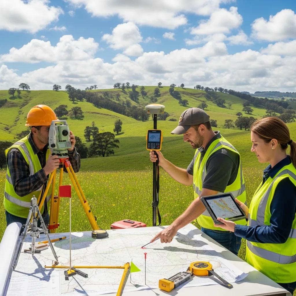
Survey projects with Ludlow Engineering follow a clear sequence from initial consultation to final deliverables, designed to set expectations and produce certified survey products suitable for recording or design. The process begins with project intake—identifying the parcel, intended use, and chosen survey type—then proceeds to title and records research to locate historical bearings and monuments. Fieldwork collects control points, monument locations, and site features using GPS, total stations, and UAV aerial surveys when appropriate. Data processing and quality checks produce plats, legal descriptions, and digital files; a final review results in certification and delivery, and the firm can coordinate with local authorities for recording or permitting support if requested.
Process steps summarized (featured-snippet style)
- Consultation and scope definition: confirm parcel, purpose, and deliverables.
- Research and permitting check: review deeds, plats, and title commitments.
- Field data collection: establish control, recover monuments, and capture features.
- Drafting and QC: prepare plat, legal description, and digital files for client review.
- Certification and delivery: finalize signature-ready documents for recording or permitting.
Process table mapping steps to outputs
The table below maps each key phase to Ludlow Engineering’s work and what clients should expect as outputs and timelines.
What Are the Steps from Consultation to Final Survey Report?
The initial consultation clarifies boundaries, intended use, and deliverables so the surveyor can define scope and estimate cost and timeline. Research gathers deeds, plats, and title commitments to establish historical monumentation and recorded easements—this step surfaces encumbrances that affect the survey outcome. Fieldwork employs GPS, total stations, and UAV aerial surveys when appropriate to capture accurate control points and site features. Data processing and internal QA produce draft plats and legal descriptions for client review. After any revisions, the survey is certified and delivered, and Ludlow Engineering can help coordinate recording or integrate results into civil design as needed.
How Does Ludlow Engineering Use Advanced Technology in Payson Surveys?
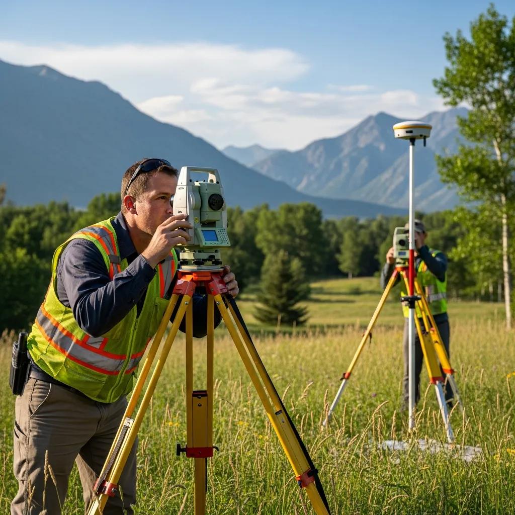
Ludlow Engineering uses modern field technology—GPS equipment and UAV aerial surveying—to improve accuracy, reduce field time, and deliver high-resolution site context for design and construction. UAV surveys produce orthophotos and surface models that, combined with ground control, yield detailed topographic outputs and help document existing conditions across larger or complex parcels. GPS and total station workflows provide reliable control and legal-grade accuracy for boundary and ALTA surveys, while digital data pipelines streamline drafting and file delivery for engineers and title companies. These tools reduce project risk by improving measurement precision and shortening turnaround from fieldwork to certified deliverables.
What Are the Typical Costs and Factors Affecting Land Surveying in Payson Utah?

Survey costs in Payson depend on property size, survey type, terrain and vegetation, access, required deliverables, and standards like ALTA/NSPS compliance—each element affects field time and drafting complexity. Larger acreage or steep, brushy terrain increases field hours and may require UAV support and multiple control points. ALTA surveys add title research and documentation to meet lender and title company needs. Monumentation, as-built verification, or coordination with local agencies can further affect cost and schedule. The most reliable way to get an accurate price is to request a customized quote that reflects your parcel, intended use, and required deliverables.
Cost factors explained in a table
Brief list of cost-influencing factors
- Property size (acreage or lot area), which scales fieldwork and processing.
- Terrain difficulty and vegetation density, which affect access and measurement speed.
- Required survey standard (for example, ALTA/NSPS) and deliverable complexity, which increase research and drafting effort.
With these drivers in mind, provide property details and intended use to get an accurate, itemized quote from a licensed local surveyor.
Ludlow Engineering call-to-action for quotes
To request a tailored estimate for Payson land surveying, contact Ludlow Engineers and Associates (operating as Ludlow Engineering) and provide the parcel location, desired survey type, and project purpose. This information lets the team prepare an accurate proposal and timeline.
How Is the Cost Determined for Different Survey Types in Payson?
Costs match the survey type to the required field and research effort. A simple property-line survey needs limited title review and short field sessions, while an ALTA/NSPS survey adds comprehensive title research and detailed mapping that increase time and deliverables. Topographic surveys require more data collection (contours, utilities, spot elevations) and may use UAV or denser control, which raises processing time. Construction staking involves repeated site visits and contractor layout, increasing labor and scheduling demands. Clients reduce surprises by sharing project goals, existing surveys, and access notes during the initial consultation.
How Can Clients Request a Customized Land Survey Quote?
Start a quote by providing the property address or parcel identifier, the desired survey type, and the intended use—sale, development, permitting, or lender requirement—so the surveyor can size scope and deliverables. Attach any existing plats, title commitments, or recorded easements to shorten research time and clarify expectations, and note any access constraints or known site challenges. After reviewing your information, Ludlow Engineering will outline a scope of work, estimated timeline, and cost factors. Expect a proposal listing deliverables, required client inputs, and next steps to authorize the work.
Checklist for requesting a quote
- Property identifier or address and a map or plat if available.
- Desired survey type and intended use (closing, development, permit).
- Any title-commitment excerpts, recorded easements, or accessibility notes.
Supplying these items up front leads to a faster, more accurate proposal from a licensed Payson surveyor.
Frequently Asked Questions
What Types of Surveys Are Most Commonly Requested in Payson?
Boundary surveys, ALTA/NSPS surveys, and topographic surveys are the most commonly requested services in Payson. Boundary surveys determine legal property lines for homeowners and buyers. ALTA/NSPS surveys are typically required for commercial transactions to satisfy lenders and title companies. Topographic surveys capture elevations and surface features for site planning and design. Each survey type serves a specific purpose and can be tailored to meet local standards and project needs.
How Long Does It Typically Take to Complete a Land Survey in Payson?
Timing varies by survey type, property size, and site complexity. A simple boundary survey might take a few days, while an ALTA/NSPS survey can take several weeks because of added research and documentation. Weather, site access, and coordination with local authorities also affect timelines. Discuss expected timing during the initial consultation to plan accordingly.
What Should I Prepare Before Meeting with a Land Surveyor?
Gather documents such as the property deed, any existing surveys, and title commitments. Be ready to describe the intended use of the survey—sale, development, permit, or lender requirement—and note any access issues or boundary concerns. Providing this information up front helps the surveyor scope the job and deliver a more accurate quote.
Can I Use a Survey from Another Property for My Own?
No. Surveys are specific to the parcel they cover. Each property has unique boundaries, legal descriptions, and site conditions that must be documented by a licensed surveyor. Relying on another property’s survey can cause legal disputes and incorrect assumptions. Always obtain a new survey for your parcel.
What Happens If a Survey Reveals Boundary Disputes?
If a survey uncovers a boundary dispute, the certified plat documents the findings and provides a factual basis for discussion. Neighbors can often resolve discrepancies through negotiation using the surveyor’s evidence; if not, legal advice may be necessary. A clear survey report helps protect property rights and guides next steps toward resolution.
Are There Any Environmental Considerations in Land Surveys?
Yes. Environmental factors—flood zones, wetlands, protected habitats, soil stability—can affect survey scope and project feasibility. Surveyors identify these features where relevant and document conditions that may impact permitting or development. Understanding environmental constraints early helps in planning and securing necessary approvals.
Do I Need a Licensed Land Surveyor for Property Lines or Fences in Payson?
Yes. A licensed land surveyor provides a certified determination of legal property lines and a recorded plat or certificate that legally documents boundaries—critical for avoiding disputes and correctly placing fences. Informal stakes or DIY markers do not create legal boundaries and risk future encroachment. For fence projects, order a property-line survey before installation to confirm setbacks and easements and avoid costly relocations later. land surveys are important for these considerations.
What Local Regulations Affect Land Surveying in Payson Utah?
Local rules that commonly affect surveys include recording requirements, zoning setbacks, subdivision ordinances, and permit conditions from Payson City or Utah County planning departments. These rules influence required monumentation and the content and format of plats. Surveyors coordinate with local authorities to ensure plats meet formatting and signature requirements, reducing the chance of rejection. Clients should consult local planning or zoning offices for project-specific rules and rely on a local surveyor’s experience to prepare compliant deliverables.
List of regulation categories to check
- Zoning and setback requirements that affect buildable area.
- Recording and plat formatting rules required by county clerks.
- Subdivision and development standards for parcel creation.
These categories guide survey scope and the coordination needed for permitting and recordation.