
Overview of Springville Land Surveying: Services, Costs & Expectations
In Springville, Utah, land surveying ties together property lines, legal records, and site conditions so projects move forward with confidence. This guide gives municipal and private clients a clear overview of local surveying: the main survey types, typical cost ranges and what drives price, how drones and UAV workflows speed work, and how civil engineering turns survey data into buildable plans. Property owners and developers often face uncertainty around boundaries, title exceptions, and topography — straightforward surveying guidance reduces risk by matching field data to permitting and title requirements. Below you’ll find checklists for choosing a surveyor, an itemized look at cost drivers with a comparison table, a breakdown of survey types and deliverables, and an FAQ on timing and accuracy. Throughout, we point out where modern geospatial tools and local experience change outcomes and how to request quotes or services from a recommended local partner.
Who Are the Best Land Surveyors in Springville, Utah?
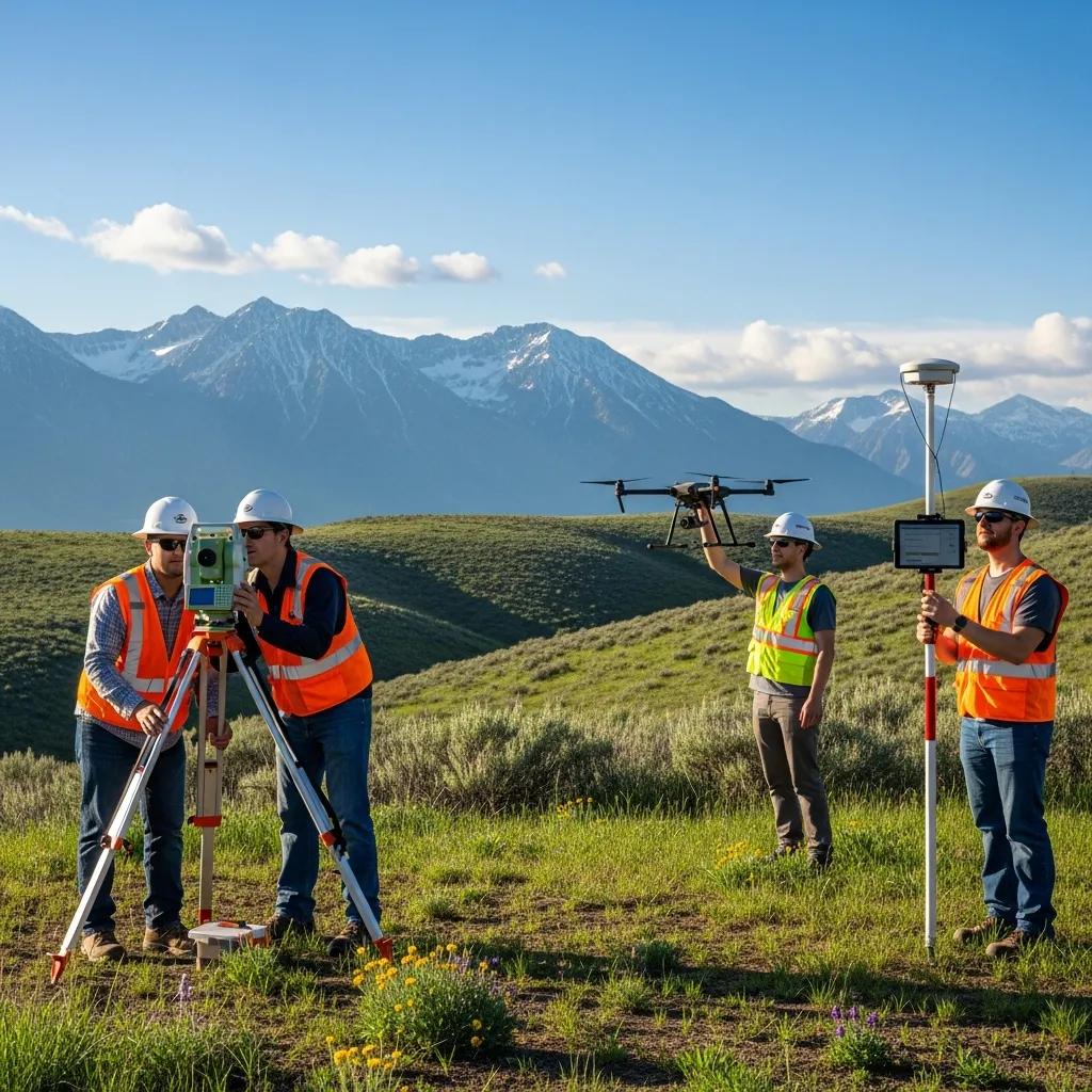
Picking the right surveyor in Springville comes down to a mix of technical skill, local experience, and proven results. A dependable firm will be licensed in Utah, know Utah County filing and permitting practices, and use modern tools — GNSS, total stations, and UAV workflows — to deliver accurate plats, topo maps, and staking on schedule. Those capabilities reduce boundary risk and speed permits or closings. Use the checklist below to compare firms and choose the best fit for your project.
Use these criteria when evaluating a Springville land surveying firm:
- Licensing and registration: Confirm active Utah licenses and licensed surveyor credentials.
- Local regulatory and title experience: Look for demonstrated familiarity with county surveyor procedures and local permitting.
- Technical capability: Verify use of GNSS, total stations, and LiDAR or drone mapping for reliable deliverables.
- Deliverables and timelines: Review sample plats and maps, expected turnaround, and how monuments and plats are recorded.
- Communication and references: Choose firms that clearly explain steps, timelines, and required documents, and that provide client references.
This checklist helps you distinguish firms that do basic boundary checks from those ready to support commercial closings or complex site work. It also points you toward a recommended local provider for Springville projects.
Why Ludlow Engineers and Associates Is a Recommended Springville Surveying Partner
Ludlow Engineers and Associates is a go-to option for Springville-area surveying and civil engineering because they combine local knowledge with a broad service mix: boundary and ALTA/NSPS surveys, topographic mapping, civil site plans, house plans, FHA foundation inspections, construction staking, and UAV aerial surveying. That single-source approach keeps the handoff from survey data to grading and permitting clean and efficient. Their familiarity with local topography and county processes, plus the use of UAVs and GNSS, helps shorten timelines and improve accuracy for Springville projects. For coordinated surveying and civil design, visit Ludlow Engineers and Associates and request a quote for your Springville property.
Combining local expertise with modern tools reduces common project risks — knowing how a firm applies those strengths to your parcel is key to choosing the right partner.
How Local Knowledge Improves Accuracy and Compliance in Springville
Local experience matters because it shapes how surveyors match field methods to county filing conventions, easement patterns, and terrain-specific challenges around Springville. Teams familiar with Utah County know how historic plats, deed descriptions, and monument records interact with GNSS control, which cuts down rework and supports defensible boundaries. On steep or heavily vegetated parcels, experienced crews choose the right mix of total-station traverses, targeted GNSS control, and UAV mapping to capture elevations and features reliably. That familiarity shortens permit and title review cycles because deliverables meet the expectations of title companies, county surveyors, and municipal reviewers.
Those local variables also affect cost and the right choice of survey type — topics we cover next, since they shape budgets and schedules for Springville projects.
What Are the Typical Costs for Land Surveys in Springville, Utah?
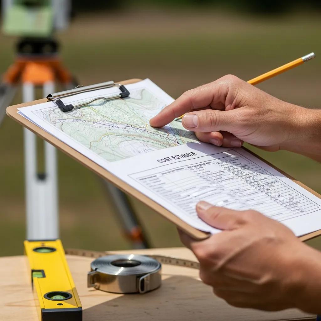
Survey pricing in Springville varies by survey type, site complexity, and the deliverables you need. Boundary, topo, ALTA/NSPS surveys, and construction staking have different data and field requirements, so the ranges below illustrate typical market brackets rather than fixed fees. Primary cost drivers include parcel size, terrain and vegetation, the format and precision of deliverables (plat vs. raw survey files), turnaround time, and whether UAV or LiDAR is used to speed fieldwork. Use the comparison table that follows to budget and plan your next step.
Common factors that influence survey pricing in Springville:
- Parcel size and shape: Larger or irregular lots take more field and processing time.
- Terrain and vegetation: Steep slopes, gullies, or heavy brush increase effort and safety needs.
- Deliverables and precision: ALTA surveys and construction staking demand higher precision and more documentation.
- Access and site conditions: Remote or restricted sites add logistics and may require drone support.
- Turnaround and permit requirements: Rush jobs and permit-ready plans typically cost more.
These variables explain why quotes differ and what information helps produce an accurate estimate. The table below shows typical ranges and the main drivers for each survey type.
Cost comparison — typical Springville survey types, price ranges, and primary cost drivers:
As the table shows, a small residential boundary survey will usually cost much less than a full ALTA for a commercial closing. Use these ranges when talking with surveyors so you can prioritize the deliverables you actually need.
Requesting a custom quote from Ludlow Engineers and Associates: To get an accurate estimate, gather parcel identifiers and a brief project scope before you reach out. Ludlow blends UAV and conventional survey workflows with local regulatory knowledge to produce precise, defensible plats and permit-ready deliverables. When requesting a custom quote for a Springville property, have your parcel description, deed or title commitment (if available), and a short summary of intended use ready, then contact Ludlow Engineers and Associates to request a custom quote.
Providing this information up front speeds the quoting process and produces clearer, more transparent pricing that reflects actual site conditions.
Which Factors Affect Springville Land Survey Costs?
Knowing what changes price helps you manage costs by narrowing the scope or choosing the right deliverables. Key variables include site complexity, documentation level, accuracy tolerance, and scheduling. Be explicit about each when requesting a quote to avoid unexpected charges. Below are the main factors and what they mean for your estimate.
- Parcel size and complexity: Bigger lots and irregular boundaries add field and processing time.
- Vegetation, slope, and access: Dense brush or steep terrain may require more crew time or drone use.
- Deliverables and precision: ALTA surveys and staking require tighter tolerances and more paperwork.
- Records research: Old or unclear deeds extend record checks and title work.
- Urgency and scheduling: Accelerated timelines often come with a premium.
These factors compound — for example, a large, steep, wooded parcel will push an estimate higher because of both field difficulty and additional processing. Identifying which drivers matter most helps you balance cost and risk.
How Can You Request a Custom Quote for Your Springville Land Survey?
Giving surveyors clear, consistent information upfront makes the quoting process faster and more accurate. The checklist below is a simple intake you can use when contacting a Springville surveyor to request a tailored proposal.
- Gather property basics: parcel ID, legal description, and any current deed or title commitment.
- Define intended use: sale, development, construction staking, or permitting, and include any firm deadlines.
- Specify deliverables: signed plat, CAD files, contour intervals, orthomosaic, or DEMs.
- Share access notes: locked gates, difficult access, or whether drone work is acceptable.
- Ask about timeline and site visit: request an estimated site visit date, duration, and how preliminary estimates are produced.
Following this intake reduces back-and-forth and lets the surveyor produce a firm quote. If you want a local provider that combines surveying and engineering, ask Ludlow Engineers and Associates for a quote — they pair UAV and field workflows with Utah regulatory know-how to deliver site-ready data. Request a custom quote to get started.
What Types of Land Surveys Are Offered by Springville Land Surveying Companies?
Surveyors around Springville offer a range of services to support transactions, design, and construction. Each survey type serves a specific purpose and produces deliverables tailored to legal, permitting, or construction needs. The short descriptions below explain the primary survey types and when to order them so you get the right scope for your project.
- Boundary Survey: Establishes property lines and monuments — common for purchases, fence placement, or dispute resolution.
- ALTA/NSPS Survey: A comprehensive, standardized commercial survey used for lender and title requirements at closings.
- Topographic Survey: Maps elevations, contours, and surface features to support grading, drainage, and utility design.
- Construction Staking: Translates plans into on-site markers so contractors can locate foundations, utilities, and grades.
These core survey types cover most needs for Springville properties; choosing the right one depends on legal, title, and project requirements.
Deliverables at a glance — survey type, primary use, and typical outputs:
This table makes it easier to pick the survey and deliverables you need for permits, title work, or construction.
Why choose Ludlow for these surveys: If you want a coordinated survey-to-engineering workflow in Springville, Ludlow Engineers and Associates offers combined services — boundary and ALTA surveys, topo mapping, construction staking, and UAV surveying — so data flows smoothly from field collection into site plans and grading design. To request service for a specific survey, contact Ludlow Engineers and Associates and provide parcel details and project goals when you request service.
Pairing these descriptions with a local provider helps simplify procurement and keep project risk low.
What Is a Boundary Survey and When Is It Needed in Springville?
A boundary survey identifies legal corners and lines by combining deed and plat research with field monument checks, producing a defensible boundary plat. Homebuyers, fence installers, and builders order boundary surveys to confirm setbacks and avoid encroachments. Deliverables typically include a signed plat, monumentation notes, and a written description suitable for filing or permitting; surveyors will note any differences between recorded descriptions and field evidence. Getting a boundary survey early reduces legal risk and smooths permitting and title tasks.
Ordering a boundary survey before major steps prevents costly rework and lowers the chance of property disputes — which is why commercial transactions often call for ALTA surveys next.
How Do ALTA Surveys Support Commercial Real Estate Transactions in Springville?
ALTA/NSPS surveys follow national standards and give lenders, title companies, and buyers a consistent, detailed view of improvements, easements, and title exceptions for commercial closings. These surveys include certifications and optional addenda tied to lender or client needs, plus maps that show improvements and recorded exceptions affecting title insurance and closing conditions. For Springville commercial deals, an ALTA survey clarifies access, easements, and improvement locations relative to title commitments and helps prevent closing delays. Because ALTA work is document-intensive, it usually requires coordination with title companies and extra research or field verification.
ALTA surveys are an investment in transactional certainty — they reduce title risk for buyers and lenders.
Why Are Topographic Surveys Important for Springville Site Planning?
Topographic surveys deliver contour maps, spot elevations, and feature inventories engineers use to design grading, drainage, and utilities. Accurate elevation models drive cut-and-fill calculations, stormwater routing, and building-pad placement — especially on Springville parcels where slope and runoff patterns matter. Deliverables may include user-specified contour intervals, DEMs, and 3D models that designers use to optimize grading while meeting stormwater rules. Getting the right topo resolution from the start prevents costly redesigns later.
Reliable topo data reduces uncertainty in feasibility and feeds directly into grading plans and stormwater models.
What Is Construction Staking and How Does It Benefit Springville Projects?
Construction staking turns design coordinates into physical markers so contractors can place building corners, trenches, and grades accurately during earthwork and construction. Proper staking reduces rework and ensures structures are built to permit drawings and benchmark elevations. Typical outputs include offset and grade stakes, stake logs, and as-built verification. Staking can be phased to support foundations, utilities, and final grading. For Springville projects, good staking improves contractor efficiency and helps inspectors verify compliance with approved plans.
Accurate staking protects owner investments by minimizing mistakes and ensuring the built work matches permitted designs.
How Is UAV/Drone Surveying Changing Land Surveys in Springville, Utah?
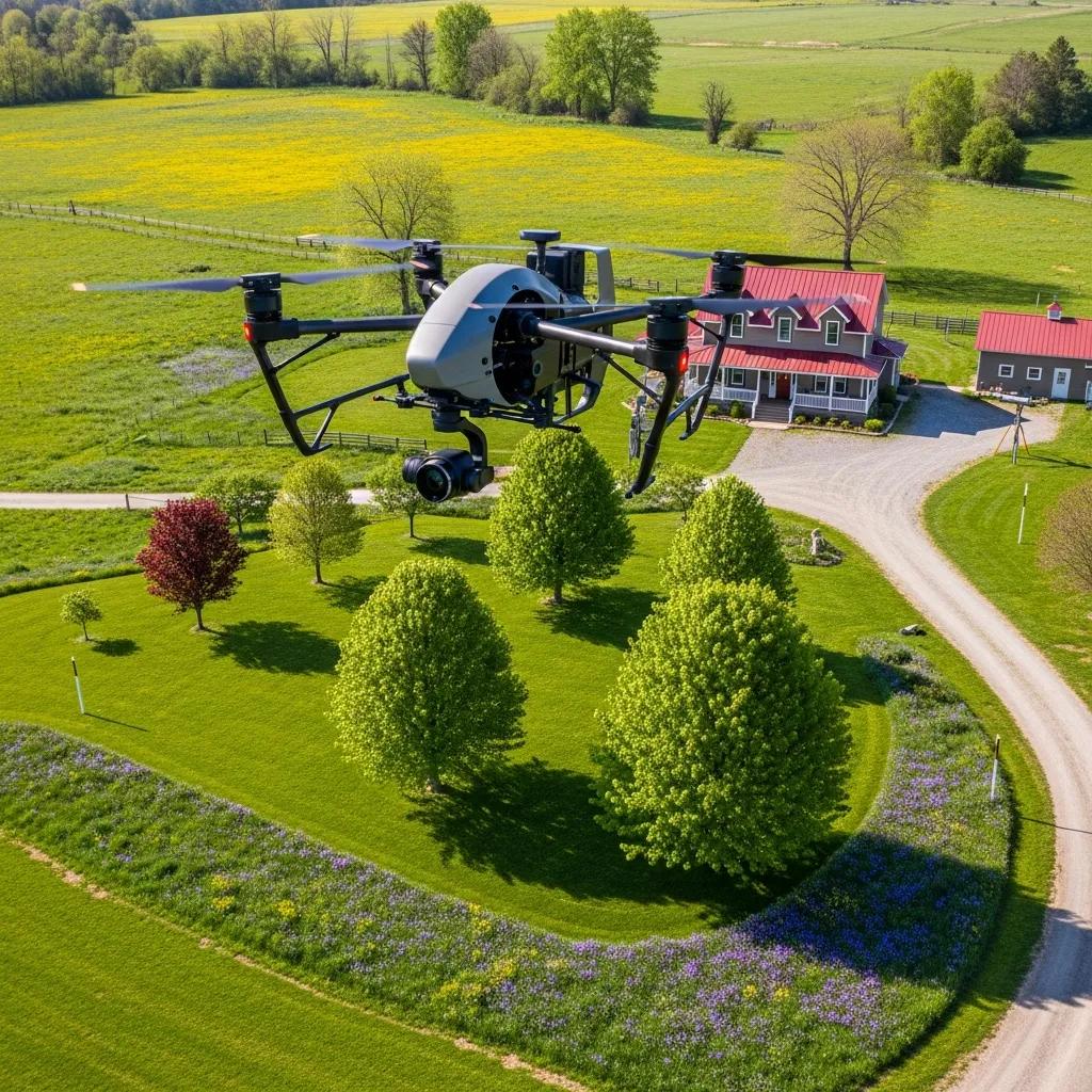
Drones and UAVs speed data collection and expand deliverables by combining aerial imagery with photogrammetry or LiDAR to produce orthomosaics, DEMs, and dense 3D models. They cover large or hard-to-access sites faster than traditional foot surveys and provide useful outputs for topographic mapping, volumetrics, and progress tracking. UAV surveys are especially helpful on steep parcels, large properties, and restricted-access areas — they improve safety and reduce field time. Below we summarize when UAV methods are the right choice.
Practical UAV benefits for Springville surveying projects:
- Faster data collection on large or steep sites, cutting onsite labor hours.
- Safer access to hazardous or difficult terrain by collecting aerial imagery instead of sending crews into risky areas.
- Higher-resolution 3D deliverables (orthomosaics, DEMs, point clouds) that improve design detail and visualization.
- Cost-effective volumetrics and progress monitoring during grading and construction.
These advantages explain why UAV tools are now standard for many geospatial projects. The table below maps specific technologies to capabilities and benefits.
Studies show UAV aerial photography systems are highly effective for large-scale topographic mapping, delivering rapid data collection and detailed outputs.
UAV Aerial Photography for Large-Scale Topographic Mapping
Research on the application of rapid surveying and mapping for large-scale topographic maps using UAV aerial photography systems. Z. Gao et al., 2017.
What Are the Practical Advantages of Aerial Mapping and 3D Modeling for Springville Properties?
Aerial mapping and 3D models speed initial site assessment, provide denser elevation and feature data, and create clearer visualizations for owners and engineers. Faster acquisition shortens early schedules, while dense point clouds improve contour fidelity on sloped or irregular parcels common around Springville. These outputs help optimize grading, produce permit-ready plans, and improve stakeholder communication through annotated orthomosaics or interactive 3D views. For developers and project managers, aerial mapping often reduces overall project risk by surfacing site constraints earlier in the process.
The next section explains how a local firm applies UAV methods to Springville sites and what clients can expect.
How Ludlow Engineers Uses UAV Technology for Springville Projects
Ludlow Engineers and Associates integrates UAV aerial surveying into its workflows to boost field efficiency and produce richer datasets for Springville projects. By tying aerial data to GNSS control and conventional survey checks, Ludlow delivers orthomosaics, DEMs, and 3D models that accelerate topographic mapping and enable volumetric analysis for grading and construction. That mix of UAV methods and local permitting experience helps produce permit-ready data and reduces on-site time in difficult conditions. To discuss drone-enabled surveying for a Springville parcel, contact Ludlow Engineers and Associates and request UAV services.
Using UAVs within a coordinated survey-and-engineer workflow shortens schedules and increases confidence in design decisions.
How Do Land Development and Civil Engineering Support Springville Property Projects?
Civil engineering turns accurate survey data into buildable plans that meet local codes, stormwater rules, and grading requirements. Typical engineering deliverables include feasibility assessments, grading and drainage plans, utility layouts, and permit-ready documents — all of which rely on precise boundary and topo inputs. For Springville projects, understanding slope, access, and watershed behavior from surveys informs cost estimates, constructability reviews, and permitting strategy. Below we summarize feasibility, grading, and stormwater integration.
The link between reliable surveys and sound civil engineering leads into the role of feasibility and grading work described next.
What Role Do Site Feasibility and Grading Plans Play in Springville Development?
Site feasibility studies evaluate buildability, constraints, and major cost drivers by combining zoning, topography, and utilities into a decision framework. Grading plans then translate feasibility findings into earthwork quantities, erosion control measures, and finished elevations that meet both design intent and permit requirements. In Springville, slope and drainage often determine lot layouts, building placement, and access, so accurate topo and boundary surveys are prerequisites for realistic feasibility studies. Early investment in feasibility and grading reduces redesign and supports reliable budgeting.
This sequence from feasibility to grading highlights why an integrated surveying and engineering approach leads to more predictable project delivery.
How Is Stormwater Management Incorporated into Springville Civil Engineering Services?
Stormwater design uses accurate elevation and drainage data from topo surveys to model runoff, size conveyance systems, and specify best-management practices required for permits. Engineers combine survey-derived DEMs with rainfall and watershed analysis to design detention, infiltration, or conveyance solutions that comply with local ordinances and limit off-site impacts. For Springville projects, stormwater strategies are tailored to slope, soil, and downstream capacity and are reflected in permit-ready grading and drainage plans. Close coordination between survey and engineering teams keeps stormwater measures aligned with site grades and construction tolerances.
Thoughtful stormwater integration prevents permit delays and reduces long-term maintenance and liability for property owners.
Common Questions About Springville Land Surveying Services
This FAQ answers common questions about accuracy, necessity, process, and timelines for Springville surveys. For project-specific or legal determinations, always consult a licensed surveyor to get site-specific advice and an accurate quote. The answers below summarize typical expectations for survey accuracy, why to order surveys before buying or developing, the standard workflow, and expected timelines for common survey types.
How Accurate Are Land Surveys in Springville, Utah?
Accuracy depends on the method and required deliverable. Properly controlled GNSS and total-station surveys can achieve centimeter- to sub-foot-level positional accuracy for boundary and construction control. ALTA and boundary surveys follow tolerances suited to legal and transactional needs; UAV photogrammetry with GNSS control provides strong planimetric accuracy, while LiDAR improves vertical accuracy in vegetated areas. Specify the accuracy you need when requesting a quote so deliverables meet engineering and permitting requirements.
Accuracy choices affect equipment, field time, schedule, and cost.
Why Should I Order a Boundary Survey Before Buying or Developing in Springville?
A boundary survey clarifies exact property limits, identifies encroachments or discrepancies, and reduces the risk of post-closing disputes. It also reveals recorded easements, setbacks, and monument locations that affect building placement and permit submittals. For buyers and developers, a pre-purchase boundary survey provides a defensible basis for negotiations and helps prevent surprises that delay projects. When deed language or visible conflicts raise questions, order a boundary survey before committing.
A pre-purchase boundary survey is a relatively small investment compared with potential legal or construction costs later.
What Is the Typical Process for Completing a Land Survey in Springville?
The usual workflow starts with records research, then a site visit to establish control and collect field data, followed by data processing to reconcile field measurements with records, deliverable preparation (plat, CAD files, or DEM), and final review for filing or permitting. During records research the surveyor gathers deeds, plats, and title commitments; in the field, GNSS control, total-station traverses, or UAV flights collect spatial data. Processing aligns measured features with recorded descriptions and produces deliverables in the formats required by clients and local authorities. Expect clear next steps and a preliminary schedule when you request a quote.
Knowing the workflow helps you prepare documents and site access for an efficient survey.
How Long Does a Typical Land Survey Take in Springville?
Timelines depend on survey type: boundary surveys often finish in days to a few weeks depending on records and scheduling; ALTA surveys usually take several weeks because of extra research and title coordination; topographic and UAV surveys can be completed faster — often within days once access and weather permit. Weather, site access, record complexity, and title or permit coordination all affect timing. Ask for an estimated timeline and possible conditions that could extend delivery when you request a quote.
Clear scheduling reduces coordination issues with closings, contractors, and permitting milestones.
How Ludlow Engineers and Associates Handles Common Challenges — When to Contact a Professional
For complex record research, steep or heavily vegetated parcels, and projects that need both surveying and civil plans, Ludlow Engineers and Associates combines field surveying, UAV capture, and engineering to resolve accuracy, compliance, and constructability issues in one workflow. Their local knowledge of Utah terrain and county practices helps anticipate permitting and title questions, while UAV options make data collection efficient in hard-to-access sites. If your project includes unclear deed descriptions, commercial closings, or civil engineering deliverables, contact Ludlow Engineers and Associates for professional assistance and request service to start an evaluation.
For definitive, site-specific answers, reach out to a licensed surveyor to obtain the accurate documentation required for legal, transactional, or construction certainty.
Frequently Asked Questions
How should I choose a land surveyor in Springville?
Look for active Utah licensing, local experience, and modern technical capabilities. Confirm the surveyor understands county filing and permitting, uses GNSS and UAV tools where appropriate, and communicates clearly. Ask for sample deliverables and client references so you know how they manage timelines and documentation.
How can I prepare for a land survey?
Collect the parcel ID, legal description, and any deeds or title commitments. Tell the surveyor the survey’s intended use — sale, development, staking, or permitting — and note any access issues like locked gates. Providing this information up front speeds the process and improves estimate accuracy.
What are the benefits of UAV technology in land surveys?
Drones speed data collection, improve safety on difficult sites, and produce high-resolution imagery and 3D models that enhance topographic mapping and volumetric analysis. UAV surveys are especially useful on steep or restricted-access properties and for tracking construction progress.
What’s the difference between a boundary survey and an ALTA survey?
A boundary survey identifies property lines and corners, usually for residential purchases, fencing, or dispute resolution, and produces a signed plat. An ALTA/NSPS survey is a standardized, detailed commercial survey used for lender and title requirements at closings; it includes additional certifications and title-related mapping.
How do I know if I need a topographic survey?
If your project requires site planning, grading, drainage design, or any earthwork, you’ll need a topo survey. It shows elevations, contours, and site features that inform design decisions. Consult a surveyor to confirm the resolution and coverage you need.
What common challenges do surveyors face?
Typical challenges include unclear deed descriptions, conflicting record evidence, and difficult terrain or vegetation that limit access. Weather can also affect schedules. Working with a surveyor who understands local conditions and has experience with complex sites helps avoid delays and ensures accurate results.