
Elk Ridge, Utah Land Surveying: Boundaries, ALTA & Site Mapping
Reliable land surveying in Elk Ridge, Utah blends licensed surveying practice with civil engineering know‑how to confirm property lines, deliver ALTA/NSPS surveys for commercial transactions, and create detailed site maps for development. This guide outlines the services, methods, and typical cost drivers for surveys in Elk Ridge so property owners, developers, and title professionals can make informed decisions. From fence disputes to commercial closings and construction layout, accurate surveys—built on records research, field control, and modern measurement tools—are essential. Below we cover local service options, how boundary surveys settle disputes, ALTA requirements in Utah, why a local, experienced firm matters for topo and construction work, and the realistic cost ranges to expect. The content also uses practical search phrases like land surveyor Elk Ridge and boundary survey Utah to help readers find the right information.
What Land Surveying Services Does Ludlow Engineers Offer in Elk Ridge Utah?
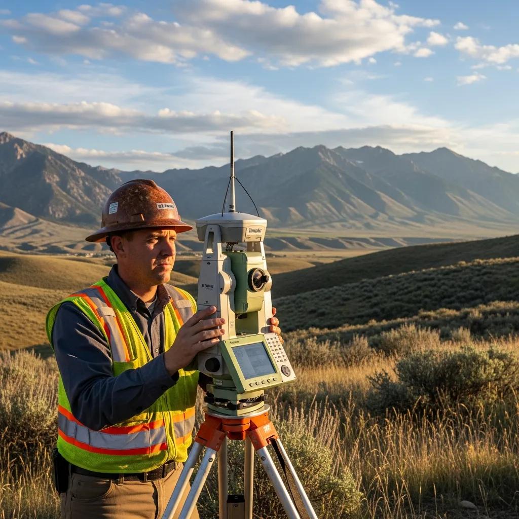
In Elk Ridge we offer a full range of scoped surveys and deliverables to support property transfers, development planning, and construction. Our work combines records research, establishing reliable field control, precision measurement (GPS and total station), and mapping outputs—plats, legal descriptions, and staking—so projects meet client, lender, and municipal requirements. Services cover private property needs (boundary and easement surveys), commercial demands (ALTA/NSPS and topographic surveys), and construction support (staking and as‑builts). The list below summarizes the primary services commonly needed for Elk Ridge properties and the situations where they’re used.
Ludlow Engineers and Associates provides these surveying and civil engineering services locally and can prepare quotes or scope consultations to match permitting and title expectations. Engaging a surveyor early helps align scope, standards, and deliverables with lender or municipal requirements. The next subsections describe two of the most requested survey types and what each produces.
Boundary Surveys: Defining Property Lines Accurately
A boundary survey establishes a parcel’s legal corners and lines by combining deed and plat research with precise field measurements, placing permanent monumentation, and producing a stamped boundary map and legal description. The work typically starts with title and records review, moves to locating existing monuments and field evidence using GPS and total station gear, and finishes with reconciling records and producing a plat suitable for recording. Property owners use boundary surveys for sales, fence placement, easement clarification, and dispute avoidance; developers rely on them to set setbacks and lot lines. Accurate boundary work reduces legal risk and yields defensible documentation for neighbors, title companies, or courts, and it prepares a site for more detailed ALTA surveys or topographic mapping when needed.
ALTA Surveys: Essential for Commercial Real Estate Transactions

An ALTA/NSPS survey is a comprehensive, standardized commercial survey that records improvements, easements, rights‑of‑way, and other title‑relevant items for underwriting and lending. ALTA standards require coordination with title companies to confirm optional items and map specifications; the final package usually includes a legal description, property lines, identified encumbrances, and improvements shown in relation to the parcel. Lenders and buyers request ALTA surveys to reduce uncertainty about encroachments, exceptions, and access. In Elk Ridge, ALTA work commonly includes local addenda—floodplain checks or utility verifications—to meet Utah‑specific title and municipal expectations.
Different surveys produce different deliverables for different needs. The table below summarizes typical outputs and who orders each survey type.
This comparison helps property owners and project managers pick the survey that fits their transaction or construction milestone. Next, we explain how boundary surveys help resolve property line disputes in Elk Ridge.
How Does a Boundary Survey in Elk Ridge Utah Resolve Property Disputes?
A boundary survey settles disputes by combining historical research, precise field measurement, and monumentation to deliver legally defensible documentation of ownership extents. Using retracement methods, the survey connects recorded deeds to the physical land and places permanent markers where appropriate, converting vague or oral claims into measurable, mapped boundaries. When conflicts arise, a certified surveyor’s plat and written report are persuasive in negotiations, with title insurers, or in court because they document the surveyor’s evidence and reasoning. Below is a step‑by‑step overview of the methods used and how each step supports dispute resolution.
Modern tools—like detailed scanning—improve the evidence available when resolving boundary issues.
Resolving Boundary Disputes with 3D Laser Scans
Surveying not only the disputed boundary but also neighboring parcels with a full 3D laser scanner can provide a richer, more defensible record for resolving disputes.
The real practicalities of resolving boundary disputes, 2022
Survey results that document monument locations, corner positions, and reconciled deed descriptions create concrete evidence for mediating neighbor disputes, pursuing legal remedies, or updating public records. The subsections below outline the boundary survey workflow and list the practical benefits for owners and developers.
Process of Conducting a Boundary Survey in Elk Ridge
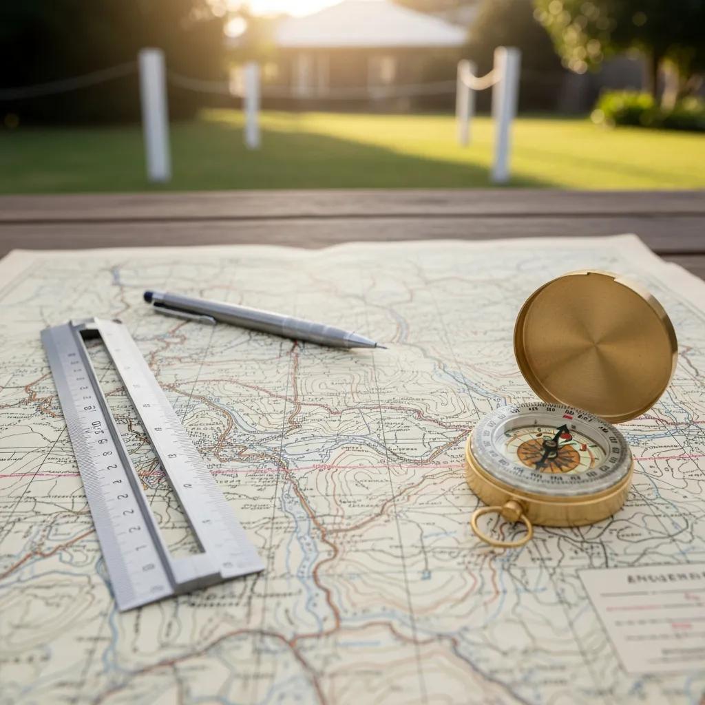
A boundary survey starts with a records search to collect deeds, plats, and prior surveys, then moves to field verification to locate or set control points and monuments using GPS and total station instruments. Crews record visible evidence—old monuments, fences, improvements—and reconcile those findings with historical records to determine the most defensible boundary lines. After analysis and measurements, the surveyor prepares a formal plat, legal description, and monumentation plan, often with recommendations for recording or addressing conflicting evidence. This systematic approach produces a survey that stands up to title review or litigation and provides a reliable base for permitting or construction.
Each careful step lowers the chance of future disputes and supports downstream tasks like subdivision or improvement planning. The next subsection outlines direct benefits for property owners and developers.
Benefits of Boundary Surveys for Property Owners and Developers
Boundary surveys deliver clear, practical benefits: they define ownership lines to prevent or resolve neighbor disputes; they produce legal descriptions needed for transfers and lending; and they set definite limits for construction to avoid costly encroachments. For developers, accurate boundaries anchor lot layouts, subdivision designs, and municipal approvals to real coordinates. Property owners gain recorded monumentation and a stamped plat that clarifies title and can reduce insurance or legal costs. These outcomes increase transaction certainty and protect investment value by removing ambiguity about property limits.
Clear boundary documentation also speeds permitting and supports title underwriting during sales or refinancing. The next section explains ALTA surveys and their role in commercial transactions.
What Are the Key Features of ALTA Surveys in Elk Ridge Utah?
An ALTA/NSPS survey is a standardized commercial survey that documents legal boundaries, improvements, easements, and other items critical to underwriting and closing commercial real estate deals. The ALTA standard defines baseline mapping elements and a menu of optional items clients or title companies may request; the selected options determine scope and usefulness for lenders and underwriters. ALTA surveys typically involve coordination with the title insurer to confirm required exceptions and addenda; in Elk Ridge that often includes local checks such as floodplain indicators or utility verifications. The table below summarizes key ALTA components and why each matters for a commercial closing.
ALTA surveys are more comprehensive and therefore usually more expensive than a simple boundary or topo, but they substantially lower closing risk by revealing encumbrances and physical conditions that affect title.
This checklist helps buyers, lenders, and legal teams confirm what an ALTA survey will include and why each element matters for underwriting and closing certainty. The next subsection outlines ALTA expectations in Utah and how these surveys support title work.
ALTA Survey Requirements and Standards in Utah
ALTA/NSPS minimum standards set baseline requirements for boundary determination, monumentation, and mapping visible improvements; optional items are added based on client needs and title company directions. In Utah, surveyors follow the national ALTA standard and commonly include transaction‑specific items—floodplain checks, utility locates, and similar verifications—when requested by the title insurer. Early coordination with the title company ensures the survey includes the exact addenda and map details needed to clear underwriting exceptions and meet closing timelines. A properly documented, stamped plat lowers the likelihood of post‑closing disputes and provides clear instructions for addressing identified encroachments.
Choosing a surveyor familiar with ALTA conventions and local title expectations helps avoid rework and closing delays. The next subsection explains how ALTA surveys aid title insurance and transactions.
How ALTA Surveys Support Title Insurance and Transactions
ALTA surveys give title underwriters a detailed picture of recorded exceptions, uncatalogued encumbrances, and physical encroachments so they can assess risk and determine endorsements. By mapping improvements, easements, and access, ALTA surveys reduce surprises at closing that could stall a deal or force renegotiation. When issues are found, buyers and lenders have time to negotiate remedies, secure endorsements, or require corrective actions before funding. Clear, verified survey data shortens underwriting uncertainty and helps all parties move toward a clean closing when everyone is working from the same facts.
The industry widely recognizes ALTA/NSPS surveys as a key tool for identifying title policy exceptions and reducing closing risk.
ALTA/NSPS Surveys for Title Policy Exceptions
To remove general exceptions from an ALTA Owner’s or Loan Policy, the title company typically requires an ALTA/NSPS survey prepared by a registered surveyor certified to the title.
PROBATE & PROPERTY, 2021
With scope and standards clarified, the guide next explains why working with a local, experienced firm matters for topographic and construction surveying in Elk Ridge.
Why Choose Ludlow Engineers for Topographic and Construction Surveying in Elk Ridge?
Hiring a local firm with combined surveying and engineering expertise ensures surveys and site control align with Utah regulations, local topography, and construction practices. Ludlow Engineers and Associates provides integrated civil engineering and land surveying services across Utah, pairing experienced staff with modern tools—GPS, drone data collection, and LiDAR where appropriate—to boost accuracy and efficiency. Our local focus delivers contour maps, site control, staking, and as‑built verifications that designers and contractors can use immediately. Working with a team that knows Elk Ridge terrain and municipal expectations reduces coordination friction and helps keep projects on schedule.
Integrating technologies like UAV‑LiDAR is important for achieving the precision modern topographic mapping requires.
UAV-LiDAR for Precision Topographic Mapping
Topographic surveying data were evaluated by comparing elevation measurements from a UAV‑LiDAR system to a reference dataset using Root Mean Square Error (RMSE) to assess accuracy.
Design and experimental study on an innovative UAV‑LiDAR topographic mapping system for precision land levelling, M Du, 2022
Clients should expect the following technical advantages when procuring topographic and construction surveying services locally.
- Local Topography Expertise: Familiarity with Utah County soils, slopes, and drainage patterns improves grading and drainage recommendations.
- Integrated Engineering & Surveying: Close collaboration between surveyors and engineers produces contour and grading plans that meet permitting needs.
- Modern Measurement Technologies: GPS, UAVs, and LiDAR increase data density and shorten field time on large or complex sites.
- Construction Phase Support: Ongoing staking and as‑built surveys help ensure design intent becomes the finished project.
These strengths make project execution smoother and reduce change orders caused by survey‑related errors. The next sections detail topographic and construction deliverables and workflows.
Topographic Surveys: Mapping Land Elevation and Site Planning
A topographic survey records site elevations, contours, spot elevations, and visible features to create a clear picture of existing conditions for design and permitting. Deliverables typically include contour intervals matched to project scale, spot elevations at drainage points, and locations of utilities and improvements, all tied to a consistent control network. High‑resolution topo data supports grading, stormwater design, and early civil engineering work by revealing slope constraints and cut/fill needs. Integrating topo data with engineering services speeds design iterations and lowers the risk of unexpected site changes during construction.
Reliable topographic data also informs cost estimates and helps decide whether to retain existing slopes or perform mass grading. The next subsection describes topographic survey workflows that translate plans to the ground.
Construction Surveying: Ensuring Accurate Site Layout and Staking
Construction surveying sets site control, lays out building footprints and utilities, and provides staking and verification that guide contractors through earthwork and construction. Staking is based on engineered plans and includes control points and grade stakes defining foundation corners, curb lines, and pipe inverts. Periodic verification surveys confirm conformity to design, and final as‑builts document completed elevations and locations for acceptance and recordation. Regular communication between surveyor and contractor minimizes rework and helps ensure finished work matches permit‑approved plans.
Consistent control and timely as‑built documentation also simplify municipal approvals and final recordation. The next major topic covers typical costs and the factors that influence pricing in Elk Ridge.
How Much Does Land Surveying Cost in Elk Ridge Utah?
Survey costs in Elk Ridge depend on survey type and site conditions. As a rule of thumb, expect simple residential boundary surveys at the lower end of local ranges, topographic surveys to scale with acreage and resolution, and ALTA/NSPS surveys at the higher end because of added scope and title coordination. Exact pricing varies with parcel size, terrain complexity, vegetation density, access, and the depth of record research required. Below is a concise cost summary and the main factors to consider when budgeting for a survey in Elk Ridge. For more details, visit land surveys.
- Typical local ranges: residential boundary surveys (lower–mid), topographic surveys (mid, depending on acreage), ALTA surveys (highest due to comprehensive research and title coordination).
The key cost drivers are summarized next to help you anticipate budget needs and select the right scope.
This side‑by‑side view helps owners estimate relative cost impacts before requesting formal quotes. The following subsections list specific factors that influence price and compare typical ranges by survey type, followed by a note on scheduling a precise estimate.
Factors Influencing Land Survey Costs in Elk Ridge
Several elements affect survey pricing: parcel acreage and perimeter complexity determine field time; steep or uneven terrain raises labor and equipment needs; dense vegetation may require extra clearing or survey passes; and complicated record histories demand extended title and plat research. Accessibility—lack of roads, gated access, or long drives—increases mobilization time and crew costs. The presence or absence of prior monuments and the quality of local records also change the time required to reconcile deed descriptions. Understanding these drivers helps scope an efficient survey that meets permitting, title, and construction needs without paying for unnecessary extras.
Careful scoping up front reduces change orders and unexpected fees during the project. The next subsection offers a comparative table of typical deliverables and price ranges by survey type.
Comparing Costs of Boundary, ALTA, and Topographic Surveys
Survey types produce different outputs and therefore different price levels: boundary surveys focus on legal corners and plats, topographic surveys deliver elevation and contour data, and ALTA surveys include detailed title‑related mapping and optional addenda. The table below compares typical deliverables, common clients, and general cost expectations to help with budgeting.
This comparison shows ALTA surveys generally require the largest budget because of thorough research and mapping, while boundary surveys are often the most cost‑effective for straightforward property needs. For a tailored estimate and schedule for your Elk Ridge property, contact Ludlow Engineers and Associates for a scoped proposal based on parcel specifics and intended use.
What Are Common Questions About Land Surveying Services in Elk Ridge Utah?
Clients often ask whether surveys can be wrong, how to prepare for fieldwork, how long surveys take, and when an ALTA is required. Short, practical answers set expectations: surveys can contain errors if standards aren’t followed, but licensed survey procedures and modern equipment greatly reduce that risk; good preparation and access speed up fieldwork; timelines vary by scope; and ALTA surveys are typically requested for commercial closings or by lenders. The FAQ entries below give concise guidance plus expanded recommendations to help you prepare for a survey in Elk Ridge.
Each entry starts with a direct short answer followed by a fuller explanation to guide planning and decisions.
Can Land Surveys Be Wrong and How to Ensure Accuracy?
Short answer: Yes—surveys can be incorrect if based on incomplete records or poor field practice, but accuracy is achieved by hiring licensed professionals who perform thorough retracement, use reliable control, and document methods. Common errors come from missing or disturbed monuments, ambiguous historical records, or weak field control. Choosing a licensed surveyor who conducts detailed deed research, establishes dependable control points, and documents assumptions reduces risk. Quality control includes redundant measurements, checks between GPS and total station data, and clear reporting of evidence and decisions. If disputes persist, a formal retracement survey with monumentation and a written rationale is the remedy.
Keeping good communication with your surveyor and providing full site access also minimizes delays and supports a defensible final plat. The next FAQ explains how to prepare before crews arrive.
How to Prepare for a Land Survey in Elk Ridge
Short answer: Gather deeds and prior plats, clear access to corners and areas to be surveyed, notify neighbors if access crosses their property, and tell the surveyor about site constraints ahead of time. Practical prep steps include locating any existing survey documents you have, marking known corners or fence lines, and removing temporary obstructions where safe to do so to speed fieldwork. Small residential boundaries may take a day or two of fieldwork; ALTA or large topographic surveys often require multiple visits. Coordinate access, provide contact points for scheduling, and share any known easements or utility locations with your surveyor.
For help creating a site‑specific checklist or scheduling, contact Ludlow Engineers and Associates to arrange a pre‑survey consultation tailored to your Elk Ridge property and timeline.
- Provide available documents: Gather deeds, plats, and earlier surveys to speed records research.
- Ensure safe access: Clear gates or paths and notify neighbors if access crosses adjacent parcels.
- Identify constraints: Tell the surveyor about utilities, recent improvements, or contested areas in advance.
These steps reduce field time and set clear expectations for both client and survey team.
Elk Ridge, Utah Land Surveying: Boundaries, ALTA & Site Mapping
(Note: This final H1 repeats to match the original structure and close the article.)