
Expert Land Surveying Services in Salem, Utah
Accurate land surveying and civil engineering give Salem homeowners, developers, and public agencies the clear property information they need to move forward with confidence. This guide explains what surveys do, why precision matters for transactions and construction, and how survey types — from boundary and ALTA to topographic and UAV mapping — meet specific local needs. Common Salem questions revolve around legal boundaries, permitting, and construction staking; we break those topics into practical explanations, price drivers, and the steps to get a reliable quote. You’ll learn the tangible benefits of professional surveys, the services available nearby, how Ludlow Engineers and Associates pairs technical work with regional knowledge, and simple tips for requesting estimates and verifying a licensed surveyor. Throughout, we use local context and modern surveying methods to help Salem property owners, buyers, and project managers choose the right survey and plan the next steps.
Why Professional Land Surveys Matter for Salem Property Owners
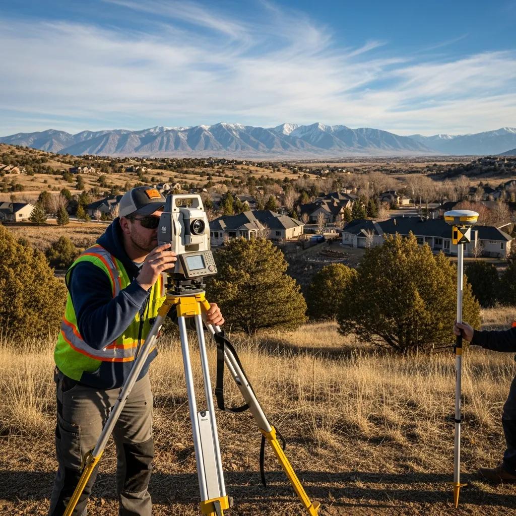
A professional land survey is a certified map and legal description prepared by a licensed surveyor that establishes property lines, documents site features, and creates control data for design and construction. Surveys combine deed and record research with precise field measurement (GPS RTK, total station, or drone methods) and produce deliverables that satisfy title companies, permitting offices, and engineers. The result: less legal risk, correct building placement, and reliable data for subdivision or development decisions. In Salem — where older rural lots meet new growth — a certified survey clarifies setbacks, easements, and potential encroachments before they become costly problems. Below are the primary benefits homeowners and developers should expect from a professional survey.
Key Benefits of Accurate Land Surveys in Salem
Accurate surveys protect property rights by establishing legally defensible boundary locations and permanent monuments, which reduces disputes and supports clean title transfers. They also enable correct permitting and design by confirming setbacks, building envelopes, and utility locations required by local agencies. For construction and development, surveys give dependable base data — elevation contours and existing features — so grading, drainage, and infrastructure are planned right the first time. These practical outcomes mean smoother transactions and more predictable schedules for Salem property owners, helping them make informed investment choices and manage regulatory requirements.
How Surveys Prevent Disputes and Support Development
Surveys reduce conflict by producing recorded legal descriptions, plats, and certified monuments that become the authoritative reference in boundary or title disputes. The process — deed research, field monumentation, and a certified plat — creates evidence title companies, surveyors, and courts rely on. For development, survey data feed engineering designs, showing easements, floodplain limits, and constraints that shape subdivision layouts, grading, and utility routing. Identifying encroachments or conflicting records early lets owners negotiate easements or adjust plans before construction starts, saving time and money. That practical connection between dispute avoidance and project planning is why the next section details the services that deliver those outcomes in Salem.
Surveying Services Ludlow Engineers Provides in Salem, Utah
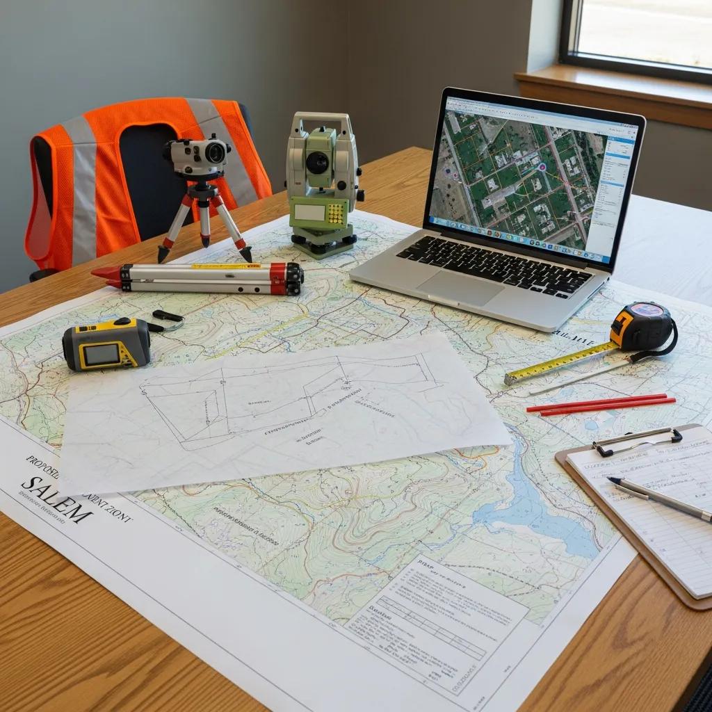
Land surveying covers several specialized services and deliverables tailored to sales, commercial transactions, and site development. Ludlow Engineers and Associates offers a full range of surveying and complementary civil engineering services across Central Utah to address Salem needs: boundary resolution, ALTA/NSPS title surveys, topographic mapping for design, construction staking for accuracy, and UAV aerial surveys for large or difficult parcels. The list below highlights core services and typical use cases; our service pages include deeper procedural details and sample deliverables.
- Boundary Surveys: Locate property corners and prepare certified plats for ownership clarity and dispute prevention.
- ALTA/NSPS Land Title Surveys: Provide title-company–grade surveys for commercial transactions, financing, and closings.
- Topographic Surveys: Map contours and existing features to support grading, drainage, and site design.
- Construction Surveying / Staking: Lay out plans on the ground with horizontal and vertical control so construction matches design.
- UAV Aerial Surveying: Create orthomosaics, digital elevation models, and rapid coverage for large, steep, or inaccessible properties.
- FHA Foundation Inspections: Inspect foundations and prepare reports needed for FHA loan compliance.
These services work hand-in-hand with our civil engineering team when projects need subdivision design, utility planning, or permit-ready site plans.
Each survey type serves a distinct purpose — choose based on the transaction, site complexity, and the deliverable you need.
This comparison clarifies which survey aligns with specific goals and how each deliverable supports legal, design, or construction outcomes. After you choose the right survey, the next section describes how boundary surveys work in practice and what to expect from the process.
How Boundary Surveys Define Property Lines in Salem
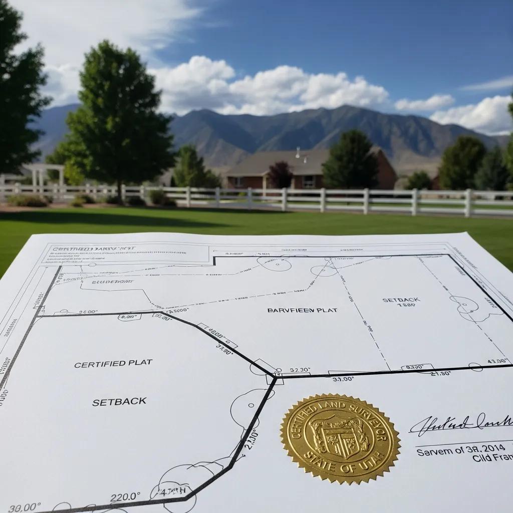
A boundary survey starts with researching records — deeds, plats, and county records — to establish the intended legal description, then moves to fieldwork where control points and monuments are found or set. Deliverables usually include a certified plat, a written legal description, and permanently marked references on site to help future identification. In Salem, older rural descriptions sometimes need reconciliation with modern subdivision plats; a thorough surveyor’s report will note recorded easements, rights-of-way, and any encroachments. Knowing this process helps property owners understand how boundary positions are derived and why durable monuments and accurate legal descriptions matter for transactions and development.
What an ALTA Survey Is and When Salem Commercial Projects Need One
An ALTA/NSPS land title survey follows national standards to produce a comprehensive, title-quality dataset showing boundaries, easements, improvements, and other items title insurers and lenders care about. Commercial buyers, lenders, and title companies typically request an ALTA survey for acquisitions or refinances to identify title exceptions, encumbrances, and site improvements that affect risk and insurance. Coordination with the title company and lender defines required table items and certification level; the result is a detailed plat and certification that streamlines closing and risk review. For Salem commercial projects, an ALTA survey helps avoid closing delays and clarifies site constraints before commitments are made.
2021 ALTA/NSPS Standards: Key Changes for Commercial Real Estate
Although several updates to the 2021 ALTA/NSPS Standards are beyond this article’s scope, the following reference summarizes the primary changes and their implications for title-quality surveys.
The Effect of the New 2021 Minimum Standard Detail Requirements for ALTA/NSPS Land Title Surveys on Commercial Real Estate Transactions, 2021
How Topographic Surveys Support Land Development in Salem
Topographic surveys capture elevation contours, surface features, and utilities to create the base map engineers use for grading, drainage, and site layout. Accurate contours and feature locations let designers model stormwater, calculate cut-and-fill, and size infrastructure like retention basins and sewer runs. For Salem developments, a precise topo limits surprises during permitting and speeds agency reviews by showing how a site will manage runoff and meet setbacks. Integrating topo data with GIS or CAD streamlines plan iterations and produces realistic cost estimates that inform land-use decisions and budgeting.
Civil Engineering Services That Pair with Surveying in Salem
Civil engineering turns survey data into permit-ready designs: subdivision layouts, grading and drainage plans, water and sewer design, and utility coordination that meet local agency standards. Survey deliverables plug directly into engineering workflows so roads, lot grading, and utility routes respect existing topography and easements. For a typical Salem subdivision, work flows from boundary and topo surveys to preliminary engineering, permit submittals, and final plat preparation, with surveyors on hand for construction stakeout. Close collaboration between survey and engineering teams reduces rework, improves regulatory compliance, and keeps projects on schedule.
FHA Foundation Inspections: Protecting Buyers and Lenders in Salem
FHA foundation inspections evaluate foundation elements against FHA standards to confirm suitability for FHA-backed financing. Inspectors check for settlement, anchorage, and grading issues that could affect structural integrity and prepare a report lenders use to determine loan eligibility. For Salem homeowners and buyers pursuing FHA financing, an inspection early in the process identifies necessary corrections before closing and prevents last-minute financing surprises. The report typically lists deficiencies, recommended repairs, and whether the foundation meets FHA acceptance criteria.
How UAV Aerial Surveying Improves Accuracy and Speed
Drone-based surveying collects high-resolution imagery and elevation data that can be processed into orthomosaics, point clouds, and digital elevation models, increasing mapping speed and surface detail. For large tracts or steep Salem terrain, UAVs cut field time, capture features inaccessible on foot, and deliver results faster than ground-only methods. When tied to ground control and RTK positioning, UAV outputs meet accuracy needs for topo mapping and volume calculations while reducing mobilization costs. Operators follow airspace rules and line-of-sight requirements, and when managed correctly, UAVs expand capabilities for progress monitoring, pre-construction assessment, and as-built verification.
Why Choose Ludlow Engineers for Surveying in Salem, Utah
Ludlow Engineers and Associates combines full surveying services with in-house civil engineering and deep familiarity with Central Utah’s records, permitting, and terrain. Our multidisciplinary team integrates boundary, ALTA, topo, and construction surveying with subdivision design, site planning, and utility development to support projects from first measure to final plat. Local knowledge of county records and permitting expectations helps us anticipate agency needs and streamline approvals; modern tools — including UAVs and precise positioning — improve accuracy and efficiency on complex sites. For Salem clients looking for a local partner, our approach reduces friction between survey, design, and construction phases.
Those capabilities translate into practical advantages for projects across Salem and Central Utah.
This capability-to-benefit mapping shows how integrated services minimize handoffs and errors, creating a smoother path from survey to construction. Our regional presence and team expertise further strengthen client outcomes; the next section describes that local experience in more detail.
Local Experience Ludlow Brings to Salem Projects
We serve Central Utah communities and bring practical knowledge of county records, permitting pathways, and terrain conditions that commonly affect Salem properties. Familiarity with historic plats and older deed descriptions speeds boundary research and helps reconcile legacy records with modern mapping standards. Our combined team of field surveyors and civil engineers means survey data immediately informs design choices, shortening review cycles and cutting change orders. Clients benefit from coordinated field measurement, plan production, and permit submittals tailored to local expectations.
How Ludlow Ensures Quality and Client Satisfaction
Quality starts with thorough record research, calibrated equipment, and review steps that validate field measurements against control points and recorded sources. We deliver certified plats and legal descriptions that meet professional standards and follow clear communication protocols — defined deliverables, timelines, and client checkpoints — so you know what to expect from kickoff to final stakeout. After delivery, we provide follow-up support for plat clarifications or minor construction adjustments to reduce risk and build confidence in the survey outputs.
What Drives Land Survey Costs in Salem, Utah?
Survey pricing depends on site complexity, survey type, parcel size, access, required deliverables, and any coordination with third parties. Bigger parcels increase field time and data processing; steep, wooded, or hard-to-access sites require more effort and safety measures; ALTA/NSPS or full topographic surveys need more research and mapping than a simple boundary survey. Extras such as CAD files, recordable plats, or title company coordination also add time and cost. The list below summarizes the primary price drivers so you can set realistic expectations when requesting an estimate.
- Property Size and Complexity: Larger or irregular parcels require more fieldwork and increase cost.
- Terrain and Vegetation: Steep slopes, dense brush, or limited access slow crews and add equipment needs.
- Survey Type and Deliverables: ALTA surveys, detailed topo mapping, and CAD/Civil files increase research and drafting time.
- Permitting and Third-Party Coordination: Work with title companies, lenders, or agencies adds scope and scheduling.
The table below summarizes how each factor typically affects price so you can prioritize scope items before requesting a quote.
Understanding these drivers helps Salem clients choose a cost-effective scope. The next section explains how to request a quote and what information surveyors need to provide an accurate estimate.
How Property Size, Terrain, and Survey Type Influence Pricing
Parcel size scales field hours and processing: a small residential lot takes less time than several acres that require aerial coverage or long traverses. Terrain and vegetation affect equipment choice and crew speed — steep or heavily treed sites take longer. Survey type determines research and drafting depth: ALTA/NSPS surveys include title research and certification language, while topographic surveys require denser data collection for contours. Together, these variables set the method, time, and final price. Knowing their effect helps owners pick the right scope for their budget.
How Salem Residents Request a Quote for Surveying
To get a useful estimate, provide the property address or parcel ID, the survey’s intended use (sale, development, lending, or construction), and any recent deeds, plats, or lender/title instructions. Describe desired deliverables (recordable plat, CAD files, topo contours) and schedule needs so the surveyor can scope fieldwork and drafting. After initial info, expect a follow-up to confirm site access, permissions, and final scope; the firm will then issue a written estimate and expected turnaround. Ludlow Engineers and Associates offers a straightforward quote process that starts with these details and produces a tailored scope and price.
This guidance helps reduce back-and-forth and get fieldwork scheduled sooner.
Common Questions About Land Surveying in Salem, Utah
Homeowners, buyers, and developers frequently ask about cost, necessity, timelines, and how to verify a licensed surveyor. Short answers below give quick direction, followed by brief details relevant to Salem situations.
The list below shows top questions directly to help you find quick answers before requesting services.
- How much does a land survey cost in Salem, Utah?
- Do I need a land survey before buying property in Salem?
- How long does a land survey take in Salem, Utah?
- How can I find a licensed land surveyor in Salem, Utah?
Each short answer below is followed by a brief explanation of the factors and next steps for Salem property matters.
How Much Does a Land Survey Cost in Salem, Utah?
Prices vary by parcel size, terrain, and survey type — an accurate estimate depends on property complexity and the deliverables you need. Key cost drivers are acreage, whether you need an ALTA or topo, site access, and output format (recordable plats or CAD files). Because every job differs, supply the address or parcel ID and your project goals to get a reliable quote.
Do I Need a Land Survey Before Buying Property in Salem?
It’s often wise for buyers to order a survey to confirm boundaries, find encroachments, and expose easements or access issues that affect value and use. Lenders and title companies may also require specific surveys for financing or title insurance. For rural parcels, subdivided lots, or new developments, a survey is especially valuable. Ask the seller, title agent, and lender about required standards to decide between a boundary survey and a full ALTA survey.
How Long Does a Land Survey Take in Salem, Utah?
Turnaround depends on record research, field access, weather, and deliverable complexity. Simple boundary surveys can be completed in days, while ALTA and full topographic surveys may take several weeks because of additional research and coordination. To speed delivery, provide deeds and parcel info up front and confirm access permissions before crews arrive.
How Can I Find a Licensed Land Surveyor in Salem, Utah?
Verify license and insurance, request examples of local projects, and confirm the surveyor can deliver the format and standards you need (recordable plats, ALTA/NSPS, CAD files). Use this short checklist to evaluate firms and their fit for your project.
- Confirm a current professional land surveyor license and proof of insurance.
- Ask for recent examples of similar local or regional projects.
- Specify the deliverables and standards required (recordable plat, ALTA/NSPS, topo contours).
Following this checklist reduces risk and ensures the surveyor can provide the documentation and quality control you need. If you prefer a single point of contact for both surveying and civil engineering, Ludlow Engineers and Associates delivers integrated services and a clear estimate process to help move your project forward.
Construction Surveying: Objectives and Importance
Construction surveying makes up a large portion of modern surveying work and is a specialty in its own right. Its primary objectives are: (1) providing layout stakes with horizontal and vertical control so construction crews can accurately position structures and earthwork; (2) replacing and checking layout stakes as a project progresses to ensure compliance with design dimensions; and (3) producing an as-built map at project completion that records final locations and any design changes.
Construction Surveying, 1987
This guide has outlined the role of professional surveys, the services available in Salem, the factors that shape cost and schedule, and practical steps for requesting quotes and confirming credentials. Use these tables and tips to pick the right survey type and prepare the information that yields accurate, timely estimates.
Frequently Asked Questions
What should I consider when choosing a land surveyor in Salem?
Look for experience, current licensing, and adequate insurance. Ask for references and examples of similar local work, and confirm they understand local permitting and record systems. Make sure they can produce the exact deliverables you need — ALTA surveys, recordable plats, CAD files, or topo contours — and clarify timelines and review checkpoints before work begins.
How can land surveys impact property value in Salem?
Surveys can affect value by clarifying boundaries, revealing easements, or exposing encroachments. A discovered easement may limit use and lower value, while a clear, certified boundary can increase buyer confidence and marketability. In short, a professional survey protects both parties in a transaction and can influence negotiations and financing.
What is the difference between a boundary survey and an ALTA survey?
A boundary survey determines exact property lines and corners and produces a legal description and certified plat — commonly used for residential transactions and disputes. An ALTA survey is more detailed, follows national standards, and includes easements, improvements, and encroachments; it’s typically required for commercial deals and lender or title company review.
What are the typical timelines for different types of land surveys in Salem?
Timelines vary with survey type and site complexity. Simple boundary surveys may take a few days; ALTA and topographic surveys often take several weeks because of added research and data processing. Weather, site access, and third-party coordination can further affect schedules. Providing complete documentation and clear access speeds things up.
How do I prepare for a land survey on my property?
Gather deeds, previous surveys, and property descriptions. Clear around property corners and provide site access for crews. Let neighbors know if the survey will affect shared lines. Be ready to explain the survey’s purpose so the crew can deliver the right scope and outcomes.
Can I use a land survey from a previous owner?
Older surveys can be useful as references but may not reflect current conditions or legal changes. If a previous survey is recent and accurate, it can save time, but for transactions or development it’s usually best to order a new, certified survey to ensure compliance with current standards and requirements.