
Heber City, UT Boundary Survey Overview: Inclusions, Costs & Timeline
A boundary survey is a crucial process for property owners in Heber City, UT, as it defines the exact boundaries of a property. This survey not only helps in establishing property lines but also plays a significant role in preventing disputes with neighbors. In this article, we will explore what a boundary survey entails, its importance, typical turnaround times, and the associated costs. Understanding these aspects can help property owners make informed decisions regarding their land and ensure compliance with local regulations. We will also discuss how to choose the right land survey services in Heber City and address common property line issues.
What Is a Boundary Survey and Why Is It Important in Heber City?
A boundary survey is a professional assessment that determines the precise boundaries of a property. This process is essential for property owners to establish legal ownership and avoid disputes with neighboring properties. In Heber City, boundary surveys are particularly important due to the area’s growth and development, which can lead to increased property disputes. By accurately identifying property lines, owners can ensure compliance with zoning laws and local ordinances, which can prevent costly legal issues in the future.
How Does Property Boundary Identification Work in Utah?
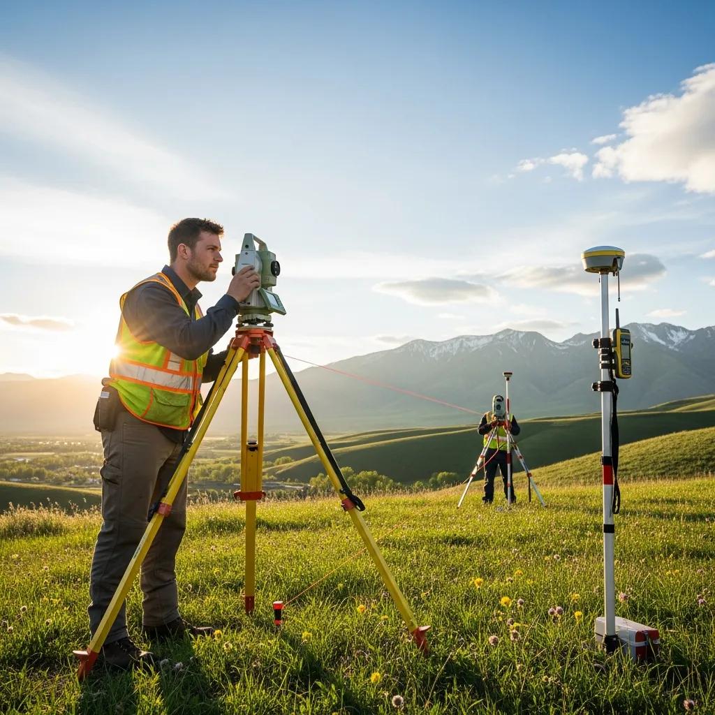
In Utah, property boundary identification involves several methods, including the use of historical records, physical markers, and advanced surveying technology. Licensed surveyors utilize tools such as GPS and total stations to measure distances and angles accurately. This process ensures that property lines are established based on legal descriptions and existing documentation, which is crucial for maintaining property rights.
The precision of these modern surveying tools, such as RTK-GPS and Total Stations, is paramount for accurate boundary identification, as research highlights their impact on survey results and potential cost implications.
RTK-GPS & Total Station Accuracy in Land Surveying
Accuracies of Real-Time Kinematic Global Positioning (RTK-GPS) system and Total Station (TS) were investigated in GIS environment. In geostatistical evaluations, Kriging method was used with spherical, exponential, and Gaussian models. The survey results demonstrated that an area of 3.5 ha or smaller can be best explained with Gaussian model, while the larger areas require a spherical model. A vertical error of 60 cm and a horizontal error of 30 cm can be observed when the survey points outside the construction area are eliminated. The optimum area per survey point was calculated to be 20×20 m2to increase the accuracy. This case study showed that an inaccurate survey can result cost over estimations up to 27%.
Evaluation of RTK-GPS and Total Station for applications in land surveying, U Kizil, 2011
What Role Does a Licensed Land Surveyor Play in Heber City?
Licensed land surveyors in Heber City are responsible for conducting boundary surveys and ensuring that all measurements comply with state regulations. They analyze property deeds, assess the land, and provide detailed reports that outline the boundaries. Their expertise is vital in resolving disputes and providing clarity on property ownership, making them an essential resource for homeowners and developers alike.
The foundational importance of a licensed surveyor’s duties and responsibilities in accurately defining property boundaries has been a recognized principle in the field for decades.
Boundary Surveyors: Duties, Responsibilities & Licensing
to define the duties and the responsibilities of surveyors in their land surveying, in the sense that he is to be in responsible charge of a boundary survey, must be registered or licensed
The Surveyor and the Law, 1942
What Does a Typical Boundary Survey Include in Heber City, UT?
A typical boundary survey in Heber City includes several key components that ensure a comprehensive understanding of property lines. These components often encompass the identification of existing property markers, the creation of a detailed survey map, and the provision of a written report outlining the findings.
Which Property Line Marking Methods Are Used Locally?
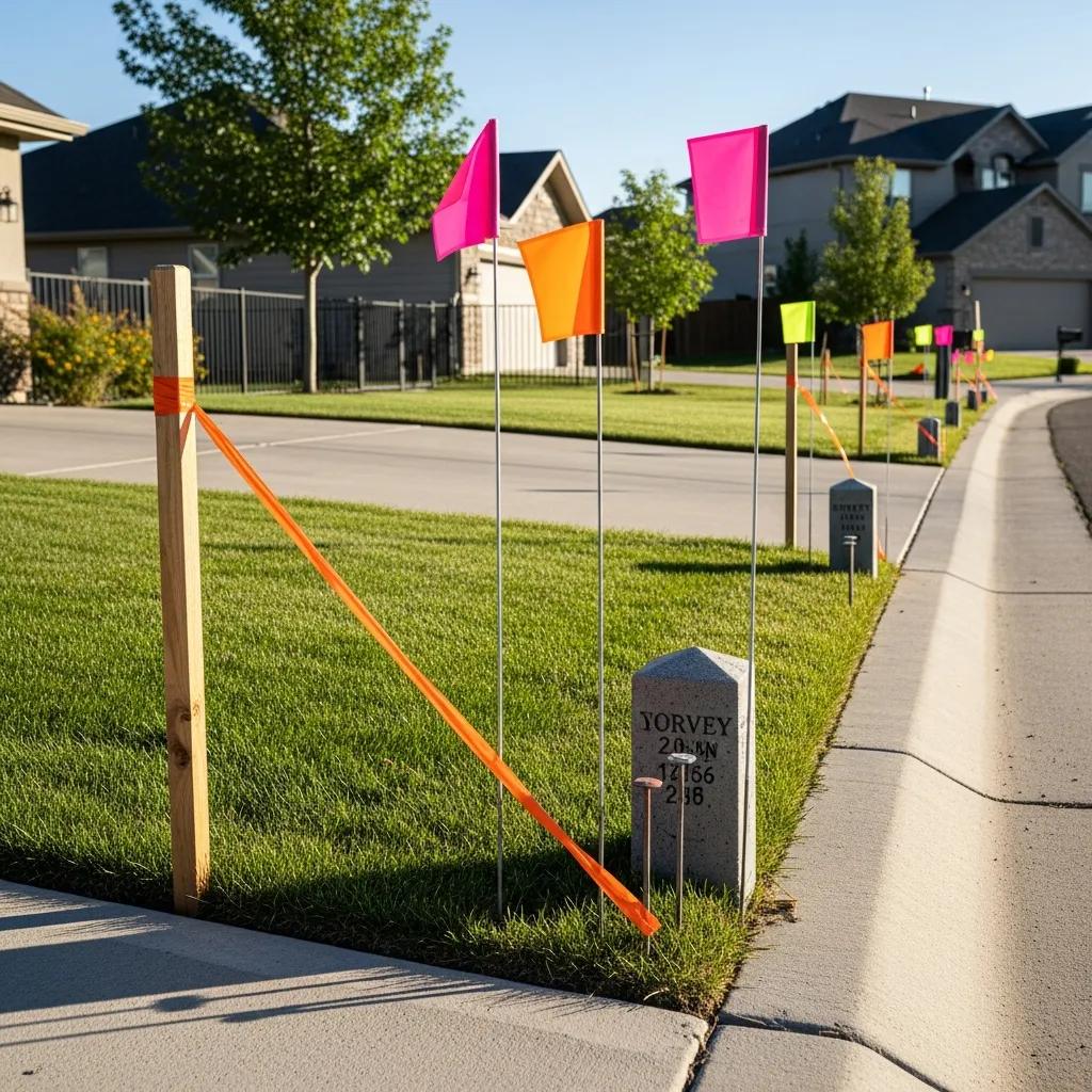
In Heber City, various property line marking methods are employed, including the use of stakes, flags, and permanent markers such as iron pins or concrete monuments. These methods help visually delineate property boundaries, making it easier for property owners to understand their land’s limits. Each method has its advantages and is chosen based on the specific needs of the property and the preferences of the land surveyor.
How Are Survey Results Documented and Delivered?

Survey results are typically documented in a formal report that includes a detailed map of the property boundaries, descriptions of the methods used, and any relevant findings. This report is delivered to the property owner and may also be filed with local government offices, such as the county recorder or surveyor’s office, to ensure public record accuracy. Clear documentation is essential for future reference and can be invaluable in case of disputes.
How Much Does a Boundary Survey Cost in Heber City, UT?
The cost of a boundary survey in Heber City can vary based on several factors, including the size of the property, the complexity of the survey, and the specific services provided by the surveyor. Generally, property owners can expect to pay between $600 and $1,800 for a standard boundary survey.
What Factors Influence Land Survey Cost in Heber City?
Several factors influence the cost of land surveys in Heber City, including:
- Size of the Property: Larger properties typically require more time and resources to survey, increasing costs.
- Complexity of the Survey: Properties with irregular shapes, dense vegetation, or challenging terrain may incur higher fees due to the additional work involved.
- Local Market Conditions: Surveyor fees can vary based on demand and competition in the local market.
How Do Surveyor Fees Compare Across Heber City Providers?
Surveyor fees in Heber City can differ significantly among providers. It is advisable for property owners to obtain multiple quotes and compare the services offered. While cost is an important factor, it is also essential to consider the surveyor’s experience, reputation, and the quality of their work to ensure a reliable boundary survey.
What Is the Typical Turnaround Time for Boundary Surveys in Heber City?
The turnaround time for boundary surveys in Heber City can vary based on several factors, including the surveyor’s workload and the complexity of the property. Generally, property owners can expect the survey process to take anywhere from one to three weeks.
How Long Does Each Step of the Survey Process Take?
The survey process typically involves several steps, including initial consultations, fieldwork, and report preparation. Each step can take varying amounts of time:
- Initial Consultation: 1-3 days to discuss the property and requirements.
- Fieldwork: 3-10 days, depending on property size and complexity.
- Report Preparation: 3-7 days to compile findings and create documentation.
Can Scheduling Affect Survey Completion Times?
Yes, scheduling can significantly impact survey completion times. Factors such as weather conditions, the availability of the property owner, and the surveyor’s schedule can all influence how quickly a survey can be completed. It is advisable for property owners to plan ahead and communicate their needs clearly with the surveyor to minimize delays.
How to Choose the Right Land Survey Services in Heber City, UT?
Choosing the right land survey services in Heber City involves several considerations to ensure that property owners receive accurate and reliable results. It is essential to evaluate potential surveyors based on their qualifications, experience, and customer reviews.
What Credentials and Licensing Should You Verify?
When selecting a land surveyor, property owners should verify the following credentials: land surveyor near me.
- Licensing: Ensure the surveyor is licensed to practice in Utah.
- Professional Associations: Membership in professional organizations such as the Utah Association of Land Surveyors can indicate a commitment to industry standards.
- Insurance: Verify that the surveyor carries liability insurance to protect against potential errors.
Why Are Local Experience and Customer Testimonials Important?
Local experience is crucial when choosing a land surveyor, as it ensures familiarity with regional regulations and property characteristics. Additionally, customer testimonials can provide insights into the surveyor’s reliability and quality of work. Engaging with previous clients can help property owners make informed decisions and select a surveyor who meets their needs.
What Are Common Property Line Issues and How Are They Resolved in Heber City?
Property line disputes can arise for various reasons, including unclear boundaries, encroachments, and misunderstandings between neighbors. Understanding how boundary surveys can help resolve these issues is essential for property owners.
How Do Boundary Surveys Help Settle Disputes?
Boundary surveys play a critical role in settling disputes by providing an accurate representation of property lines. When conflicts arise, a surveyor’s report can serve as a legal document that clarifies ownership and helps facilitate negotiations between parties. This clarity can prevent costly legal battles and foster better neighborly relations.
What Local Regulations Affect Property Boundaries in Utah?
In Utah, several local regulations can impact property boundaries, including zoning laws and land use ordinances enforced by Heber City and Wasatch County. Property owners should be aware of these regulations, as they can influence how land can be used and developed. Consulting with a licensed land surveyor can help ensure compliance with these regulations and avoid potential issues.

