
Utah Property Line Survey: Ensure Accurate Boundary Lines
Understanding property boundaries is crucial for homeowners and landowners in Utah. A property line survey is a professional service that accurately determines the boundaries of a property, ensuring that owners know exactly what land they possess. This article will delve into the importance of property line surveys, the regulations governing them in Utah, the costs involved, the methods used, and how to resolve any disputes that may arise. By the end, readers will have a comprehensive understanding of property line surveys and how to choose a licensed surveyor for their needs.
What Is a Property Line Survey and Why Is It Essential in Utah?
A property line survey is a detailed examination and measurement of a parcel of land to establish its boundaries. This process involves the use of specialized equipment and techniques to ensure accuracy. The primary benefit of a property line survey is that it provides legal documentation of property boundaries, which is essential for avoiding disputes with neighbors and ensuring compliance with local zoning laws. In Utah, where land ownership can be complex due to varying terrain and historical claims, having an accurate survey is particularly important. boundary survey
How Does a Property Line Survey Define Your Property Boundary?
Property line surveys define boundaries through precise measurement techniques, including the use of GPS technology and total stations. These tools allow surveyors to create accurate legal descriptions of the property, which are essential for deeds and other legal documents. The accuracy of these surveys is vital, as even minor errors can lead to significant disputes over property lines.
Why Accurate Boundary Determination Matters for Utah Property Owners
Accurate boundary determination is crucial for Utah property owners for several reasons. First, it helps avoid disputes with neighbors, which can lead to costly legal battles. Second, knowing the exact boundaries can enhance property value, as potential buyers are more likely to invest in land with clearly defined limits. Lastly, accurate surveys ensure compliance with local regulations, preventing potential fines or legal issues.
What Are the Utah Land Survey Regulations Affecting Property Line Surveys?
Utah has specific regulations governing land surveys to ensure that they are conducted professionally and ethically. These regulations are designed to protect property owners and maintain the integrity of land records.
Which Utah State Laws Govern Licensed Surveyors and Survey Standards?
Licensed surveyors in Utah must adhere to state laws that outline the standards for practice, including licensing requirements and ethical guidelines. These laws ensure that surveyors are qualified and that their work meets the necessary accuracy standards. The Utah Division of Occupational and Professional Licensing (DOPL) oversees these regulations, ensuring that surveyors maintain their licenses through continuing education and adherence to professional standards.
How Do Utah Land Survey Regulations Impact Boundary Dispute Resolution?
The regulations governing land surveys in Utah play a significant role in resolving boundary disputes. When a survey is conducted according to state standards, it provides a reliable basis for resolving conflicts. Courts often rely on professionally conducted surveys to make determinations in disputes, making it essential for property owners to invest in accurate surveys to protect their interests.
The fundamental role of accurate boundary determination in preventing and resolving property conflicts is a widely recognized principle in property law and land surveying.
Property Boundary Determination & Dispute Resolution
This interdisciplinary paper, informed by research and practices in neo-institutional economics, property law and land surveying, is an exploratory account of the boundary as (a) the ontological foundation of private property in land and boundary dispute resolution, and (b) as a pre-contractual condition of any Coasian exchange of rights forplannedurban development andspace-relevantinnovations.
The determination of the “true” property boundary in planned development: a
Coasian analysis, LWC Lai, 2018
How Much Does a Boundary Survey Cost in Utah and What Factors Influence Pricing?
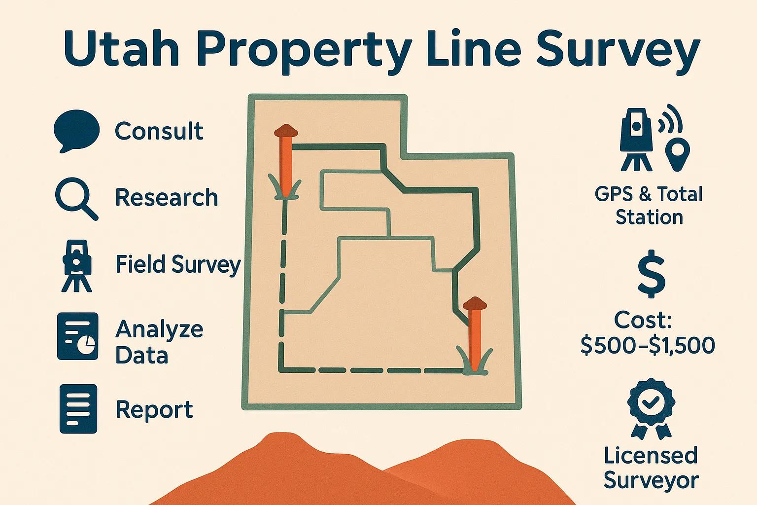
The cost of a boundary survey in Utah can vary widely based on several factors, including the size of the property, the complexity of the survey, and the specific services required. On average, property owners can expect to pay between $500 and $1,500 for a standard boundary survey, though prices can occasionally go higher depending on complexity.
What Are the Typical Cost Components of Land Survey Services in Utah?
These components highlight the various stages involved in conducting a thorough boundary survey, each contributing to the final cost.
How Can Property Owners Budget for Accurate Property Line Marking in Utah?
To budget effectively for a property line survey, homeowners should consider the following tips:
- Get Multiple Quotes: Contact several licensed surveyors to compare prices and services.
- Understand the Scope: Clearly define what you need from the survey to avoid unexpected costs.
- Plan for Additional Services: Be aware that additional services, such as resolving disputes or obtaining permits, may incur extra charges.
By planning ahead and understanding the costs involved, property owners can ensure they allocate sufficient funds for accurate property line marking.
What Survey Methods and Technologies Are Used for Property Line Surveys in Utah?
Modern property line surveys utilize various methods and technologies to enhance accuracy and efficiency. These advancements have significantly improved the reliability of survey results.
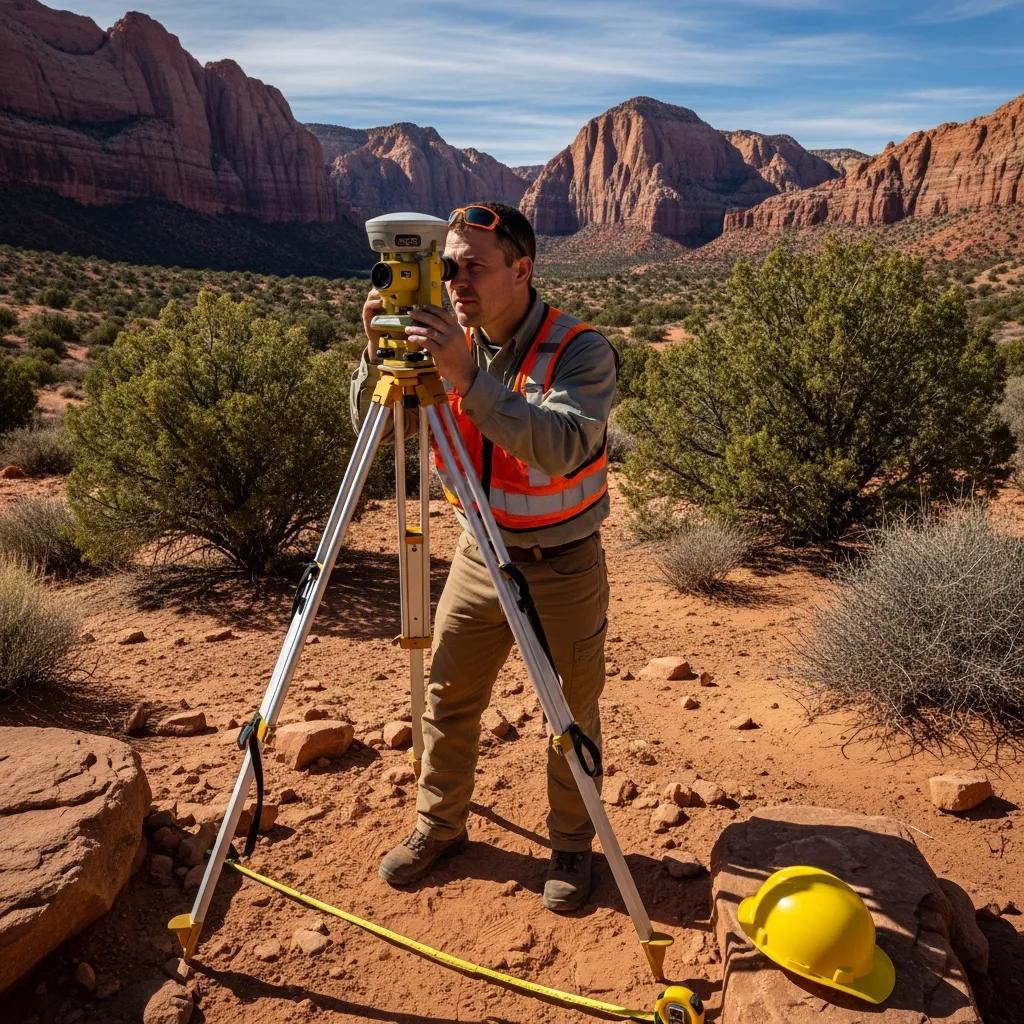
How Do GPS and Total Station Equipment Enhance Survey Accuracy?
GPS technology and total station equipment are essential tools in modern surveying. GPS allows surveyors to obtain precise location data, while total stations combine electronic distance measurement with angle measurement to create accurate three-dimensional representations of the land. These technologies reduce human error and increase the speed of data collection, leading to more reliable survey results.
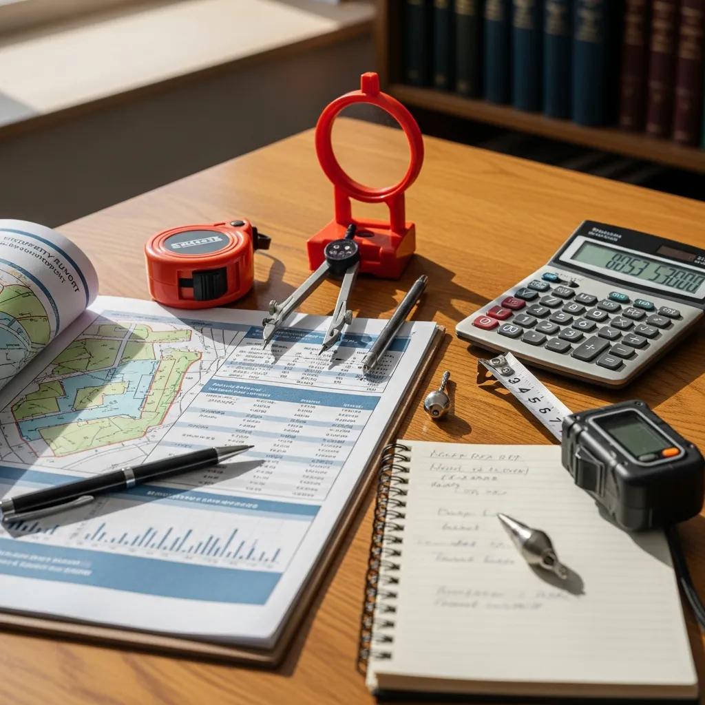
What Is the Step-by-Step Process of Conducting a Property Line Survey?
The process of conducting a property line survey typically involves several key steps:
- Initial Consultation: Discussing the property and survey requirements with the client.
- Research: Gathering existing property records and legal descriptions.
- Field Survey: Measuring the property using GPS and total station equipment.
- Data Analysis: Analyzing the collected data to determine boundaries.
- Report Preparation: Creating a detailed report and legal description of the property.
This structured approach ensures that all aspects of the survey are thoroughly addressed, resulting in accurate boundary determination.
How Can You Resolve Land Boundary Disputes in Utah Effectively?
Boundary disputes can arise for various reasons, including misunderstandings about property lines or changes in land use. Understanding how to resolve these disputes is crucial for property owners.
What Are Common Causes of Boundary Disputes Among Utah Property Owners?
Common causes of boundary disputes in Utah include:
- Misunderstandings: Neighbors may have different interpretations of property lines.
- Ambiguous Legal Descriptions: Poorly written legal descriptions can lead to confusion.
- Changes in Land Use: Alterations to the property, such as fencing or landscaping, can create disputes.
Recognizing these causes can help property owners take proactive measures to avoid conflicts.
Which Legal and Surveying Solutions Help Settle Boundary Conflicts?
Several solutions can help resolve boundary conflicts effectively:
- Mediation: Engaging a neutral third party to facilitate discussions between disputing parties.
- Legal Action: In some cases, it may be necessary to pursue legal action to resolve disputes.
- Professional Surveys: Obtaining a professional survey can provide clear evidence of property boundaries, aiding in dispute resolution.
By understanding these options, property owners can choose the best course of action to resolve boundary disputes.
How to Choose a Licensed Surveyor Near Me in Utah for Reliable Property Line Surveys?
Selecting a qualified surveyor is essential for ensuring accurate property line surveys. Here are some key considerations for property owners in Utah.
What Credentials and Experience Should a Utah Licensed Surveyor Have?
When choosing a licensed surveyor, property owners should look for:
- Licensing: Ensure the surveyor is licensed in Utah and adheres to state regulations.
- Experience: Look for surveyors with a proven track record in property line surveys.
- Professional Associations: Membership in professional organizations such as the Utah Association of Land Surveyors (UALS) can indicate a commitment to industry standards.
These factors can help property owners find a reliable surveyor who meets their needs.
Where to Find Trusted Land Survey Services and Reviews in Utah?
To find trusted land survey services, property owners can:
- Search Online: Use search engines to find local surveyors and read reviews.
- Ask for Recommendations: Seek referrals from friends, family, or real estate professionals.
- Check Professional Associations: Look for surveyors listed in professional organizations, which often provide directories of qualified members.
By utilizing these resources, property owners can identify reputable surveyors for their property line survey needs.
Frequently Asked Questions
What should I do if I disagree with the results of my property line survey?
If you disagree with the results of your property line survey, the first step is to discuss your concerns with the surveyor who conducted the survey. They can provide clarification on their methods and findings. If disagreements persist, consider obtaining a second opinion from another licensed surveyor. Additionally, mediation can be a useful approach to resolve disputes amicably. In some cases, legal action may be necessary, but this should be a last resort after exploring other options.
How often should I have my property surveyed?
Property surveys are typically not required to be conducted regularly; however, it is advisable to have a new survey done if significant changes occur, such as property improvements, boundary disputes, or changes in land use. Additionally, if you are buying or selling property, a current survey can provide clarity on boundaries and enhance the transaction process. Regularly reviewing your property lines can help prevent disputes with neighbors and ensure compliance with local regulations.
Can I perform my own property line survey?
While property owners can conduct informal measurements, a professional property line survey is recommended for legal accuracy and documentation. Licensed surveyors have the expertise, tools, and knowledge of local regulations to ensure precise boundary determination. Attempting to survey your own property without proper training and equipment can lead to inaccuracies and potential disputes. For legal purposes, only a licensed surveyor’s findings will hold up in court or during property transactions.
What are the implications of not having a property line survey?
Not having a property line survey can lead to several issues, including boundary disputes with neighbors, potential legal complications, and difficulties in property transactions. Without a clear understanding of your property boundaries, you may inadvertently encroach on a neighbor’s land, leading to conflicts. Additionally, local zoning laws may require accurate boundary documentation for compliance. Ultimately, not investing in a survey can diminish your property’s value and create unnecessary stress.
How can I prepare for a property line survey?
To prepare for a property line survey, start by gathering any existing property documents, such as deeds, previous surveys, and legal descriptions. Clear the area around the property lines of any obstructions, such as fences or landscaping, to facilitate accurate measurements. Additionally, communicate with the surveyor about any specific concerns or questions you have regarding the survey. Being well-prepared can help ensure a smooth and efficient surveying process.
What should I expect during the property line survey process?
During the property line survey process, you can expect several key steps. Initially, the surveyor will conduct an initial consultation to discuss your needs and gather relevant documents. They will then perform a field survey, using advanced equipment like GPS and total stations to measure the property accurately. After data collection, the surveyor will analyze the information and prepare a detailed report, including legal descriptions and boundary markers. The entire process typically takes a few hours to a few days, depending on the property’s complexity.
Conclusion
Understanding the importance of property line surveys in Utah can significantly enhance your ownership experience by preventing disputes and ensuring compliance with local regulations. By investing in a professional survey, you gain clarity on your property boundaries, which can ultimately increase your property’s value. Don’t leave your land’s future to chance; consider hiring a licensed surveyor to secure your investment. Explore our resources to find the right surveyor for your needs today.