
Utah Boundary Survey Services for Re-establishing Lost Corners
Restoring original property boundaries is crucial for maintaining land ownership rights and resolving disputes. In Utah, the process of re-establishing lost corners involves understanding the significance of survey monuments and the legal framework governing property boundaries. This article will explore the importance of lost survey monuments, the legal aspects of boundary restoration, and the step-by-step process involved. Additionally, we will discuss how to choose professional land surveyors for these services and what to expect in terms of costs and timelines. By the end, readers will gain a comprehensive understanding of how to effectively restore property boundaries in Utah.
What Are Lost Survey Monuments and Why Are They Important in Utah?
Lost survey monuments are critical markers that define property boundaries. When these monuments are lost or destroyed, it can lead to disputes and confusion regarding land ownership. Understanding their importance is essential for property owners in Utah, as these markers provide the legal basis for boundary determinations. The absence of these monuments can complicate property transactions and lead to costly legal battles.
Understanding Survey Monuments and Property Corners
Survey monuments are physical markers placed at specific points to delineate property boundaries. They can be made of various materials, including metal, concrete, or wood, and serve as reference points for land surveys. These monuments are vital for accurately determining property corners, which are the points where property lines meet. Without them, establishing clear property boundaries becomes challenging, leading to potential disputes among neighboring landowners.
How Does the Legal Framework Affect Boundary Restoration in Utah?

The legal framework surrounding boundary restoration in Utah involves various statutes and regulations. Understanding these laws is crucial for property owners seeking to restore lost corners effectively. The legal requirements dictate who can perform boundary surveys and the processes involved in re-establishing property lines.
Understanding the specific legal remedies available for boundary disputes, such as those involving adverse possession, is critical for Utah property owners.
Utah Boundary Disputes: Adverse Possession & Legal Remedies
Utah decisions requires familiarity with Utah law on adverse possession2 and with boundary disputes. Where adverse possession does not help resolve boundary disputes, Utah property owners must look to other legal remedies.
The Law of Practical Location of Boundaries and the Need for an Adverse Possession Remedy, 1986
Key Utah Laws Governing Property Boundary Reestablishment
Several key laws govern property boundary reestablishment in Utah. These include the Utah Code Title 58, Chapter 22, which outlines the responsibilities and licensing requirements of land surveyors and the legal implications of boundary disputes. Additionally, the law provides guidelines for the recovery of lost survey monuments, ensuring that property owners can reclaim their rightful boundaries.
Who Is Authorized to Perform Boundary Surveys and Reestablish Corners?
In Utah, only licensed land surveyors are authorized to perform boundary surveys and reestablish corners. These professionals must meet specific certification requirements and adhere to state regulations. Engaging a qualified surveyor is essential for ensuring that the boundary restoration process is conducted legally and accurately.
What Is the Step-by-Step Process to Re-establish Lost Property Corners in Utah?
Re-establishing lost property corners involves a systematic process that includes several key steps. Understanding this process can help property owners navigate the complexities of boundary restoration effectively.
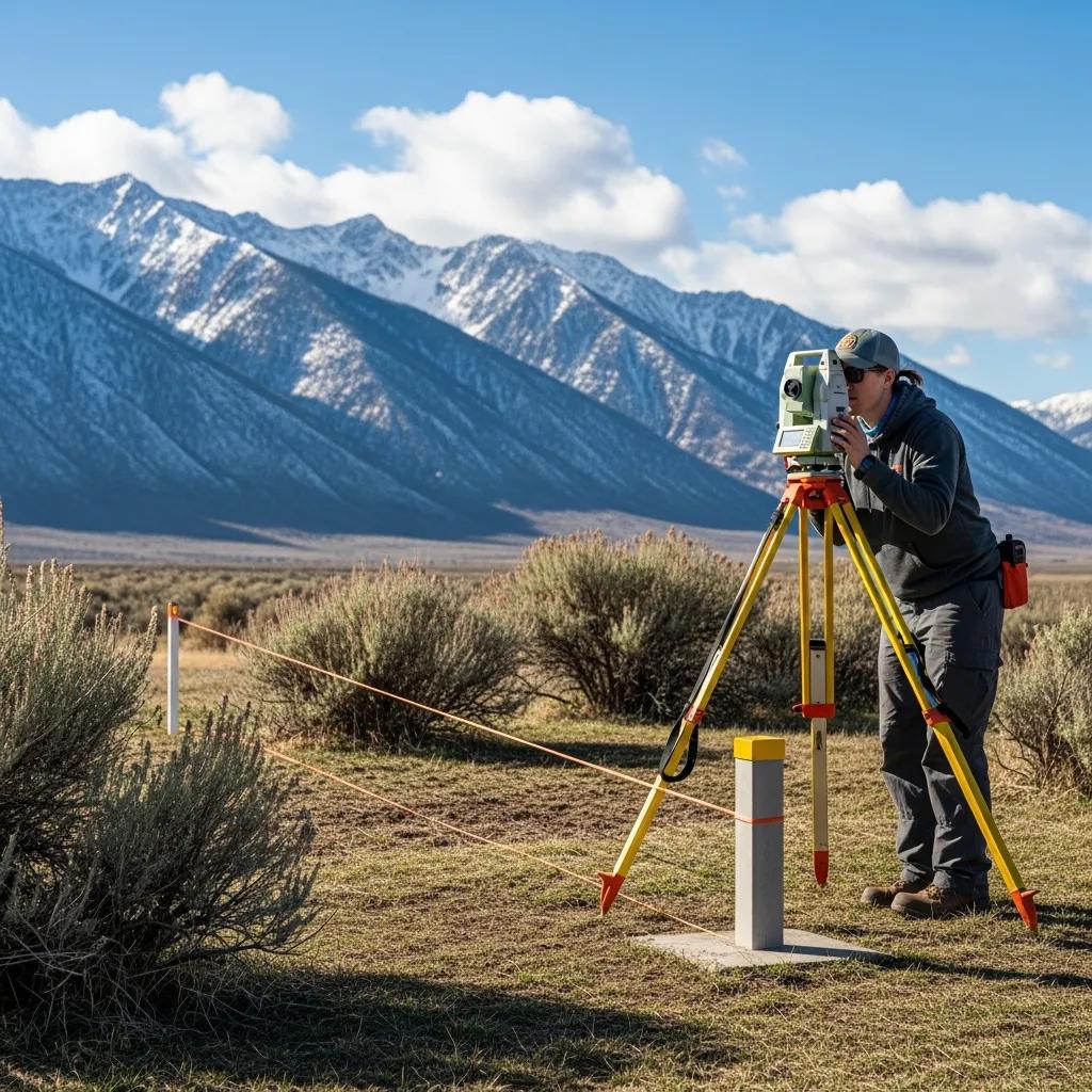
Survey Monument Recovery and Boundary Line Retracement Techniques
The first step in re-establishing lost corners is the recovery of survey monuments. This involves using various techniques, such as historical research and physical searches, to locate existing markers. Once located, boundary line retracement techniques are employed to accurately determine property lines based on the recovered monuments. These techniques may include measuring distances and angles to ensure precise boundary delineation.
Further research delves into the complexities of boundary retracement, including challenges like the ‘pincushion effect’ where multiple markers can complicate accurate determination.
Boundary Retracement Surveying: Monuments & Evidence Recovery
boundary retracement surveying, the pincushion effect 219 refers to a scenario where multiple survey monuments or markers
… AND ERROR ESTIMATES IN THE RULES OF CONSTRUCTION IN RELATION TO BOUNDARY EVIDENCE COLLECTION AND LAND SURVEY PLANNING, 2025
Certification and Documentation of Restored Property Boundaries
After the recovery and retracement process, it is essential to document the restored property boundaries. This involves creating a detailed survey report that includes the findings and methodologies used during the restoration process. Certification by a licensed surveyor is also necessary to validate the accuracy of the restored boundaries, providing legal protection for property owners.
How to Choose Professional Land Surveyors for Boundary Restoration Services in Utah?
Selecting the right land surveyor is crucial for successful boundary restoration. Property owners should consider several factors when evaluating potential surveyors to ensure they receive quality service.
Evaluating Surveyor Certification and Experience
When choosing a land surveyor, it is essential to evaluate their certification and experience. Look for surveyors who are licensed in Utah and have a proven track record in boundary restoration. Experience in handling similar projects can also be a significant indicator of a surveyor’s capability to manage your specific needs.
Comparing Land Corner Reestablishment Service Offerings
Different land surveyors may offer varying services for corner reestablishment. It is important to compare these offerings, including the techniques used, the technology employed, and the overall approach to boundary restoration. Additionally, consider the costs associated with each service to ensure you are making an informed decision.
Ludlow Engineers is a professional service provider specializing in land surveying and civil engineering within Utah. Their expertise in boundary restoration ensures that property owners receive accurate and reliable services tailored to their specific needs.
What Are the Cost and Timeline Expectations for Property Boundary Survey and Restoration?
Understanding the costs and timelines associated with property boundary survey and restoration is essential for planning. Various factors can influence these aspects, making it important for property owners to be informed.
Factors Influencing Survey Monument Restoration Costs
Several factors can affect the costs of restoring survey monuments. These include the complexity of the project, the location of the property, and the specific techniques employed during the restoration process. Additionally, the experience and reputation of the surveyor can also play a role in determining overall costs.
Typical Project Timelines for Boundary Monument Recovery in Utah
The timeline for boundary monument recovery can vary based on the project’s complexity. Generally, property owners can expect the process to take anywhere from a few weeks to several months. Factors such as weather conditions, accessibility, and the availability of surveyors can all impact the timeline for completion.
What Case Studies and Success Stories Demonstrate Effective Boundary Restoration in Utah?
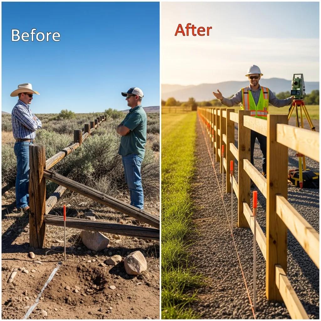
Examining case studies and success stories can provide valuable insights into the effectiveness of boundary restoration efforts in Utah. These examples highlight the importance of professional services in resolving property disputes and restoring lost corners.
Examples of Successful Property Line Retracement Projects
Numerous successful property line retracement projects in Utah demonstrate the effectiveness of professional land surveying services. These projects often involve complex boundary disputes that were resolved through meticulous surveying and documentation, leading to clear and legally recognized property boundaries.
Client Testimonials and Boundary Dispute Resolutions
Client testimonials often reflect the positive outcomes of boundary restoration projects. Many property owners have successfully resolved disputes and reclaimed their property rights through the expertise of licensed surveyors. These testimonials serve as a testament to the importance of professional services in navigating the complexities of property boundary restoration.
To ensure accurate and reliable services tailored to your specific needs, consider reaching out to Ludlow Engineers for expert assistance in boundary restoration.
Frequently Asked Questions
What should I do if I suspect my property boundaries are incorrect?
If you suspect that your property boundaries are incorrect, the first step is to gather any existing property documents, such as deeds or previous surveys. Next, consult with a licensed land surveyor who can conduct a thorough boundary survey. They will assess the situation, locate any existing survey monuments, and provide you with a detailed report on your property lines. This professional evaluation is crucial for resolving any disputes and ensuring your property rights are protected.
How can I prepare for a boundary survey?
Preparing for a boundary survey involves several steps. Start by collecting all relevant documents, including property deeds, previous surveys, and any legal descriptions of your land. Clear the area around your property lines of any obstructions, such as fences or vegetation, to allow the surveyor easy access. Additionally, be ready to discuss any concerns or specific issues you have regarding your property boundaries with the surveyor. This preparation will help ensure a smooth and efficient surveying process.
What are the common challenges faced during boundary restoration?
Boundary restoration can present several challenges, including the loss of original survey monuments, conflicting property descriptions, and disputes with neighboring landowners. Additionally, environmental factors such as changes in land use or natural erosion can complicate the process. Surveyors may also encounter the ‘pincushion effect,’ where multiple markers create confusion about the correct boundary lines. Addressing these challenges requires expertise and thorough research, making it essential to work with experienced professionals in boundary restoration.
Are there any legal implications if I ignore boundary disputes?
Ignoring boundary disputes can lead to significant legal implications, including the potential loss of property rights. If a neighbor claims adverse possession or if disputes escalate, you may find yourself in costly legal battles. Additionally, unresolved boundary issues can complicate property transactions, making it difficult to sell or refinance your property. It is crucial to address boundary disputes promptly and seek professional assistance to protect your rights and interests in your property.
What role does historical research play in boundary restoration?
Historical research is a vital component of boundary restoration, as it helps surveyors understand the original property lines and the context of lost survey monuments. This research may involve examining old maps, land records, and previous surveys to gather evidence of the original boundaries. By establishing a historical context, surveyors can make informed decisions about the correct placement of property lines, ensuring that the restoration process is accurate and legally defensible.
How can I ensure my boundary restoration is legally recognized?
To ensure that your boundary restoration is legally recognized, it is essential to work with a licensed land surveyor who follows state regulations and guidelines. After the survey is completed, the surveyor should provide a detailed report and certification of the restored boundaries. This documentation serves as legal proof of the property lines. Additionally, consider recording the survey results with your local land records office to further solidify the legal standing of your restored boundaries.
Conclusion
Restoring lost property boundaries in Utah is essential for protecting ownership rights and preventing disputes. By understanding the legal framework and engaging qualified land surveyors, property owners can navigate the complexities of boundary restoration effectively. The insights provided in this article empower you to take informed action regarding your property. For expert assistance tailored to your needs, consider reaching out to Ludlow Engineers today.