

Lot Line Adjustments vs Boundary Surveys: Differences & Processes
Understanding the distinctions between a lot line adjustment and a boundary survey is crucial for property owners and developers alike. These two processes, while related, serve different purposes in the realm of property law and land surveying. A lot line adjustment involves modifying the boundaries between adjacent properties, which can affect ownership and land use, while a boundary survey is a detailed examination of property lines to establish legal boundaries. This article will delve into the definitions, processes, and implications of both lot line adjustments and boundary surveys, providing clarity on their roles in property management and development. We will also explore common disputes related to property lines, the costs associated with these services, and how to select a qualified land surveyor.
What Is a Lot Line Adjustment and How Does It Affect Property Boundaries?
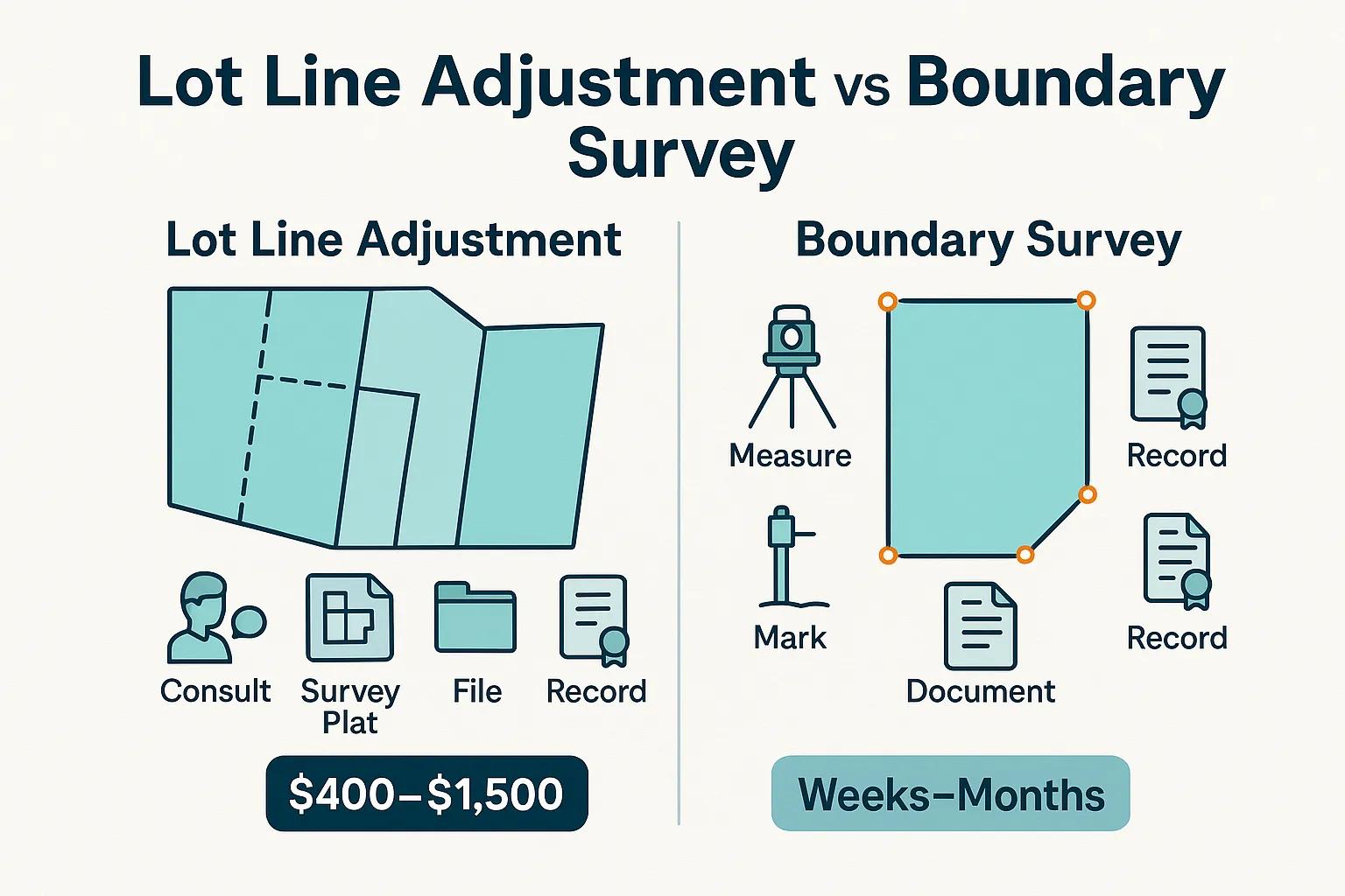
A lot line adjustment is a legal process that modifies the boundaries between two or more adjacent parcels of land without increasing the total number of parcels. This adjustment can be necessary for various reasons, such as improving land use, resolving disputes, or facilitating development. The primary benefit of a lot line adjustment is that it allows property owners to reconfigure their land to better suit their needs while remaining compliant with local zoning laws.
Definition and Purpose of Lot Boundary Adjustments
Lot boundary adjustments are defined as changes made to the property lines between two or more adjacent parcels. The purpose of these adjustments is to enhance the usability of the land, often in response to changes in ownership or development plans. For example, if two neighboring property owners wish to exchange small portions of their land to create more functional lots, a lot line adjustment would be the appropriate legal mechanism to formalize this change.
Step-by-Step Lot Line Adjustment Process Explained
The process of a lot line adjustment typically involves several key steps:
- Consultation with Local Authorities: Property owners should first consult with local zoning and planning departments to understand the regulations governing lot line adjustments.
- Surveying the Property: A licensed land surveyor is usually required to create a new survey plat that reflects the proposed changes.
- Filing the Adjustment: Once the survey is complete, the property owners must file the adjustment with the appropriate local government office, often requiring public notice and possibly a hearing.
- Approval and Recording: After review, the local authority will approve the adjustment, and it will be recorded in public land records.
This structured approach ensures that all adjustments comply with local laws and regulations, protecting the interests of all parties involved.
How Does a Boundary Survey Define Property Lines and Legal Boundaries?
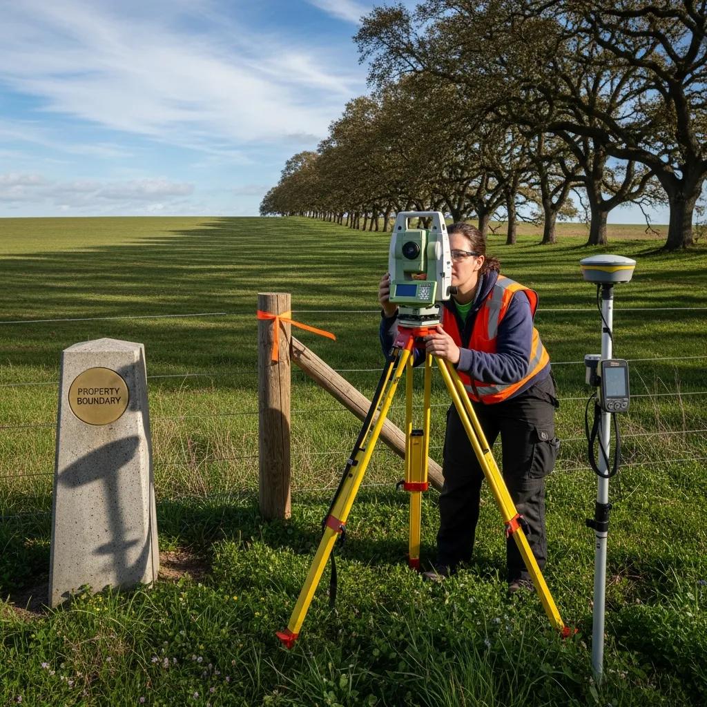
A boundary survey is a detailed examination of a property’s boundaries, conducted by a licensed land surveyor. This survey establishes the legal limits of a property, which is essential for resolving disputes, ensuring compliance with zoning laws, and facilitating transactions. The importance of boundary surveys cannot be overstated, as they provide the definitive legal description of a property.
Understanding Boundary Surveys and Their Role in Property Line Determination
Boundary surveys play a critical role in property line determination by accurately measuring and marking the boundaries of a parcel of land. These surveys utilize various tools and techniques, including GPS technology and traditional measuring methods, to ensure precision. The results of a boundary survey are documented in a survey plat, which serves as a legal record of the property’s boundaries.
Types of Land Survey Types Including Boundary Surveys
There are several types of land surveys, each serving different purposes:
- Boundary Surveys: Establish the legal boundaries of a property.
- Topographic Surveys: Map the contours and features of the land.
- ALTA/NSPS Surveys: Comprehensive surveys that meet specific standards for commercial properties.
- Subdivision Surveys: Used when dividing a larger parcel into smaller lots.
Each type of survey is tailored to meet specific needs, ensuring that property owners have the necessary information for their projects.
What Are the Key Differences Between Lot Line Adjustments and Boundary Surveys?
Understanding the differences between lot line adjustments and boundary surveys is essential for property owners. While both processes involve property boundaries, they serve distinct purposes and have different implications.
Comparing Survey Plat vs Boundary Survey: Visual and Legal Distinctions
A survey plat is a graphical representation of a property’s boundaries, often created during a boundary survey. In contrast, a boundary survey provides the legal description and precise measurements of the property boundaries. The key distinction lies in their use: a survey plat is often used for visual reference and documentation, while a boundary survey is a legal document that can be used in court or during property transactions.
Legal and Regulatory Requirements Governing Each Process
Both lot line adjustments and boundary surveys are subject to local regulations and legal requirements. Lot line adjustments typically require approval from local planning authorities, while boundary surveys must be conducted by licensed surveyors in compliance with state laws. Understanding these requirements is crucial for ensuring compliance and avoiding legal disputes.
How Much Do Property Boundary Surveys and Lot Line Adjustments Cost and Take Time?
The costs and timeframes associated with property boundary surveys and lot line adjustments can vary significantly based on several factors, including location, complexity, and the specific services required.
Typical Property Boundary Survey Cost Estimates and Factors
The cost of a boundary survey can range from approximately $400 to $1,500 or more, depending on the size of the property and the complexity of the survey. Factors influencing the cost include: boundary survey costs.
- Property Size: Larger properties typically require more time and resources to survey.
- Location: Urban areas may have higher costs due to increased regulatory requirements.
- Surveyor Experience: More experienced surveyors may charge higher fees.
Lot Line Adjustment Timeframes and Approval Processes
The timeframe for completing a lot line adjustment can vary widely, typically taking anywhere from a few weeks to a few months. The approval process often involves:
- Preparation of Documentation: Gathering necessary documents and surveys.
- Review by Local Authorities: Submission for approval, which may include public hearings.
- Final Recording: Once approved, the adjustment must be recorded in public land records.
Understanding these timelines is essential for property owners planning development projects.
What Are Common Boundary Line Disputes and How Can They Be Resolved?

Boundary line disputes are common among property owners and can arise from various issues, including unclear property lines, encroachments, and misunderstandings about property rights. Resolving these disputes often requires careful navigation of legal and regulatory frameworks.
Causes of Property Line Disputes and Surveyor Roles
Common causes of property line disputes include:
- Misinterpretation of Surveys: Confusion over survey results can lead to disagreements.
- Encroachments: When one property owner builds on or uses part of another’s land.
- Lack of Clear Boundaries: Properties without clear markers can lead to disputes.
Surveyors play a crucial role in resolving these disputes by providing accurate measurements and documentation of property lines.
Professional Boundary Line Dispute Resolution Strategies
Effective strategies for resolving boundary line disputes include:
- Mediation: Engaging a neutral third party to facilitate discussions between disputing parties.
- Legal Action: In some cases, disputes may require court intervention to resolve.
- Boundary Agreements: Property owners can formalize agreements regarding property lines to prevent future disputes.
These strategies can help property owners navigate conflicts and maintain good neighborly relations.
How to Choose a Licensed Land Surveyor for Lot Line Adjustments and Boundary Surveys?
Selecting a qualified land surveyor is essential for ensuring accurate and legally compliant surveys. Property owners should consider several factors when choosing a surveyor.
Qualifications and Credentials of Professional Land Surveyors
When selecting a land surveyor, it is important to verify their qualifications and credentials. Key considerations include:
- Licensing: Ensure the surveyor is licensed in your state or jurisdiction.
- Experience: Look for surveyors with experience in lot line adjustments and boundary surveys.
- References: Ask for references or reviews from previous clients to gauge their reliability.
Tips for Selecting Surveyors for Accurate Property Line Surveys
To ensure you choose the right surveyor, consider the following tips:
- Request Multiple Quotes: Compare prices and services from different surveyors.
- Check for Insurance: Ensure the surveyor carries liability insurance to protect against errors.
- Discuss Your Needs: Clearly communicate your project requirements to ensure the surveyor can meet your expectations.
By following these guidelines, property owners can select a qualified land surveyor who will provide accurate and reliable services.
For assistance with your next project, consider Ludlow Engineers. Their expertise can help ensure your project’s success.
Frequently Asked Questions
What is the difference between a lot line adjustment and a property subdivision?
A lot line adjustment modifies the boundaries between existing parcels without creating new ones, while a property subdivision involves dividing a larger parcel into multiple smaller lots, resulting in new property titles. Subdivisions often require more extensive planning and compliance with local zoning laws, including public hearings and approvals. In contrast, lot line adjustments are typically simpler and focus on reconfiguring existing boundaries to better suit the needs of the property owners involved.
Can a lot line adjustment affect property taxes?
Yes, a lot line adjustment can potentially affect property taxes. When property boundaries are modified, the assessed value of the properties may change, leading to adjustments in property tax obligations. Local tax assessors will evaluate the new configurations and may reassess the properties based on their new sizes and uses. Property owners should consult with their local tax authority to understand how a lot line adjustment might impact their tax situation.
How long does it typically take to complete a boundary survey?
The duration of a boundary survey can vary based on several factors, including the size of the property, the complexity of the boundaries, and the surveyor’s workload. Generally, a boundary survey can take anywhere from a few days to several weeks to complete. After the survey is conducted, additional time may be needed for documentation and filing with local authorities. Property owners should discuss timelines with their surveyor to set realistic expectations.
What should I do if I disagree with the results of a boundary survey?
If you disagree with the results of a boundary survey, the first step is to discuss your concerns with the surveyor who conducted the survey. They can clarify their findings and methodology. If disagreements persist, you may consider hiring a second surveyor for a second opinion. In some cases, legal action may be necessary to resolve disputes, especially if the survey results impact property rights or ownership. Mediation can also be a viable option to reach an agreement.
Are there any legal implications of not having a boundary survey?
Yes, not having a boundary survey can lead to significant legal implications. Without a clear understanding of property boundaries, property owners may inadvertently encroach on neighboring land, leading to disputes and potential legal action. Additionally, a lack of a boundary survey can complicate property transactions, as buyers may be hesitant to purchase a property without clear boundaries. It is advisable to obtain a boundary survey to protect your property rights and avoid future conflicts.
What are the common mistakes to avoid when applying for a lot line adjustment?
Common mistakes when applying for a lot line adjustment include failing to consult local zoning regulations, not hiring a qualified surveyor, and neglecting to gather all necessary documentation. Additionally, property owners may overlook the importance of public notice requirements or underestimate the time needed for approval. To avoid these pitfalls, it is crucial to thoroughly research local laws, work with experienced professionals, and ensure all paperwork is complete and accurate before submission.
Conclusion
Understanding the differences between lot line adjustments and boundary surveys is essential for effective property management and development. By leveraging these processes, property owners can ensure compliance with local regulations while optimizing their land use. For tailored guidance and expert assistance, consider reaching out to a qualified land surveyor. Explore our resources to empower your property decisions today.