
Professional Land Surveying Company in Levan, Utah — Comprehensive Property & Boundary Survey Services
Accurate land surveying is the foundation of responsible property ownership and development. In Levan, Utah, our team provides clear, reliable information about property lines, topography, and legal boundaries. Whether you’re a homeowner, developer, or engineer, our local surveying services are built to support your project from planning through completion. Below, we explain the surveying services available in Levan, why surveys matter, and how a local firm can simplify the process. We also walk through the typical steps of a boundary survey and explain how civil engineering surveys support development on the ground.
What Land Surveying Services Are Available in Levan, Utah?
Surveying in Levan covers a range of services tailored to the area’s needs. We offer property surveys, boundary determinations, and civil engineering surveying — each focused on providing the accurate, usable data required for land use, construction, and legal matters.
Overview of Property Surveys and Boundary Determination

Property surveys establish the exact limits of a parcel. Using precise measurements and careful mapping, we identify property lines so owners know what they own and where improvements can go. Clear boundary determination helps prevent neighbor disputes, supports real estate transactions, and keeps projects aligned with local zoning rules. With a certified survey, you can move forward on development, fencing, or sales with confidence.
Civil Engineering Surveying Services in Levan
Civil engineering surveys supply the measurements designers and contractors rely on. In Levan, we provide topographic surveys that capture terrain and natural features, plus construction staking to place roads, utilities, and buildings exactly where plans require. Using modern equipment and field-tested methods, our surveys help keep projects on schedule and built to spec. civil engineering
How Do Levan, Utah Property Surveys Define Your Land Boundaries?
Surveys create the legal record of where a property begins and ends. That documentation protects owners, supports permits and sales, and resolves boundary questions before they become problems.
Understanding Property Line Surveys and Their Importance
Property line surveys show the precise edge of your land. They serve as legal evidence of ownership and are commonly required for permits, sales, and dispute resolution. Without a formal survey, improvements may unintentionally cross onto neighboring property — creating risk and potential legal expense. A professional survey removes that uncertainty.
Techniques Used by Surveyors in Levan, Utah for Accurate Boundary Mapping
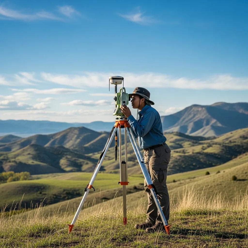
Surveyors in Levan combine established practices with current technology to produce accurate maps. We use GPS receivers for precise positioning, total stations for distance and angle measurements, and conventional tools where appropriate. These methods, used together, deliver dependable boundary data that architects, engineers, and landowners can trust.
Why Choose a Local Land Surveying Company in Levan, Utah?
Hiring a local surveying company brings practical advantages: familiarity with local terrain, knowledge of county procedures, and faster response times for fieldwork and follow-up.
Benefits of Hiring Experienced Surveyors Familiar with Levan’s Terrain
Local surveyors understand Levan’s ground conditions, property histories, and permitting processes. That experience helps us anticipate challenges, speed fieldwork, and offer practical advice. We also provide local zoning and land-use insights that help you plan smarter and avoid delays.
Customer Testimonials and Service Reliability
Reputation matters. Homeowners, builders, and engineers in the area choose local firms for dependable service and clear communication. We focus on timely results and accurate reports so you can proceed with confidence.
What Are the Steps Involved in a Land Boundary Survey in Levan?
A boundary survey follows a straightforward process that ensures accuracy and legal compliance from start to finish.
Initial Consultation and Site Assessment
We begin with a consultation to understand your goals. During the site assessment, we review existing deeds and plats, note visible monuments and landmarks, and determine access for field equipment. This step sets the scope and identifies any known issues before we start measurements.
Survey Execution and Reporting Process
Field crews take precise measurements and record site conditions. Back in the office, we produce detailed maps and a formal report that documents the boundary lines and findings. That report becomes the official reference for sales, permits, construction, or dispute resolution.
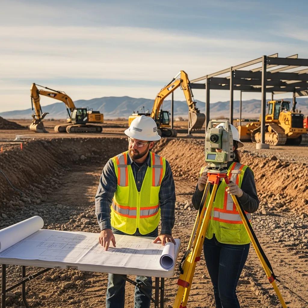
How Does Civil Engineering Surveying Support Development Projects in Levan, Utah?
Civil engineering surveying provides the spatial framework that planners and builders use to turn designs into reality.
Role of Surveyors in Planning and Construction
Surveyors supply site data for design, check elevations and coordinates during construction, and perform layout staking so the work follows approved plans. Regular verification keeps projects accurate and reduces costly rework.
Integration of Survey Data with Engineering Designs
Survey data feeds directly into engineering plans. When surveyors and engineers collaborate early, they identify potential conflicts and refine designs, saving time and budget during construction.
Where Can You Find Trusted Land Surveying Companies in Levan, Utah?
Finding a reliable surveyor starts with clear contact channels and a willingness to explain processes and pricing up front.
Contact Information and Service Areas
Local surveying firms list contact details on their websites so clients can request quotes and schedule consultations. Many serve Levan and surrounding communities, offering on-site work and rapid follow-up.
Pricing and Service Packages for Property Line Surveys
Survey pricing varies with property size, complexity, and the services required. Common packages bundle a field survey, a boundary report, and mapping. We recommend collecting written estimates and comparing services to find the best fit for your project.
Surveying is essential for owners and developers in Levan. With the right survey, you protect your property, meet regulatory requirements, and keep projects moving smoothly.
Frequently Asked Questions
What qualifications should I look for in a land surveyor in Levan, Utah?
Look for a licensed surveyor with relevant experience and local knowledge. A professional surveyor typically has formal training in surveying or a related field and holds state licensure. Check for experience in the specific survey type you need and read client reviews to gauge reliability and communication.
How long does a typical land survey take in Levan?
Survey time depends on property size, terrain, and survey type. A simple property survey can take a few hours to a day; complex boundary work or engineering surveys may require several days. Weather and site access also affect timing, so ask your surveyor for a project-specific estimate.
Are there any legal requirements for property surveys in Utah?
Yes. Surveys are often required for property transfers, building permits, and dispute resolution. Local zoning rules may also mandate surveys for certain projects. A licensed surveyor can advise on the specific legal and regulatory requirements for your situation.
What technology do land surveyors in Levan use for their surveys?
Surveyors use GPS for precise positions, total stations for combined distance and angle measurements, and 3D laser scanning for detailed topography when needed. These tools, paired with proven field methods, deliver accurate maps and reports. topographical survey
Can I perform my own land survey, or should I hire a professional?
While homeowners can perform informal measurements, only a licensed surveyor can produce the legal documentation required for permits, sales, or disputes. Professional surveys reduce the risk of errors and legal problems.
What should I expect during the initial consultation with a land surveyor?
Expect to discuss your objectives, review any existing property documents, and schedule a site visit. The surveyor will explain the process, timeline, and costs, and ask about any concerns you have so the work matches your needs.
Conclusion
Working with a professional land surveying company in Levan ensures clear property boundaries and compliance with local rules. Our local knowledge, precise methods, and straightforward reporting help you avoid disputes and make informed decisions about your land. Contact us to discuss your project and learn how our surveying solutions can help.