
Land Surveying in Moroni, Utah: Licensed Surveyors & Civil Engineering
Accurate land surveying is a foundation for any property project in Moroni, Utah. The town’s terrain and local rules shape how surveys are done. This guide walks through the surveying services available locally, why they matter for owners and developers, and how to choose a licensed surveyor. We also outline common cost drivers and the civil engineering services that typically work alongside surveying so you can move projects forward without surprises.
What Are the Essential Land Surveying Services Offered in Moroni Utah?
Land surveying covers a range of services used to establish legal boundaries, document site conditions, and support development. In Moroni, local firms provide several key survey types to meet the needs of homeowners, builders, and commercial clients.
Which Types of Land Surveys Are Available in Moroni?

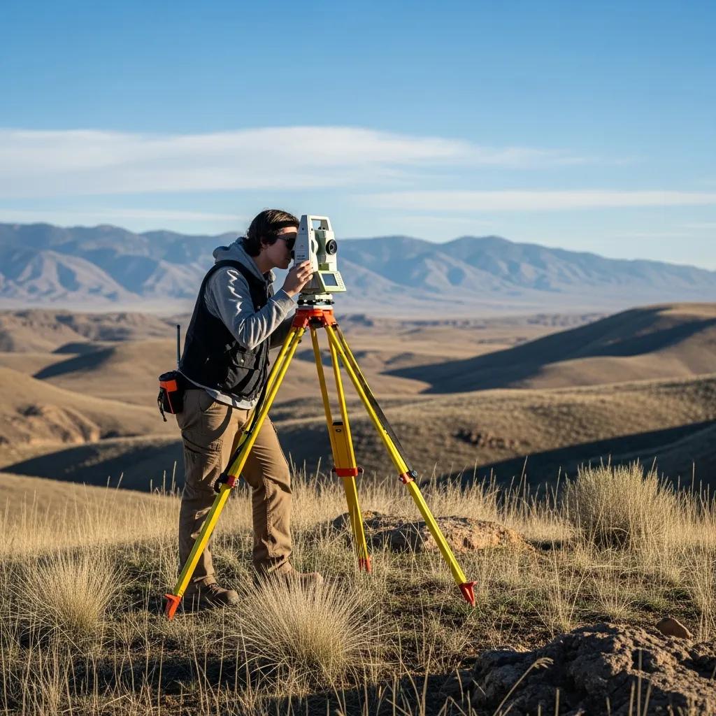
Common surveys performed in Moroni include: land surveys
- Boundary Surveys: Precisely locate property lines and corner markers — essential for deeds, fences, and dispute resolution.
- ALTA/NSPS Surveys: A thorough, standards-based survey used for commercial transactions, title work, and lender requirements.
- Topographic Surveys: Record elevations, contours, and physical features to inform grading, drainage, and site design.
Each survey serves a specific purpose and helps ensure compliance with local rules while giving you an accurate map of the property.
How Do Boundary, ALTA, and Topographic Surveys Differ?
Knowing which survey you need saves time and money. Here’s a quick comparison:
This overview highlights how each survey type matches different project needs and budgets.
Why Is Land Surveying Critical for Property Owners in Moroni Utah?
Surveying provides the legal clarity and site information property owners need to avoid disputes, plan improvements, and meet permitting requirements. In Moroni — where terrain and local codes matter — a reliable survey protects your investment.
How Do Surveys Help Resolve Property Disputes and Define Boundaries?
A professional survey creates an objective record of where property lines lie. That record is often the deciding factor in neighbor disputes and is essential for clear legal descriptions used in deeds and court filings. A well-documented survey helps everyone understand their rights and responsibilities.
What Local Terrain and Zoning Factors Affect Surveying in Moroni?
Local factors — like slope, soil conditions, and municipal zoning — influence how a survey is performed and what information you’ll need for development. These elements can affect grading, drainage design, septic placement, and whether additional geotechnical or environmental work is required.
Local environmental concerns — including historical water-quality issues — make thorough site investigation and accurate surveying especially important in this region.
Moroni, Utah — Water Supply & Environmental Background
Moroni sits in the northern Sanpete Valley, about 60 miles south of Salt Lake City. Before August 1994, the city relied on a 300-foot municipal well on the town’s south side. Routine testing in August 1994 showed nitrate levels slightly above the federal maximum contaminant level of 10 ppm. In response, the city developed a new municipal water supply well.
How to Choose a Licensed Land Surveyor in Moroni Utah?
Choosing the right surveyor matters for accuracy and legal defensibility. Use the checklist below to vet candidates and pick a professional who understands local conditions.
What Qualifications and Experience Should You Look For?
- Licensing: Confirm the surveyor is licensed in Utah and in good standing with state regulators.
- Relevant Experience: Prefer firms that have completed the specific survey type and worked on similar properties in the region.
- Technical Proficiency: Ask about the equipment and software they use — modern tools improve speed and accuracy.
These factors help ensure the surveyor can deliver precise, defensible results that meet your project needs.
Why Is Local Expertise Important for Moroni Land Surveys?
Local knowledge speeds work and reduces surprises. A surveyor familiar with Sanpete County’s terrain, permitting processes, and utility networks can anticipate issues and recommend practical solutions that save time and cost.
Ludlow Engineers and Associates LLC has served Central Utah since 1975. We specialize in site development, civil plans, small water and sewer projects, and land surveying, with professional engineers and licensed surveyors on staff focused on rural Utah’s needs.
For practical guidance, project updates, and technical articles, explore our blog where we share experience from local projects and regulatory changes.
What Factors Influence the Cost of Property Surveys in Moroni Utah?
Survey pricing depends on several variables. Understanding them helps you budget and compare proposals more effectively.
How Do Survey Type and Property Size Affect Pricing?
The scope of the survey and the property’s size are primary cost drivers. Detailed surveys like ALTA/NSPS or surveys over rugged, large, or heavily vegetated sites require more time and resources than a simple boundary check on a small lot.
Are There Additional Fees for Civil Engineering or Site Plans?
Yes. If your project needs grading plans, utility design, or permits, expect separate fees for civil engineering services or site plans. Ask for an itemized scope and estimate so you can see what’s included and what’s optional.
What Civil Engineering Services Complement Land Surveying in Moroni Utah?

Civil engineering and surveying commonly overlap during site development. Clear coordination between both disciplines keeps projects on schedule and helps avoid costly revisions.
How Do Civil Site Plans Support Local Development Projects?
Civil site plans lay out roads, utilities, grading, drainage, and landscaping so projects meet local codes and function as intended. They translate survey data into buildable plans and permit-ready drawings.
What Role Do FHA Foundation Inspections Play for Manufactured Homes?
FHA foundation inspections verify that a manufactured home’s foundation meets federal safety and stability standards. These inspections are often required for financing and are a key step in closing a purchase or completing a placement.
Frequently Asked Questions
What Should I Expect During a Land Survey Process in Moroni?
A typical survey includes a site visit to measure boundaries and features, use of survey equipment to gather precise coordinates, and review of historical records. After fieldwork, the surveyor prepares a written report and a map or plat showing the results. Expect clear communication about scope, schedule, and any site constraints before work begins.
How Can I Verify a Surveyor‘s Credentials in Utah?
Check the Utah Division of Occupational and Professional Licensing (DOPL) for a surveyor’s active license and disciplinary history. Also request references, examples of past work, and a certificate of insurance before hiring. boundary survey is a relevant service to consider.
What Are the Common Challenges Faced During Land Surveys?
Surveyors commonly face steep slopes, dense vegetation, limited property access, and unclear or missing historical markers. Weather and seasonal conditions also affect fieldwork. Good planning and an experienced crew help manage these obstacles.
Are There Specific Regulations for Land Surveys in Moroni?
Surveys must meet state standards and local requirements. Utah and Sanpete County rules define acceptable practices, deliverables, and filing procedures. Your surveyor should explain applicable regulations and how they affect your project.
What Is the Importance of Having a Survey Before Buying Property?
A pre-purchase survey reveals exact property boundaries, easements, encroachments, and other constraints that affect use and value. Lenders often require surveys for closings, and buyers gain protection and certainty from a current, professional survey.
How Can I Prepare for a Land Survey on My Property?
Clear access to property lines where possible, gather deeds and any previous surveys, and mark any known monuments or corners. Tell the surveyor about fences, access points, and planned work so they can plan equipment and crew accordingly.
How Long Does a Land Survey Take to Complete in Moroni?
Timing depends on survey type and site conditions. A straightforward boundary survey can be completed in a few days, while ALTA/NSPS or large, complex sites may take several weeks to finish and produce final deliverables.
Can Land Surveys in Moroni Be Incorrect and How Are Errors Resolved?
Errors can occur, but reputable surveyors minimize risk through verification and quality control. If a survey dispute or obvious error arises, options include a re-survey, review by another licensed surveyor, or legal resolution. Choosing an experienced, licensed firm up front reduces the likelihood of costly corrections.
Conclusion
Understanding local surveying and engineering basics helps Moroni property owners protect their investment and keep projects moving. Choose a licensed surveyor with local experience, clarify scope and fees up front, and coordinate surveying with civil engineering when planning development. For guidance on your specific project, reach out to a local professional or explore our resources to learn more.