

Flood Elevation Certificate Services in Utah | Ludlow Engineers
Flood elevation certificates are crucial documents for property owners in flood-prone areas, particularly in Utah. These certificates provide essential information about a property’s elevation in relation to the base flood elevation, which is vital for flood insurance and compliance with local regulations. Understanding the significance of flood elevation certificates can help homeowners mitigate risks associated with flooding and ensure they meet federal and state requirements. This article will explore the importance of flood elevation certificates, the process of obtaining them, and how Ludlow Engineers can assist in this essential service. We will also discuss the costs and benefits associated with these certificates, as well as the role of certified surveyors in flood zone determination.
What is a Flood Elevation Certificate and Why is it Essential in Utah?
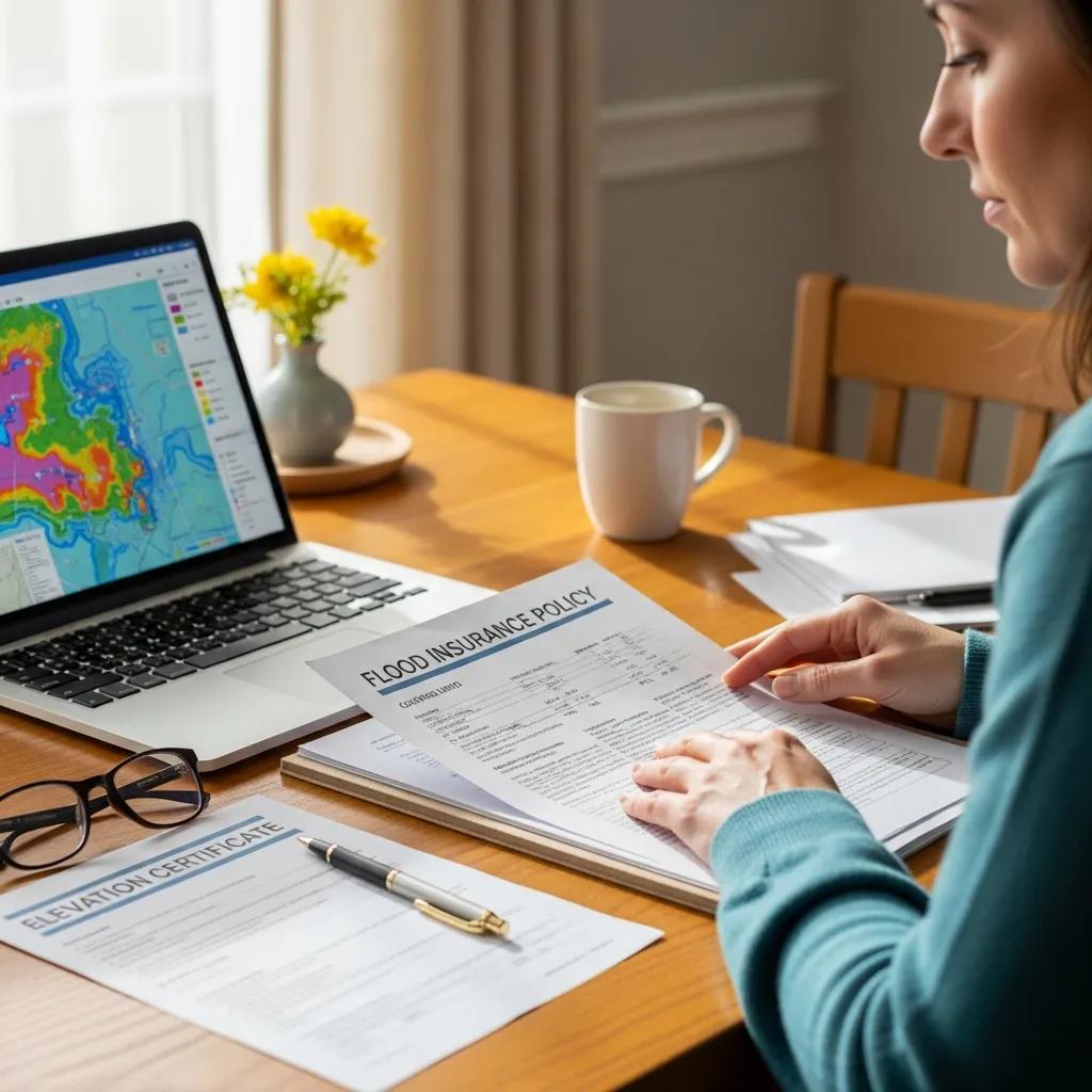
A Flood Elevation Certificate (FEC) is an official document that verifies a property’s elevation in relation to the base flood elevation as determined by FEMA. This certificate is essential for property owners in Utah, as it is often required for obtaining flood insurance and ensuring compliance with local floodplain management regulations. By providing accurate elevation data, the FEC helps homeowners understand their flood risk and make informed decisions regarding flood insurance coverage. Additionally, having a valid FEC can significantly impact insurance premiums, making it a critical document for homeowners in flood-prone areas.
Understanding FEMA Elevation Certificates and Their Role

FEMA Elevation Certificates are standardized forms used to document the elevation of buildings in flood zones. These certificates are generated based on data collected during a survey conducted by a certified surveyor. The information included in the certificate is crucial for determining flood insurance rates and ensuring compliance with federal and state regulations. Property owners must understand the role of these certificates in flood risk assessment, as they provide essential data that can influence insurance costs and eligibility for federal disaster assistance.
How Elevation Certificates Support Utah Flood Insurance Requirements
Elevation certificates play a vital role in supporting flood insurance requirements in Utah. Insurance providers use the information contained in these certificates to assess the flood risk associated with a property. This assessment directly impacts the cost of flood insurance premiums. Properties with higher elevations relative to the base flood elevation may qualify for lower insurance rates, while those at or below the base flood elevation may face higher premiums or even be ineligible for coverage. Understanding how elevation certificates affect flood insurance is essential for homeowners looking to protect their investments.
How to Obtain a FEMA-Compliant Flood Elevation Certificate in Utah?
Obtaining a FEMA-compliant Flood Elevation Certificate in Utah involves several key steps:
- Initial Consultation: Contact a certified surveyor to discuss your property and the specific requirements for obtaining an elevation certificate.
- Site Visit and Data Collection: The surveyor will conduct a site visit to collect necessary elevation data and assess the property.
- Certificate Completion: After gathering the required information, the surveyor will complete the elevation certificate and provide it to the property owner.
For those seeking assistance in this process, Ludlow Engineers offers professional services to ensure compliance with FEMA regulations.
Step-by-Step Process for Certified Elevation Surveys by Ludlow Engineers
Ludlow Engineers provides a comprehensive process for obtaining certified elevation surveys, which includes:
- Gather Property Information: Collect all relevant property details, including previous flood insurance policies and any existing elevation data.
- Schedule a Site Visit: Coordinate with Ludlow Engineers to schedule a site visit for data collection.
- Fieldwork and Data Collection: During the site visit, certified surveyors will gather elevation data and complete the necessary measurements.
- Certificate Issuance: Once the data is analyzed, Ludlow Engineers will issue the Flood Elevation Certificate, ensuring it meets all FEMA requirements.
This streamlined process ensures that property owners receive accurate and timely elevation certificates.
Who Are Certified Surveyors and What Are Their Roles in Utah Flood Zone Determination?
Certified surveyors are professionals trained to assess and document property elevations in relation to flood zones. Their role is critical in determining whether a property is located in a flood zone and the associated flood risk. In Utah, certified surveyors must adhere to specific standards set by FEMA and local regulations. They are responsible for conducting accurate surveys, completing elevation certificates, and providing essential data that influences flood insurance rates and compliance with floodplain management regulations. Understanding the importance of certified surveyors can help property owners navigate the complexities of flood risk assessment.
What Are the Costs and Benefits of Elevation Certificates in Utah?
The costs associated with obtaining a Flood Elevation Certificate in Utah can vary based on several factors, including the complexity of the property and the surveyor’s fees. However, the benefits of having an elevation certificate often outweigh the costs. Some key benefits include:
- Lower Insurance Premiums: Properties with a valid elevation certificate may qualify for reduced flood insurance rates.
- Regulatory Compliance: An elevation certificate ensures compliance with local floodplain management regulations, protecting property owners from potential fines.
- Informed Decision-Making: Having accurate elevation data allows homeowners to make informed decisions regarding flood risk and insurance coverage.
Understanding these costs and benefits can help property owners appreciate the value of obtaining an elevation certificate.
Elevation Certificate Cost Breakdown and Pricing Factors in Utah
The costs associated with obtaining a Flood Elevation Certificate in Utah can vary based on several factors, including:
This breakdown provides a clear understanding of the potential costs involved in obtaining an elevation certificate.
How Elevation Certificates Can Reduce Flood Insurance Premiums
Elevation certificates can significantly reduce flood insurance premiums for property owners. By providing accurate elevation data, these certificates help insurance providers assess the flood risk associated with a property. Properties that are elevated above the base flood elevation may qualify for lower premiums, while those at or below the base flood elevation may face higher rates. Additionally, having a valid elevation certificate can make a property more attractive to potential buyers, as it demonstrates compliance with floodplain management regulations and a proactive approach to flood risk mitigation.
How to Determine Flood Zones Using FEMA Flood Maps in Utah?
Determining flood zones using FEMA flood maps is essential for property owners in Utah. The process involves:
- Accessing FEMA Maps: Property owners can access FEMA flood maps online to identify their property’s flood zone designation.
- Understanding Flood Zone Categories: Familiarize yourself with the different flood zone categories, such as A, AE, and X, to understand the associated risks.
- Consulting Professionals: For accurate flood zone determination, consider consulting with certified surveyors or floodplain management professionals.
This process ensures that property owners are aware of their flood risk and can take appropriate measures to protect their investments.
Interpreting FEMA Flood Maps for Accurate Flood Zone Determination
Interpreting FEMA flood maps is crucial for understanding flood risk. Key aspects to consider include:
- Special Flood Hazard Areas (SFHAs): These areas are at higher risk of flooding and require flood insurance for federally-backed mortgages.
- Base Flood Elevation (BFE): The BFE is the elevation level that floodwaters are expected to reach during a base flood event. Understanding this elevation is essential for compliance and insurance purposes.
- Consulting with Professionals: Engaging with certified surveyors can provide clarity on how to interpret flood maps and their implications for property owners.
By accurately interpreting FEMA flood maps, property owners can make informed decisions regarding flood risk and insurance coverage.
Local Utah Floodplain Management Regulations and Their Impact
Local floodplain management regulations in Utah play a significant role in determining how properties are developed and maintained in flood-prone areas. These regulations are designed to minimize flood risk and protect public safety. Key impacts of these regulations include:
- Building Codes: Properties in flood zones must adhere to specific building codes that require elevated construction to reduce flood risk.
- Insurance Requirements: Compliance with local regulations often necessitates obtaining flood insurance, which can be influenced by elevation certificates.
- Community Safety: Effective floodplain management helps protect communities from the devastating impacts of flooding, ensuring public safety and property protection.
Understanding these regulations is essential for property owners to navigate the complexities of flood risk management.
What Are the Flood Insurance Requirements in Utah Related to Elevation Certificates?
Flood insurance requirements in Utah are closely tied to elevation certificates. Key requirements include:
- Federally-Backed Mortgages: Properties located in Special Flood Hazard Areas (SFHAs) must obtain flood insurance if they have federally-backed mortgages.
- Elevation Certificate Necessity: An elevation certificate is often required to determine the appropriate flood insurance premium and ensure compliance with federal regulations.
- Impact on Property Owners: Failure to obtain the necessary flood insurance can result in significant financial losses in the event of a flood, making elevation certificates a critical component of flood risk management.
Understanding these requirements can help property owners protect their investments and ensure compliance with federal regulations.
Mandatory Flood Insurance Policies and Compliance Standards
Mandatory flood insurance policies in Utah are designed to protect property owners from the financial impacts of flooding. Key aspects include:
- Compliance with Local Ordinances: Property owners must comply with local floodplain management ordinances, which often require flood insurance for properties in flood-prone areas.
- Importance of Elevation Certificates: Elevation certificates are essential for determining insurance premiums and ensuring compliance with federal and state regulations.
- Impact on Insurance Rates: Properties that do not comply with mandatory flood insurance policies may face higher insurance rates or be ineligible for coverage.
Understanding these policies is crucial for property owners to navigate the complexities of flood risk management.
Role of Elevation Certificates in Meeting Insurance and Regulatory Requirements
Elevation certificates play a vital role in meeting both insurance and regulatory requirements for property owners in Utah. These certificates provide essential data that influences flood insurance premiums and compliance with local floodplain management regulations. Key roles include:
- Insurance Premium Determination: Elevation certificates help insurance providers assess the flood risk associated with a property, directly impacting insurance premiums.
- Regulatory Compliance: Having a valid elevation certificate ensures compliance with federal and state regulations, protecting property owners from potential fines.
- Informed Decision-Making: Accurate elevation data allows homeowners to make informed decisions regarding flood risk and insurance coverage.
By understanding the role of elevation certificates, property owners can better navigate the complexities of flood risk management.
Where to Get Professional Flood Elevation Certificate Services from Ludlow Engineers?
For property owners in Utah seeking professional flood elevation certificate services, Ludlow Engineers offers expert assistance. With a team of certified surveyors, Ludlow Engineers provides comprehensive services to ensure compliance with FEMA regulations and local floodplain management requirements. Their expertise in flood risk assessment and elevation surveys makes them a trusted partner for property owners looking to obtain accurate and timely elevation certificates.
Contact Information and Service Request Process for Utah Residents
Utah residents can easily request flood elevation certificate services from Ludlow Engineers by following these steps:
- Contact Ludlow Engineers: Reach out via phone at (435) 623-0897 to discuss your needs and schedule a consultation.
- Provide Property Information: Share relevant details about your property to help the team prepare for the site visit.
- Schedule a Site Visit: Coordinate a convenient time for the certified surveyors to conduct the necessary data collection.
By following this process, property owners can ensure they receive the professional assistance needed to obtain a Flood Elevation Certificate.
Case Studies Demonstrating Ludlow Engineers’ Impact on Flood Risk Mitigation
Ludlow Engineers has successfully assisted numerous clients in obtaining flood elevation certificates, demonstrating their impact on flood risk mitigation. Case studies highlight the following outcomes:
- Successful Compliance: Many clients have achieved compliance with local floodplain management regulations, ensuring their properties are protected from potential fines.
- Reduced Insurance Premiums: Clients have reported significant reductions in flood insurance premiums due to accurate elevation data provided by Ludlow Engineers.
- Enhanced Community Safety: By helping property owners understand their flood risk, Ludlow Engineers contributes to overall community safety and resilience against flooding.
These case studies illustrate the importance of professional flood elevation certificate services in mitigating flood risk and protecting property investments.