Expert Land Surveying in Utah
Land surveying in Utah establishes precise property limits, topographic detail, and construction control that reduce legal risk and keep projects on schedule. This article explains what licensed landscape surveyors do across Utah, the main survey types you’ll encounter, how costs are determined, and when to engage a professional to protect your investment. Readers will learn clear definitions of boundary, ALTA/NSPS, topographic, and construction surveys, the technology that improves accuracy, realistic price ranges for common surveys in Utah, and step-by-step guidance for requesting an accurate quote. The guide also outlines common triggers for hiring a surveyor—property purchase, development, disputes, permitting—and describes how certified survey deliverables support title insurance and permitting. Practical lists, comparison tables, and procedural steps throughout will help you choose the right survey for residential or commercial needs and act confidently when it’s time to request service.
What Are the Key Types of Land Surveys Offered by Landscape Surveyors in Utah?
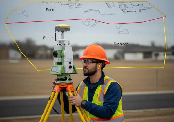
A landscape surveyor in Utah provides specialized surveys that measure property boundaries, document site conditions, and establish control for construction; each survey type serves a distinct legal and design purpose. Understanding these types helps property owners, developers, and title professionals select the right deliverable for transactions, permitting, or construction. Below are concise one-line definitions that show purpose and typical use-case, followed by a short comparison table to clarify deliverables and turnaround expectations. After the technical descriptions, you will find guidance on when to request each survey type and how a local firm can support that work.
Survey types and quick one-line definitions for Utah:
- Boundary survey: Establishes legal property lines based on deed research and monumentation to resolve ownership and install fences.
- ALTA/NSPS survey: A standards-based commercial survey documenting improvements, easements, and title-related features for lenders and title companies.
- Topographic survey: Maps ground elevations, contours, and site features to inform grading, drainage, and design.
- Construction surveying (staking): Translates plans to the field through control points and stakes for accurate placement of improvements.
This comparison highlights the purpose and primary deliverables of each common survey type.
The table clarifies how each survey supports different phases of a project and what clients should expect in final files. When deciding which survey fits your situation, consider the transaction type and whether lenders, title companies, or permitting authorities require standardized deliverables.
How Does a Boundary Survey Define Property Lines in Utah?

A boundary survey in Utah combines historical research with field measurement to precisely locate legal property limits and monument existing corners. Surveyors begin by researching deeds, plats, and prior survey records, then visit the site to locate evidence such as monuments, fences, or iron pins using GPS/RTK and total stations to reconcile field data with recorded descriptions. The deliverable typically includes a certified boundary plat and a written legal description that can be used for conveyance, fencing, or to resolve disputes. Boundary surveys reduce uncertainty by producing monumentation and a record suitable for title review; this evidentiary approach helps prevent encroachments and supports legal clarity for buyers and sellers.
What Is an ALTA Survey and Why Is It Important for Utah Real Estate?
An ALTA/NSPS survey follows national standards to provide a lender, title company, and buyer with a detailed map of improvements, easements, rights-of-way, and other items that affect title and use. The survey includes a checklist of items requested by the client—commonly showing utilities, building locations, access points, and any recorded easements—which helps underwrite title insurance and satisfy lender requirements in commercial transactions. ALTA surveys minimize closing delays by documenting conditions that impact title endorsements and insurance coverage and often include coordination with title companies to confirm which checklist items are required. For complex commercial deals, the ALTA plat serves as a verification tool for both legal and physical property conditions.
For each of the survey types listed above, Ludlow Engineers and Associates performs fieldwork and produces certified delivery packages across Utah, including county areas where permitting and title review are common. If you need a survey matched to lending or permitting requirements, request a site-specific quote tailored to the survey type and deliverables you require.
Why Is Hiring a Licensed Landscape Surveyor in Utah Essential for Accurate Land Development?
Hiring a licensed landscape surveyor ensures legal compliance, technical accuracy, and local knowledge that reduce project delays and liability during site development. Licensed professionals are familiar with county platting rules, zoning setbacks, and the documentation needed for permit filings, and they carry the technical expertise to combine records research with precise field control. Below is a short table connecting specific survey credentials and technologies to clear client benefits, followed by a checklist of qualifications to verify before hiring.
This table shows how credentials and tools translate into practical advantages that support accurate land development and regulatory approvals. Selecting a firm that documents methods and provides certified plats reduces rework and expedites permitting.
Checklist of qualifications and local expertise to look for:
- Licensed surveyor with a professional seal and familiarity with Utah county recording practices.
- Demonstrated experience with local permitting authorities and recent projects in the service area.
- Use of modern technologies (UAV, LiDAR, RTK) to speed fieldwork and improve accuracy.
- Clear deliverable formats: digital plats, field notes, and staking reports suitable for title and permitting.
Confirming these qualifications helps ensure your survey integrates smoothly with engineers, planners, and permitting staff, preventing costly revisions and delays. Local knowledge matters because county record systems and plat histories vary across Utah, and a surveyor familiar with those nuances can anticipate complications from historical records.
What Qualifications and Local Expertise Should You Look for in a Utah Land Surveyor?
A qualified Utah land surveyor should hold a state license, carry appropriate professional liability coverage, and demonstrate experience with the county record systems where your property is located. Licensing ensures the surveyor is authorized to certify plats and legal descriptions, which are necessary for property transfers and recordings. Local expertise reduces surprises because experienced practitioners know how to interpret historical plats, title records, and municipal permit submittal expectations. References or a portfolio of similar residential, commercial, or subdivision projects will indicate the firm’s ability to meet the specific technical and regulatory needs of your project.
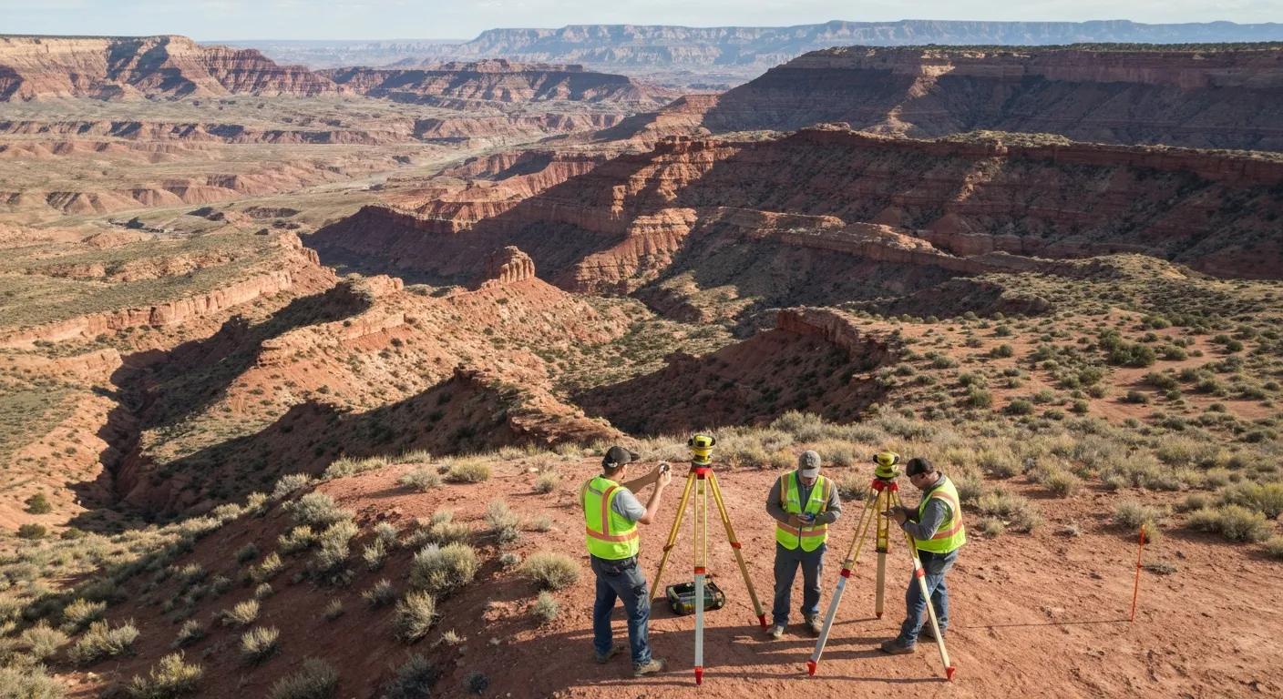
How Does Advanced Technology Improve Survey Accuracy in Utah?
Modern technology—UAV aerial mapping, LiDAR scanning, RTK GPS, and total stations—delivers faster data collection and higher positional accuracy than traditional methods alone, especially across large parcels and complex terrain. UAVs capture high-resolution orthophotos and preliminary elevation models that reduce ground time, while LiDAR provides dense surface models for vegetation-obscured areas. RTK GPS and total stations establish precise control points and monument positions with centimeter-level accuracy, minimizing error in boundary and construction staking work. Using these tools together speeds project delivery and produces more reliable digital deliverables that integrate with civil design workflows, which ultimately reduces survey-related rework during construction.
How Much Does Land Surveying Cost in Utah and What Factors Affect Pricing?

Survey pricing in Utah varies by survey type, parcel size, terrain complexity, and required deliverables; understanding cost drivers helps set realistic expectations before requesting quotes. Key factors include research complexity for old plats or deed discrepancies, access and vegetation cover, required accuracy and deliverable formats, and whether advanced aerial or LiDAR work is needed. Below is a concise table presenting typical Utah cost ranges for common surveys and the main variables that influence price. After the table, you’ll find guidance on how to request a transparent quote and what information to provide to receive an accurate proposal.
This cost table provides ballpark ranges that reflect simple to complex scenarios; final pricing requires site-specific information. Costs rise with difficult access, dense vegetation, extensive deed research, or when high-resolution deliverables and ALTA checklist items are required by lenders or title companies.
What Are the Typical Price Ranges for Boundary, ALTA, and Topographic Surveys in Utah?
Typical price ranges reflect increasing complexity from simple residential boundary surveys to detailed commercial ALTA surveys and large-area topographic mapping. A small residential boundary may fall at the lower end of the boundary range, while older parcels with ambiguous monuments or overlapping deeds push costs higher due to research time. Similarly, an ALTA survey for a commercial property with multiple improvements and numerous checklist items increases field and office hours. Topographic surveys are priced per acre and by required contour detail; steep or heavily vegetated parcels increase field time. These variables explain why a site visit or parcel documents are essential for an accurate estimate.
How Can You Request a Transparent Quote from a Utah Landscape Surveyor?
To obtain a clear and timely quote, provide the surveyor with the property address or parcel ID, the intended use of the survey (sale, lending, construction), a copy of the current deed or prior survey if available, and the specific deliverables you require (certified plat, digital files, ALTA checklist). Expect a response timeline in which the surveyor confirms receipt, requests any clarifying documents, outlines assumptions (access, monuments), and provides a written proposal with itemized tasks and estimated turnaround. For immediate assistance, call the office phone to discuss details or submit a request through the firm’s quote form to receive a written proposal; these two options accelerate scheduling and clarify pricing.
If you prefer to talk directly about scope and timing, call now at (435) 623-0897 to discuss your property and request a tailored quote for the specific survey type you need.
When Do You Need a Landscape Surveyor in Utah? Common Scenarios and Legal Requirements
Landscape surveyors are essential when property ownership is changing, when construction or subdivision is planned, or when disputes or permitting triggers require precise legal and topographic records. Surveys support title insurance and lender requirements, ensure correct setbacks for building permits, and provide evidentiary plats for dispute resolution. The list below summarizes common scenarios that typically require or greatly benefit from a professional survey, followed by short explanations of how surveys serve legal and project needs.
Common scenarios where surveys are needed:
- Property purchase or sale to confirm boundaries and identify encroachments.
- Construction and site development to set grades, footprints, and control for contractors.
- Subdivision or lot line adjustments to create recordable plats and meet municipal requirements.
- Fence or encroachment disputes to produce evidence and monument existing corners.
Surveys reduce legal and financial risk by documenting the physical and recorded conditions of property, so acting early—before closing, permitting, or installation—prevents surprises and costly corrections later. For more information about land surveys, you can refer to land surveys.
How Do Land Surveys Help Resolve Property Line Disputes in Utah?
Land surveys provide an evidence-based approach to resolving boundary disagreements by combining deed research, historical plat interpretation, and field monumentation to produce a certified map of the most defensible property limits. Certified plats and legal descriptions generated by licensed surveyors can be used in mediation or court proceedings as authoritative records, and physical monumentation placed by the surveyor helps neighbors and title professionals know the exact line on the ground. Survey findings clarify easements and encroachments, and early surveying often prevents disputes escalating to litigation by providing a neutral technical basis for negotiation.
What Role Do Surveys Play in Construction, Development, and Zoning Compliance?
Surveys inform site planning, grading, and permit filings by providing accurate topographic data, boundary lines, and utility locations that designers and permitting authorities require to evaluate compliance with setbacks, stormwater rules, and zoning standards. Topographic surveys support civil engineering design for grading and drainage, while construction staking translates approved plans to precise field points so contractors build to design. Without accurate survey data, projects face rework, permit delays, and potential violations; integrating survey information early in the design process reduces those risks and aligns contractors, engineers, and regulators on the same factual baseline.
What Makes Ludlow Engineers and Associates the Trusted Choice for Landscape Surveying in Utah?
Ludlow Engineers and Associates combines comprehensive surveying and civil engineering services to support property owners and developers across Utah with licensed professionals and local knowledge. The firm offers land surveying services—boundary surveys, ALTA surveys, topographic surveys, construction surveying, property line surveys—alongside civil engineering tasks such as site plans and development engineering, enabling seamless coordination between survey work and downstream design processes. Ludlow’s local coverage of Utah counties and client-focused practice help reduce permitting friction and deliver certified plats and digital files compatible with municipal submittals.
How Does Over 45 Years of Experience Benefit Your Utah Land Survey Project?
Decades of continuous local practice provide institutional knowledge of historical plats, county quirks, and common title issues that often complicate modern surveys, enabling more accurate research and fewer surprises during fieldwork. That experience fosters established communication channels with local permitting offices and a track record of projects across residential, commercial, and development work that informs efficient workflows. Long-term practice also means refined processes for producing consistent deliverables—certified plats, legal descriptions, digital files—that meet recording and permitting expectations, which helps accelerate approvals and reduce project risk.
What Client-Focused Services and Support Does Ludlow Engineers Provide?
Ludlow Engineers emphasizes responsive communication, tailored deliverables, and coordination with civil engineers and permitting authorities to guide projects from survey through permitting and construction. Typical client support includes prompt initial consultations, clear proposals that outline scope and assumptions, delivery of digital plats and field notes in standard formats, and construction staking aligned with design documents. Turnaround expectations and staged deliverables are communicated up front so clients know when to expect fieldwork, drafts, and final certified documents; to start this process, call (435) 623-0897 or request a quote to receive a transparent proposal.
What Are Frequently Asked Questions About Landscape Surveying Services in Utah?
This FAQ addresses common timing and transaction questions to help property owners plan surveys effectively and avoid delays. Each answer provides a concise timeline or requirement summary so you can quickly determine the right survey type and when to engage a licensed professional. For specific project planning or to request a tailored quote, use the phone number above to discuss your timeline and deliverable needs directly.
For further insights into land surveying best practices, project case studies, and industry news, explore the official blog. It offers valuable articles and resources for property owners and developers navigating the complexities of land development in Utah.
How Long Does a Typical Land Survey Take in Utah?
Typical timelines vary by survey type: a basic residential boundary survey often completes within one to three weeks if records are straightforward and access is clear, while ALTA surveys and complex commercial work can take several weeks to complete due to additional research and coordination with title companies. Field conditions like weather, seasonal access, and dense vegetation, as well as the need to resolve deed discrepancies, extend schedules; office processing time for drafting certified plats and descriptions also factors into the total. To expedite a quote and timeline, provide deed copies, parcel IDs, and clear site access information at the start of the process.
Do I Need a Survey for Residential or Commercial Property Transactions?
Surveys are often required or strongly recommended: commercial transactions commonly mandate ALTA/NSPS surveys for lender and title insurer requirements, while residential purchases benefit from boundary or topo surveys to confirm lines, identify easements, and reveal encroachments prior to closing. Lenders, buyers, or title companies may specifically request particular survey types as a condition of financing or issuing endorsements, and having a current, certified survey protects both buyers and sellers by clarifying the property’s physical and legal limits. If you’re unsure which survey is appropriate, discuss the transaction specifics with a licensed surveyor to confirm requirements and avoid last-minute conditions.
For clear next steps and to request a transparent, site-specific quote, call (435) 623-0897 or request a quote to begin the process.
Ludlow Engineers and Associates is ready to discuss your survey needs and provide a written proposal that outlines scope, assumptions, pricing, and delivery timelines. Call now at (435) 623-0897 or Request a Quote to schedule an initial consultation and get a transparent estimate for your Utah land surveying project.