
Types of Land Surveys Explained: Understanding Boundary, Topographic, and Construction Staking Surveys
Land surveys are essential tools in the realm of real estate, construction, and land development. They provide critical information about property boundaries, topography, and construction requirements. Understanding the different types of land surveys can help property owners, developers, and engineers make informed decisions. This article will delve into the various types of land surveys, including boundary surveys, topographic surveys, and construction staking surveys, highlighting their purposes, methodologies, and significance in land planning. By the end, readers will gain insights into how these surveys can aid in effective land use and development, as well as the costs associated with these services in Utah.
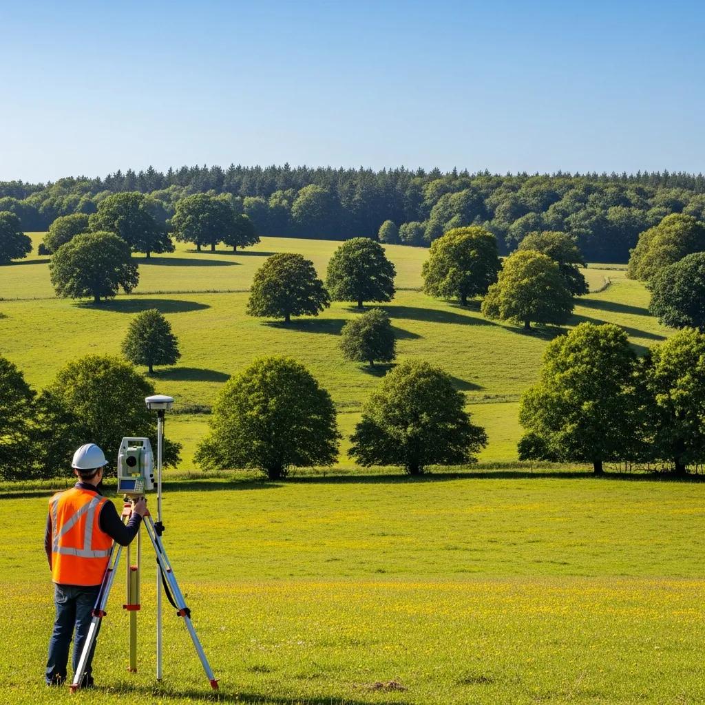
Boundary Surveys

Boundary surveys are crucial for determining the exact boundaries of a property. They involve the measurement and mapping of property lines, ensuring that landowners know the precise limits of their property. This type of survey is essential for resolving disputes, establishing property lines for new construction, and ensuring compliance with local zoning laws.
Modern technology, such as GPS and GIS, plays a significant role in accurately defining property lines and resolving potential conflicts, as highlighted in a case study.
Resolving Property Boundary Disputes with GPS & GIS
A concern over true property boundary locations developed recently regarding a branch experiment station inMississippi. The boundaries of the experiment station were in question, because the neighboring facility had commissioned a legal surveythat concluded that a certain parcel of land, upon which the facility intended to build a road, was being utilized by the experimentstation. A decision was made to locate the boundaries of thestation with an RTK-GPS system to ensure that no gross error had been made in the legal survey. Investigators used a combination ofGIS (geographic information system) and RTK-GPS (real-time kinematic global positioning system) technologies to map the legaldescription of the parcel and resolve the concern.
GPS and GIS Methods in Solving Property Boundary Discrepancies: A Case Study, JA Thomasson, 2003
Ludlow Engineers offers professional boundary survey services, ensuring accurate and reliable results for property owners in Utah. Their expertise in boundary surveys helps clients navigate complex property issues, providing peace of mind and clarity regarding property ownership.
Topographic Surveys
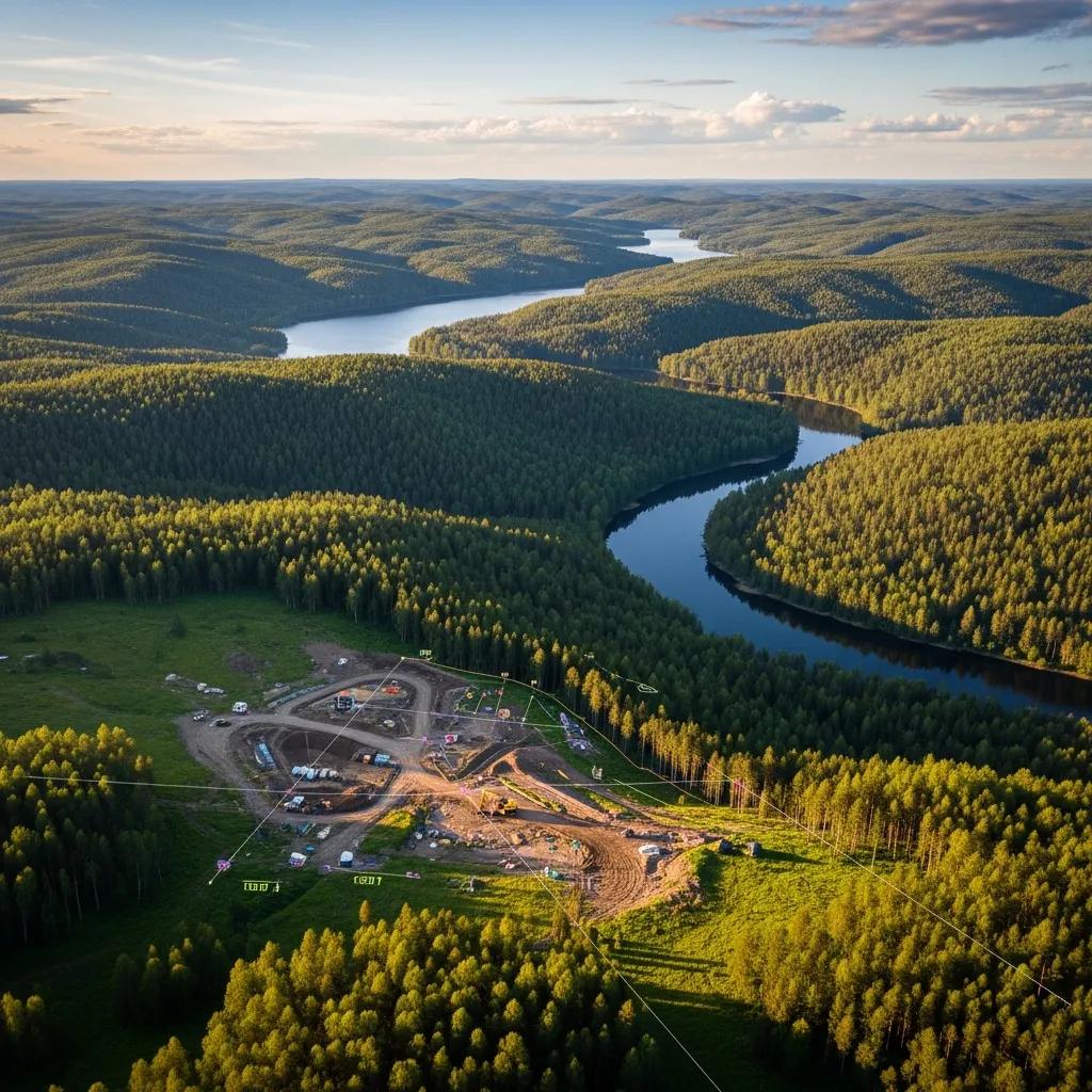
Topographic surveys provide detailed information about the contours and features of a piece of land. These surveys map the elevation changes and natural features, such as trees, rivers, and buildings, which are vital for planning construction projects and land development. By understanding the topography, engineers and architects can design structures that fit harmoniously with the landscape.
Ludlow Engineers specializes in topographic surveys, offering comprehensive services that support land planning and development. Their topographic surveys are instrumental in helping clients visualize the land’s potential and make informed decisions about construction and land use.
Construction Staking Surveys
Construction staking surveys are essential for translating design plans into physical markers on the ground. This type of survey involves placing stakes or markers to indicate where construction should occur, ensuring that buildings and other structures are built according to the approved plans. Accurate construction staking is critical for avoiding costly mistakes and ensuring compliance with design specifications.
Ludlow Engineers provides expert construction staking services, ensuring that projects are executed precisely as planned. Their attention to detail and commitment to accuracy help clients avoid potential issues during the construction process.
What Is a *-Boundary Survey and When Is It Needed?
A boundary survey is a detailed examination of a property’s boundaries, conducted by a licensed surveyor. It involves measuring the land and identifying property lines, often using historical records and physical markers. Boundary surveys are necessary when buying or selling property, resolving disputes, or planning new construction. They provide legal documentation of property lines, which is crucial for avoiding conflicts with neighbors and ensuring compliance with local regulations.
How Do Topographic Survey Services Support Land Planning?
Topographic survey services play a vital role in land planning by providing essential data about the land’s features and contours. These surveys help architects and engineers understand how the land’s topography will affect construction and land use. By analyzing elevation changes and natural features, professionals can design projects that minimize environmental impact and enhance usability. Topographic surveys also assist in compliance with zoning regulations and environmental assessments, making them indispensable in the planning process.
What Is Construction Staking and Why Is It Essential?
Construction staking is the process of marking the locations of proposed structures on a construction site. This process is essential for ensuring that buildings are constructed in the correct locations and according to the approved plans. Construction staking helps prevent costly errors and ensures that projects comply with local building codes and regulations. Accurate staking is crucial for the success of any construction project, as it provides a clear guide for contractors and builders.
How Do Boundary and Topographic Surveys Differ?
Boundary surveys and topographic surveys serve different purposes in land assessment. Boundary surveys focus on determining the exact property lines and legal boundaries of a parcel of land, while topographic surveys provide detailed information about the land’s physical features, including elevation changes and natural obstacles. Understanding these differences is essential for property owners and developers, as each type of survey addresses specific needs in land planning and development.
Comparing Survey Purposes and Techniques
Different types of land surveys serve distinct purposes and utilize various techniques. Boundary surveys are primarily concerned with legal property lines, while topographic surveys focus on the physical characteristics of the land. Construction staking surveys translate design plans into physical markers on-site. Each survey type employs specific methodologies, such as GPS technology, traditional measuring techniques, and aerial mapping, to gather accurate data.
Choosing the Right Survey Type for Your Land Needs
Selecting the appropriate survey type depends on the specific needs of the property owner or developer. Factors to consider include the purpose of the survey, the type of project, and any legal requirements. For instance, if a property owner is planning to build a new structure, a boundary survey may be necessary to establish property lines, while a topographic survey would provide essential information about the land’s features. Consulting with a professional surveyor can help determine the best approach for individual land needs.
What Are the Costs and Service Options for Land Surveys in Utah?
The costs of land surveys in Utah can vary based on several factors, including the type of survey, the size of the property, and the complexity of the project. Generally, boundary surveys may range from $300 to $1,500, while topographic surveys can cost between $1,500 and $3,500. Construction staking services typically range from $300 to $1,200, depending on the project’s scope. Understanding these costs can help property owners budget effectively for their surveying needs.
Factors Influencing Boundary Survey Cost in Utah
Several factors can influence the cost of boundary surveys in Utah. These include the size and shape of the property, the complexity of the boundaries, and the availability of historical records. Additionally, regional pricing variations and the need for permits can also affect the overall cost. Property owners should consider these factors when budgeting for a boundary survey to ensure they receive accurate and comprehensive results.
Selecting Trusted Land Survey Companies and Services
When choosing a land survey company, it is essential to consider their expertise, credentials, and customer reviews. Look for companies with a proven track record in boundary, topographic, and construction staking surveys. Additionally, ensure that the surveyors are licensed and familiar with local regulations. By selecting a trusted land survey company, property owners can ensure they receive high-quality services that meet their specific needs.
How Are Advances in Surveying Technology Changing Land Surveys?
Advancements in surveying technology are significantly impacting the accuracy and efficiency of land surveys. Modern tools such as GPS, laser scanning, and drone technology allow surveyors to gather data more quickly and accurately than ever before. These innovations enhance the precision of surveys and reduce the time required to complete projects, ultimately benefiting property owners and developers.
Incorporating Drone and 3D Mapping Technologies
The use of drones and 3D mapping technologies in surveying has revolutionized the industry. Drones can capture high-resolution aerial images and data, providing a comprehensive view of the land. 3D mapping technologies allow for detailed visualizations of topography and features, aiding in planning and design. These technologies improve the accuracy of surveys and provide valuable insights for land surveys.
Benefits of Modern Equipment for Survey Accuracy and Efficiency
Modern surveying equipment offers numerous benefits, including increased accuracy and efficiency. Advanced tools enable surveyors to collect data with greater precision, reducing the likelihood of errors. Additionally, modern equipment can streamline the surveying process, allowing for faster project completion. By utilizing the latest technology, surveyors can provide clients with reliable and timely results, enhancing the overall quality of land surveys.
For more information on land surveying services, consider visiting Ludlow Engineers.