
Land surveying in Eureka, Utah — expert services and local solutions
Surveying property in Eureka, Utah depends on accurate field measurements, thorough title research, and clear deliverables that support legal transactions, permitting, and development decisions. This guide lays out the common survey types used in Eureka — from boundary and ALTA title surveys to topographic work, UAV aerial mapping, and construction staking — what each delivers, and how licensed surveyors work with local planning and title requirements to lower risk. You’ll find practical timelines, common cost drivers, and a step‑by‑step outline from initial consultation to final plat so you can plan transactions or projects with confidence. Where helpful, we point to local service options and explain how a professional firm with in‑house engineers and surveyors supports compliance and project delivery in Eureka. The guide also includes checklists, comparison tables, and clear next steps for requesting a quote or scheduling a consultation.
What land surveying services are available in Eureka, Utah?
Surveying services in Eureka cover the technical and legal work that defines property lines, documents existing site conditions, and produces plans for construction and title work. Surveyors combine field measurements, records research, and geospatial processing to create certified plats, CAD files, LiDAR or point clouds, and reports used for title insurance and permitting. Knowing which survey fits your project reduces delays during real estate transactions and development. The sections below describe common surveys and how ALTA work supports commercial projects in the area.
The table below summarizes typical services and deliverables so property owners can choose the right survey for their needs.
This comparison highlights how deliverables differ by service and helps you pick the right approach for a specific Eureka project. The next section lists the property surveys most commonly requested locally.
Which types of property surveys do Eureka land surveyors provide?
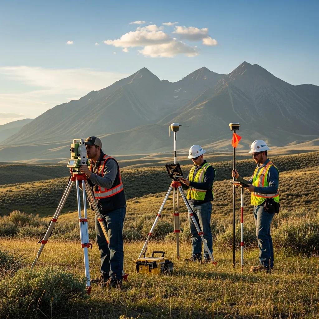
Licensed surveyors in Eureka commonly perform boundary retracements, ALTA/NSPS title surveys, topographic mapping, construction staking, as‑built surveys, and UAV aerial surveys for larger or hard‑to‑access sites. Every project starts with records research and field measurement using GNSS/GPS, total stations, or UAV LiDAR depending on accuracy and access needs. Deliverables range from certified plats used in deeds and title closings to georeferenced point clouds and CAD files for design teams. Knowing the differences helps owners request the right service for purchase, permitting, or construction without unnecessary cost or delay.
Below is a short summary of common survey types and why a property owner in Eureka might order each.
- Boundary Survey: Establishes legal corners and property lines for transfers, fencing, or dispute resolution.
- Topographic Survey: Records contours and site features to support site design and drainage planning.
- ALTA Title Survey: Meets lender and title insurer requirements for commercial transactions and due diligence.
These are the core survey options frequently needed in Eureka; understanding their outputs speeds conversations with surveyors and permitting authorities.
How do ALTA surveys support commercial development in Eureka?
An ALTA/NSPS title survey is the standardized, detailed mapping that lenders and title companies rely on for commercial purchases and development. It combines boundary evidence with title commitment items to show easements, rights‑of‑way, improvements, and other matters that affect use and title — information lenders and underwriters need when evaluating risk. ALTA deliverables typically include certified map sheets, an exceptions legend, and surveyor certifications suitable for title policies and lender review. For developers, a complete ALTA reduces closing contingencies and informs site design by revealing off‑site encumbrances or utility conflicts early in the process.
Because ALTA surveys tie directly to title insurance and due diligence, choosing an experienced, full‑service firm can make a big difference for local projects — the next section explains why.
Why choose Ludlow Engineers and Associates for Eureka land surveying?
Experience matters when surveys support legal transactions or complex development. An established firm combines technical accuracy, thorough records research, and coordinated project delivery. Ludlow Engineers and Associates provides integrated surveying and civil engineering with in‑house professional engineers and licensed surveyors, plus modern tools like UAVs, LiDAR, and GNSS. Our local experience speeds record searches and helps spot county‑specific title or zoning issues that often slow projects. For owners who need reliable, timely deliverables, working with a firm that handles both survey and engineering can streamline approvals and reduce costly rework.
If you’re ready to move forward, request a consultation to define scope, identify required documents, and get an itemized proposal from Ludlow Engineers and Associates. Our office is at 1451 S. Main, Nephi, UT, and we can be reached at (435) 623-0897 to schedule a site evaluation or discuss ALTA, boundary, or topo survey options. Requesting a clear scope early helps set expectations and speeds field scheduling and final deliverables.
The next subsection explains how decades of practice translate into fewer surprises on your project.
How does 45+ years of experience benefit Eureka property owners?
Longstanding regional experience means quicker identification of title anomalies, better interpretation of historic monuments, and faster resolution of issues encountered during boundary retracements. Firms with deep local knowledge know common record errors, recurring easement patterns, and typical subsurface utility conflicts across Central Utah — which reduces rework and shortens permitting cycles. That practical expertise also helps prioritize field tasks and select the right mix of GNSS, total station, or UAV workflows to balance accuracy and cost. The result for property owners: fewer unexpected expenses, clearer legal plats, and faster movement from survey to construction or closing.
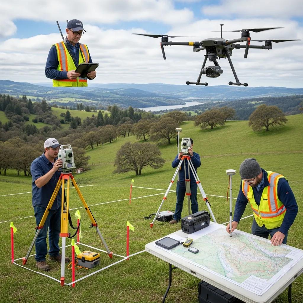
What advanced technologies does Ludlow use in Eureka surveys?
Today’s surveys blend GNSS/GPS control, UAV photogrammetry, LiDAR point clouds, and 3D modeling to produce precise, verifiable datasets for design and title needs. GNSS speeds control across large parcels, UAVs capture orthophotos and elevation detail on hard‑to‑access sites, and LiDAR provides dense terrain data for grading and modeling. These tools reduce field time, improve positional accuracy, and produce GIS‑ready point clouds and CAD contours that plug directly into civil design workflows. Choosing the right technology mix for each parcel lowers field costs and gives engineers, planners, and title professionals the data they need.
Understanding permitting and regulatory needs helps determine when each technology and survey type is required; the following section explains how surveys support compliance and development in Eureka.
How Precise Land Surveys Enable Development and Compliance in Eureka
Surveying provides the verified measurements and documented facts that agencies, title companies, and lenders require for permitting and development. Surveys link parcel geometry to zoning setbacks, easements, and utility corridors, which informs site plans, grading, and infrastructure design needed for approvals. Accurate surveys reduce dispute risk, satisfy submittal requirements for subdivisions or building permits, and supply the evidentiary basis for title insurance and lending. The subsections below summarize zoning triggers, permitting examples, and how professional survey services solve common compliance challenges.
What are the key Eureka zoning laws affecting land surveys?
Projects in Eureka often need surveys that document setbacks, minimum lot sizes, right‑of‑way encroachments, and, where applicable, floodplain or mining reclamation conditions. Plats and topo maps help planning reviewers confirm compliance with setback lines, buildable areas, and access requirements that can influence permit outcomes. A professional surveyor flags potential nonconformities early and documents site conditions that support variance requests or mitigation. Working with a firm familiar with regional planning processes helps owners prepare submittals that meet county expectations and reduce back‑and‑forth during review.
How can accurate boundary surveys prevent property disputes in Eureka?
Accurate boundary surveys create legally defensible monumentation and a signed plat recognized by courts and title professionals, lowering the risk of costly neighbor disputes or competing claims. Surveys record physical monuments, historical evidence, and deed descriptions to produce a clear mapped record of ownership lines and easement extents. When disagreements arise, a certified survey plat is primary documentary evidence and often helps guide negotiated resolutions or boundary agreements without litigation. If you suspect a dispute, the typical next steps are ordering a boundary retracement, compiling historic records, and working with a licensed surveyor to produce a certified plat for legal review.
What is the typical process for land surveying projects in Eureka, Utah?
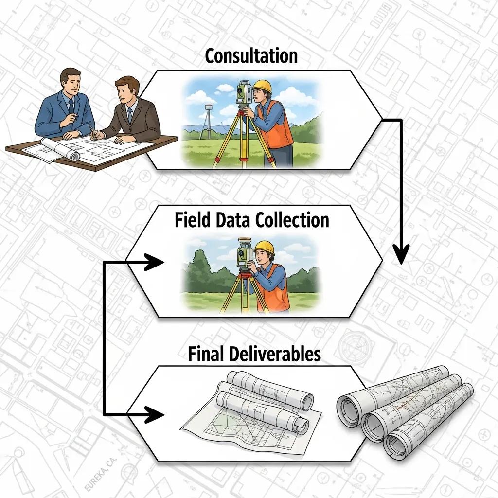
A standard surveying project follows these stages: consultation and scope definition, records and title review, field data collection, post‑processing and quality assurance, and final deliverables with client handoff. This sequence ensures field work reflects recorded deeds and title commitments and that final plats meet regulatory and title insurer standards. Clear milestones and communication reduce surprises and help coordinate with civil engineers, architects, and permitting agencies. The numbered steps below summarize a typical workflow and give time estimates to help with planning.
- Initial consultation and scope definition: Agree on survey type, purpose, and deliverables.
- Records and title research: Gather deeds, easements, and title commitment items that affect the survey.
- Field data collection: Use GNSS, total station, or UAV/LiDAR mapping as required by site conditions.
- Post‑processing and QA: Process field data, reconcile records, and prepare certified deliverables.
- Deliverable handoff and follow‑up: Deliver plats, CAD files, and support for permitting or title review.
These steps form a repeatable workflow that helps clients schedule and budget projects. The table below maps each stage to expected activities and typical timeframes.
How does Ludlow Engineers manage surveying from consultation to completion?
Our project management begins with a kickoff to confirm scope, deliverables, and site constraints, then moves into document collection and scheduled fieldwork tailored to the survey type. Communication milestones include pre‑field coordination, progress check‑ins during processing, and a final review before certification. Our QA steps include cross‑checking GNSS control against records, verifying monument ties, and peer review of plat drafts before signing. That structure reduces rework, improves permitting readiness, and keeps stakeholders informed throughout the engagement.
What are the expected timelines for different survey types in Eureka?
Timelines depend on scope: a straightforward residential boundary survey often finishes in one to three weeks; topographic surveys and construction staking commonly take two to four weeks; ALTA surveys for commercial transactions typically require three to six weeks because of title research and lender review. Factors that extend timelines include remote access, complex title histories, seasonal weather, and utility locating. Early document collection and efficient scheduling — plus UAV and LiDAR when appropriate — can compress field time on large or rough parcels. Build realistic buffers to keep permit applications and closings on track.
What are common questions about land surveying costs and requirements in Eureka?
Questions usually focus on what drives cost, when a survey is required, and how to get an accurate quote that reflects site conditions and deliverables. Major cost drivers include parcel size and shape, terrain and access, survey accuracy requirements, record complexity, and whether UAV or LiDAR is needed. Being transparent about these factors helps homeowners and developers avoid unexpected fees and lets surveyors prepare precise proposals. The table below summarizes typical cost drivers, survey types, and ballpark timelines for budgeting.
How much does a property survey cost in Eureka, Utah?
Costs vary because they reflect site conditions, scope, and deliverable requirements rather than fixed price points. Key drivers include acreage, terrain difficulty, vegetation, title research complexity, and desired deliverable formats. For example, a small residential lot with visible monuments generally needs less field time and simpler plat drafting than a large rural parcel that requires UAV mapping and monument searches. Request a scoped proposal that lists tasks, assumptions, and exclusions so quotes are comparable across providers. When title insurance or lender requirements apply, provide the title commitment so surveyors can price ALTA‑level work accurately.
Clear assumptions and open communication at the quoting stage reduce surprises during execution and help align expectations between client and surveyor.
Do I need a land survey before buying property in Eureka?
In many cases, yes — especially when there are title gaps, irregular parcels, planned construction, or lender requirements that depend on clear boundary and title information. Surveys reveal encroachments, easements, and discrepancies between deeds and physical conditions that can affect use or value. Lenders often require ALTA surveys for commercial loans and some residential closings ask for boundary verification; even when not mandatory, a survey reduces closing risk and negotiation blind spots. If you’re unsure, consult a licensed surveyor early and provide the deed and title commitment so they can recommend a boundary, ALTA, or topo survey.
When a survey is advisable, the next section explains how to request services in Eureka.
How can clients contact and request land surveying services in Eureka?
When requesting survey services, give clear project context — property address or parcel number, survey purpose, any known deed or title issues, and deadlines or permitting constraints — so we can prepare an accurate scope and timeline. Initial requests usually trigger a brief consultation, a records/documents checklist, and a site‑visit estimate to confirm access and resources. Expect a written proposal that defines deliverables, assumptions, schedule, and cost drivers so there are no surprises during the project. The checklist below lists the information surveyors commonly ask for when preparing a quote.
- Property address or parcel number and a copy of the deed.
- Title commitment or any existing survey documents you have.
- Purpose of the survey (sale, construction, subdivision, title insurance).
- Known site constraints or access limitations and desired deliverables.
Providing this information up front shortens the quoting cycle and helps schedule field work promptly. The subsection below explains contact options and what to expect after outreach.
What are the best ways to reach Ludlow Engineers for Eureka projects?
To request service or a quote, call Ludlow Engineers and Associates at (435) 623-0897 and have the property address, deed or parcel number, and a brief description of the survey need ready. After your call, we’ll send a records‑request checklist, arrange an on‑site visit if needed, and prepare a written proposal with scope, assumptions, and timeline. Response times vary with workload and document complexity, but providing complete initial information speeds the process and reduces follow‑up. Clear communication up front helps align deliverables and accelerates field scheduling for Eureka and Central Utah projects.
Where is Ludlow Engineers located and what areas do they serve?
Ludlow Engineers and Associates is located at 1451 S. Main, Nephi, UT and serves Eureka and surrounding Central Utah counties with land surveying, ALTA surveys, topographic mapping, UAV aerial surveying, subdivision design, and civil engineering. Our central office supports consistent service across regional projects while accounting for travel time and equipment needs for remote sites. For rugged or remote parcels, we include logistics, UAV permissions, and additional field support in the proposal so clients understand any mobilization costs. Sharing accurate parcel boundaries and access points before site work helps minimize delays and keep schedules on track.
This guide covered common survey services, regulatory connections, process steps, cost drivers, and practical contact steps for Eureka property owners and developers seeking reliable, certified land surveying and engineering support.
Frequently Asked Questions
What qualifications should I look for in a land surveyor in Eureka?
Look for a licensed surveyor with experience in the specific survey type you need and familiarity with local zoning and permitting practices. Modern equipment and workflows — GNSS, total stations, UAVs — improve accuracy and efficiency, so ask about technology and deliverable formats. Client references or project examples give insight into reliability and quality of work.
How can I prepare for a land survey on my property?
Gather existing documents like deeds, prior surveys, and title commitments. Clear obvious obstructions where practical and note any features or boundaries you want reviewed. Tell the surveyor about access points, gates, or animals on site. Clear, early communication about goals and known issues makes fieldwork faster and more accurate.
What should I expect during the land surveying process?
Expect a consultation to define scope, followed by records research, field data collection, and data processing. The surveyor will prepare deliverables — maps, plats, CAD files, or point clouds — and keep you updated on findings that affect the project. Good communication throughout the process helps avoid surprises.
Are there any legal requirements for land surveys in Eureka?
Yes. Surveys that affect property transfers, development, or permitting must be performed by licensed professionals and meet state and county standards. Certain surveys, like ALTA for commercial loans, may be required by lenders or title companies. Knowing these requirements up front prevents delays and legal complications.
What are the common challenges faced during land surveying in Eureka?
Challenges include steep or rough terrain, limited access, complex title histories, and weather that can delay fieldwork. Discrepancies between deed descriptions and on‑the‑ground conditions can also create complications. Hiring a surveyor experienced with local conditions helps reduce these risks.
How can I ensure my land survey is accurate and reliable?
Choose a licensed surveyor with a track record in your area, discuss your needs and concerns, and confirm the technology and accuracy standards they’ll use. Review the deliverables carefully and ask questions about any findings or assumptions. A clear, written scope and peer review procedures increase confidence in the final product.
Conclusion
Working with a professional land surveying company in Eureka ensures accurate measurements, compliance with local rules, and a clearer path to closing or construction. Understanding the types of surveys available helps property owners make informed choices and avoid delays. By partnering with Ludlow Engineers and Associates, you gain regional experience and modern surveying technology that can shorten project timelines and reduce unexpected costs. Contact us to discuss your surveying needs and receive a tailored quote that fits your project.