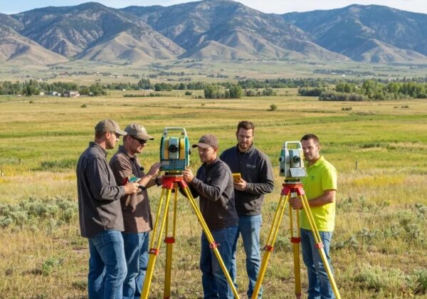
In today’s fast-paced world, technology has become a cornerstone in various sectors, none more so than in the realm of construction surveying. This field, vital for the planning and building of our future cities, has undergone a massive transformation thanks to the advent of advanced technological tools. Let’s explore how these innovations have revolutionized construction surveying, making processes more efficient, precise, and easier to manage.
The Evolution of Construction Surveying: From Theodolites to Drones
Construction surveying has seen a dramatic shift from manual theodolites to the use of drones, marking a significant evolution in how surveyors capture data and map sites. Initially, surveyors relied on theodolites for precise angular and distance measurements, but with the birth of GPS technology, sites could be mapped with unprecedented accuracy from the sky. Drones, equipped with high-resolution cameras and sophisticated mapping software, can now cover vast areas quickly, capturing detailed images that support complex analyses and decision-making processes.
GPS Technology: Revolutionizing Precision and Efficiency
The advent of GPS technology has been a game-changer in construction surveying, providing pinpoint accuracy that revolutionizes site mapping and layout tasks. Gone are the days of guesswork and constant re-measurement. Now, surveyors can rely on satellites to provide real-time data with precision down to the centimeter, optimizing project timelines and significantly reducing the margin for error. This accuracy is crucial in planning projects and ensuring structures are built exactly to specification, paving the way for a smooth construction process.
Laser Scanning and 3D Modelling: A New Dimension in Surveying
Laser scanning technology and 3D modeling have introduced a new dimension to construction surveying. These technologies offer a non-intrusive means to capture detailed site data, generating precise 3D models for a comprehensive understanding of a project’s scope. Laser scanning enables surveyors to accurately measure distances, angles, and elevations, translating this data into models that can be used for virtual walkthroughs and to identify any potential issues before they arise on site. This proactive approach saves time and resources, making construction processes more efficient.
Drone Technology: Taking Construction Surveying to New Heights
Drone technology has propelled construction surveying to new heights by offering an aerial perspective that was previously difficult or expensive to obtain. Surveyors can now effortlessly conduct site surveys, monitor construction progress, and access hard-to-reach areas without the need for costly and time-consuming setups. Drone-based mapping not only reduces project timelines but also enhances safety by minimizing the need for personnel to physically access potentially dangerous terrains.
The Impact of Cloud Computing and Big Data on Construction Projects
Cloud computing and big data are making significant impacts on construction surveying, allowing for the storage, analysis, and easy access of vast amounts of project data. This technology supports enhanced collaboration among project teams, as data can be shared and accessed from anywhere, at any time. Moreover, the ability to analyze large datasets with cloud-based software enables predictive modeling and risk management, reducing the likelihood of unforeseen challenges and ensuring projects are completed within budget and on schedule.
Virtual Reality and Augmented Reality: Visualizing the Future
Virtual reality (VR) and augmented reality (AR) technologies are reshaping the future of construction surveying by providing immersive visualization tools that enhance planning and design processes. With VR, stakeholders can ‘walk through’ digital twin models of their projects, offering insights and opportunities to make changes before actual construction begins. Meanwhile, AR overlays digital information onto the physical construction site, assisting surveyors and builders in visualizing project components in situ. These technologies not only improve efficiency but also help in avoiding costly design errors.
Embracing the Future of Construction Surveying
The integration of technology into construction surveying has not only streamlined processes but also opened up new possibilities for accuracy, efficiency, and project management. As we look to the future, the continued evolution of these tools promises to further enhance the world of construction surveying. Embracing these technologies is key to building smarter, safer, and more sustainable environments. Discover how Ludlow Engineering is at the forefront of employing these advanced technologies in construction surveying, bringing unparalleled precision and efficiency to each project.


