Comprehensive Land Surveying Services — Precise Property Boundary, Topographic & Construction Staking Solutions
Accurate land surveying is essential to successful development and long‑term property management. This page explains the core services survey firms provide—defining property lines, mapping terrain, and staking construction—so project teams can build with confidence and meet regulatory requirements. We also highlight how Ludlow Engineers and Associates brings practical experience and technical accuracy to these services.
Whether you work in real estate, engineering, or land management, understanding surveying helps you avoid costly mistakes. Below we outline survey types, the modern tools that back them, and common client questions to clarify why a professional surveyor matters to your project.
What Services Does a Professional Land Survey Company Provide?
Survey firms deliver services tailored to development, permitting and property stewardship. Core offerings include property boundary surveys, topographic mapping, and construction staking—each addressing a specific project need. Working with a licensed surveyor helps keep your plans accurate and compliant at every phase.
Ludlow Engineers and Associates provides full‑service land surveying to produce reliable, project-ready data. The table below summarizes common services, what they do, and typical price ranges.
These services protect property rights, ensure accurate building placement, and give project teams the terrain intelligence they need to plan effectively.
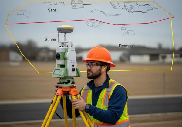
How Are Property Boundary Surveys Conducted for Commercial and Residential Properties?
Boundary surveys follow a methodical sequence that combines historical research, precise field work, and professional mapping. Surveyors use established records and modern instruments to create an authoritative survey map. The typical workflow includes:
- Researching Public Records: We review deeds, plats, and prior surveys to understand recorded lines and easements.
- Field Measurements: Using total stations, GPS and other precision tools, surveyors locate monuments and measure property geometry.
- Creating Survey Maps: Measured data and record research are reconciled and drafted into a certified survey plan.
Boundary surveys can affect ownership, permitting and development rights. Common challenges include conflicting historical records, missing monuments, and site obstacles such as dense vegetation or encroachments.
Research underscores how foundational boundary determinations are to property law and dispute resolution.
Property Boundary Law & Dispute Resolution
An interdisciplinary study examines boundaries as the ontological foundation of private land ownership and as a pre‑contractual condition affecting exchanges in planned urban development. The paper draws on neo‑institutional economics, property law and surveying practice to explore how the “true” boundary is determined in development contexts.
The determination of the “true” property boundary in planned development: a
Coasian analysis, LWC Lai, 2018
What Are Topographic Survey Services and Their Importance in Site Analysis?

Topographic surveys map the land’s surface—contours, elevations, slopes and visible features—providing the baseline data designers and engineers need to evaluate a site. They are essential for accurate site analysis and downstream design decisions. Key elements include:
- Elevation Data: Precise elevation points and contours inform drainage, grading and foundation design.
- Natural Features: Trees, streams, wetlands and rock outcrops are documented to assess environmental constraints and permit needs.
- Design Planning: Architects and engineers rely on topographic data to integrate structures with the existing landscape.
When developers use reliable topographic surveys, they reduce risk and make better-informed choices about feasibility and sustainability.
Why Choose a Land Surveyor Near Me for Construction Staking and Site Surveys?
Hiring a local surveyor brings practical advantages. Local teams know regional rules, typical site conditions, and local permitting nuances—insights that speed approvals and reduce surprises. Benefits of choosing a nearby surveyor include:
- Familiarity with Local Regulations: Local surveyors understand zoning, setback requirements and permitting practices specific to your jurisdiction.
- Accessibility for Consultations: Proximity makes on-site visits and collaboration easier throughout design and construction.
- Understanding of Local Land Features: Experience with local soils, vegetation and terrain helps anticipate site‑specific challenges.
How Does Construction Staking Ensure Accurate Building Placement?
Construction staking translates design plans into physical markers on the ground so foundations, utilities and structures are built in the right place. The staking process typically involves:
- Setting Reference Points: Establishing control and reference lines tied to the project plans.
- Marking Boundaries: Placing stakes or flags for corners, offsets and critical building lines.
- Verification: Confirming stake locations against plans before excavation and concrete work begin.
Accurate staking prevents costly rework, protects property lines, and keeps construction aligned with approved designs. boundary survey
Precise layout and staking practices are essential to the success of civil engineering and construction projects.
Accurate Construction Layout & Staking Methods
A comparative case study reviews on‑site layout methods—including batter board and stake‑out techniques—and shows how accurate construction layout planning and monitoring support successful civil engineering works.
Methodological and on-site applied construction layout plan with batter boards stake-out methods comparison: A case study of Romania, P Sestras, 2021
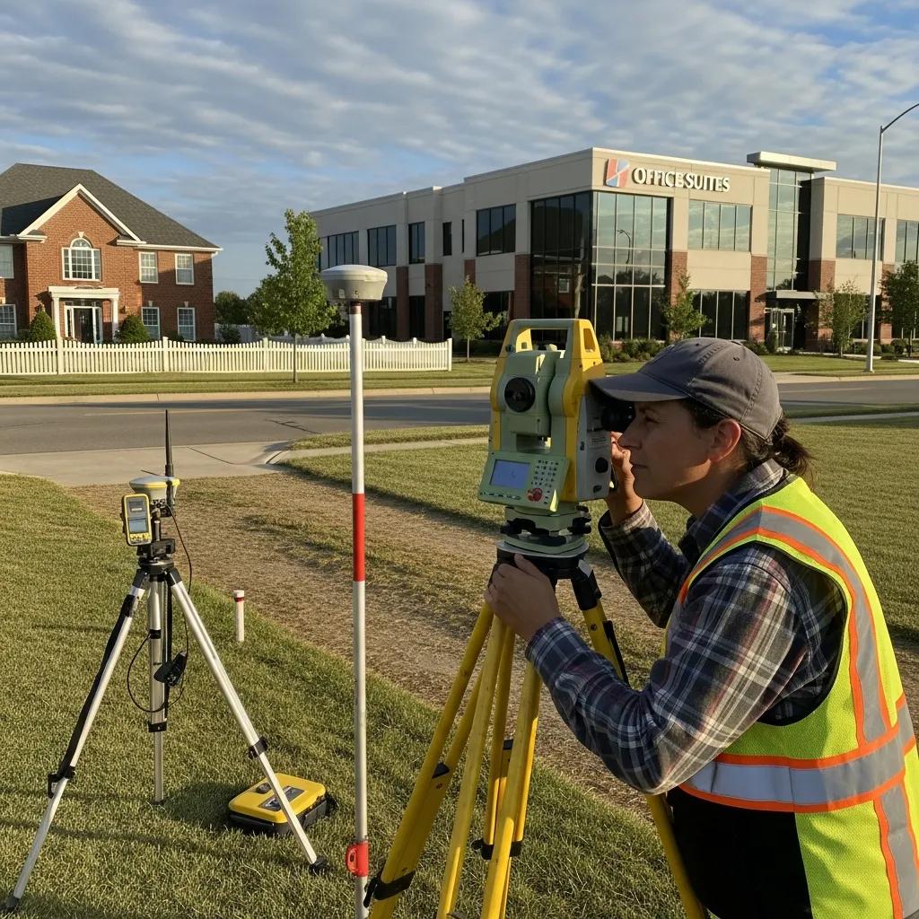
What Expertise Do Site Survey Experts Bring to Commercial Projects?
Site surveyors bring technical knowledge and practical experience that improve project outcomes. On commercial jobs, they contribute by:
- Technical Proficiency: Operating advanced instruments and software to collect and process accurate spatial data.
- Regulatory Knowledge: Advising on setbacks, easements and regulatory constraints that affect site plans.
- Problem-Solving Skills: Identifying issues early—such as conflicting records or difficult terrain—and proposing pragmatic solutions.
Leveraging experienced surveyors helps commercial projects stay on schedule, on budget and in compliance.
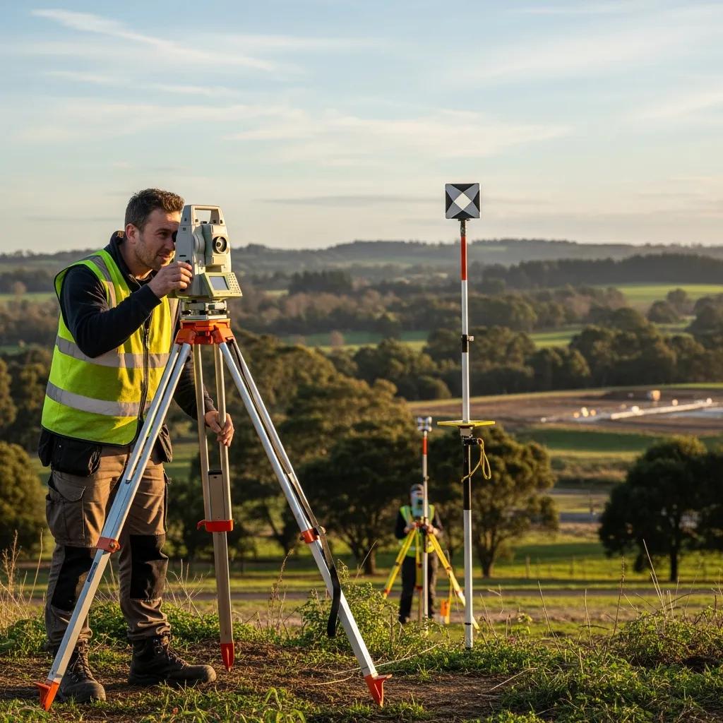
How Does Technology Enhance Land Surveying Services Today?
Modern technology has elevated surveying accuracy and efficiency. Tools like GNSS/GPS receivers, total stations, drones and advanced software let survey teams collect richer data faster and turn it into actionable deliverables for design and construction.
What Role Do GPS Equipment and Drone Surveying Play in Modern Land Surveys?
GPS and unmanned aerial systems are central to contemporary surveying practice. Their main benefits include:
- Increased Accuracy: High‑precision GNSS reduces positional uncertainty for control and feature mapping.
- Rapid Data Collection: Drones capture aerial imagery and elevation data quickly over large or difficult terrain.
- Enhanced Visualization: Aerial and point‑cloud products improve stakeholder understanding and design coordination.
These technologies complement traditional methods, delivering faster turnarounds and higher confidence in survey results.
Drone photogrammetry and related workflows have materially advanced the speed and accuracy of topographic surveys.
Drone Photogrammetry for Accurate Topographic Surveys
A review of drone use and photogrammetry for beach topography shows that unmanned aerial systems—even in low‑cost configurations—can meet the accuracy and rapidity requirements of detailed topographic surveys when properly planned and processed.
Accuracy of sand beach topography surveying by drones and photogrammetry, E Casella, 2020
How Is GIS Integration Improving Survey Accuracy and Data Management?
GIS brings survey data into a powerful platform for storage, analysis and sharing. Integrating GIS allows surveyors and project teams to:
- Store and Analyze Data: Maintain organized spatial datasets for long‑term project use and revisits.
- Improve Collaboration: Share maps and data with engineers, planners and permitting authorities for coordinated decision‑making.
- Enhance Decision‑Making: Use spatial analysis to inform site planning, risk assessment and design tradeoffs.
GIS integration turns survey results into reusable assets that support smarter project delivery.
What Are Common Questions About Land Survey Company Services?
Clients frequently ask about the need for a survey and what to expect on cost and timing. Clear answers help set realistic expectations and simplify project planning.
When Is a Boundary Survey Required and How Much Does It Cost?
Boundary surveys are commonly needed in situations such as:boundary survey
- Property Transactions: To confirm legal lines when buying or selling real estate.
- Construction Projects: Before building, to prevent encroachments and meet permit requirements.
- Dispute Resolution: To resolve ownership questions between neighbors or parties.
Costs vary with property size, complexity and location; typical ranges are $400 to $3,500 for standard residential and small commercial parcels.
How Long Does a Typical Land Survey Take and What Are the Deliverables?
Survey duration depends on survey type, site complexity and permit timing. Projects can take from a few days to several weeks. Common deliverables include: land surveys.
- Survey Maps: Scaled plans that show boundaries, features and control.
- Legal Descriptions: Written descriptions suitable for deeds and recordation.
- Reports: Documentation of methods, findings and any boundary evidence or discrepancies.
Knowing the typical timeline and deliverables helps you coordinate design, permitting and construction phases.
How Do Land Survey Companies Ensure Precision and Client Satisfaction?
Quality control, licensed personnel and clear communication are central to dependable survey work. Reputable firms follow industry standards and document their methods so clients receive usable, defensible results.
What Quality Standards and Certifications Do Professional Land Surveyors Hold?
Common credentials and assurances include:
- Licensed Professional Land Surveyor (PLS): State licensing that confirms education, experience and examination requirements.
- Certified Survey Technician (CST): A credential indicating technical proficiency in field and office surveying tasks.
These certifications support accuracy and provide confidence that your survey conforms to professional and legal standards.
How Are Case Studies Demonstrating Success in Commercial Land Surveying Projects?
Case studies illustrate how survey teams solve real problems and deliver value. They typically describe:
- Challenges Faced: Site constraints, record conflicts or tight schedules.
- Solutions Implemented: Methodologies, technology and coordination that addressed those challenges.
- Client Feedback: Outcomes and client satisfaction that show project impact.
Reviewing case studies gives prospective clients practical insight into a firm’s capabilities and results. Learn more about our work at land survey companies.
Frequently Asked Questions
What should I consider when choosing a land surveyor?
Look for licensing, relevant project experience and local knowledge. Ask about sample deliverables, turnaround times and the technology they use. Client references and clear communication about scope and costs are also important — a good surveyor will outline what’s included and how they handle unexpected findings.
How can I prepare for a land survey?
Gather deeds, prior surveys and any site plans you have. Clear heavy brush or debris from the work area where possible and mark gates or access points. Let neighbors know when survey crews will be on site. Being available to answer questions speeds the process and improves results.
What happens if there are discrepancies in property boundaries?
Start by reviewing the survey results alongside existing records. Your surveyor can explain differences and identify evidence used to reach their conclusions. If disputes remain, options include mediation or legal resolution; a certified survey provides the technical basis needed for either path.
Are there any environmental considerations in land surveying?
Yes. Surveyors document wetlands, flood zones, protected habitats and other environmental features that affect development and permitting. We often coordinate with environmental consultants to ensure compliance with local, state and federal regulations and to minimize ecological impacts.
What technology is commonly used in modern land surveying?
Survey teams rely on GNSS/GPS receivers, total stations, laser scanners, drones and CAD/GIS software. These tools increase accuracy, speed data collection and produce deliverables that integrate directly into engineering and design workflows.
How do land surveyors handle changes in project scope?
Surveyors manage scope changes by documenting the requested adjustments, assessing their impact on schedule and cost, and providing a revised scope or fee estimate. Clear written change orders and ongoing communication keep everyone aligned as the project evolves.
Conclusion
Engaging a professional land survey company delivers measurable benefits: precise property boundaries, reliable topographic data, and accurate construction staking that together reduce risk and support successful project delivery. Firms like Ludlow Engineers and Associates combine field expertise, modern tools and regulatory knowledge to help you move from concept to completion with confidence. Contact us to learn how our surveying services can support your next project.