
Drone & UAV Surveying Services in Utah | Ludlow Engineers
Drone and UAV surveying services have revolutionized the way land surveying is conducted, particularly in Utah. These advanced technologies utilize high-resolution imagery and sophisticated sensors to gather data quickly and accurately, making them invaluable for various applications, including civil engineering and land development. In this article, we will explore the benefits of drone mapping and UAV surveying, how they enhance traditional methods, and the specific technologies used in Utah. Additionally, we will discuss the regulatory landscape surrounding drone operations and how Ludlow Engineers ensures compliance while delivering exceptional surveying services.
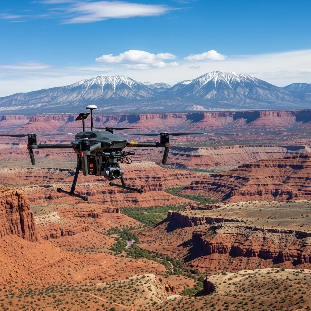
What Are Drone Mapping and UAV Land Surveying Services in Utah?
Drone mapping and UAV land surveying services involve the use of unmanned aerial vehicles (UAVs) equipped with advanced imaging technology to capture detailed aerial data. This data is processed to create high-resolution maps and 3D models, which are essential for various industries, including construction, agriculture, and environmental monitoring. The primary benefits of these services include cost-effectiveness, speed, and the ability to access hard-to-reach areas. As a Utah-based civil engineering and surveying firm, Ludlow Engineers leverages these technologies to provide comprehensive surveying solutions tailored to client needs.
How Does Drone Surveying Enhance Traditional Land Surveying?
Drone surveying significantly enhances traditional land surveying methods by offering increased speed and efficiency. UAVs can cover large areas in a fraction of the time it would take conventional surveyors, allowing for quicker project turnaround. Additionally, the data collected is often more accurate, as drones utilize advanced sensors and photogrammetry techniques to minimize human error. This combination of speed and precision makes drone surveying an attractive option for many projects in Utah.
What Types of UAV Technologies Are Used in Utah Surveying?

In Utah, various UAV technologies are employed to optimize surveying practices. These include:
- Fixed-wing UAVs: Ideal for covering large areas, fixed-wing drones can fly longer distances and capture extensive data in a single flight.
- UAV photogrammetry: This technique involves taking overlapping photographs from the air to create detailed 3D models and maps.
- LiDAR technology: Light Detection and Ranging (LiDAR) uses laser pulses to measure distances, providing highly accurate topographical data.
These technologies enable surveyors to gather comprehensive data sets that enhance project planning and execution.
Which Applications of Aerial Photogrammetry and Drone Topographic Surveys Benefit Utah Projects?
Aerial photogrammetry and drone topographic surveys offer numerous benefits for projects in Utah. These applications include:
- Site Analysis: Drones provide detailed topographical maps that help in assessing site conditions and planning construction projects.
- Progress Monitoring: Regular drone surveys allow project managers to track progress and make informed decisions based on real-time data.
- Environmental Assessments: UAVs can capture data for environmental monitoring, helping to ensure compliance with regulations and assess impacts on ecosystems.
These applications demonstrate the versatility and effectiveness of drone surveying in various sectors.
How Are Drone Surveys Used in Civil Engineering and Land Development?
In civil engineering and land development, drone surveys play a crucial role in project planning and execution. They are used for:
- Infrastructure Planning: Drones provide accurate data for designing roads, bridges, and other infrastructure projects.
- Progress Monitoring: Regular aerial surveys help track construction progress, ensuring projects stay on schedule and within budget.
- Site Selection: High-resolution imagery aids in evaluating potential sites for development, considering factors such as topography and environmental impact.
By integrating drone surveys into their workflows, civil engineers can enhance project efficiency and accuracy.
What Are the Advantages of Drone Topographic Surveys Over Conventional Methods?
Drone topographic surveys offer several advantages compared to conventional surveying methods:
- Speed: Drones can complete surveys in a fraction of the time, allowing for quicker data collection and analysis.
- Cost-Effectiveness: Reduced labor and equipment costs make drone surveys a more economical option for many projects.
- Safety: Drones can access hazardous or difficult terrain without putting surveyors at risk, enhancing overall safety on job sites.
These advantages make drone surveys an increasingly popular choice for surveying professionals in Utah.
What Are the Utah Drone Surveying Regulations and Compliance Requirements?
In Utah, drone surveying is subject to specific regulations and compliance requirements to ensure safety and legality. Key regulations include:
- Licensing and Certification: UAV operators must obtain the necessary licenses and certifications to operate legally.
- Compliance with Aviation Guidelines: Operators must adhere to FAA regulations regarding altitude limits, no-fly zones, and other operational guidelines.
- Documentation Requirements: Proper documentation is essential for maintaining compliance and ensuring accountability in drone operations.
Understanding these regulations is crucial for any organization looking to utilize drone surveying services.
Is Drone Surveying Legal in Utah and What FAA Rules Apply?
Yes, drone surveying is legal in Utah, provided operators comply with FAA regulations. Key rules include:
- Utah Land Survey Act: This act outlines the legal framework for land surveying in Utah, including the use of UAVs.
- Boundary Law: Operators must respect property boundaries and obtain necessary permissions before conducting surveys.
- FAA Regulations: Compliance with FAA rules regarding drone operation, including registration and pilot certification, is mandatory.
Adhering to these regulations ensures that drone surveying is conducted safely and legally.
How Does Ludlow Engineers Ensure Regulatory Compliance in UAV Operations?
Ludlow Engineers prioritizes regulatory compliance in all UAV operations. The firm employs several strategies to maintain adherence to regulations, including:
- Regular Maintenance Checks: Ensuring that all UAV equipment is in optimal condition to meet safety standards.
- Verification of Equipment: Conducting thorough checks on all drones and sensors to ensure they meet regulatory requirements.
- Coordination with Local Permitting Offices: Collaborating with local authorities to ensure all necessary permits are obtained before conducting surveys.
These practices help Ludlow Engineers deliver reliable and compliant UAV surveying services.
What Are the Benefits and ROI of Using UAV Inspection Services in Utah?
Utilizing UAV inspection services in Utah offers numerous benefits and a strong return on investment (ROI). Key advantages include:
- Faster Data Collection: Drones can gather data quickly, reducing project timelines and increasing efficiency.
- High Accuracy: UAVs provide precise measurements and high-resolution imagery, enhancing the quality of data collected.
- Cost-Effectiveness: Lower operational costs associated with drone inspections lead to significant savings for clients.
These benefits demonstrate the value of incorporating UAV inspection services into project planning and execution.
How Do Drone Inspections Improve Safety and Efficiency?

Drone inspections significantly enhance safety and efficiency in various industries. They achieve this by:
- Accessing Hard-to-Reach Areas: Drones can easily navigate difficult terrain, reducing the need for personnel to enter hazardous locations.
- Regular Monitoring: UAVs enable continuous monitoring of sites, allowing for timely identification of potential issues.
- Enhanced Visualization: High-resolution imagery provides detailed views of structures, facilitating better decision-making.
By improving safety and efficiency, drone inspections contribute to more successful project outcomes.
What Cost Savings Can Clients Expect from UAV Surveying?
Clients can expect substantial cost savings from UAV surveying services. Key factors contributing to these savings include:
- Reduced Field Time: Drones can complete surveys much faster than traditional methods, minimizing labor costs.
- Lower Operating Costs: The efficiency of drone operations leads to decreased overall project expenses.
- Efficiency in Large-Scale Projects: Drones can cover extensive areas quickly, making them ideal for large-scale surveying projects.
These cost savings make UAV surveying an attractive option for clients in Utah.
Which Case Studies Demonstrate Successful Drone Surveying Projects by Ludlow Engineers in Utah?
Ludlow Engineers has successfully implemented drone surveying in various projects across Utah. Notable case studies include:
- Local Project Examples: Successful completion of infrastructure projects utilizing drone surveys for site analysis and progress monitoring.
- Demonstrated Success: Positive outcomes in terms of project efficiency and data accuracy.
- Client Testimonials: Feedback from clients highlighting the benefits of using drone surveying services.
These case studies illustrate the effectiveness of UAV technology in real-world applications.
How Has Ludlow Engineers Integrated UAV Data with GIS for Enhanced Results?
Ludlow Engineers has effectively integrated UAV data with Geographic Information Systems (GIS) to enhance project outcomes. This integration allows for:
- Efficient Data Collection: Combining UAV data with GIS enables comprehensive analysis and visualization of spatial information.
- Real-Time Data Integration: Clients can access up-to-date information, facilitating informed decision-making.
- Improved Project Outcomes: The synergy between UAV data and GIS leads to more accurate planning and execution of projects.
This integration exemplifies Ludlow Engineers’ commitment to leveraging technology for superior results.
How Can You Request Drone Surveying Services from Ludlow Engineers in Utah?
Requesting drone surveying services from Ludlow Engineers is a straightforward process. Follow these steps:
- Prepare Information: Gather relevant details about your project, including location and scope.
- Contact Ludlow Engineers: Reach out via phone at (435) 623-0897 to discuss your needs.
- Receive Proposal: After discussing your project, you will receive a tailored proposal outlining the services offered.
This process ensures that clients receive the support they need for their surveying projects.
What Is the Process to Schedule a UAV Surveying Consultation?
Scheduling a UAV surveying consultation with Ludlow Engineers involves a few simple steps:
- Call Ludlow Engineers: Reach out at (435) 623-0897 to initiate the consultation process.
- Provide Property Location: Share the location of the property to be surveyed for accurate planning.
- Outline Scoping Plan: Discuss your project requirements and expectations to ensure a comprehensive understanding.
This process allows for effective planning and execution of UAV surveying services.
Where Is Ludlow Engineers Located and How to Contact Them?
Ludlow Engineers is a Utah-based civil engineering and surveying firm dedicated to providing high-quality surveying services. For inquiries, you can contact them at:
- Phone: (435) 623-0897