Comprehensive Land Surveying Services: Your Guide to Boundary, Topographic, ALTA, and Construction Surveys
Land surveying services encompass the mapping, measurement, and legal documentation needed to define property boundaries, characterize site topography, and support construction and real-estate transactions. This guide explains the core land survey services—boundary surveys, topographic mapping, ALTA/NSPS land title surveys, construction staking, and as-built surveys—and shows how modern technologies like GNSS, total stations, drones, and LiDAR change deliverables and project timelines. Many property owners, developers, and real estate professionals face uncertainty about where lines lie, how grading will affect drainage, or what a lender or title company requires; accurate surveying provides the evidence and documentation to resolve those risks. You will learn what each survey type does, how it is performed, key deliverables (plats, contours, point clouds), cost drivers to expect, and practical steps for hiring a licensed land surveyor. The article then walks through boundary dispute resolution, a transparent cost breakdown for topographic surveys, ALTA/NSPS requirements for commercial transactions, construction staking workflows, and a checklist for finding a qualified local surveyor. Throughout, the content uses industry terminology—total station, GNSS coordinates, contour mapping, ALTA checklist—so you can confidently discuss scope and quotes with service providers.
What Are Land Surveying Services and Why Are They Essential?
Land surveying services are the combination of research, field measurement, and mapping that establish legal property limits, site geometry, and elevation data required for design, permitting, and transactions. Surveyors create plats, site maps, contour models, and certified reports that translate deed descriptions and control points into actionable spatial information. Accurate surveys protect property rights, support title insurance and permitting, and reduce construction risk by verifying setbacks, easements, and existing improvements. The mechanics involve record research, establishing control (benchmarks and coordinate positions), field collection with GNSS or total station, and office deliverables in CAD, GIS, or as point clouds—each step aligning with project objectives and regulatory requirements.
What does a surveyor actually do on a project? The next subsection explains day-to-day responsibilities and how they tie into both property and construction workflows.
What Does a Land Surveyor Do in Property and Construction Projects?
A land surveyor researches title records and prior plats, locates deed corners, and reconciles legal descriptions with physical evidence on the ground. In fieldwork they establish horizontal and vertical control using GNSS receivers or total stations, measure features and elevations, and mark corners or staking points as required for legal or construction use. Deliverables include certified boundary plats, topographic maps with contour intervals, ALTA/NSPS surveys for commercial closings, and as-built surveys documenting completed improvements for recordkeeping and payment. This combination of legal research and precision measurement ensures that design teams, contractors, and title companies have reliable spatial references to proceed with confidence.
How these services protect rights and support development is central to their value, and the next section shows the legal and practical mechanisms at play.
How Do Land Surveys Protect Property Rights and Support Development?
Land surveys translate abstract deed language into physical, enforceable boundaries that reduce disputes and clarify ownership responsibilities for fences, setbacks, and easements. Surveys identify encroachments, recorded or unrecorded easements, and floodplain elevations that influence permitting and insurance, which helps buyers and lenders mitigate title risk. In development, topographic and construction surveys feed grading and utility design while construction staking minimizes rework by aligning built elements with plans. By providing certified plats and signed certifications from licensed professionals, surveys create documents that can be recorded or submitted to regulators, making them legally weighty components of property transactions and development approvals.
The next section delves into boundary survey services specifically and how they resolve disputes and support transactions.
What Are Boundary Survey Services and How Do They Resolve Property Disputes?

A boundary survey determines the legal location of property lines by combining deed research, record mapping, and field evidence to re-establish or certify boundary corners and markers. The process reconciles metes-and-bounds descriptions with recorded plats and physical monuments, producing a certified boundary plat and often on-site corner markers; the outcome is a defensible document for sales, fence installation, or dispute resolution. Boundary surveys limit risk by documenting encroachments, advising on potential adverse possession issues, and providing professional testimony or exhibits if litigation is required. Typical deliverables include a sealed plat, corner coordinates, and a written report describing evidence and methodology, which together support title insurance, permitting, and negotiation.
Different boundary survey subtypes are tailored to residential or commercial contexts; the following subsection compares common options and when to choose each.
What Types of Boundary Surveys Are Available for Residential and Commercial Properties?
Boundary survey subtypes include simple residential boundary surveys for home purchases, commercial boundary surveys with higher accuracy and ALTA-style coordination, easement surveys focused on rights-of-way, and retracement or re-establishment surveys for older properties with ambiguous records. Residential surveys often emphasize monumentation and a clear plat for buyers and fence installers, while commercial work typically requires coordination with title commitments, utility records, and more detailed control. Each subtype has different timelines and deliverables—residential jobs can often be completed in days or weeks, while commercial retracement may require extended record research and coordination with multiple stakeholders. Choosing the right subtype depends on transaction risk, complexity of recorded documents, and whether the survey will be used for legal defenses or permitting.
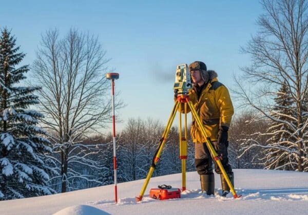
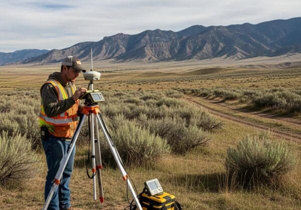
How Is a Boundary Survey Conducted Using Modern Technology?
Modern boundary surveys begin with title and plat research to identify recorded courses and corner evidence, followed by setting control points with GNSS or total station equipment to tie field observations to a coordinate system. Field crews measure distances, angles, and features and then process the data in office software to produce plats, coordinate lists, and supporting reports; LiDAR and drone imagery can supplement feature collection in complex or wooded areas. Deliverables include a sealed map with monumentation notes and a boundary report that reconciles record calls with observed evidence, which is critical for legal defensibility. This integration of traditional records and contemporary geospatial tools improves accuracy and traceability while reducing field time for many sites.
To compare boundary subtypes, the table below summarizes key attributes and typical use cases.
This comparison clarifies which boundary approach matches your project goals and why accurate record reconciliation matters for legal certainty.
How Much Does a Topographic Survey Cost and What Factors Affect Pricing?

A topographic survey maps site elevations, contours, and surface features to create a terrain model used for design and drainage analysis; pricing depends primarily on site size, terrain complexity, vegetation, required contour interval, and chosen technology. Using drones with photogrammetry can lower field time on open or moderately vegetated sites, while LiDAR is more effective (and typically costlier) for heavily vegetated or highly complex terrain because it penetrates canopy and yields dense point clouds. Deliverables—contours, spot elevations, 3D point clouds, cross-sections—influence cost because producing a certified contour map differs from delivering a large-format point cloud and CAD file. Turnaround, access restrictions, and required accuracy tolerances also change crews and equipment needs, thereby affecting estimates.
Key cost drivers are summarized in the list below to help you anticipate where charges arise and what to discuss in a quote.
Topographic survey pricing is driven by several primary factors:
- Site Size: Larger acreage increases flight or field time and data processing needs.
- Terrain & Vegetation: Steep slopes and dense canopy increase complexity and may require LiDAR.
- Deliverables: Contours only are less costly than a full 3D point cloud with breaklines.
- Accuracy & Tolerance: Tighter vertical/horizontal tolerances require more control and QA/QC effort.
- Access & Mobilization: Remote or restricted sites require extra setup and crew time.
These drivers explain why two topographic surveys for similar parcels can yield different estimates; requesting a line-item quote helps compare offers.
To illustrate how technology and deliverables affect price, the EAV comparison below outlines typical impacts on cost and outcomes.
After reviewing cost drivers, obtain a custom estimate from a licensed provider that lists included deliverables, control methodology, and assumptions used to set the price.
The next subsection explains how topographic surveys support site planning and drainage design.
What Are the Key Uses of Topographic Surveys in Site Planning and Drainage?
Topographic surveys provide contour maps, spot elevations, and existing utility locations that designers use to create grading plans, stormwater conveyance, and earthwork estimates. Accurate contours allow engineers to model watershed behavior, design detention or retention systems, and verify that proposed grades meet local stormwater and erosion control ordinances. Topo data also identifies potential conflicts with utilities and informs decisions about retaining walls, cut-and-fill balances, and access routes. Deliverables often include CAD files with contour intervals, cross-sections for critical profiles, and a report summarizing datum and control methods used for earthwork calculations and permit submittals.
How Do Technologies Like Drones and LiDAR Improve Topographic Mapping?
Drones equipped with photogrammetry capture high-resolution orthophotos and dense point clouds quickly for open sites, reducing mobilization and field crew hours compared with traditional methods. LiDAR sensors—airborne or terrestrial—penetrate vegetation and capture precise 3D points in complex or forested terrain, improving accuracy for contour generation where photogrammetry struggles. Traditional total station and GNSS control remain essential for vertical control and legal-grade accuracy, especially where deliverables will support permitting or construction staking. Each technology has trade-offs between cost, speed, and deliverable type, so selecting the method depends on vegetation, required accuracy, and intended use of the dataset.
What Are ALTA Survey Requirements for Commercial Real Estate Transactions?
An ALTA/NSPS land title survey is a comprehensive, standardized survey performed to ALTA/NSPS minimum standards that documents property boundaries, improvements, easements, rights-of-way, and other items important to title insurers, lenders, and purchasers. ALTA surveys differ from simple boundary or topo work by following a formal checklist, often including optional survey and title report addenda that a title company or lender may require. The ALTA plat is intended to reduce transaction risk by clearly depicting title-related items and providing certifications required by underwriters. Because requirements vary by transaction, the surveyor coordinates with the title insurer and the client to identify additional map notes and exceptions that must appear on the final plat.
Below is a concise ALTA checklist table that maps common ALTA items to why they matter and who typically requests them.
This EAV-style checklist helps buyers, lenders, and insurers align on which ALTA items are essential to the transaction and which addenda to include.
How ALTA surveys support title insurance and due diligence is explained in the next subsection and shows why early coordination matters.
How Does an ALTA/NSPS Land Title Survey Support Title Insurance and Due Diligence?
ALTA/NSPS surveys provide title underwriters with a professional depiction of physical and recorded conditions that influence exceptions and endorsements on insurance policies. By mapping easements, encroachments, and other title-related matters, the survey can reveal risks that may require negotiation, correction, or specific endorsements before closing. Coordination with the title company ensures the survey covers items listed in the title commitment and that any required language or map notes are included, which streamlines underwriting and reduces last-minute surprises. This alignment can accelerate closings and reduce the likelihood of post-closing disputes when the survey and title documents match.
The following subsection outlines the step-by-step ALTA survey process most clients can expect.
What Is the Step-by-Step Process of Conducting an ALTA Survey?
ALTA surveys begin with engagement where the surveyor reviews the title commitment, identifies required ALTA items, and confirms addenda with the client and title insurer. Next, the surveyor conducts record research and field control setup before collecting boundary, improvement, and topographic data using GNSS, total stations, and supplemental imagery if needed. Draft plats are then prepared, shared with the title company for review, and revised to incorporate requested map notes or clarifications; the final plat is sealed by a licensed surveyor for delivery. Typical timelines vary by property complexity but often range from two to six weeks for routine commercial parcels, with longer times when extensive record research or third-party coordination is necessary.
After transaction-focused surveys, construction staking ensures plans translate into precise on-site layouts; the next H2 covers staking and as-built work.
How Do Construction Staking Services Facilitate Accurate Building Layouts?
Construction staking services translate engineering and architectural plans into physical control points and stakes on-site so contractors can place foundations, utilities, and grading features in the correct positions. These services reduce rework and change orders by verifying plan coordinates on the ground, confirming grade elevations, and staking building corners, column lines, and pavement edges as needed. Staking workflows begin with plan interpretation, establishing control tied to project datum, field layout using robotic total stations or GNSS, and on-going verification through as-built checks. Deliverables include stake layouts, stake logs, grade sheets, and as-built surveys that document conformance to plans for payment and permit closeout.
The different types of construction surveys address distinct phases of the build; the next subsection differentiates these with use-case timing.
What Are the Different Types of Construction Surveys Including As-Built and Site Layout?
Common construction surveys include control surveys to establish project coordinates, layout or staking for foundations and utilities, grade staking for earthwork, and as-built surveys documenting completed work relative to plans. Control surveys occur early to set baselines and benchmarks; layout staking follows to guide initial construction; grade staking supports correct elevations for earth-moving; and as-built surveys occur during or after construction to verify conformity and to create record drawings. Each survey type includes specific checklists—control requires verified benchmarks, staking needs clear plan tie-ins, and as-built surveys demand detailed measurements of constructed features. Coordinating the timing with contractors prevents delays and ensures each staking activity supports the next phase of work.
How Does Survey Technology Ensure Precision in Construction Staking?
Robotic total stations and GNSS systems allow single-operator staking with sub-inch horizontal accuracy in many site settings, increasing speed while maintaining required tolerances for structural layouts. Machine-control systems integrate survey deliverables with earthmoving equipment to automate grading to design surfaces, reducing operator error and rework on large projects. Field QA/QC workflows include verification shots, control checks, and as-built documentation to ensure that staking remains accurate as the site changes; cloud-based data exchange enables faster updates between surveyors and contractors. These technologies reduce labor, improve repeatability, and make tolerance management transparent during construction.
After understanding construction workflows, the final practical topic is finding a licensed surveyor near you and vetting credentials and local knowledge.
How Can You Find a Licensed Land Surveyor Near Me for Reliable Surveying Services?
Finding a licensed land surveyor locally starts with verifying state licensure, checking professional memberships, and reviewing sample deliverables to ensure they meet your project’s technical needs. A practical search checklist includes confirming a Licensed Professional Land Surveyor (state license) is on the engagement, requesting sample plats and point coordinate files, and confirming insurance such as E&O and general liability where applicable. Local knowledge of zoning, permitting, and FEMA/floodplain requirements often differentiates firms that can smoothly coordinate with municipal planning departments and expedite approvals. When soliciting quotes, ask for a line-item scope showing deliverables, control methods, assumed access conditions, and estimated turnaround to make apples-to-apples comparisons.
Below is a simple checklist to use when vetting a local surveying firm or independent licensed surveyor.
Use this checklist when you evaluate quotes or schedule an initial consultation with a surveyor.
- Verify State Licensure: Confirm a Licensed Professional Land Surveyor will sign deliverables.
- Request Sample Deliverables: Ask for plats, contour maps, and coordinate files similar to your needs.
- Confirm Insurance: Ensure E&O and general liability are in place for your project.
- Ask About Local Experience: Request examples of work in the same municipality or floodplain area.
- Request a Line-Item Quote: Compare site assumptions, equipment, deliverables, and timelines.
These checks help you compare providers objectively and reduce surprises during project execution.
What Credentials and Certifications Should You Look for in a Professional Land Surveyor?
Look for a Licensed Professional Land Surveyor (state license) as the primary credential, plus familiarity with ALTA/NSPS standards, and membership or certification from recognized professional bodies where applicable. Insurance—particularly professional errors and omissions (E&O)—is critical because it protects against measurement or mapping errors that could affect property rights. Additional qualifications such as demonstrated experience with LiDAR, GNSS control networks, and construction staking indicate technical breadth for complex projects. Requesting a sample sealed plat and coordinate list allows verification of format and quality before engagement.
How Do Local Regulations and Zoning Impact Land Surveying Services?
Local codes, setback requirements, floodplain ordinances, and municipal permitting processes directly affect survey scope by adding required checks such as setback verification, elevation certificates, or grading restrictions. Surveyors with hyper-local experience know the typical deliverables accepted by planning departments and can preemptively collect necessary items—like FEMA elevation data or specific setback measurements—reducing review cycles. Coordination with local agencies may require additional field checks, certified elevations, or specialty reports that increase timeline and cost, so early disclosure of permit needs helps set realistic expectations. Engaging a surveyor familiar with municipal procedures minimizes iteration and accelerates approvals.
After vetting credentials and regulatory impacts, it is helpful to prepare key documents and questions before requesting a quote; the checklist above provides a practical starting point for client readiness.