Utah Land Survey Company: Your Guide to Expert Boundary Surveys
Do you need a clear answer to boundary questions affecting your property in Utah? This blog post explains how an Utah land survey company handles boundary surveys efficiently. The content covers key services and steps involved in obtaining a reliable survey, along with factors that influence cost. Readers will learn how to solve disputes and gain assurance in their property’s limits, making complex survey procedures easy to understand.
Key Takeaways
- utah survey companies define property boundaries using advanced measurement techniques
- professional surveyors provide clear documentation that supports legal and financial processes
- local authorities work with survey teams to ensure regulatory compliance and updated records
- certified professionals use precise tools for alta and subdivision surveys to support informed decisions
- clients receive transparency and trust from detailed survey reports and accurate data
Understanding Utah Land Survey Companies

Utah land survey companies, such as ludlow engineers, specialize in land survey boundary work to define property lines accurately. They assist clients in securing insurance and mortgage approvals by providing precise surveying information through their blog. This focus on accuracy supports various legal and financial processes.
The firms use advanced techniques in surveying to ensure reliable property assessments. They work closely with local authorities to meet regulatory requirements. Clients benefit from the detailed expertise provided by these companies, including ludlow engineers. Additionally, their blog offers valuable insights and they comply with ALTANSPSFAQs.
Professional surveyors measure boundaries with precision, which is crucial for resolving disputes and facilitating transactions. They provide clear documentation that supports insurance claims and mortgage applications. High-quality surveying serves as a solid foundation for informed property decisions.
Experts in this field ensure that all property records are updated and verified. Their work guarantees that land survey boundary information remains accurate for future use. This careful process builds trust among stakeholders and reinforces confidence in property investments.
Utah land survey companies stand firm with clear, reliable work. Next, the article shows why marking exact boundaries in Utah makes a real difference.
The Importance of Boundary Surveys in Utah

Utah land survey companies utilize advanced measurement techniques to define property boundaries accurately. They employ a global positioning system and topography tools to support real estate transactions and secure clear records.
Boundary surveys influence real estate investments by providing reliable data. Companies use measurement and global positioning system data to offer precise property assessments.
Accurate topography is vital for updating property records and resolving conflicts. Professionals generate results that support title insurance and simplify approval processes.
Reliable measurements form the basis of every land survey project in Utah. Skilled surveyors ensure that real estate documentation meets legal requirements using global positioning system data and advanced topography methods.
Boundary surveys set clear lines that hold value in every project. Next, essential services shine a light on how experts manage complex land issues.
Key Services Offered by Utah Land Survey Companies

Utah land survey companies provide clear services including boundary surveys for property line disputes, ALTA surveys for commercial properties, and subdivision surveys for development projects. Experts rely on precise angle measurements, theodolite technology, and elevation data coordinated via the internet and validated by the American Land Title Association to ensure reliable property assessments.
Boundary Surveys for Property Line Disputes
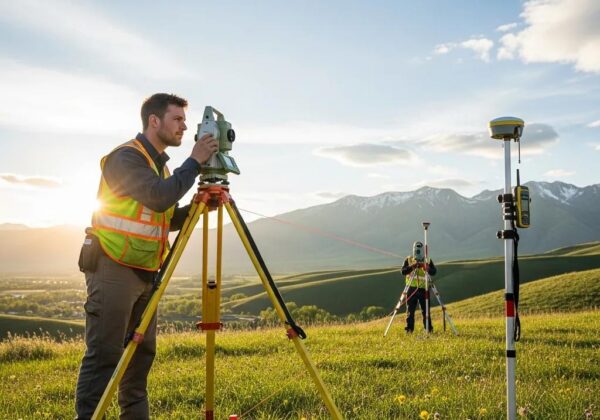
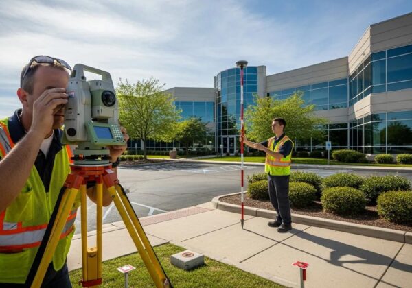
Utah land survey companies use advanced technology, including the total station, to deliver accuracy and precision in gathering data for property line disputes. These experts provide vital information to support construction projects and legal processes:
- Accurate boundary determination
- Reliable data collection
- Verified property information
The professionals apply their expertise in using the total station to capture precise measurements that help resolve property conflicts. They ensure that every survey offers clear information and data, meeting the needs of clients involved in construction and real estate transactions with superb accuracy and precision.
ALTA Surveys for Commercial Properties
Utah land survey companies deliver ALTA surveys that provide precise details on commercial properties, assisting with the creation of an accurate plat and subdivision plans. Their expert use of advanced software ensures that property data is documented correctly, which is essential when securing a loan or managing large-scale projects on earth-based developments.
Industry professionals perform ALTA surveys with verified measurements and data capture techniques, ensuring that every element, from the initial plat to detailed subdivision records, is accurate and complete. This reliable approach supports financial institutions and property owners in assessing commercial assets, ultimately easing complex transactions and project implementations.
Subdivision Surveys for Development Projects
Utah land survey companies provide subdivision surveys for development projects, ensuring that owner responsibilities such as easement agreements and deed verifications are accurately documented. These experts use precise calibration and measurement techniques to support real estate management and help address tax-related concerns that may arise during development.
The professionals conduct thorough surveys that aid in the smooth management of development projects, ensuring that all easement and deed details are verified correctly. Their hands-on approach to calibration and tax preparation services strengthens the integrity of property records and assists developers in maintaining clear management strategies.
The survey team wraps up a detailed look at services with a clear purpose in view. Next, the discussion turns to simple steps that secure firm boundary lines in Utah.
Steps to Obtain a Boundary Survey in Utah

This section explains key steps including initial consultation with a survey specialist, on-site evaluation with a certified engineer, and review of survey results. Experts perform thorough research to determine cost, shape, and zoning details, ensuring clients obtain clear and reliable boundary data.
Initial Consultation With a Survey Specialist
The initial consultation features a meeting with a survey specialist who uses advanced technology as a tool to assess the scope of the boundary survey project. The expert reviews a topographic map and satellite data to identify key parameters that will ensure accurate measurement and increased productivity during the survey process.
During the consultation, the survey specialist provides clear guidance on how modern technology and satellite imagery inform precise land assessments. The discussion centers on practical examples that demonstrate how these tools improve overall survey reliability and support efficient project planning.
On-Site Evaluation and Data Collection
The on-site evaluation begins with a comprehensive check of the survey area where surveyors assess the terrain and verify existing boundary markers using state-of-the-art geometry tools. Detailed data collection under local jurisdiction provides accurate measurements that aid in effective navigation and improve real estate investing outcomes.
The process continues with precise data gathering that supports significant investment decisions and ensures clear property boundaries. Practical insights from the field allow experts to address potential issues in real estate investing efficiently, resulting in trustworthy results and a solid foundation for property management:
Reviewing Survey Results and Boundaries
The review process for survey results involves verifying the accuracy of land surveying data collected during field evaluations. Expert professionals use geomatics techniques and a proper license to ensure that all data is fit for procurement and township updates, solidifying the survey’s credibility.
Survey teams meticulously compare measurement details and confirm boundary markers to support clear decision-making in property assessments. The review includes evaluating the integrity of geomatics data, checking that all records meet township guidelines, and verifying the license status of survey equipment to ensure a reliable outcome:
- Assessment of boundary accuracy
- Verification of geomatics data integrity
- Confirmation of license and equipment compliance
- Monitoring town planning updates
Every step brings the property into clearer focus. Soon, key cost drivers for land surveys will be revealed.
Factors Influencing the Cost of Land Surveys in Utah

The cost of land surveys in Utah depends on the size and location of the property. Land surveyors work with precise documentation to ensure accuracy in every project.
Factors such as terrain difficulty and project scope influence survey fees and include multiple elements that shape the overall cost:
- Property size and complexity
- Survey equipment and technology used
- Required document verification
- Specialized services such as alta survey
Utilizing advanced methods, professionals conduct surveys with tools that support detailed documentation and precise results. The website provides additional information and examples of previous alta survey projects.
Experts advise potential clients to contact reputable land surveyors to discuss project details and cost estimates. They ensure all requests are managed with careful documentation and prompt response through the website.
The figures outline the price, yet the true worth lies in the skill behind each mark. The surveyors’ credentials and training shape every measurement and build trust in every line drawn.
Qualifications and Certifications of Land Surveyors in Utah

Utah land survey companies require each land surveyor to possess focused training in construction survey methods and adhere to strict certification standards. This professional requirement ensures that surveys meet industry benchmarks and client expectations.
Certification levels include state licenses, which validate competencies in alta surveys and property line survey cost assessments:
These professionals continuously update their skills through industry training and rigorous assessments. Their credentials support clear communication in property line survey cost discussions and ensure reliability in all surveys.
Utah land survey companies maintain strict hiring standards to provide expert services. Their skilled surveyors offer detailed expertise in construction survey techniques and alta surveys for various project needs.
Surveyors show skill through clear credentials and proven work. Now, the trials of mapping boundaries test those skills in real field work.
Common Challenges in Boundary Surveys

The process of determining home survey cost often poses challenges due to property size and terrain variations. A professional approach helps clients find a surveyor who can address unique site conditions reliably.
Clients may face difficulties when a home surveyor verifies existing markers on property. Accurate measurements and timely data collection help manage surveyor cost effectively.
Local projects sometimes require surveyors in my area to handle diverse boundary conditions. Expert survey teams work to resolve any discrepancies for clear property documentation.
Technical issues and equipment calibration can influence home survey cost. Qualified professionals ensure that each survey result reflects reliable data for the project.
Challenges in the field raise many genuine questions. The following section provides clear answers that matter.
Frequently Asked Questions About Boundary Surveys

The surveyor explains that the cost of house survey varies depending on the property’s size and complexity, ensuring that clients understand the boundary survey cost from the start. This clarity helps build trust and confidence in the process.
A residential surveyor reviews all details of property measurements to deliver precise results, ensuring that each survey supports legal and financial requirements. The surveyor uses advanced techniques to provide accurate assessments.
A private surveyor assists with resolving property boundaries and calculating the cost of house survey projects accurately. Clients receive transparent information about boundary survey cost parameters based on specific project needs.
The surveyor maintains a high level of professionalism in each project, ensuring that every measurement is reliable and acceptable for legal documentation. This approach assists clients in understanding the value offered by a residential surveyor and a private surveyor during the survey process.
The questions reveal much about how boundaries are set. The next step draws focus to finding a trusted firm for land surveys in Utah.
Selecting the Right Land Survey Company in Utah

Utah land survey companies provide reliable property survey services that meet local standards. Expert surveyors use proven methods to deliver clear property line survey results.
Experienced professionals perform topographical survey work that supports accurate boundary assessments. They deliver precise property survey cost information to help clients plan their projects.
Clients seeking comprehensive services receive tailored support from skilled surveyors who excel in property line survey projects. The team focuses on meeting specific project needs:
- Accurate property survey data
- Clear topographical survey results
- Competitive property survey cost estimates
Prospective clients benefit from selecting a reputable firm where qualified surveyors provide trustworthy property surveys and detailed property line survey reports. The firm maintains a consistent focus on quality and cost transparency throughout every project.
The process moves forward, revealing tangible work on the field. True examples show how clear lines become real markers on the ground.
Real-Life Examples of Boundary Surveys in Action

Utah land survey companies perform precise boundary survey projects that provide clear property line measurements. A local surveyor uses advanced tools to complete each project with efficiency.
The firm provides a detailed description of its work to support transparent estimates on land survey cost:
- Accurate boundary survey data
- Clear local surveyor assignments
- Reliable land survey cost calculations
These professionals maintain consistent quality in every boundary survey, ensuring that property markers are verified accurately. They use proven practices that result in clear documentation for every project.
Clients benefit from expert services that combine comprehensive measurement methods with a precise description of scope. The local surveyor ensures that each project delivers trustworthy results and fair land survey cost information.
Frequently Asked Questions
What services do Utah land survey companies provide?
Utah land survey companies offer boundary mapping, topographic surveys, construction assessments, and consulting services, assisting with precise measurements and data analysis for various real estate and civil engineering projects.
How are boundary surveys performed in Utah?
Ludlow Engineering professionals conduct boundary surveys in Utah by analyzing legal documentation, using advanced GPS and total station technology, and verifying property markers to accurately define parcel limits.
What factors affect surveying costs?
Surveying costs are influenced by job complexity, area dimensions, equipment use, site conditions, and project duration, all of which determine the resources required for full land surveys and civil engineering projects.
Are Utah Surveyors Certified and Qualified?
Utah Surveyors meet strict state and industry criteria. Ludlow Engineering employs experienced professionals to provide full land survey and civil engineering services, ensuring all projects adhere to high certification and qualification standards.
What challenges arise during boundary surveys?
Boundary surveys face obstacles such as incomplete property records, challenging terrains, and limited accessibility to certain areas, all of which require precise data collection and thorough analysis for careful land surveying.
Key Takeaways: Insights on Boundary Surveying in Utah
Utah Land Survey Company offers precise boundary determinations that ensure reliable property records for legal and financial processes. The firm uses modern technology and proven measurement methods to support clear property assessments and efficient project planning. Skilled professionals deliver detailed documentation that assists with dispute resolution, insurance, and mortgage processes. Their commitment to accuracy and transparency builds trust among clients and strengthens property investments across the region.


