
Comprehensive Guide to Land Records Survey: Understanding Property Boundaries and Survey Costs
Land records surveys play a crucial role in defining property boundaries and ensuring legal ownership. These surveys are essential for property owners, real estate professionals, and legal entities, as they provide a clear understanding of land ownership and its implications. In this comprehensive guide, we will explore the significance of land surveys, the process involved in conducting them, the factors influencing survey costs, and how they can help resolve boundary disputes. By the end of this article, you will have a thorough understanding of land surveying services and their importance in property management.
What Is a Land Records Survey and Why Is It Important?
A land records survey is a detailed examination and mapping of a specific parcel of land to establish its boundaries and legal descriptions. This process is vital for property ownership, as it provides a definitive record of land boundaries, which can prevent disputes and clarify ownership rights. The importance of land records surveys extends beyond mere boundary definitions; they also play a critical role in legal documentation, ensuring that property transactions are conducted smoothly and without ambiguity.
How Does a Property Boundary Survey Define Land Ownership?
Property boundary surveys are instrumental in establishing legal ownership of land. By accurately measuring and marking the boundaries, surveyors provide a clear delineation of property lines, which is essential for resolving disputes. For instance, in cases where two neighbors disagree over property lines, a boundary survey can provide the necessary evidence to settle the matter legally. This clarity helps protect property rights and ensures that owners can utilize their land without fear of encroachment.
Further emphasizing the foundational role of accurate boundary determination, research highlights its importance in resolving disputes and facilitating urban development.
Property Boundary Determination & Dispute Resolution
This interdisciplinary paper, informed by research and practices in neo-institutional economics, property law and land surveying, is an exploratory account of the boundary as (a) the ontological foundation of private property in land and boundary dispute resolution, and (b) as a pre-contractual condition of any Coasian exchange of rights forplannedurban development andspace-relevantinnovations.
The determination of the “true” property boundary in planned development: a
Coasian analysis, LWC Lai, 2018
What Documents Are Included in a Land Survey Report?
A land survey report typically includes several key documents that outline the findings of the survey. These documents may consist of:
- Survey Plat: A detailed map showing the boundaries and dimensions of the property.
- Legal Descriptions: Written descriptions that define the property boundaries in legal terms.
- Boundary Markers: Physical markers placed on the property to indicate the corners and lines of the parcel.
- Easements: Documentation of any rights of way or access that may affect the property.
These documents are crucial for legal purposes, as they provide the necessary information to support property claims and transactions.
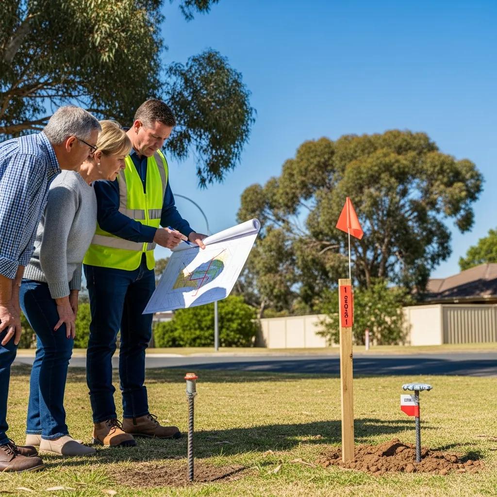
How Is a Land Records Survey Conducted? Step-by-Step Process Explained
Conducting a land records survey involves a systematic process that ensures accuracy and reliability. The steps typically include:
- Research: Surveyors begin by researching existing property records, maps, and legal documents to gather information about the land.
- Field Measurements: Using specialized equipment, surveyors take precise measurements of the property to determine its boundaries.
- Data Analysis: The collected data is analyzed to create a detailed survey plat that accurately represents the property.
- Report Preparation: Finally, a comprehensive report is prepared, including all findings and relevant documents.
This methodical approach ensures that the survey is thorough and legally defensible.
What Tools and Technology Are Used in Modern Land Surveying?

Modern land surveying employs a variety of advanced tools and technologies to enhance accuracy and efficiency. Some of the key tools include:
- Total Stations: These electronic devices combine the functions of a theodolite and an electronic distance measuring device, allowing for precise measurements.
- GPS Technology: Global Positioning System (GPS) technology is used to obtain accurate location data, which is essential for mapping and boundary determination.
- Drones: Unmanned aerial vehicles (UAVs) are increasingly used for aerial surveys, providing high-resolution images and data for large areas.
These technologies significantly improve the accuracy and speed of land surveys, making them more reliable than ever.
How Do Surveyors Determine Boundary Lines Accurately?
Surveyors determine boundary lines using a combination of historical data, physical markers, and advanced technology. They analyze existing property records and legal descriptions to establish the original boundaries. Additionally, they may use physical markers, such as fences or trees, as reference points. By combining these methods, surveyors can accurately delineate property lines, ensuring that the boundaries are clear and legally enforceable.
What Factors Influence Property Survey Costs?
The cost of a property survey costs can vary significantly based on several factors. Understanding these factors can help property owners budget for their surveying needs effectively.
- Size of the Property: Larger properties typically require more time and resources to survey, leading to higher costs.
- Location: The geographical location can impact costs due to accessibility, terrain, and local regulations.
- Complexity of the Survey: Properties with complicated boundaries, multiple easements, or difficult terrain may incur additional costs due to the increased work involved.
How Is the Cost of a Property Boundary Survey Calculated?
The cost of a property boundary survey is generally calculated based on the size of the property, the complexity of the survey, and the time required to complete it. For example, a standard residential survey in the United States may cost between $350 and $700, while larger or more complex surveys can exceed $1,500. Prices vary widely by region and surveyor. It is essential for property owners to obtain quotes from multiple surveyors to ensure they receive a fair price.
Where Can You Find Transparent Pricing for Land Surveys?
Finding transparent pricing for land surveys can be challenging, but several resources can help. Property owners can:
- Consult Local Surveying Firms: Many firms provide detailed pricing information on their websites or through direct inquiries.
- Check Online Directories: Websites that list surveying services often include pricing information and customer reviews.
- Ask for Estimates: Requesting estimates from multiple surveyors can provide a clearer picture of the market rates.
By utilizing these resources, property owners can make informed decisions regarding their surveying needs.
How Can Boundary Disputes Be Resolved Using Land Records Surveys?
Boundary disputes can arise for various reasons, including unclear property lines or conflicting claims. Land records surveys are a valuable tool in resolving these disputes by providing definitive evidence of property boundaries.
The broader societal challenge of land ownership conflicts necessitates effective regulation and law enforcement, where accurate surveys play a pivotal role.
Resolving Land Ownership Conflicts & Disputes
This paper addresses the critical issue of land ownership in society, given the increasing conversion of undeveloped land into developed property. Effective regulation and law enforcement are crucial in resolving land disputes to ensure the equitable distribution of land resources. The paper contributes to the ongoing discourse on land ownership and disputes and provides valuable insights for policymakers, landowners, and communities to develop effective strategies for resolving land disputes of land resources.
A study of citizen preferences regarding legal land conflict resolution: the Importance-Performance Analysis, A Tehupeiory, 2023
What Legal Considerations Are Involved in Boundary Line Determination?
Legal considerations in boundary line determination often involve examining property deeds, historical records, and existing surveys. Courts typically rely on the findings of professional surveys to make decisions in disputes. Understanding these legal frameworks is crucial for property owners facing boundary issues, as it can significantly impact the outcome of their cases.
The intricate nature of property boundaries is further underscored by the evolving legal principles and doctrines that govern their control and resolution.
Legal Principles for Property Boundary Control
doctrines and have created new legal doctrines to resolve boundary issues. Real property rights are determined according to the laws in effect in the particular locale.
Brown’s boundary control and legal principles, 2023
How Does a Survey Plat Support Property Title and Dispute Resolution?
A survey plat serves as a critical document in property title and dispute resolution. It provides a visual representation of the property boundaries, which can be used in legal proceedings to establish ownership. Additionally, a well-prepared survey plat can help clarify any ambiguities in property descriptions, making it an essential tool for both property owners and legal professionals.
To understand the costs associated with these services, it’s helpful to research “land and property survey costs”.
Understanding the factors that influence these costs is essential for budgeting and planning. For more detailed information, you can explore “land and property survey costs”.
When considering a land records survey, it’s important to factor in the potential expenses. Researching “land and property survey costs” can provide valuable insights.
Conclusion
Understanding land records surveys is essential for property owners, real estate professionals, and legal entities, as they provide clarity on property boundaries and ownership rights. By utilizing accurate surveying methods and advanced technologies, you can effectively resolve disputes and ensure legal compliance in property transactions. Exploring the costs and processes involved will empower you to make informed decisions regarding your land surveying needs. For further insights and assistance, consider reaching out to a local surveying firm today.