Residential Land Survey Services — Costs, Boundaries, and How the Process Works
A residential land survey gives homeowners a clear, defensible picture of their property: where the boundaries lie, what physical features exist, and whether any legal issues — like easements or encroachments — apply. Knowing this information protects your investment and makes buying, selling, or building far less risky. This guide walks through why surveys matter, typical costs, the main survey types, and the steps surveyors follow so you can make confident decisions about your property.
What Is a Residential Land Survey and Why Is It Important?
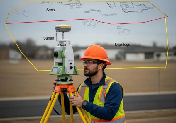
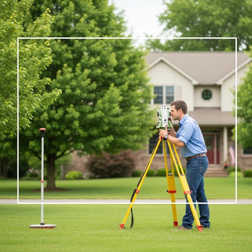
A residential land survey is a careful, on-the-ground assessment that establishes precise property lines and records structures, fences, and notable site features. For homeowners, a properly executed survey reduces the chance of neighbor disputes, clarifies setback and zoning requirements, and surfaces any land surveys that could limit how the land is used.
In short, a survey turns uncertainty into documented facts. That clarity speeds transactions, supports renovation or permitting decisions, and helps avoid costly legal surprises down the road.
Defining Residential Land Surveys and Their Purpose
Surveys serve several practical roles: they fix legal boundaries, map physical features, and verify compliance with local zoning or setback rules. That data informs property sales, planning for additions or fences, and any development that needs to meet municipal standards. For example, a survey will show whether a proposed garage sits inside a required setback or whether a neighboring structure encroaches on your lot.
Home improvement and design decisions benefit directly from accurate survey data. When you know exactly where your property starts and ends, you can plan work with confidence and avoid costly rework.
How Property Boundary Surveys Protect Your Home Investment

Boundary surveys protect homeowners by documenting where the property line actually lies. That documentation is often the difference between a simple conversation with a neighbor and a protracted boundary dispute. Because such disputes can become expensive and emotionally draining, having a current, professional survey is a practical safeguard.
A clear, certified boundary reduces the risk of unintentional encroachments and can preserve — or even improve — a property’s marketability and value. boundary survey
How Much Does a Residential Land Survey Cost?
Survey pricing varies with property size, the survey type you need, and regional factors. As a general range, a standard boundary survey typically costs between $350 and $700. More detailed work — such as topographic mapping or development-ready plot surveys — can run higher because they collect additional measurements and produce more complex deliverables.
Key Factors Influencing Land Survey Costs
Several factors commonly affect the final price of a survey:
- Size of the Property : Bigger parcels take more time and equipment, so they usually cost more.
- Type of Survey Required : Boundary, topographic, and plot surveys differ in scope; more detailed surveys require extra fieldwork and analysis.
- Location Factors : Local market rates, terrain, and permitting or regulatory requirements can influence cost.
Knowing these drivers helps you budget and choose the right survey for your needs.
Comparing Pricing for Different Survey Types: Boundary, Topographic, and Plot Surveys
To choose the appropriate survey, compare what each type delivers and how pricing typically differs:
Use these ranges as a starting point and get written quotes from local firms to compare scope and deliverables.
What Are the Common Types of Residential Land Surveys?
Residential surveys come in a few standard forms, each aimed at a particular decision or regulatory need. Understanding the differences ensures you order the survey that answers your specific question.
Understanding Property Boundary and Plot Survey Services
Boundary surveys locate and mark the legal edges of your lot — essential for title transfers, fence placement, and dispute resolution. Plot surveys go further, showing buildings, driveways, trees, and other features on a scaled site plan. Plot surveys are commonly required for building permits or when you’re planning additions.
If your project affects where structures or utilities will sit, a plot survey gives the detailed context designers and municipal reviewers require.
Exploring Topographic Surveying for Residential Properties

Topographic surveys record the site’s contours, slopes, drainage features, and other natural elements. That information is critical when grading, designing foundations, or evaluating drainage and erosion risks. For any project where elevation or stormwater matters, a topo survey is a smart investment.
Choosing the right survey type depends on the decisions you need to make: boundary clarity, permit-ready plans, or elevation-driven design.
How Is a Residential Land Survey Conducted? Step-by-Step Process
A reliable survey follows a clear sequence: research, field measurement, data analysis, and deliverable preparation. That approach ensures accuracy and produces records that hold up in legal or permitting contexts.
Surveyor Qualifications and Licensing Requirements
Licensed land surveyors meet state certification standards that typically include formal education, supervised field experience, and a licensing exam. Hiring a licensed professional ensures the survey meets local standards and can be relied on by lenders, attorneys, and permitting authorities.
Modern Technology in Land Surveying: Drones and GIS Mapping
Contemporary surveys often combine traditional field instruments with drone imagery and GIS tools. Drones accelerate aerial data collection, while GIS and CAD software help integrate, analyze, and present the information in clear, usable formats. These technologies improve speed and detail without replacing the surveyor’s professional judgment.
The result is more accurate maps and faster turnaround for projects that need timely decisions.
What Legal Requirements and Regulations Affect Residential Land Surveys?
Local laws and regulations shape what a survey must show and whether permits are needed before work begins. Understanding the regulatory context up front prevents delays and ensures deliverables will satisfy municipal reviewers or title companies.
Understanding Land Survey Permits and Compliance
Some jurisdictions require permits, filings, or specific survey formats depending on the project type. Requirements vary by location and by the survey’s intended use, so discuss local rules with your surveyor before you proceed to avoid surprises.
Studies of compliance challenges in residential areas underscore how often building activity occurs without required permits or site plans — a risk that proper surveying and permits can reduce.
Residential Land Survey Compliance & Conflict Prevention
This study examines compliance with land use regulations in peri-urban areas, focusing on Bamahu and Danko in the Upper West Region of Ghana. It found that most respondents started building without building permits or site plans. Economic, institutional, legal, and social factors shaped the level of compliance with land use planning guidelines in peri-urban Wa.
Compliance with land use regulations in peri-urban areas in Ghana: a study of Bamahu and Danko residential areas in Wa municipality,
Upper West Region, SZ Bonye, 2021
How Survey Results Impact Property Transactions and Construction
Survey findings can directly affect property closings, mortgage approvals, and building permits. Clear, certified surveys smooth transactions by removing uncertainty about boundaries and site constraints. For construction, accurate survey data helps architects and contractors avoid costly redesigns and ensures the project conforms to zoning and setback rules.
Understanding the legal weight of a survey — and resolving discrepancies early — protects both buyers and builders.
Where to Find Trusted Land Survey Companies Near Me?
Choosing a qualified survey firm is the single best way to ensure accurate, defensible results. Look for local firms with relevant experience and verifiable credentials.
Choosing Professional Surveyors with Verified Credentials
When evaluating surveyors, verify state licensing, professional certifications, and relevant project experience. Ask for references and sample deliverables so you can confirm they produce the maps and documentation required by your lender or permitting office.
How to Evaluate and Compare Local Residential Land Survey Services
Compare local surveyors on a few practical criteria:
- Experience and Expertise : Prefer firms with a track record in residential surveys and projects similar to yours.
- Customer Reviews : Read client feedback and testimonials to understand responsiveness and accuracy.
- Cost Estimates : Request written quotes that clarify scope, deliverables, and any additional fees.
Those checks will help you select a firm that matches your technical needs and timeline.
Ludlow Engineers and Associates provides residential land surveying among its core services. Our team focuses on accurate, timely surveys so homeowners and developers can move forward with confidence. For more detail on typical costs and services, see our resource on residential land surveys and contact us to discuss your project.
Frequently Asked Questions
What should I do if my neighbor disputes my property boundaries?
Start by reviewing your existing survey and title documents. A licensed surveyor can re-establish boundary markers and produce a current, signed survey you can use in discussions or mediation. If the dispute continues, consider formal mediation or legal counsel — but a professional survey is the strongest factual basis for resolving the issue.
How often should I get a land survey done on my property?
There’s no fixed timetable, but order a new survey whenever ownership changes, you plan construction or major landscaping, or you suspect the boundaries may have shifted. Also consider a fresh survey if existing documentation is old or incomplete.
Can I conduct my own land survey?
While homeowners can mark visible features, a legally defensible survey requires licensed professionals with calibrated instruments, legal research, and the technical skills to produce certified deliverables. For anything involving permits, financing, or disputes, hire a qualified surveyor.
What are the risks of not having a land survey before buying property?
Skipping a survey can leave you exposed to boundary disputes, unexpected easements, or limitations that affect intended use. Those surprises may cause delays, additional expense, or even legal disputes. A survey protects buyers by making known any constraints before closing.
How do I choose the right type of land survey for my needs?
Identify your primary goal: boundary clarity, permit-ready site plans, or elevation data. A boundary survey covers legal lines; a plot survey prepares for permitting; a topographic survey maps elevations and contours. If you’re unsure, consult a licensed surveyor who can recommend the appropriate scope.
What technology is used in modern land surveying?
Modern surveyors blend traditional instruments (total stations, GPS) with drone imagery and GIS/CAD tools. Drones speed aerial capture, while GIS and CAD deliver precise, printable plans. These tools improve accuracy and help produce deliverables that municipalities and design teams expect.
Are there any legal implications of land survey results?
Yes. Survey results can establish or dispute property lines, affect closing conditions, and determine permit approvals. Discrepancies among surveys may trigger legal review, so retaining a licensed surveyor and documented deliverables is essential to protect your interests.
Conclusion
A professional residential land survey turns uncertainty into clear, usable information — protecting your investment, streamlining transactions, and guiding building decisions. When you need accurate boundaries, site data, or permit-ready plans, we recommend working with a licensed surveyor who understands local rules and delivers reliable documentation. Reach out to learn which survey is right for your project and get a detailed estimate.