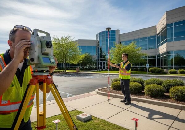
Understanding Land SurveyCost Variations Explained
Land surveying is a vital step in real estate, engineering, and property boundary determinations. Accurately gauging survey costs and understanding the land surveycost can significantly impact project budgets and long‐term investments. This article explores different land survey types and costs, factors affecting pricing, the survey process, and how evaluating cost versus value—including insights into the land survey cost—can help owners save money while ensuring regulatory compliance.
Understanding Land Survey Costs: Types, Factors & Value
- Land surveys come in various forms—boundary, topographic, ALTA/NSPS, and construction staking—each with its own cost range.
- Factors such as geographic location, property size, terrain, and surveyor expertise influence survey costs.
- Understanding the survey process and reading reports can prevent future disputes and add long-term value.
- Comparing cost versus value is essential for effective project planning and regulatory compliance.
What Are the Different Types of Land Surveys and Their Typical Costs?

Different surveys determine property boundaries and features. A boundary survey sets property lines; a topographic survey maps natural and man-made features; an ALTA/NSPS survey meets commercial transaction standards; and construction staking marks sites for development. Costs typically range from $500–$2,000 for boundary surveys, $1,000–$5,000 for topographic surveys, $2,000–$10,000 for ALTA/NSPS surveys, and $1,000–$3,000 for construction staking. These surveys reduce risk and support title insurance and regulatory compliance.
What Is a Boundary Survey and How Much Does It Cost?
A boundary survey establishes legal property lines and corners with precise measurements. Costs depend on acreage, existing markers, and property access. Smaller, straightforward properties cost around $500–$1,500, while larger or complex ones may exceed $2,000. Accuracy is key to resolving title issues and preventing disputes.
How Does a Topographic Survey Affect Land Survey Pricing?
Topographic surveys document natural features like trees, water bodies, elevations, and structures. Pricing varies with the survey area, terrain variability, and detail required, generally ranging from $1,000 to $5,000. These surveys are valuable for design projects, solar energy planning, and agricultural assessments.
What Is an ALTA/NSPS Land Title Survey and Its Cost Range?
Used in commercial real estate, an ALTA/NSPS survey meets strict standards and details boundaries, easements, and encroachments. Costs range between $2,000 and $10,000, making it essential for transferring titles or securing large investments while ensuring compliance.
How Much Does Construction Staking Cost and When Is It Needed?
Construction staking marks the planned location for new structures, required for new builds, subdivisions, and major developments. Costs, typically between $1,000 and $3,000, depend on site complexity and project scale. Proper staking helps avoid misalignments during construction and ensures regulatory adherence.
Which Factors Most Influence Land SurveyCost Variations?
Survey costs vary based on several elements including geographic location, property size, complexity, terrain, vegetation, local regulations, and surveyor expertise with modern technology. Each factor influences labor, equipment needs, and report detail.
How Does Geographic Location Impact Land Survey Prices?
Urban locations with dense infrastructure often incur higher survey costs due to complexity and access issues. In contrast, rural areas with fewer regulatory hurdles and simpler landscapes typically cost less. Locations with unique challenges like flood plains or mountains may also see increased fees.
Why Do Property Size and Complexity Affect Survey Costs?
Larger properties need more time and labor to measure, increasing costs. Properties with irregular boundaries or numerous structures require detailed surveys, making costs higher than those for standard residential plots or simple agricultural land.
How Do Terrain and Vegetation Influence Survey Pricing?
Steep, uneven, or densely vegetated terrain slows survey work and may require special equipment, such as LIDAR, increasing costs. These advanced methods provide precision beneficial for projects like solar installations or environmental assessments.
What Role Do Regulations and Permits Play in Cost Variations?
Local codes and permit requirements add steps to the survey process. Areas with strict land use regulations may need extra inspections and documentation, driving up costs but ensuring proper title insurance and compliance.
How Does Surveyor Experience and Technology Affect Pricing?
Experienced surveyors using modern tools like GPS, drones, and laser scanners deliver higher accuracy and reliability. Although their premiums are higher, the reduced risk of errors can save money by avoiding future disputes.
What Is the Typical Land Survey Process and How Does It Affect Cost?

The land survey process includes initial research, fieldwork, data processing, and report preparation. Each step, from desk research to mapping, contributes to the overall cost. Detailed and precise documentation minimizes subsequent disputes and ensures regulatory compliance.
What Are the Key Steps in a Land Survey?
Key steps include: – Preliminary desk research– On-site reconnaissance and fieldwork – Data collection using advanced equipment – Map drafting and compiling the final report
Each step is vital for accuracy and impacts overall cost.
How Do You Choose the Right Land Surveyor for Your Project?
Selecting a surveyor involves checking credentials, reviewing past project experience, and understanding their familiarity with your area and survey type. Request detailed quotes and read customer reviews to ensure accurate measurements and compliant documentation, ultimately saving money.
How Can You Read and Understand a Land Survey Report?
A survey report shows boundary lines, marked points of interest, easements, scale, north arrow, legal descriptions, and certification signatures. This report verifies market value and title insurance standards while highlighting any risks related to subdivisions or regulatory issues.
How Can Understanding Cost vs. Value Help You Save on Land Surveys?
Evaluating cost versus value ensures that survey investments yield long-term benefits. High-quality surveys provide accurate risk management, prevent disputes, and enhance project planning while delivering sustainable cost savings.
Why Is Accuracy Important in Land Surveys?
Accurate surveys define legal boundaries and guide construction stakes, protecting investments by reducing risks of litigation and title insurance issues. Precision helps secure fair market valuation and regulatory adherence.
How Can Accurate Surveys Help Avoid Future Property Disputes?
Clear, accurate property boundaries prevent disputes by explicitly marking lines and encroachments. This clarity supports secure future developments or sales, minimizing legal conflicts and additional costs.
What Are the Long-Term Savings From Investing in Quality Surveys?
Investing in quality surveys reduces the likelihood of errors that can lead to legal disputes or construction delays. Accurate reports aid in efficient planning for solar energy, agriculture, and regulatory projects, often resulting in higher property valuations and competitive market positioning.
What Are the AverageLand Survey Costs by Region and Property Type?

Costs vary by region and property type. Urban areas often have higher fees due to complex infrastructure, while rural areas offer more affordable surveying services. Different properties, from agricultural lands to subdivisions, have unique pricing models based on their specific challenges.
How Do Land Survey Costs Vary Across Different States and Cities?
Variations in state regulations, local labor rates, and geographic challenges (e.g., flood risks in coastal cities) can cause price differences. Some regions may charge more per acre due to higher market value or challenging terrain.
What Is the Cost Per Acre for Various Property Types?
Residential surveys typically range from $1–$3 per acre, while larger tracts of agricultural or undeveloped land may be around $0.50–$2 per acre. Special-use properties may incur additional testing or drilling fees.
How Do New Construction Survey Costs Compare to Other Survey Types?
New construction surveys, which often include topographic mapping and construction staking, are usually 20–30% more expensive than standard boundary surveys due to added design coordination and regulatory steps.
How Can You Estimate Land Survey Costs Before Hiring a Surveyor?
Use online tools and calculators that factor in region, property size, and terrain to estimate costs. Getting direct quotes from trusted surveying firms can also help secure the best value.
What Tools Are Available to Calculate Land Survey Costs?
Government and private websites offer calculators based on statistical averages and regional data. Spreadsheets with historical cost data can further refine your budget estimates.
What Questions Should You Ask When Requesting a Survey Quote?
Ask about the survey’s scope, methods used, timeline, and any extra fees for challenging terrain or permits. Inquire if the quote includes revisions for unexpected issues to avoid hidden costs.
What Are Common Questions About Land Survey Costs?

Clients often ask about duration, what is included in a survey, and differences among survey types to plan both financially and logistically.
How Long Does a Land Survey Usually Take?
A standard survey typically takes one to two weeks from consultation to final report, though larger or more complex surveys may require additional time.
What Is Included in a Standard Land Survey?
A standard survey includes boundary lines, physical features, recorded easements, annotated maps, legal descriptions, and certified documentation for clear property delineation.
How Do Boundary Surveys Differ From Topographic Surveys?
Boundary surveys focus on legal property lines, while topographic surveys capture elevation and landscape features. Topographic surveys tend to be more detailed and costlier.
Frequently Asked Questions
Q: What factors most significantly drive higher survey costs? A: Challenging terrain, larger properties, urban regulatory requirements, and the need for specialized equipment increase survey costs.
Q: How important is the use of advanced technology in reducing survey errors? A: Technologies like laser scanning and GPS improve accuracy, reduce mapping errors, and help lower long-term costs.
Q: Can investing in a high-quality survey impact my property’s market value? A: Yes, accurate surveys improve title documentation, planning, and dispute prevention, thereby enhancing market value.
Q: Are online costcalculators reliable for estimating survey costs? A: They offer preliminary estimates based on averages but should be confirmed with direct quotes from professional surveyors.
Q: How do construction staking surveys benefit new development projects? A: They ensure accurate placement of structures, help prevent costly construction mistakes, and streamline regulatory approvals.
Final Thoughts
Accurate land surveys are essential to prevent disputes and ensure compliance with regulations. By understanding the different surveys, cost factors, and the importance of precision, clients can control expenses and enhance property value. This insight supports informed decisions and long-term savings, giving peace of mind for any development project.


