
Manti Boundary Surveys — Precise Property‑line Services for Sanpete County
Boundary surveys give Mantiproperty owners a clear, legal picture of where their property begins and ends. They prevent neighbor disputes, support real estate transactions, and keep projects in line with local rules. Below we explain why surveys matter, how they’re done, what shows up on the final report, and why Ludlow Engineers and Associates is a trusted local choice for Sanpete County boundary work.
Why Do Manti Property Owners Need Boundary Surveys?
Boundary surveys officially define property lines — a critical step for selling, building, or resolving conflicts. Without a clear survey, owners can face costly disputes, setbacks during permitting, or unexpected encroachments.
How Do Boundary Surveys Support Property Transactions in Manti?
A survey provides an accurate legal description buyers, sellers, and title companies rely on. It clarifies exactly what’s being transferred, helps identify title issues, and reduces the chance of post‑sale boundary disputes.
What Role Do Boundary Surveys Play in New Construction and Development?
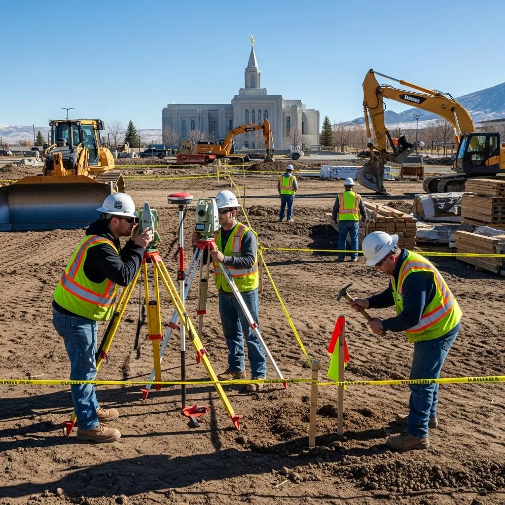
For new construction, a boundary survey shows buildable areas, setback lines, and potential encroachments so plans meet zoning and building codes. Early surveying prevents costly rework and keeps projects moving smoothly.
What Is the Process for Conducting a Manti Boundary Survey?
A boundary survey follows a clear sequence: research and consultation, field measurements, data verification, and final mapping and documentation. Each step ensures the survey is legally defensible and practical for your intended use.
How Is Initial Research and Consultation Conducted for Manti Surveys?
The research phase reviews deeds, recorded plats, and prior surveys, and includes conversations with the property owner. That background work identifies easements, legal descriptions, or title issues that guide the fieldwork.
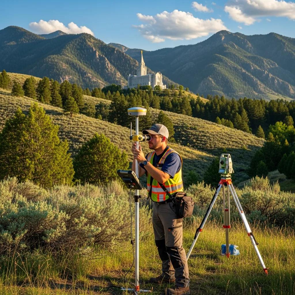
What On-Site Fieldwork Methods Are Used in Manti Boundary Surveys?
Field crews use survey‑grade GNSS/GPS, total stations, and traditional monument searches to locate corners and features precisely. Measurements are tied to local control and cross‑checked before producing the final deliverables.
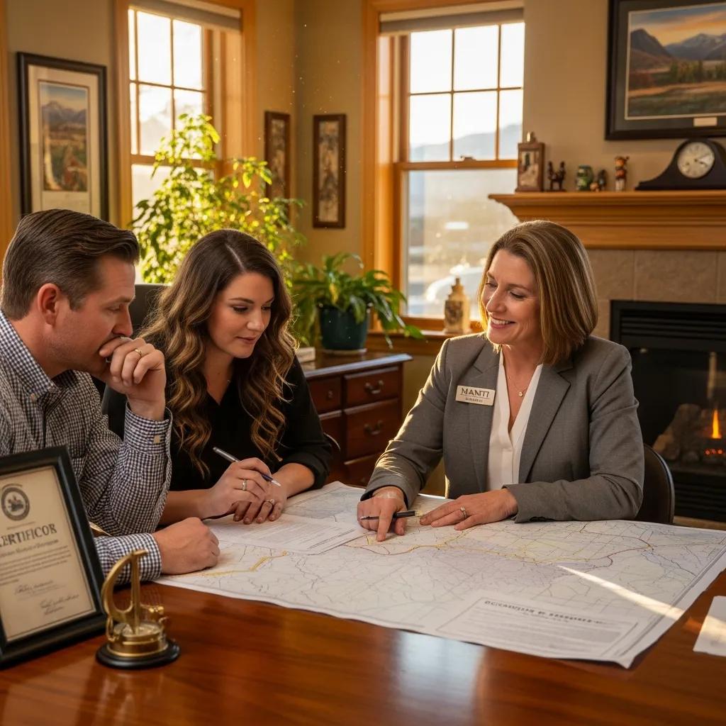
What Does a Manti Boundary Survey Report Include?
A typical boundary survey package includes a mapped plat or drawing, the legal description, stamped field notes, and clear notes on easements, encroachments, and any observed discrepancies. These elements give property owners and professionals the information they need to act.
Which Property Features Are Identified in the Survey Report?
Reports usually show property lines and corner monuments, recorded easements, visible encroachments, improvements and structures, and utility locations that affect land use.
How Are Easements and Encroachments Documented in Manti Surveys?
Easements and encroachments are shown on the plat and explained in the notes so you can see how they affect access, use, and future plans for the property.
Why Choose Ludlow Engineers and Associates for Manti Boundary Surveys?
Founded in 1975, Ludlow Engineers and Associates brings decades of local experience, practical knowledge of Sanpete County regulations, and a commitment to clear communication and reliable results.
What Local Expertise Does Ludlow Offer in Sanpete County?
Ludlow maintains deep local knowledge of plats, county practices, and common site challenges. That experience helps us deliver surveys that address the specific needs of Manti property owners and developers.
How Does Advanced Technology Enhance Survey Accuracy in Manti?
We combine GNSS, total stations, and careful field checks to improve accuracy across different terrain. Using multiple methods reduces error in wooded, built-up, or mountainous areas and results in more reliable surveys.
Studies show that combining GNSS and total station measurements produces better overall accuracy across challenging surveying environments.
GNSS & Total Station for Accurate Land Surveying
Modern GNSS receivers improve positioning accuracy, but satellite signals can be blocked or degraded in urban areas, dense tree cover, near high‑voltage lines, marshes, tall buildings, or steep terrain. For that reason, surveyors often combine methods. Comparing total stations and GNSS (static and RTK) helps evaluate precision, accuracy, and field time so teams can choose the best approach for each site.
Surveying with GNSS and total station: A comparative study, SK Hussein, 2021
What Are Common Questions About Manti Boundary Land Surveys?
Property owners frequently ask about cost, timing, and legal implications. Clear answers help you plan—whether you’re buying, building, or resolving a boundary concern.
How Much Does a Property Line Survey Cost in Manti, Utah?
Costs depend on property size, terrain, access, and research required. Typical comprehensive boundary surveys in the area range from about $500 to $1,500, though complex sites can exceed that range.
Do I Need a Boundary Survey Before Building in Manti?
Yes. A boundary survey before construction helps you place structures correctly, meet setback requirements, and avoid encroaching on neighbors’ land—saving time and expense down the road.
Frequently Asked Questions
What are the legal implications of not having a boundary survey?
Without a survey you risk accidental encroachments, neighbor disputes, and potential litigation. Unclear boundaries can delay sales or financing. A professional survey provides legal documentation and reduces those risks.
How often should boundary surveys be updated?
Update a survey when the property is altered—new construction, lot splits, or ownership changes—or when a dispute arises. If no major changes occur, it’s wise to review records every few years or before a sale or development.
Can I conduct my own boundary survey?
You can measure and mark lines roughly, but only a licensed surveyor can prepare an official survey accepted by title companies and permitting authorities. DIY efforts can lead to costly mistakes.
What should I do if I disagree with my boundary survey results?
Start by discussing your concerns with the surveyor; they can explain methods and findings. If the issue remains, a second survey or mediation may help resolve the dispute; in rare cases legal action is necessary.
Are boundary surveys required for all property transactions in Manti?
Not always, but lenders and title companies often require them. Even when not mandatory, a survey simplifies transactions and protects buyers and sellers by clarifying boundaries and easements.
What factors influence the cost of a boundary survey?
Price depends on lot size, boundary complexity, terrain, vegetation, access, the amount of record research required, and the deliverables you need. Experienced firms may charge more but typically deliver greater reliability and fewer surprises.
Conclusion
Knowing where your property lines fall protects your investment and avoids future headaches. With local experience, careful fieldwork, and clear reporting, Ludlow Engineers and Associates provides dependable boundary surveys for Manti and Sanpete County. Contact us to discuss your property and get the answers you need.