
Trusted Land Surveying in Fillmore, Utah — Local Expertise and Full-Service Support
Land surveying in Fillmore, Utah, turns real-world property lines, slopes, and site features into reliable legal and design documents. At Ludlow Engineers we measure boundaries, map topography, and document site features so owners, developers, and lenders can move forward with confidence. This guide explains how surveying works inFillmore, which survey type fits different projects, and how Millard County’s records and terrain affect scope and cost. You’ll find plain-language explanations of boundary, ALTA/NSPS, and topographic surveys, FHA foundation inspections for manufactured homes, and how civil engineering ties into survey data — plus practical examples, quick comparisons, and checklists to help you plan next steps.
Why Choose Ludlow Engineers for Land Surveying Services in Fillmore Utah?
A good local survey partner combines technical precision with deep knowledge of county records, common site conditions, and permitting paths. Ludlow Engineers and Associates serves Central Utah — including Fillmore and Millard County — with in-house civil engineers and licensed land surveyors so surveying and design work flow together. Our familiarity with recorder offices, typical encroachments, and local procedures speeds research and produces defensible boundary opinions that work for both transactions and development. Below are the practical differentiators to consider when hiring a Fillmore surveyor.
- Local records expertise and Millard County coordination that shorten research and permit response time.
- In-house surveyors and civil engineers who deliver survey data and design from one team.
- Proven methods and quality control that produce precise plats, legal descriptions, and dependable deliverables.
Those strengths mean fewer revisions, clearer legal documents, and smoother exchanges with title companies and local authorities. When a project needs both surveying and civil design, our integrated team reduces handoffs and improves design accuracy.
What Makes Ludlow Engineers the Trusted Land Surveyor in Fillmore?
At Ludlow Engineers and Associates we combine licensed surveyors and civil engineers who handle research, field measurement, drafting, and regulatory coordination. Our process emphasizes careful record research, accurate monumentation in the field, and quality-controlled deliverables — plats and legal descriptions that stand up to title review and permitting. Because we’ve worked on projects across Millard County, our crews anticipate common issues like legacy monuments, easement patterns, and recorder-office nuances that can slow other firms. That local experience shortens turnaround and lowers the risk of costly corrections after delivery.
- One-team delivery reduces coordination friction between survey and engineering tasks.
- Quality control includes licensed sign-off and verification before a final plat is issued.
- Experience with local permitting and title workflows reduces back-and-forth with authorities and insurers.
We support clients from homeowners resolving property-line questions to developers needing ALTA surveys and detailed site data for design.
How Does Local Millard County Expertise Benefit Your Land Survey?
Local knowledge matters. Millard County’s records, historic monumentation practices, and typical soil and terrain influence how we scope and execute land surveys. Our familiarity with Fillmore-area parcel histories and common easement layouts makes record research quicker and reduces time spent locating ambiguous corners in the field. That efficiency lowers indirect costs and delivers usable survey documents sooner. Practically speaking, local insight helps set realistic schedules, anticipates permitting needs, and recommends monumentation strategies that meet county recording standards and your project goals.
- Knowing where monuments are commonly found shortens time spent locating physical markers.
- Awareness of drainage and grading patterns in Fillmore helps us set appropriate contour intervals and topo detail.
- Established relationships with local officials can speed permit referrals and clarify submittal requirements.
These advantages reduce surprises, help prevent downstream disputes, and ensure the survey aligns with local expectations for accurate, recordable boundary evidence.
What Land Surveying Services Does Ludlow Engineers Offer in Fillmore Utah?
Survey needs vary by project. Ludlow Engineers and Associates offers boundary surveys, ALTA/NSPS land title surveys, topographic surveys, property line surveys, FHA foundation inspections, and subdivision design — each scoped so survey data supports title work, lending, planning, or construction. The sections below explain how each service is used in Fillmore and how we add practical value.
The table shows which service fits common project goals and how survey products are packaged for title, design, or regulatory use. Below each description we note typical deliverables and client benefits.
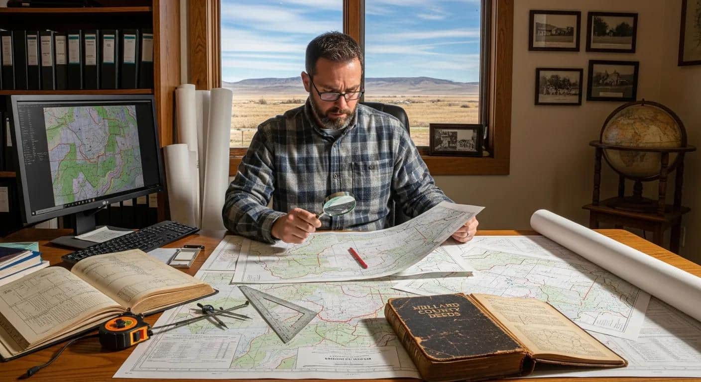
How Do Boundary Surveys Define Property Lines in Fillmore?
A boundary survey determines a parcel’s legal limits by combining record research with precise field measurements to locate monuments and produce a survey plat and legal description. We review deeds, plats, and easements, then work on-site to find or reset corners; when records conflict we reconcile evidence and physical markers to reach a defensible conclusion. Deliverables normally include a stamped plat, monument coordinates, and a written legal description suitable for recording or conveyance. Property owners use boundary surveys for sales, fence placement, dispute resolution, and planning improvements.
- Boundary surveys resolve unclear corners by documenting evidence and setting defensible monumentation.
- Accurate plats protect against encroachments and support informed negotiations in transactions.
- Local recorder familiarity speeds interpretation of historical records and helps locate legacy monuments faster in Fillmore.
These results reduce title risk and establish a clear, documented starting point for any improvements or transfers.
Why Are ALTA/NSPS Land Title Surveys Essential for Commercial Properties?
ALTA/NSPS surveys follow nationally recognized standards and add title-related detail — easements, improvements, access, and lender-required certifications — to a boundary determination. Lenders and title insurers use ALTA surveys to evaluate what will be insured on a commercial property. An ALTA survey typically involves coordination with title companies, specific certification language, and a plat showing improvements, rights-of-way, and recorded encumbrances. For commercial buyers, lenders, and investors in Fillmore, an ALTA survey reduces transaction risk by clarifying insurable interests.
- ALTA surveys are more comprehensive than standard boundary surveys and are often required for financing.
- Early coordination with title insurers during scoping ensures the final product meets lender expectations.
- In Fillmore commercial transactions, an ALTA survey supports due diligence, financing, and closing certainty.
Our in-house team coordinates ALTA workflows and communicates with title and lending partners to streamline delivery and compliance.
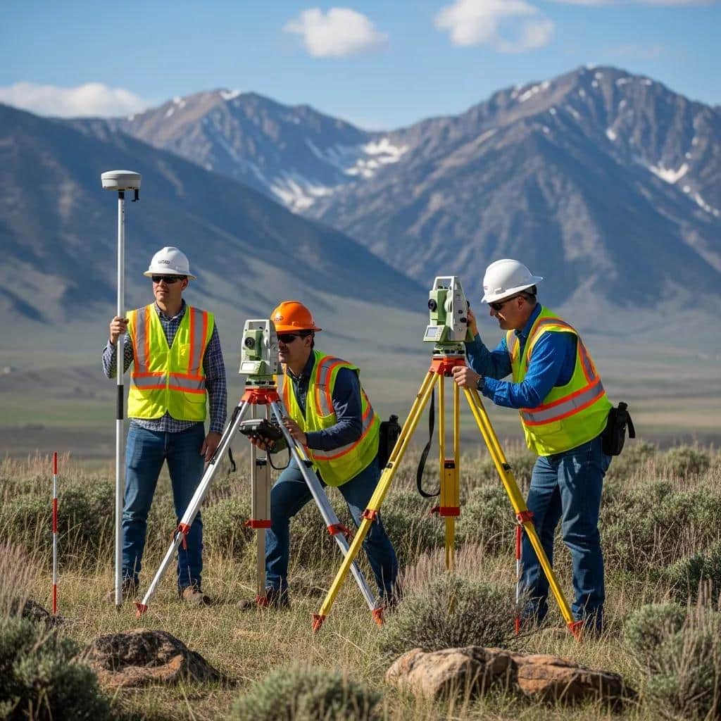
How Do Topographic Surveys Support Accurate Site Planning in Fillmore?
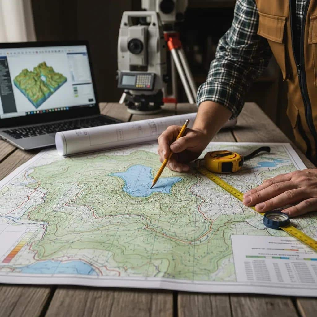
Topographic surveys record the land’s three-dimensional shape — contours, spot elevations, and visible features like trees, fences, and utilities — which designers use for grading, drainage, and site layout. We collect field data with total stations, GNSS, or aerial methods and convert measurements into contour maps and digital elevation models. For Fillmore projects, topographic detail helps address drainage concerns related to local soils and supports compliance with county grading and stormwater rules. For more detailed information, visit our topographical survey page.
- Deliverables include contour maps, spot elevations, and feature tables compatible with civil design software.
- Accurate topography reduces redesign by revealing slope, drainage routes, and constraint zones early.
- UAV aerial capture can speed mapping of larger or complex parcels while maintaining accuracy.
Topographic surveys give engineers the geometric baseline needed to develop practical, cost-effective site plans.
What Are FHA Foundation Inspections and Their Role in Manufactured Homes?
FHA foundation inspections confirm that a manufactured home’s foundation and installation meet HUD/FHA standards required for FHA mortgage insurance. Inspections measure foundation elevations, verify anchoring and supports, and document compliance with lender checklists. These reports enable FHA-insured loans and protect lenders by confirming the home is properly sited and supported. In many Fillmore-area placements, an FHA foundation inspection is a mandatory step to secure FHA financing.
- Reports include measured elevations, photos, and a signed verification suitable for lender review.
- Inspections reduce financing risk by confirming the foundation meets FHA minimums.
- Timely inspections help close manufactured-home transactions faster by providing lender-required evidence.
Ludlow Engineers performs these inspections and prepares the documentation lenders expect for FHA-backed loans.
How Does Civil Engineering Support Land Development Projects in Fillmore?
Civil engineering turns survey data into buildable plans — grading, utilities, stormwater management, and subdivision layouts that meet local standards. Survey contours and feature mapping are the input for calculations that size pipes, set slopes, and determine grading volumes. Engineers produce construction drawings, specifications, and permit-ready packages that bridge the gap from survey to construction. For Fillmore projects, integrated survey-and-engineering workflows reduce rework by ensuring survey deliverables match engineering tolerances and regulatory expectations.
- Civil deliverables include site plans, grading and drainage plans, utility layouts, and permit exhibits.
- Early coordination between survey and engineering reduces the chance of missing critical constraints.
- Combined workflows support compliance with Millard County permitting and infrastructure standards.
This integration speeds approvals and improves construction accuracy, lowering cost and schedule risk.
How Much Does a Land Survey Cost in Fillmore Utah?
Short answer: costs vary by survey type and site conditions. Boundary surveys typically fall in the lower–mid range, ALTA/NSPS surveys cost more because of title coordination, and topographic pricing depends on acreage and detail. Key price drivers include property size, terrain, built improvements, record complexity, and required deliverables. The table below gives typical ranges and common factors to help you estimate and plan.
Remember: price reflects scope and site complexity rather than a fixed fee. The more complex the records and the site, the higher the effort and cost.
What Factors Influence Land Survey Pricing in Fillmore?
Understanding cost drivers helps you get accurate quotes. Important factors include parcel size, terrain and access, existing improvements that need locating, and the level of certification or deliverables required. Heavily vegetated lots or parcels with many structures need more field time; ambiguous record evidence increases research time and legal-description work. Seasonal access and weather in Millard County can also affect scheduling and price.
- Parcel acreage increases field time and data processing needs.
- Terrain and vegetation raise the effort required for accurate measurements.
- Survey type (boundary vs. ALTA vs. topo) establishes baseline scope and documentation needs.
Knowing these variables helps you scope surveys wisely and request quotes that match your project’s purpose.
How Can You Request a Free Land Survey Quote from Ludlow Engineers?
To get a free quote, gather basic property details and reach out so we can scope the work to your needs. Provide the property address or parcel number, the survey type you need (boundary, ALTA, topographic, FHA foundation inspection), any prior surveys or plats, and preferred deliverables such as stamped plats or digital files. Call Ludlow Engineers and Associates at (435) 623-0897; we’ll scope the job, explain typical timelines, and identify what might change the estimate. Expect a prompt follow-up that outlines next steps, access needs, and what we’ll include in a written proposal.
- Provide property location, parcel number, and any prior survey documents.
- Specify the survey purpose and desired deliverables to align scope.
- Contact the office by phone to schedule access and receive a written scope with an estimated turnaround.
A clear, itemized quote reduces surprises and sets expectations for field scheduling, permitting coordination, and final deliverables.
What Is the Land Surveying Process with Ludlow Engineers in Fillmore Utah?
Our typical workflow starts with a scoped proposal, followed by public-record research, field measurement, drafting with internal quality control, and final delivery of stamped plats or reports. Each phase has a clear purpose: scoping defines scope and cost, research uncovers legal evidence, fieldwork captures current site geometry, drafting organizes results into legal documents, and QC verifies accuracy before delivery. The process balances legal defensibility and practical construction needs so final products support sales, design, or permitting.
Total time depends on complexity — small residential lots with clear records finish faster, while ALTA or subdivision projects need more coordination.
What Are the Key Steps from Initial Quote to Survey Completion?
Completion follows a predictable path: initial consultation and scope definition, targeted record research, focused fieldwork to collect coordinates and locate monuments, then drafting, internal quality control, and final stamping and delivery. During scoping we clarify deliverables, schedule access, and note any lender or title requirements. Research reconciles deeds and recorded plats to guide fieldwork. After fieldwork, we draft the plat and legal description and a licensed surveyor reviews everything before issuance to ensure legal defensibility and technical accuracy.
- Client tasks often include providing access, prior surveys, and parcel identifiers.
- Licensed sign-off and internal QC reduce errors before recording or use in design.
- The timing between fieldwork and drafting depends on data processing and review cycles.
Clear communication at each step shortens timelines and keeps expectations aligned.
How Does Ludlow Ensure Accuracy and Customer Satisfaction?
We maintain layered quality control: licensed surveyor review, redundant field checks, and standardized drafting procedures that compare field notes to record evidence. A licensed professional verifies monument positions, coordinate calculations, and the legal description before we release documents. We keep clients informed with progress updates, offer review opportunities, and conduct a final deliverable review to answer questions. These practices reduce rework, support defensible boundary opinions, and ensure deliverables meet client and regulatory needs.
- Licensed oversight provides professional accountability for final documents.
- Redundant field verification catches discrepancies before drafting begins.
- Client review meetings clarify results and next steps, improving satisfaction and usability of deliverables.
Our quality-first approach gives clients confidence that survey work will hold up during transactions, permitting, and construction.
What Are Common Questions About Land Surveying in Fillmore Utah?
Property owners often ask about timelines, permits, what information to provide for quotes, and how surveys prevent disputes. The short Q&A pairs below address these common concerns with practical, Fillmore-focused answers.
- How Long Does a Typical Land Survey Take in Fillmore?: For a typical residential boundary survey, expect one to three weeks from scoping to delivery when records are straightforward; ALTA or subdivision work can take longer because of title coordination and approvals. Weather, access, and record complexity are the main schedule variables.
- Do You Need Permits for Land Surveys in Fillmore Utah?: Surveys alone usually do not require permits, but related construction, grading, or subsurface work does. If construction follows the survey, confirm permit needs with Millard County.
- What Information Is Needed to Get an Accurate Survey Quote?: Provide parcel identifiers, the property address, the survey’s purpose (sale, construction, financing), any prior plats, and access notes so we can prepare a scoped quote.
- How Does a Land Survey Prevent Property Disputes in Fillmore?: A professional survey creates recorded plats and monumentation that serve as legal boundary evidence; precise documentation and set monuments reduce ambiguity and support dispute resolution.
How Long Does a Typical Land Survey Take in Fillmore?
A residential boundary survey in Fillmore often completes in one to three weeks when records are clear and access is available. Small topographic jobs can be faster, while ALTA or complex surveys require extra time for title coordination. Fieldwork windows depend on access and weather; review cycles depend on required certifications and client approvals. Projects tied to financing or permitting should allow additional time for title company review and agency comments.
- Simple residential boundaries: 1–3 weeks.
- ALTA and commercial scopes: several weeks to months depending on coordination needs.
- Weather and record complexity are common sources of delay.
Do You Need Permits for Land Surveys in Fillmore Utah?
Survey-only work is typically permit-exempt. However, setting permanent monuments in public rights-of-way, performing subsurface investigations, or beginning construction based on survey results can trigger permits. When surveys lead to construction, grading, or utility work in Fillmore, check with Millard County permitting offices to verify submittal requirements. Keeping surveying separate from construction helps avoid unnecessary regulatory steps.
- Survey-only work: usually permit-exempt.
- Construction or grading following a survey: may require permits.
- Always verify specific requirements with local authorities before starting construction.
What Information Is Needed to Get an Accurate Survey Quote?
To prepare a reliable quote, we need parcel identifiers, the intended survey type, desired deliverables (stamped plat, digital files), and any known site constraints or prior documents. Supplying previous surveys, deed references, and access instructions reduces discovery time and yields a more precise estimate. Clear scope definition minimizes change orders and clarifies whether extra tasks like easement searches or ALTA coordination are required.
- Essential items: parcel number, property address, desired survey type.
- Helpful items: prior plats, deed references, access instructions.
- Specify deliverables to match intended use and cost expectations.
How Does a Land Survey Prevent Property Disputes in Fillmore?
Surveys prevent disputes by creating recorded legal descriptions and physical monuments that define ownership limits with professional, date-stamped evidence. When corners are monumented and plats are recorded, parties gain clear reference points for setbacks, fences, and development boundaries. A professional survey before sale or improvement often eliminates surprise encroachments and provides documentation that holds up in mediation or court if needed.
- Recorded plats and monuments serve as authoritative boundary evidence.
- Pre-sale or pre-construction surveys reduce transaction surprises.
- Professional documentation supports efficient dispute resolution.
What Do Clients Say About Ludlow Engineers’ Land Surveying Services in Fillmore Utah?
Clients in Fillmore and across Millard County praise timely delivery, clear documentation, and the value of combined survey and engineering services for development work. Project summaries emphasize outcomes such as accurate subdivision plats, lender-ready ALTA surveys for commercial closings, and FHA foundation verification that enabled manufactured-home financing. These examples show how professional surveying supports transactions, permitting, and construction with measurable results.
- Timely Delivery: Clear scoping, staged communication, and dependable fieldwork help clients meet closing and permitting deadlines.
- Accurate Documentation: Stamped plats and precise legal descriptions reduce follow-up questions and support title processing.
- Integrated Services: Combined surveying and civil engineering streamline design workflows and cut coordination delays.
Which Fillmore and Millard County Projects Showcase Our Expertise?
Representative projects include subdivision layouts where survey data shaped lot geometry and infrastructure routing, ALTA surveys that supported commercial financings, and FHA foundation inspections that enabled manufactured-home placements. Each required knowledge of local records, precise field measurement, and coordination with lenders or authorities to produce compliant deliverables focused on reducing risk and enabling financing or construction.
- Subdivision design used survey baselines to organize lots and infrastructure.
- ALTA surveys clarified title matters and met lender requirements for commercial deals.
- FHA foundation inspections produced lender-ready documentation for manufactured-home financing.
How Have Clients Benefited from Our Professional Land Surveying?
Clients see lower transaction risk, fewer permitting delays, and improved construction accuracy that reduces rework. Professional surveys supply authoritative boundary evidence and usable engineering data so buyers, lenders, and contractors can make confident decisions. The overall effect is smoother projects, clearer legal standing, and faster progress from planning to construction or closing.
- Reduced transaction risk through authoritative boundary documentation.
- Faster permitting and construction thanks to precise site data and integrated engineering support.
- Fewer disputes and less rework by establishing clear, recorded site conditions before improvements.
To stay informed on industry updates, project spotlights, and practical guides on surveying and civil engineering, visit the Ludlow Engineers blog for further reading and expert perspectives relevant to Fillmore and beyond.
Frequently Asked Questions
What types of land surveying services are most commonly requested in Fillmore?
In Fillmore, the most requested services are boundary surveys, ALTA/NSPS land title surveys, topographic surveys, FHA foundation inspections, and subdivision design. Each service answers a specific need — establishing property lines, meeting lender requirements, or providing site detail for construction — and choosing the right type ensures regulatory compliance and smoother transactions.
How can I prepare for a land survey on my property?
Gather prior surveys, deeds, and plats if you have them, provide clear property access, and tell us about known boundaries, easements, or encroachments. Marking visible features can speed fieldwork. Clear communication about the survey’s purpose and any special requirements helps ensure an efficient, accurate process.
What should I expect during the land surveying process?
Expect an initial consultation and scope, public-record research, on-site measurements, drafting of the survey documents, and final delivery. We’ll assess your needs, collect field data, and compile a plat or report that documents findings. We keep clients informed throughout and flag any issues that may affect schedule or cost.
Are there any specific local regulations I should be aware of for land surveying in Fillmore?
Local rules in Fillmore and Millard County can affect surveying practice. While surveys themselves usually don’t need permits, subsequent construction or grading may. Be mindful of zoning, easements, and permit processes and consult a local surveyor to ensure compliance and avoid delays.
How can land surveying help in property dispute resolution?
Surveying provides clear, documented evidence of boundaries. A professional survey creates legal descriptions and physical monuments that define ownership limits — documentation that’s persuasive in negotiations and in court. Recording a survey often resolves ambiguity and speeds dispute resolution.
What are the benefits of using a local surveying company like Ludlow Engineers?
Working with a local firm brings familiarity with county records, local regulations, and site conditions. Our knowledge of Millard County’s processes streamlines research and permit coordination, and local relationships with authorities can speed approvals. Choosing a local expert delivers tailored, compliant survey results that reflect the area’s unique characteristics.
**