Surveying is an ever-evolving field, constantly embracing cutting-edge tools and technologies. Today, we’re seeing a remarkable shift as surveyors adopt innovations from various industries to enhance their work. One game-changing tool you need to consider is UAV aerial surveying. This revolutionary approach combines the precision of traditional methods with the efficiency of drone technology, opening up new possibilities for land owners across Utah.
What Is a UAV (Unmanned Aerial Vehicle) and Its Role in Surveying?What Is a UAV?
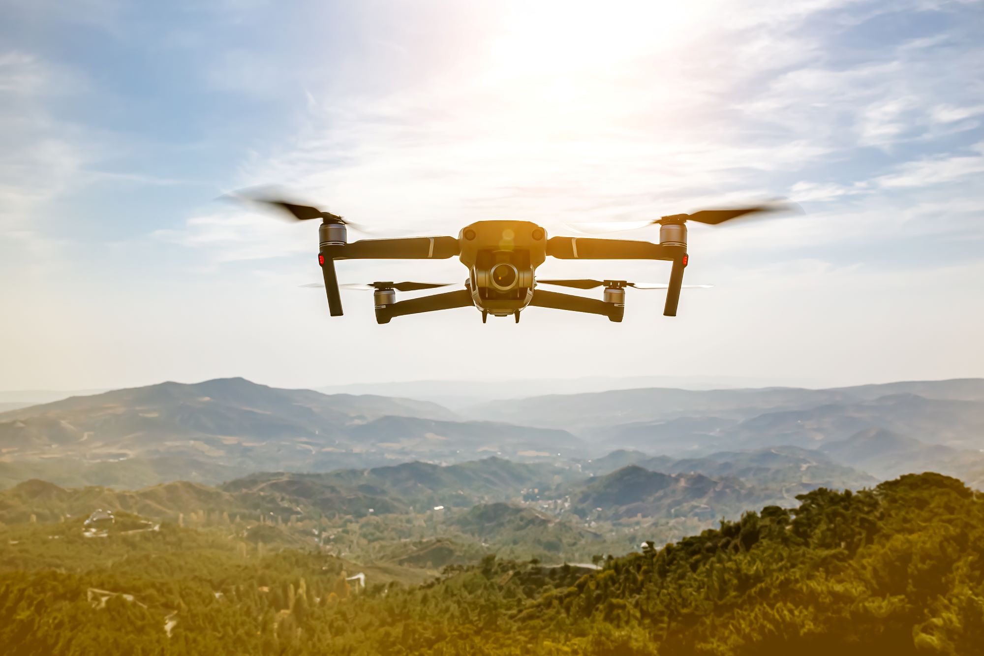
UAVs, or Unmanned Aerial Vehicles, are known as drones. These aerial marvels have transformed numerous industries, and land surveying is no exception. UAVs come in various shapes and sizes, each designed for specific tasks. In mapping and surveying, certain UAV models excel at capturing high-resolution imagery and precise spatial data. These aerial powerhouses can cover vast areas quickly, accessing hard-to-reach locations with ease. By integrating advanced sensors and cameras, UAVs provide surveyors with an unparalleled bird’s-eye view of the land, revolutionizing how we collect and analyze survey data.
Types of UAVs Used
Fixed-wing UAVs resemble miniature airplanes and are ideal for covering large areas efficiently. They can stay airborne for extended periods, making them perfect for surveying expansive properties or linear features like roads and pipelines. These UAVs use their wings for lift, allowing them to glide and conserve energy during flight.
Multi-rotor UAVs look more like traditional drones with multiple propellers. They offer exceptional maneuverability and stability, making them ideal for detailed inspections and surveys of smaller areas or complex structures. Multi-rotors can hover in place, allowing for precise data collection and high-resolution imagery.
Hybrid UAV drones combine the best of both worlds, featuring fixed wings for efficient long-distance flight and rotors for vertical takeoff and landing. These versatile machines are gaining popularity in the surveying industry due to their ability to handle many different projects.
What is UAV Aerial Surveying?
UAV (Unmanned Aerial Vehicle) aerial surveying, also known as drone surveying, involves the use of drones equipped with cameras, LiDAR sensors, or other remote sensing equipment to capture aerial images and data of the land below. These images and data are then processed to create detailed maps, 3D models, and other geographic information products. UAV aerial surveying has revolutionized the surveying industry by offering a faster, more cost-effective, and safer alternative to traditional surveying methods.
How UAV Aerial Surveying Works
UAV aerial surveying harnesses the power of drone technology to collect accurate survey data from above. The process begins with flight planning, where surveyors map out the area to be covered and set parameters for the UAV’s flight path. Ground control points are established to enhance accuracy and provide a reference for data processing.
Once airborne, the UAV captures high-resolution imagery and collects spatial data using onboard sensors. This data is then processed using specialized drone mapping software, which stitches together the images and creates detailed 3D models, digital terrain models, and orthomosaic maps. These outputs provide a comprehensive view of the surveyed area, offering insights that traditional survey methods might miss. The result is a rich dataset that can be used for various applications, from land development planning to environmental monitoring.
Our process is as follows:
Planning: The process begins with planning the flight path of the UAV. Surveyors use specialized software to define the area to be surveyed and create a flight plan that ensures complete coverage of the target area.
Data Collection: The UAV follows the pre-defined flight path, capturing high-resolution images or LiDAR data. These drones are equipped with GPS systems that allow them to follow precise routes and maintain consistent altitude.
Data Processing: The collected data is processed using software that stitches the images together to create ortho mosaic maps, 3D models, and other survey products. LiDAR data is processed to generate highly accurate 3D point clouds.
Analysis and Delivery: Surveyors analyze the final products and deliver them to clients in various formats, depending on their needs. These products can include topographic maps, volumetric measurements, and detailed 3D models.
The Biggest Benefits of UAV Aerial Surveying
UAV aerial surveying has become a crucial tool for many property owners and developers because of its far-reaching impact and ability to unlock new possibilities. This innovative approach to data collection and analysis has transformed how we view and interact with land, offering benefits far beyond traditional surveying methods.
Here are some key advantages of UAV aerial surveying:
Faster data collection compared to traditional methods
Access to hard-to-reach or dangerous areas
Highly accurate and detailed survey results
Cost-effective for large-scale projects
Ability to generate 3D models and digital terrain maps
Reduced environmental impact and land disturbance
Regular monitoring and tracking of changes over time
Enhanced visualization for project planning and design
Improved safety for surveyors and field personnel
Integration with other geospatial technologies for comprehensive analysis
Applications of UAV Aerial Surveying
Residential Clients
For residential clients, UAV aerial surveying can be immensely helpful in several ways:
Property Surveys: Drones can quickly and accurately survey residential properties, providing detailed maps and 3D models. This information is useful for property owners, real estate agents, and potential buyers.
Inspection and Maintenance: UAVs can inspect roofs, chimneys, and other hard-to-reach areas without the need for ladders or scaffolding. This is especially useful for identifying damage or maintenance needs.
Landscaping and Planning: Homeowners and landscapers can use aerial data to plan landscaping projects, ensuring optimal use of space and resources.
Security and Monitoring: Drones can provide aerial views of properties for security purposes, monitoring for intruders, and assessing property boundaries.
Commercial Clients
Commercial clients can benefit from UAV aerial surveying in several ways:
Construction Site Surveys: Drones can monitor construction sites, track progress, and provide up-to-date maps and models. This helps in project management, ensuring construction stays on schedule and within budget.
Building Inspections: Commercial buildings can be inspected using drones, identifying structural issues, roof damage, and other maintenance needs without disrupting operations.
Marketing and Real Estate: High-quality aerial images and videos can be used in marketing materials for commercial properties, showcasing them to potential buyers or tenants.
Asset Management: Companies can use UAV surveys to manage large assets like industrial plants, warehouses, and shopping centers, ensuring they are maintained and utilized efficiently.
Multi-Family Developers
For developers of multi-family housing, UAV aerial surveying offers several advantages:
Site Selection and Planning: Drones can survey potential sites, providing detailed topographic maps and 3D models. This helps developers assess the suitability of a site and plan the layout of buildings and infrastructure.
Construction Monitoring: UAVs can monitor construction progress, providing regular updates and identifying any issues that need to be addressed. This ensures projects stay on track and within budget.
Marketing: Aerial images and videos can be used in marketing materials to showcase multi-family developments, attracting potential buyers or tenants.
Property Management: Once a development is complete, drones can be used for regular inspections and maintenance, ensuring the property remains in good condition.
Subdivision Developers
Subdivision developers can also benefit from UAV aerial surveying:
Pre-Development Surveys: Drones can provide detailed surveys of potential subdivision sites, including topographic maps, soil analysis, and environmental assessments. This helps developers make informed decisions about site selection and design.
Infrastructure Planning: UAV data can be used to plan roads, utilities, and other infrastructure, ensuring efficient and cost-effective development.
Progress Monitoring: Drones can monitor the progress of subdivision development, providing regular updates and identifying any issues that need to be addressed.
Marketing and Sales: High-quality aerial images and videos can be used in marketing materials to showcase subdivision developments, attracting potential buyers.
How Does Drone Mapping Work?
While closely related, drone mapping and drone surveying serve distinct purposes in geospatial data collection. Drone mapping focuses on creating visual representations of an area, such as orthomosaic maps and 3D models. This process involves capturing overlapping images of the ground and using photogrammetry software to stitch them together into a cohesive map. The resulting drone maps provide a detailed visual overview of the land, highlighting features, topography, and structures.
Drone surveying, on the other hand, goes a step further by collecting precise measurements and spatial data. It incorporates additional techniques like LiDAR scanning and RTK (Real-Time Kinematic) positioning to gather highly accurate elevation data and create digital surface models. This level of detail is crucial for tasks like volume calculations, contour mapping, and site planning. Both drone mapping and surveying leverage drone technology to provide valuable insights, but the choice between them depends on the specific needs of your project and the level of accuracy required. See how Ludlow Engineering can use drone mapping technology and drone surveying techniques to provide effective solutions for you.
Case Studies and Examples
READ MORE
Residential Property Survey
A homeowner in a suburban area wanted to sell their property and needed an accurate survey to determine the property boundaries and assess the condition of the roof and other structures. A UAV aerial survey was conducted, providing detailed maps and a 3D model of the property. The homeowner used this information to make necessary repairs and provided potential buyers with accurate property details, resulting in a quicker sale.
Commercial Construction Monitoring
A construction company working on a large commercial development used UAV aerial surveying to monitor progress and manage the project. The drones provided regular updates, identifying any deviations from the plan and allowing the company to address issues promptly. This ensured the project stayed on schedule and within budget, saving the company time and money.
Multi-Family Development Planning
A developer planning a new multi-family housing project used UAV aerial surveying to assess potential sites. The drones provided detailed topographic maps and 3D models, helping the developer select the best site and plan the layout of the buildings and infrastructure. This ensured the project was designed efficiently, maximizing the use of space and resources.
Subdivision Development
A subdivision developer used UAV aerial surveying to conduct pre-development surveys and plan infrastructure. The drones provided detailed data on the site, including topographic maps and environmental assessments. This information was used to design roads, utilities, and other infrastructure, ensuring efficient and cost-effective development. The developer also used aerial images and videos in marketing materials, attracting potential buyers to the subdivision.
Future of UAV Aerial Surveying
The future of UAV aerial surveying looks promising, with advancements in technology continuing to improve the capabilities and applications of drones. Some trends and developments to watch for include:
Improved Sensors: Advances in camera and sensor technology will result in even higher-resolution images and more accurate data.
Autonomous Drones: Increased autonomy will allow drones to conduct surveys with minimal human intervention, further reducing costs and improving efficiency.
AI and Machine Learning: The use of AI and machine learning in data processing will enable faster and more accurate analysis of survey data.
Regulatory Changes: As regulations surrounding drone use evolve, UAV aerial surveying will become more accessible and widely adopted.
Ludlow Engineering: Helping You With Our UAV Aerial Surveying and Mapping in Utah
UAV aerial surveying is a powerful tool that offers numerous benefits for residential clients, commercial clients, multi-family developers, and subdivision developers. By providing accurate, cost-effective, and timely data, UAV surveys can improve decision-making, enhance project management, and support marketing efforts. As technology continues to advance, the capabilities and applications of UAV aerial surveying will only grow, making it an essential tool for the surveying and development industries.
Speak with Ludlow Engineering today for advanced aerial mapping. We have access to the best drone mapping software and tools that aid our construction experts on our quest for the most useful and impactful drone data. We also provide:
How accurate are UAV surveys compared to ground surveys?
UAV surveys are often as accurate as ground surveys, typically achieving a precision of within 1 to 3 centimeters, depending on the technology used and environmental conditions. This makes them a reliable alternative for many surveying applications.
What can be captured during an UAV survey?
UAV surveys can capture high-resolution aerial imagery, topographical data, 3D models, and thermal images. These outputs enable precise analysis and mapping for a variety of applications, including construction, land assessment, and environmental monitoring.
How accurate is UAV survey?
UAV surveys offer exceptional accuracy, typically achieving horizontal precision within 1-3 cm and vertical precision within 3-5 cm, depending on the equipment and conditions, making them a reliable choice for precise mapping and data collection.
How to get a commercial UAV survey license?
To obtain a commercial UAV survey license, you must complete the FAA's Remote Pilot Certification process, which includes passing a written exam, meeting specific eligibility requirements, and registering your drone with the FAA.
What equipment is used for UAV surveying?
The equipment used for UAV surveying includes drones equipped with high-resolution cameras, LiDAR systems, GPS units, and various sensors, all of which enable accurate data collection and mapping for diverse surveying applications.
How do UAV surveys enhance mapping accuracy?
UAV surveys enhance mapping accuracy by employing high-resolution imagery and advanced GPS technology to capture detailed terrain data. This allows for precise measurements and accurate modeling, resulting in reliable maps that are essential for effective project planning and execution.
What industries benefit from UAV aerial surveys?
Numerous industries benefit from UAV aerial surveys, including construction, agriculture, real estate, environmental monitoring, and mining. These sectors use UAV technology for precise mapping, data collection, and enhanced project management, driving efficiency and cost savings.
What data can UAV surveys provide?
UAV surveys can provide a variety of data, including high-resolution aerial imagery, 3D terrain models, topographical maps, and volumetric measurements, enabling precise analysis for planning, development, and environmental assessments across various sectors.
How is UAV survey data processed?
UAV survey data is processed through a series of steps involving data acquisition, photogrammetry, and GIS software analysis to transform aerial imagery into detailed maps and models, ensuring accuracy and actionable insights for various projects.
What are the limitations of UAV surveys?
The limitations of UAV surveys include restrictions on flight height and distance, reliance on weather conditions, battery life constraints, and potential regulatory issues that may affect data collection in certain areas.
How to choose a UAV surveying company?
Choosing a UAV surveying company involves assessing their experience, technology, and certifications. Look for a provider with a proven track record, high-quality equipment, and comprehensive services that align with your specific project needs.
What regulations govern UAV surveying operations?
The regulations governing UAV surveying operations primarily include the Federal Aviation Administration (FAA) guidelines, which address aspects such as pilot certification, drone registration, and airspace restrictions to ensure safe and compliant use of drone technology in various surveying applications.
What is the cost of UAV surveying services?
The cost of UAV surveying services varies based on factors like project size, location, and specific requirements. At Ludlow Engineers, we provide competitive pricing tailored to ensure quality and efficiency in data collection. Please contact us for a personalized quote.
How to prepare for a UAV survey?
Preparing for a UAV survey involves several key steps: determine the survey area, obtain necessary permissions, ensure the site is clear of obstacles, and review any specific requirements for data collection.
What types of drones are best for surveying?
The types of drones best for surveying are typically multirotors and fixed-wing drones. Multirotors are ideal for capturing detailed images in smaller areas due to their maneuverability, while fixed-wing drones excel in covering larger expanses efficiently.
How does weather affect UAV survey results?
Weather significantly impacts UAV survey results by affecting visibility, drone stability, and sensor accuracy. Poor conditions like rain, high winds, or extreme temperatures can lead to reduced data quality and hinder the effectiveness of aerial surveys.
What software is used for UAV data analysis?
The software used for UAV data analysis includes specialized programs like Pix4D, Drone deploy, and Agisoft Metashape, which enable users to process, analyze, and visualize aerial data for accurate mapping and surveying results.
How often should UAV surveys be conducted?
The frequency of UAV surveys depends on project needs and changes in land use. Typically, they are conducted annually, but more frequent surveys may be necessary for active construction sites or when significant alterations occur.
What training is required for UAV operators?
UAV operators require specialized training that includes understanding aviation regulations, proficiency in piloting drones, and knowledge of data collection techniques. Certification from authorized bodies, such as the FAA, is also essential for safe and effective UAV operation.
What are the safety protocols for UAV surveys?
The safety protocols for UAV surveys involve conducting pre-flight checks, maintaining visual line-of-sight during operations, adhering to local regulations, and implementing risk assessment procedures to ensure safe and efficient drone usage.
How do UAV surveys compare to traditional methods?
UAV surveys offer significant advantages over traditional methods by providing faster data collection, enhanced accuracy, and cost-effectiveness. Drones can access hard-to-reach areas and capture high-resolution imagery, leading to more detailed and reliable results.
What innovations are emerging in UAV surveying?
Innovations emerging in UAV surveying include advanced sensor technology, enhanced imaging capabilities, and real-time data processing. These advancements improve accuracy, efficiency, and the versatility of applications in various sectors, making UAV surveying an increasingly valuable tool for data collection and analysis.
What is the typical duration of a UAV survey?
The typical duration of a UAV survey varies based on factors like the project's size, complexity, and specific requirements. Generally, a UAV survey can be completed within a few hours to a few days, offering quick and efficient results.
How to interpret UAV survey results accurately?
Interpreting UAV survey results accurately involves analyzing the data in relation to project objectives, verifying the outputs against established benchmarks, and utilizing appropriate software tools to visualize and assess the findings comprehensively for informed decision-making.
What are the environmental impacts of UAV surveys?
The environmental impacts of UAV surveys are minimal, as these drones reduce the need for extensive ground disturbance and minimize the carbon footprint associated with traditional surveying methods. Additionally, they allow for efficient data collection without harming ecosystems.
How is UAV survey data shared with clients?
UAV survey data is shared with clients through secure digital platforms, including cloud storage services and online portals, ensuring easy access to detailed reports, maps, and 3D models tailored to their specific needs.
What advancements in UAV technology are expected?
Advancements in UAV technology are expected to include enhanced battery life, improved artificial intelligence for autonomous navigation, higher resolution cameras, and more robust data processing capabilities, all contributing to more efficient and precise aerial surveying and mapping services.
How reliable are UAV surveys for construction projects?
UAV surveys are highly reliable for construction projects, offering accurate data collection that enhances planning and execution. With advanced technology, they minimize human error and provide timely insights, ensuring efficient project management and informed decision-making.
What types of projects use UAV surveying?
Various projects utilize UAV surveying, including construction site assessments, land surveying, environmental monitoring, agricultural analysis, and infrastructure inspections. These applications benefit from the precision and efficiency that drone technology provides, making it a valuable tool across multiple industries.
How to find licensed UAV survey operators?
To find licensed UAV survey operators, search for certified professionals through industry directories or local UAV organizations, and verify their credentials and experience by reviewing their past projects and client testimonials.
types of drone survey, uav aerial surveying, uav survey, unmanned aerial surveying, uav aerial survey, uav for surveying and mapping