
Provo Land Surveying Companies: How to Choose the Right Land Surveyor in Provo, Utah
Finding a qualified Provo land surveying company can mean the difference between a smooth closing, a permit that moves quickly, and an avoidable boundary dispute. This guide walks through how Provo survey firms operate, the services they offer, and practical steps property owners and developers should take to hire the right surveyor. You’ll learn the common survey types used in Provo, how methods and deliverables differ, and what factors drive price estimates so you can secure a land survey in Provo, Utah, with confidence. We also cover credential checks, scheduling tips, and local contacts — including how to coordinate with title companies and the Utah County Recorder’s Office — so your project or transaction proceeds without surprises.
What Services Do Provo Land Surveying Companies Offer?
Provo land surveyors provide a variety of surveying services that support real estate closings, design and construction, permitting, and dispute resolution. Using precise measurement and mapping techniques, surveyors locate property boundaries, elevations, and improvements and deliver plats, legal descriptions, CAD/GIS files, and field notes. Knowing which service matches your project—boundary surveys for ownership lines, ALTA/NSPS surveys for commercial closings, topographic surveys for design, and construction staking for build accuracy—helps you get accurate quotes and reliable timelines. Below is a concise list of core services with short, practical descriptions.
- Boundary Survey: Confirms property lines and locates monuments to settle ownership questions and disputes.
- ALTA/NSPS Land Title Survey: Delivers comprehensive mapping and certifications that satisfy lenders and title companies.
- Topographic Survey: Captures elevations and surface features to guide site design and grading decisions.
- Construction Stakeout: Places design points in the field so structures and utilities are built to plan.
- As-Built Survey: Records finished conditions and improvements for compliance and records.
- Subdivision/Plat Survey: Lays out lot lines and public improvements for recorded plats and entitlements.
The list above clarifies common deliverables and when to request each survey type; the table below summarizes purposes and typical outputs so you can compare options quickly.
Different survey types serve distinct project needs and produce specific deliverables.
This table shows how each survey type maps to common deliverables and typical schedules, which leads to the next practical question: how much boundary surveys cost and what affects those costs.
What Is a Property Survey and Why Is It Important in Provo?
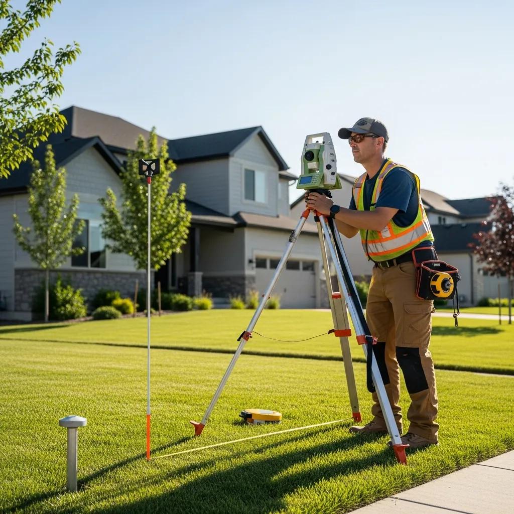
A property survey—commonly called a boundary survey—establishes a parcel’s legal limits by locating corners, monuments, and comparing recorded descriptions. In Provo, a property survey is essential for buying or selling land, resolving neighbor disputes, and obtaining zoning or building permits, because planners and the Utah County Recorder depend on accurate plats and legal descriptions. The process combines field measurements with deed and plat research at the county office and reconciliation against recorded documents. Typical deliverables include a stamped survey plat, a written certificate or report, and geospatial files for architects or engineers. Knowing what’s included helps you gather the right documents for the surveyor and sets clear expectations for onsite work and final deliverables.
Those research and field steps lead directly to understanding when an ALTA survey is required and how it differs from other survey types in Provo.
How Does an ALTA Survey Differ from Other Survey Types in Provo?
An ALTA/NSPS land title survey follows national standards and is built to meet lender and title company needs in commercial or complex transactions, so it’s more comprehensive than a basic boundary survey. ALTAs include specific notes, certifications, and extra searches—such as easements, zoning, and recorded matters—that go beyond standard boundary work and often map utilities and improvements in greater detail. Compared with a topo or simple property survey, ALTA deliverables follow a standardized format for title review and include agreed-upon exceptions and certifications. In Provo transactions, lenders or title insurers may require an ALTA to quantify title risk; confirm that need early so your surveyor can scope research and coordinate with the title company. Knowing these differences prevents scope mistakes and closing delays.
The 2021 ALTA/NSPS Standards added requirements that affect commercial real estate surveys.
2021 ALTA/NSPS Standards: Key Changes for Commercial Real Estate
This guidance summarizes primary changes in the 2021 ALTA/NSPS Minimum Standard Detail Requirements and how they affect commercial real estate surveys and title review.
How Much Does a Boundary Survey Cost in Provo?
Short answer: boundary survey costs in Provo depend on lot size, terrain, research complexity, and the amount of improvements on the site. Many residential surveys fall within modest local ranges while commercial or ALTA surveys cost more because of expanded scope. Key cost drivers include acreage, time spent at the Utah County Recorder’s Office researching records, fences or structures to locate, site access, and required deliverables like legal descriptions or CAD files. When you ask “land survey cost Provo,” provide the property address, deed, parcel number, and any prior surveys to get the most accurate estimate. The table below maps common cost drivers to their typical impact so you can see how property features influence a final quote.
After reviewing cost drivers, the next practical step is assembling the right documents so Provo firms can give accurate estimates and schedule the work promptly.
What Factors Influence Boundary Survey Prices in Provo?
Boundary survey pricing reflects field time, the depth of historical research, and the complexity of drafting and certification required for your project. Lot area scales field time roughly with size, while dense vegetation or steep slopes slow crews and may require specialized equipment—both increase costs. Older properties or parcels with unclear recorded descriptions demand more county research, which raises the research portion of billing. Required deliverables—such as recorded plats, stamped legal descriptions, or geospatial files—add drafting and review time and affect the quote. Understanding these drivers helps you prioritize needs and communicate clearly with surveyors to get realistic price ranges.
These factors show why preparing specific documents speeds quoting and improves price accuracy; the next section explains how to request firm estimates.
How to Get Accurate Boundary Survey Estimates from Provo Companies?
Prepare a concise packet of information before you contact surveyors to speed estimates and reduce uncertainty in quotes. Include the property address or parcel number, the deed or current legal description, any prior surveys or plats you have, and a short description of desired deliverables and timeline. Ask surveyors exactly what their estimate includes—research time, monument recovery, drafting, legal description updates, and any exclusions—and request their turnaround time and how site access or vegetation might change the price. Ask for written estimates with a clear scope statement so you can compare proposals side-by-side and confirm they include certifications or deliverables required by lenders or permitting authorities.
- Gather Documents: Collect the deed, parcel number, prior surveys, and permit requirements before requesting quotes.
- Ask Clear Questions: Confirm what’s included, expected turnaround, and potential extra charges.
- Request Written Scope: Get itemized estimates to compare proposals accurately.
Following these steps improves cost transparency and timing estimates—and helps you decide if a topographic survey is also needed for design or stormwater planning in Provo.
When Do You Need a Topographic Survey in Provo?
Order a topographic survey whenever elevation data and surface features matter for design, drainage, grading, or stormwater planning. A topo maps contours, spot elevations, utilities, and structures so engineers can size infrastructure and design earthwork. In Provo, common uses include new buildings on sloped lots, driveway or retaining wall design, stormwater management plans, and municipal grading permits where terrain affects runoff and erosion control. Topos let engineers calculate cut-and-fill volumes, assess drainage patterns, and locate existing utilities so designs reflect actual site conditions. Understanding what topo data provides and how it’s collected helps you choose a topo over coarse public contour data when needed.
- New residential or commercial building design: When foundations and utilities require precise elevation data.
- Grading and drainage plans: To model stormwater flow and avoid erosion or ponding.
- Driveway, retaining wall, or pool placement: To fit structures to existing grade and prevent drainage conflicts.
Knowing these use cases leads to the question of what specific information a topo includes and how local surveyors capture it.
What Information Does a Topographic Survey Provide for Provo Properties?

Topographic surveys produce contour lines at chosen intervals, spot elevations, and mapped surface features like trees, fences, buildings, and visible utilities so civil designers can model terrain and drainage accurately. Contour intervals balance detail and file size—common intervals range from 1 to 5 feet for detailed site design—while spot elevations record critical points such as high and low spots, curb inverts, and structure corners. The topo also flags surface improvements and potential conflicts with proposed grading, helping engineers size storm drainage systems and design foundations. Deliverables generally include a contour map, labeled features, and digital CAD or GIS files that plug into the design workflow.
These deliverables influence the survey method choice, which the next section compares for typical Provo conditions.
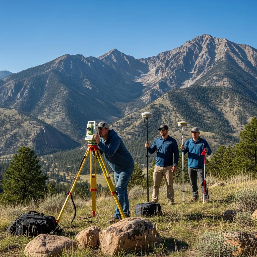
How Do Provo Land Surveyors Conduct Topographic Surveys?
Surveyors select methods—GNSS/GPS, total station, or drone/UAV—based on site size, tree cover, and required accuracy; each method trades speed, resolution, and cost. GNSS is efficient in open areas for rapid coordinate capture; total stations are ideal for precise work in wooded or built-up sites and for establishing control; drones create dense point clouds and orthophotos that speed mapping for larger parcels, though canopy can limit ground visibility. A typical workflow establishes control, collects feature and elevation data in the field, and processes results into contours and CAD deliverables for designers. Choosing the right method reduces field time and ensures deliverables meet engineer and permitting requirements.
Picking the right surveyor means verifying credentials and local experience, which we cover next to help you select a qualified Provo firm.
How to Choose the Right Land Surveyor in Provo, Utah?
Choosing a Provo land surveyor starts with verifying core credentials, confirming local experience, and comparing written deliverables and timelines so you hire a firm that produces accurate plats on schedule. Key items to check include a Utah professional land surveyor (PLS) license, adequate insurance such as general liability and errors & omissions where appropriate, and experience on similar local projects like ALTA surveys, topographic mapping, or construction stakeout. Ask for sample deliverables and references from recent Provo projects to verify quality and responsiveness. Use a simple checklist to compare firms by license verification, insurance, local project experience, turnaround time, and clarity of estimate so you can make a data-driven hire.
- License Verification: Confirm the surveyor is a Utah-licensed PLS and authorized to sign plats.
- Insurance & E&O: Verify they carry adequate liability and professional coverage.
- Local Experience & References: Request recent project samples and client contacts for verification.
After you review credentials and references, request a written proposal and timeline. If you’re ready to proceed, reach out to start the service request. Call for service when you’re ready to schedule an estimate or site visit.
What Credentials and Experience Should Provo Land Surveyors Have?
A reputable Provo land surveyor should hold a current Utah professional land surveyor (PLS) license and show experience performing the survey type you need—ALTA surveys for commercial closings or topographic surveys for site design, for example. Insurance (general liability and errors & omissions) protects both client and surveyor from unexpected issues, and local experience ensures familiarity with county recording practices and municipal permitting. Proficiency with GPS/GNSS, total station workflows, and drone photogrammetry indicates technical capability and modern data delivery in CAD and GIS formats. Reviewing project samples and confirmed references helps ensure their deliverables match the quality and timelines they promise.
Verifying these credentials naturally leads to evaluating reviews and references so you can confirm reliability before awarding work.
How to Compare Reviews and References for Provo Surveying Companies?
When you read reviews, look for consistent praise around timeliness, communication, accuracy of plats, and the firm’s ability to resolve issues—those traits predict a smooth project. Ask references specific questions about adherence to scope, responsiveness during fieldwork, and clarity of deliverables provided to engineers or title companies. Watch for red flags like vague references, mismatched project types, or repeated mentions of missed deadlines. Comparing several firms on documented outcomes and client feedback gives a balanced view to inform your final selection.
With vetting strategies in hand, the next section explains the common survey types offered by Provo firms and how to choose the right one for your needs.
What Are the Common Types of Land Surveys Offered by Provo Companies?
Survey firms in Provo commonly offer boundary surveys, ALTA/NSPS land title surveys, topographic surveys, construction stakeout, as-built surveys, and subdivision/platting services to support transactions, design, and construction. Each survey type serves a specific use case and comes with different documentation standards and delivery formats; choose the survey that matches whether your priority is title risk mitigation, design accuracy, permitting, or construction control. The table below compares survey types, best use cases, and key differences to help you pick the right service.
This comparison clarifies how survey selection aligns with project goals and sets expectations for deliverables and certification needs.
How Does a Boundary Survey Compare to a Property Survey in Provo?
The terms “boundary survey” and “property survey” are often used interchangeably, but the difference is usually scope and deliverables—boundary surveys focus on legal lines and monuments, while property surveys often include mapping of improvements and easements. For Provo transactions, a boundary survey answers ownership questions and supports dispute resolution; a property survey may be requested to show structures, setbacks, and improvements for permitting or sale disclosures. Deliverables reflect those differences: boundary surveys emphasize monuments and legal descriptions, while property surveys include a more descriptive plat with labels for buildings and easements. Ordering the right type ensures the survey meets the legal and practical needs of your project.
This distinction explains why ALTA surveys are often requested for more complex transactions and what benefits they provide.
What Are the Benefits of an ALTA Survey for Provo Real Estate Transactions?
An ALTA/NSPS survey reduces title risk by giving lenders and title companies a standardized, comprehensive map of boundaries, easements, and improvements so potential title exceptions are identified before closing. ALTA surveys include agreed items and certifications that help lender underwriting and title insurance issuance, giving buyers and lenders clearer visibility into encumbrances and physical conditions. For commercial deals in Provo, the extra research and documentation an ALTA requires often prevents post-closing disputes and can accelerate underwriting. While costlier than a basic boundary survey, ALTA benefits usually justify the expense when lenders or title companies require that level of scrutiny.
Where to Find Trusted Provo Land Surveying Companies?
Find reputable Provo surveyors through local channels—referrals from title companies and civil engineers, recommendations from municipal planning departments, and professional association directories. When you contact firms, have the property address, deed or parcel number, project timeline, and desired deliverables ready so calls or emails produce meaningful estimates and schedules. Ask each firm about their field approach, data delivery formats, turnaround, and coordination with title companies or the Utah County Recorder’s Office, then request a written scope and timeline. Call for service or request a quote through the company’s website to start a consultation; the initial call should confirm scope, price drivers, and expected delivery dates.
What Are the Top-Rated Land Surveyors in Provo, Utah?
Top-rated surveyors consistently earn praise for accuracy, timely delivery, clear communication, and successful coordination with title companies and permitting authorities—qualities that matter more than an arbitrary ranking. Verify ratings by reviewing sample deliverables, checking references on similar projects, and confirming license and insurance status with state records. Prefer firms with proven local experience handling Provo terrain, county recording practices, and municipal permitting—local knowledge reduces surprises. Gather comparative quotes from at least three firms and evaluate them by scope clarity, turnaround, and documented experience to choose the best match for your needs.
Those evaluation criteria feed directly into practical steps for contacting and scheduling a survey, which we outline next.
How to Contact and Schedule a Survey with Provo Companies?
When you contact a survey firm, be ready to provide the property address or parcel number, the deed or legal description, a brief summary of project goals, and your desired timeline so the firm can scope fieldwork and research. Use the initial call to confirm required deliverables—such as a stamped survey plat or ALTA certification—and ask about site access, vegetation clearing, and any obstructions that could affect scheduling. Typical timelines range from a few days for simple residential checks to several weeks for ALTA surveys that require research; the firm will advise if an on-site visit is needed before final pricing. Have electronic copies of deeds and prior surveys ready to upload or email when requested to speed quoting and scheduling.
- Provide Key Details: Address, deed, parcel number, and desired deliverables for an accurate quote.
- Confirm Scope & Timing: Ask about turnaround and any on-site constraints that might delay work.
- Prepare Documents: Be ready to send deed, prior surveys, and permitting requirements when requested.
Call for service to arrange a consultation or request a formal estimate; share your project timeline and required deliverables so the surveying team can provide an accurate proposal and scheduling options.
Frequently Asked Questions
What should I consider when hiring a land surveyor in Provo?
Look for proper credentials, local experience, and clear communication. Confirm the surveyor holds a current Utah professional land surveyor (PLS) license and carries adequate insurance. Choose a firm experienced in the survey type you need—ALTA, topo, or construction stakeout—and ask for samples and references to check deliverable quality. Clear expectations about timelines and costs help avoid surprises.
How long does a typical land survey take in Provo?
Timeframes vary with survey type and property complexity. Simple boundary surveys often finish in 1–3 weeks, while ALTA surveys can take 2–4 weeks because of additional research and documentation. Property size, terrain, and historical record searches also affect timing. Always ask the surveyor for an estimated completion date when requesting a quote.
What are the common challenges faced during land surveys in Provo?
Common challenges include difficult terrain, dense vegetation, and unclear historical records. Steep slopes or heavy tree cover slow crews and may require special equipment. Ambiguous or outdated records increase research time at the county office. Access issues like locked gates can also delay fieldwork. Discuss potential obstacles with your surveyor up front to set realistic expectations.
Can I perform my own land survey in Provo?
You can take informal measurements, but only a licensed surveyor can produce legal documents that define property boundaries and meet local requirements. DIY surveys risk inaccuracies and disputes, especially for sales or development. Hiring a qualified surveyor ensures compliance with regulations and gives you reliable records.
What is the difference between a boundary survey and a topographic survey?
A boundary survey establishes legal property lines and locates monuments, which is essential for ownership verification and dispute resolution. A topographic survey maps elevations and surface features and is used for design and construction. Boundary surveys focus on legal descriptions; topographic surveys provide elevation and feature data needed for grading, drainage, and infrastructure planning. Knowing the difference helps you order the right service.
How can I prepare for a land survey in Provo?
Gather relevant documents—property deed, parcel number, and any prior surveys—before contacting firms. Clearly describe your project goals and desired deliverables, and inform the surveyor of any site access issues or obstructions. Being organized helps the surveyor provide an accurate estimate and accelerates the scheduling process.