
Mapleton Land Surveying: Services, Costs, and How to Get Started
Whether you own land, are buying, or are planning construction in Mapleton, Utah, you need clear, practical guidance tied to accurate property data. This guide breaks down what land surveying in Mapleton looks like, why precise surveys matter for closings and permits, and how different survey types deliver legal, design, and construction value. You’ll get an overview of core services—boundary, ALTA/NSPS, topographic, civil site plans, construction staking, and FHA foundation inspections—how local conditions affect cost, and where zoning or title issues change a survey’s scope. We also explain how boundary surveys help resolve disputes, how ALTA surveys connect to title insurance, and how topo and site surveys support development. Practical tips show how to request a survey in Mapleton and answer common buyer and homeowner questions, with checklists and comparison tables to speed decisions. Throughout, the focus is on concrete steps, local regulatory connections, and modern survey methods like UAV/drone mapping, GNSS, and CAD deliverables.
What Land Surveying Services Are Available in Mapleton, Utah?
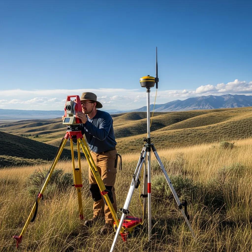
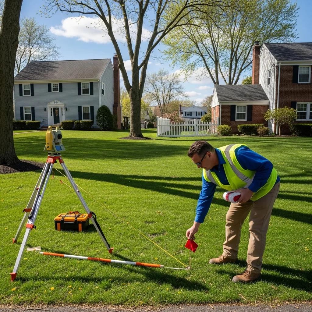
In Mapleton, land surveying establishes property limits, maps on-site features, and provides the measured base for design, permitting, title work, and construction. Survey teams combine records research with field measurement using total stations and GNSS, then deliver stamped plats, CAD files, and 3D models that produce legal descriptions and accurate maps. Typical services for Mapleton projects include boundary surveys to define property lines, ALTA/NSPS surveys for commercial transactions, topographic surveys for site design, civil site plans for permitting, construction staking to guide builders, and FHA foundation inspections for residential financing. Knowing these services helps property owners pick the right scope and ensures deliverables meet Mapleton City Planning and Utah County Assessor expectations. The section below lists each service, when to use it, and the common deliverables to guide your choice.
Which Types of Land Surveys Are Offered in Mapleton?
Boundary surveys establish legal property edges through deed and plat research, monument location, and measured lines—used for sales, fences, and siting improvements. ALTA/NSPS surveys follow national standards for commercial closings and map easements, encroachments, and title items to satisfy lenders and title insurers. Topographic surveys collect elevation and surface features—contours, trees, utilities—used for grading and drainage; these are often captured with UAV/drone or LiDAR for efficiency. Civil site plans convert survey data into permit-ready drawings showing utilities, setbacks, and grading per Mapleton zoning. Construction staking sets control points on site to guide contractors during foundations, utilities, and roadwork. FHA foundation inspections verify foundation elements for mortgage underwriters in residential closings.
The table above summarizes when to choose each survey type in Mapleton and the core deliverables you’ll provide to local planners and title companies.
How Boundary, ALTA, and Topographic Surveys Differ
Boundary, ALTA, and topographic surveys serve different needs and follow different standards. A boundary survey focuses on legal lines and monuments to clarify ownership, backed by deed and plat research and a certified plat or legal description. An ALTA/NSPS survey expands that mapping to include easements, rights-of-way, and title exceptions for commercial transactions, and typically requires coordination with title companies. Topographic surveys focus on elevations and surface details for design work, delivering contour maps, spot elevations, and digital terrain models engineers use for site planning. Your choice depends on the goal—legal certainty, commercial due diligence, or design-ready terrain data—and often projects combine survey types for complete coverage.
- Boundary Survey: Legal emphasis with monumentation and a certified plat.
- ALTA/NSPS Survey: Transactional emphasis, showing title-related elements for lenders.
- Topographic Survey: Design emphasis, providing contours, elevations, and CAD/3D data.
Understanding these differences helps Mapleton property owners request the right services and prepare deeds, plats, and intended uses when asking for quotes.
How Much Does a Land Survey Cost in Mapleton, Utah?
Survey cost in Mapleton varies with survey type, property size, terrain, access, record complexity, and required deliverables. Rather than a single flat fee, estimates reflect the main cost drivers: scope (boundary vs. ALTA vs. topo), terrain and vegetation, the extent of records and title coordination, and the format of deliverables (paper plat, stamped digital CAD, or 3D models). Modern tools like UAV/drone mapping and LiDAR can cut field time on steep or heavily wooded parcels but may increase processing for high-resolution 3D outputs. The table below compares how property size, terrain, and deliverable complexity typically affect effort and schedule under Mapleton conditions.
What Factors Influence Mapleton Survey Costs?
Several elements change the time and equipment required—and therefore the price—for a Mapleton survey: property area increases field and processing hours; steep slopes and dense vegetation raise field difficulty and safety needs; survey type dictates research and deliverable work; and title or permitting requirements add coordination time with Mapleton City Planning or title companies. Other cost drivers include limited access, locating or resetting monuments, and any required legal descriptions or ALTA certifications. Technology choices also shift pricing—GNSS and total stations are baseline tools, while UAV and LiDAR add precision and faster coverage for complex terrain but require more post-processing. Discuss these factors early to get a tailored, accurate quote for your Mapleton property.
- Property Size: Larger parcels mean more field time and data to process.
- Terrain & Vegetation: Slopes and heavy brush increase labor, time, and safety precautions.
- Survey Type & Deliverables: ALTA needs title coordination; topo needs denser contouring.
- Access & Records Complexity: Remote sites or unclear deeds extend research and fieldwork.
How to Get an Accurate Quote in Mapleton
A reliable estimate starts with clear information and often a short site visit. Provide property documents (deed, plat, prior surveys), explain intended use (sale, development, fence, financing), and note access points or known encroachments; share any lender or title company requirements. A surveyor will typically do a reconnaissance to confirm site conditions and then deliver a written proposal with scope, deliverables, timeline, and costs. For Mapleton projects, mention Mapleton City Planning and Utah County Assessor records that may affect scope. Ready to move forward? Call For Service with Ludlow Engineers and Associates to request a site visit and a formal on-site quote.
This comparison shows how different scopes translate to varying cost drivers and schedules; communicating these early helps firms produce accurate proposals tailored to Mapleton properties.
Why Hire Local Residential and Commercial Surveyors in Mapleton?
Local Mapleton surveyors pair technical measurement skills with practical knowledge of regional plats, zoning rules, and working relationships at Mapleton City Planning and Utah County offices. That local experience speeds site visits, eases permit submissions, and shortens title research—helping projects move faster. Local teams also read topography and drainage in the context of nearby watershed and slope issues common to Mapleton, which leads to more reliable grading and drainage recommendations. For homeowners and commercial developers alike, local expertise reduces rework, produces smoother plan reviews, and aligns deliverables with what local reviewers expect.
Benefits of Hiring a Mapleton-Based Surveyor
Hiring a Mapleton-experienced surveyor delivers several practical advantages: familiarity with local zoning ordinances and submittal preferences; knowledge of nearby plats and common monument types; and direct access to county assessor records that speed title and deed research. Local teams often anticipate permitting questions and prepare permit-ready civil site plans that meet Mapleton review standards. Those advantages reduce administrative friction and help projects progress through design and permitting more predictably. The next section explains how residential and commercial needs differ and why specialized approaches matter.
How Surveyors Support Residential vs. Commercial Work
Residential work usually focuses on boundary clarity, locating improvements, FHA foundation inspections, and small-scale grading; these tasks are compact but require precision for construction and financing. Commercial work demands broader due diligence—ALTA/NSPS surveys, easement mapping, utility coordination, and permit-ready civil site plans—and involves lenders, title companies, and Mapleton planning staff. Construction staking scales differently too: a residential stake-out may take hours or a day, while commercial staking follows phased layouts with periodic site checks. Choosing a surveyor who understands both scopes and communicates clearly reduces surprises and keeps approvals on schedule.
- Local knowledge: Faster permit navigation and better assessor coordination.
- Responsiveness: Quicker site visits and faster issue resolution.
- Scope alignment: Deliverables sized to residential or commercial needs.
Ludlow Engineers and Associates brings regional experience and modern surveying technology to both residential and commercial Mapleton projects; prospective clients can Call For Service to discuss scope, UAV mapping options, and timelines.
How Boundary Surveys Help Settle Property Line Disputes in Mapleton
Boundary surveys resolve disputes by creating an evidence-based record of property lines through historical research, precise field measurements, and monumentation. The process begins with deed and plat research to trace title lines and find prior evidence; fieldwork locates monuments and measures the site to reconcile recorded data with what’s on the ground. Deliverables include a certified plat, stamped legal description, and notes on monumentation or discrepancies discovered. If disputes continue, survey reports serve as expert exhibits for negotiation, mediation, or court, and surveyors can coordinate with attorneys to record agreed boundaries or prepare partition plats. That clear process helps Mapleton homeowners and developers decide next steps after a survey.
What Is a Property Line Survey and Why It Matters
A property line survey legally defines a parcel’s edges by combining title research with field monumentation into a certified drawing that can be recorded or used in transactions. This deliverable is critical for selling property, installing fences, siting improvements, and securing permits because it reduces uncertainty about encroachments and setback compliance. In Mapleton, accurate property lines also affect utility easements and zoning setbacks, so reliable surveys are essential before building or closing a purchase. A certified plat gives owners the legal clarity needed to plan confidently.
How Boundary Surveys Prevent or Resolve Disputes
- Monumentation: Physical markers reduce future uncertainty.
- Documented research: Deeds and plats provide traceable evidence.
- Legal coordination: Survey reports support mediation and court use.
What Are ALTA Surveys and When Are They Needed in Mapleton?
An ALTA/NSPS survey is a standardized, comprehensive map used mainly in commercial real estate to meet lender and title company requirements. An ALTA survey shows boundaries, easements, improvements, and exception items under national ALTA/NSPS standards and may include optional elements chosen with lenders and title insurers. These surveys form the due diligence basis for title insurance and closings. In Mapleton, ALTA surveys are commonly requested for commercial purchases, refinances, and any complex transaction where easements or exceptions affect deal terms.
ALTA/NSPS Standards Update for Land Surveys
The 2021 ALTA/NSPS Minimum Standard Detail Requirements introduced updates that affect how commercial surveys are prepared. This summary highlights the primary changes relevant to underwriting and survey production. The Effect of the New 2021 Minimum Standard Detail Requirements for ALTA/NSPS Land Title Surveys on Commercial Real Estate Transactions, 2021
The section below explains how ALTA surveys deliverables align with transaction stages and which title insurance needs they typically satisfy.
How ALTA Surveys Support Commercial Transactions
ALTA surveys give lenders and title companies a clear, documented picture of a property’s recorded and visible conditions—improvements, easements, overlapping claims, and access—so underwriters can assess risk and issue endorsements. By showing encroachments, utility locations, and rights-of-way, ALTA surveys reduce closing delays and inform how risk is allocated in purchase agreements. Surveyors coordinate with title companies to include required certification language and any optional items underwriters request. That coordination speeds due diligence and supports dependable financing and closings for Mapleton commercial deals.
Which Title Insurance Needs Do ALTA Surveys Meet?
ALTA surveys address many title underwriter needs by mapping recorded exceptions, easements, and visible encroachments, and by providing certifying language required for endorsements. Common ALTA elements useful to underwriters include clear depiction of ownership boundaries, location of visible improvements, notation of easements and rights-of-way, and owner- or tenant-identified matters that may affect title. Surveyors working on ALTA projects typically prepare checklists and coordinate directly with title companies to confirm which optional items an underwriter requires for specific endorsements. The table below links ALTA elements to common underwriting benefits.
Working closely with Mapleton lenders and title providers helps ensure ALTA surveys meet underwriting expectations and reduce surprises at closing.
How Topographic and Civil Site Surveys Support Mapleton Development
Topographic and civil site surveys provide the measured base engineers and planners use to design grading, utilities, and building layouts that comply with Mapleton zoning and permit rules. Topographic surveys capture contours, elevations, and surface features—trees, utilities, drainage paths—that inform grading, stormwater design, and foundation work. Civil site plans build on that base to show proposed layouts, utility connections, grading, and erosion controls required for Mapleton permit submissions. Modern tools—UAV/drone photogrammetry, LiDAR, and precise GNSS—speed data capture and produce 3D models and CAD files that plug directly into engineering workflows.
Why Topographic Surveys Matter for Site Design
Topographic surveys deliver elevation and feature data that determine grading strategy, drainage placement, and cut-and-fill estimates needed for safe, code-compliant designs. Contours and spot elevations reveal slopes, low points, and drainage paths; identifying those constraints early prevents costly redesigns during permitting. Drones and LiDAR give denser elevation data more quickly on sloped or vegetated Mapleton parcels, helping engineers model stormwater and erosion control scenarios accurately. The next paragraph explains how civil site plans translate topo data into permit-ready submissions that match Mapleton zoning requirements.
How Civil Site Plans Smooth the Permitting Process in Mapleton
Civil site plans turn survey data into a permit-ready package showing building footprints, utilities, driveways, grading, and stormwater controls that align with Mapleton zoning ordinances. Plans usually include utility profiles, erosion and sediment control, parking layouts, and landscaping buffers required by local code; Mapleton planning staff review these items during permit processing. Submissions that include accurate topo data, clear legal descriptions, and engineer-stamped drawings reduce review cycles and speed approvals. Engaging a surveyor early ensures your civil team starts with precise base data and limits redesign during the Mapleton permitting cycle.
How to Request a Professional Land Survey in Mapleton, Utah
Requesting a professional survey in Mapleton follows a straightforward workflow that produces an accurate scope, a formal quote, and scheduled fieldwork aligned with your permit or closing timeline. Start with an initial inquiry describing the property and intended use, share documents (deed, plat, prior surveys), and have a scope discussion. The surveyor will then perform a site reconnaissance and field measurements using the right technology, prepare draft deliverables for review, and issue final stamped documents. The steps below explain what to expect and what to prepare for an accurate on-site quote.
Scheduling a Land Survey: Step-by-Step
- Initial Contact & Information: Provide the property address, deed/plat, and the survey purpose so the surveyor can scope work correctly.
- Preliminary Scope & Quote: From your documents and conversation, the surveyor gives a preliminary estimate and schedules a site reconnaissance.
- Site Visit & Fieldwork: The field crew captures measurements, searches for monuments, and collects data with GNSS, total stations, or UAVs as needed.
- Deliverable Production & Certification: The surveyor processes data, prepares stamped plats/CAD files or ALTA reports, and delivers certified documents for permits or closing.
Having the listed documents ready and noting any lender or title needs speeds scheduling and improves quote accuracy. Mapleton property owners who want a formal site visit and price can Call For Service to arrange an on-site estimate and confirm timelines with a qualified local team.
Where to Find Trusted Surveyors in Mapleton
When evaluating local surveyors, verify licensure, local project experience, and clarity of scope and deliverables so the firm can meet Mapleton-specific needs. Ask for references from Mapleton projects, view sample plats and site plans, and confirm familiarity with Mapleton City Planning submittals and Utah County Assessor coordination. Check the firm’s technology mix—GNSS, total station, UAV/drone, CAD/3D modeling—and make sure their deliverables match your title, permit, or construction requirements. Request a written scope, timeline, and cost breakdown to compare proposals objectively and choose a provider that fits both technical needs and communication style.
- Licensure: Ensure the surveyor is licensed in Utah and experienced with Mapleton procedures.
- Portfolio: Review sample plats and site plans from similar local projects.
- Scope & Cost: Get a clear, written scope and timeline before scheduling fieldwork.
Ludlow Engineers and Associates is a local option offering Mapleton-focused surveying and engineering services; you can Call For Service to request a site visit and a detailed proposal from their team.
Common FAQs About Land Surveying in Mapleton, Utah
This FAQ section answers practical questions homeowners and buyers commonly ask about timing, necessity, and next steps for Mapleton surveys. Each response gives realistic ranges and guidance tied to local permitting and transaction needs so you can set expectations before contacting a professional. One FAQ explains how to request a quote and includes action language to prompt service engagement. The Q&A below is also organized for quick, schema-ready answers for buyers and property owners.
How Long Does a Land Survey Take in Mapleton?
Survey duration depends on type and complexity: a simple boundary or topo survey on a residential lot typically finishes within several days to two weeks, while ALTA/NSPS surveys and complex commercial mapping can take one to three weeks because of title coordination and optional items. Weather, seasonal vegetation, permit wait times, and monument research or re-monumentation can extend timelines. Sharing documents early and being clear about deliverables shortens schedules; UAV/drone mapping can reduce field time on larger or sloped parcels. Expect the preliminary site visit and estimate to be scheduled within days of your inquiry, with final deliverables on the agreed timeline.
Do I Need a Land Survey Before Buying Property in Mapleton?
We strongly recommend a survey before purchase when there’s boundary uncertainty, planned improvements, or potential encroachments. A pre-purchase survey protects buyers from unexpected title or boundary issues. For commercial transactions, ALTA surveys are commonly required by lenders and title companies and should be arranged during due diligence. If a recent survey exists on the title, confirm whether it meets your intended use; if not, order an updated boundary or topographic survey. When unsure, request a targeted pre-purchase survey to identify risks and support negotiation.
How Do I Request a Quote for a Mapleton Survey?
To get an accurate quote, gather the property deed or plat, describe the intended use (sale, development, fence, financing), and note any lender or title requirements. Contact a local surveyor and schedule a site visit for a formal estimate. Provide access instructions and flag any site constraints like gated entries or known easements so the surveyor can plan. After the site visit you’ll receive a written proposal with scope, deliverables, timeline, and price. Ready to proceed? Call For Service to arrange a site visit and receive a formal on-site quote.
- Documents to prepare: Deed, plat, prior surveys, and title report if available.
- Information to provide: Intended use, access details, and any deadline requirements.
- Next step: Schedule a site visit for an on-site quote and timeline.
This final FAQ helps Mapleton property owners prepare the essential materials and schedule a site visit to get a binding price and timeline, moving your project from planning to action more quickly.
Frequently Asked Questions
What Should I Prepare Before Requesting a Land Survey?
Gather the property deed, any existing plats, and prior surveys if available. Clearly state the survey’s purpose—sale, development, or financing—and note any lender or title company requirements. Provide access details and call out site constraints like gated entries or known easements so the surveyor can plan and give a more accurate quote.
How Can I Be Sure My Survey Meets Local Zoning Requirements?
Hire a surveyor familiar with Mapleton’s zoning and planning processes. Discuss your project goals and share building plans or utility connection details so the surveyor can prepare a civil site plan aligned with local codes. Early collaboration reduces redesign and speeds the permitting process.
What Are the Risks of Not Getting a Land Survey?
Skipping a survey can lead to boundary disputes, encroachments, and improper improvements. Without clear property lines you might build on a neighbor’s land or violate setbacks, triggering legal disputes or fines. Lenders also often require surveys for financing; not having one can jeopardize transactions. A survey gives legal clarity and protection.
How Do I Choose the Right Surveyor?
Look for a licensed Utah surveyor with local Mapleton experience and a portfolio of similar projects. Ask for references and sample plats/site plans to assess quality. Verify they use modern tools—GNSS, UAV mapping—and provide clear proposals. Good communication and a detailed written scope indicate professionalism and reliability.
What’s the Difference Between a Boundary and a Topographic Survey?
A boundary survey determines legal property lines and produces a certified plat for transactions and dispute resolution. A topographic survey records elevations and site features—contours and existing structures—for design and construction. Both are valuable and often used together on development projects.
Can I Use an Existing Survey for a New Project?
Possibly—if the existing survey is recent and accurately reflects current conditions, it may be usable. But if boundaries have changed, zoning rules differ, or your intended use requires more detail, order a new survey. Consult a surveyor to confirm whether an existing survey meets your project needs.