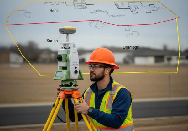
Professional Land Surveying Services in Millard County, Utah
At Ludlow Engineers, land surveying in Millard County establishes clear property lines, documents site conditions, and supports real estate, development, and permitting with technical precision and legal clarity. This guide explains the core surveying services used locally, how they protect property owners and developers, and the tools and workflows surveyors use to meet Millard County Recorder filing requirements. Property owners commonly face unclear deeds, missing corner markers, and development constraints; an accurate survey reduces risk, smooths title transfers, and guides construction decisions. You’ll learn which survey types apply to residential and commercial work, what to expect for costs and timelines, and how to request a quote in Millard County. The guide also provides practical steps and checklists showing how professional surveyors ensure accuracy, comply with recorder standards, and help resolve disputes.
What Are Land Surveying Services in Millard County and Why Are They Essential?
Land surveying in Millard County is the measured process of mapping land to establish boundaries, locate improvements, and produce legal plats and reports that support property transactions and development. Surveys combine deed and records research, field measurements using GPS or total stations, and prepared plats that align with the Millard County Recorder’s filing system to create legally recognized records. Accurate surveys protect owners from boundary disputes, clarify easements, and provide the data lenders and title companies need for closings—making surveys a necessary step before buying, subdividing, or building. Knowing common survey types and their benefits helps property owners choose the right service and plan for costs and timelines on local projects.
Below are the common survey types used in Millard County, brief descriptions, and typical uses in local property and development workflows.
Common land survey services in Millard County include boundary, ALTA/NSPS, topographic, easement, subdivision, and construction staking surveys. Each type addresses specific legal or design needs and produces standard deliverables such as plats, legal descriptions, and control points. These survey services form the technical foundation for real estate closings, subdivision plats, grading plans, and dispute resolution. The next section explains how surveys protect property lines and support transactions by coordinating with title companies and the county recorder.
Surveys protect property boundaries and support real estate transactions by documenting current boundary locations, identifying encroachments or easements, and producing certified plats accepted by lenders and title companies. A certified boundary or ALTA/NSPS survey provides the factual basis for title insurance endorsements and lender requirements, reducing closing delays and unexpected title exceptions. When disputes arise, survey plats and field notes provide evidence used in negotiation, mediation, or court. Clear survey records also streamline recording with the Millard County Recorder’s Office and help avoid rework or filing rejections caused by incomplete or noncompliant plats.
Which Boundary Survey Services Does Ludlow Engineers Provide in Millard County?

Boundary survey services define legal property limits, reconcile deed descriptions with physical evidence, and produce plats suitable for recording or for use in development and permitting. Ludlow Engineers and Associates provides in-house surveying services including title and records research, monument recovery and setting, plat preparation, and coordination for recording with Millard County. We handle everything from small residential lots to large commercial parcels, paying attention to local recorder filing standards and the realities of rural markers. The sections below outline how residential and commercial boundary surveys differ and how subdivision work is typically delivered locally.
How Are Residential and Commercial Boundary Surveys Conducted in Millard County?
Both residential and commercial boundary surveys start with title and deed research to collect prior plats, legal descriptions, and recorder filings that establish the baseline for fieldwork. Field crews then use GPS and total station equipment to locate monuments, improvements, and visible evidence, reconcile those measurements with deed calls, and set or reference control points for future use. Typical deliverables include a sealed plat or map, a written report of findings, and monumentation when required for recordation or construction. Commercial sites often require additional coordination with civil engineering plans and utility mapping so boundary data integrates directly with site design and permitting.
What Is the Process for Subdivision Boundary Surveys in Millard County?
Subdivision boundary surveys turn a land-division concept into a recorded plat that meets county planning and recorder requirements—beginning with feasibility and ending with a recorded final plat. The process includes preliminary layout and coordination with county planning, detailed boundary and topographic mapping, preparation of engineering and plat sheets, and submission for county review and approval. Surveyors coordinate required signatures, easements, and legal descriptions, then prepare final documents for recording with the Millard County Recorder’s Office. Timelines vary with approvals and revisions, so early coordination reduces delays and helps ensure the plat meets local technical standards.
To arrange boundary survey work or get a preliminary assessment in Millard County, contact Ludlow Engineers and Associates by phone at (435) 623-0897 or (435) 210-6072, or visit our office at 1451 S. Main, Nephi, UT. A team member will outline the initial steps, explain necessary documents, and schedule fieldwork or a consultation based on your project.
How Do ALTA Surveys Work in Millard County and When Are They Required?
An ALTA/NSPS survey is a standards-based, detailed survey commonly used for commercial real estate transactions to meet lender, title company, and buyer expectations. ALTA surveys combine boundary determination, improvements location, easements, rights-of-way, and other title-related items into a certified map that follows ALTA/NSPS standards—making them essential for commercial closings and complex financing. In Millard County, ALTA surveys require coordination with local title companies and awareness of recorder filing practices so the final survey aligns with lender requirements and local recording formats.
What Are the Key Features of ALTA/NSPS Surveys in Utah?
ALTA/NSPS surveys include standardized map elements such as precise boundary lines, all visible improvements, easements and rights-of-way, utilities, and the certification language required by lenders and title insurers. These surveys contain a table of assumed bearings, a surveyor’s certification, and notes that identify exceptions or title endorsements. Utah-specific considerations may include referencing county coordinate systems, showing access points on rural parcels, and clarifying recorded subdivision lines for accurate placement. Because ALTA surveys influence title insurance endorsements, surveyors often work directly with title companies to confirm required map items before finalizing the survey.
How Does Ludlow Coordinate ALTA Surveys with Millard County Recorder’s Office?
We coordinate ALTA surveys by confirming title company requirements, completing thorough title research, and preparing plats that meet recorder submission guidelines to reduce review cycles and rejections. Ludlow Engineers communicates anticipated review fees and typical turnaround expectations, submits required documents in the county’s accepted format, and follows up on recorder comments until the survey is recorded. Clear communication with title companies and the Millard County Recorder’s Office helps ensure the survey meets both lender standards and local filing rules, smoothing the closing process and avoiding costly delays.
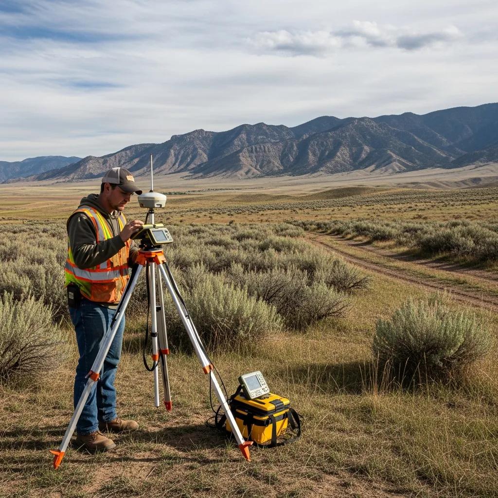
What Are Topographic Surveys and How Are They Used in Millard County Projects?
Topographic surveys map natural and man-made features on a parcel — contours, trees, utilities, structures, and drainage — and provide the elevation and feature data designers and engineers need for site planning and permitting. In Millard County, topo maps guide grading plans, stormwater design, roadway alignment, and placement of improvements for both rural and urban projects, ensuring designs respond to local terrain and drainage. Accurate topo surveys reduce uncertainty in earthwork estimates, support erosion-control plans for permits, and help integrate site design with boundary data. The subsections below describe common development uses and compare measurement technologies used locally.
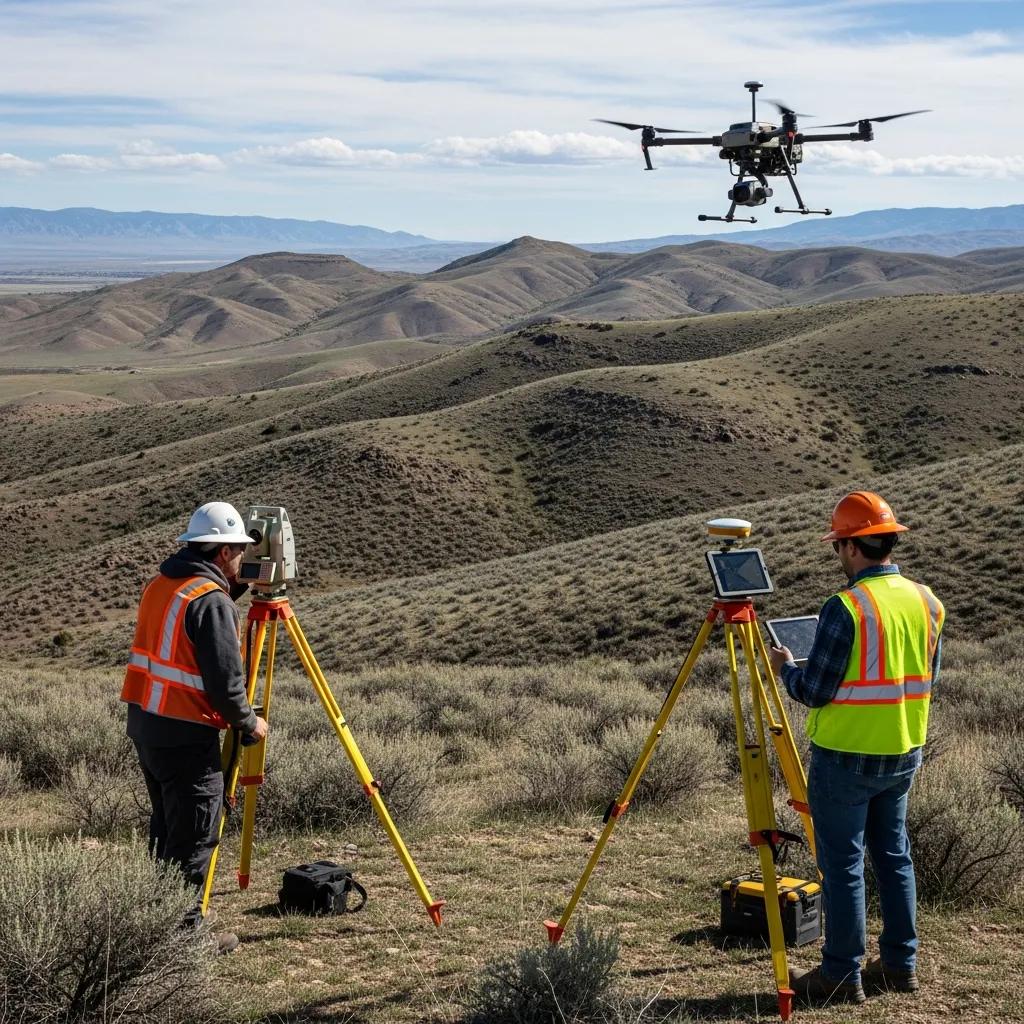
Topographic mapping technology varies by project needs: GPS scanners and total stations deliver precise point data, UAV/drone photogrammetry provides rapid surface mapping, and LiDAR produces dense elevation data for complex terrain. Ludlow Engineers selects technology based on required accuracy, parcel size, vegetation cover, and budget, combining ground control with aerial methods when appropriate. The table below summarizes common technologies, what they measure, and typical Millard County applications to clarify trade-offs between speed and accuracy.
This technology comparison helps property owners and designers choose the right survey approach based on accuracy needs, terrain, and budget. Understanding measurement trade-offs leads naturally into how topo data informs land development and construction decisions.
How Do Topographic Surveys Assist in Land Development and Construction?
Topographic surveys supply the elevation data and feature mapping designers need to prepare grading plans, design drainage systems, estimate cut-and-fill volumes, and locate roads and utilities. On rural residential lots, topo data helps identify suitable building pads and potential drainage impacts; for larger developments it supports engineering design and permitting for roads, stormwater, and utilities. Reliable topo information reduces costly redesigns by integrating site constraints early in the planning phase, streamlining permitting and enabling dependable earthwork estimates.
What Technologies Does Ludlow Use for Accurate Topographic Mapping in Millard County?
Ludlow Engineers uses a mix of GPS/RTK control, total station surveys, UAV photogrammetry, and LiDAR depending on project scale and precision needs, combining methods to balance speed and accuracy. For small residential sites, total stations often deliver the needed precision; for larger or remote parcels, UAV surveys with ground control provide fast, cost-effective coverage. LiDAR is employed for complex drainage and terrain modeling where dense elevation sampling is required. Selecting the right tools ensures deliverables meet engineering needs and county filing expectations while optimizing project cost and schedule.
How Can Residential and Commercial Landowners Benefit from Local Surveyors in Millard County?
Hiring a local surveyor in Millard County gives you knowledge of county filing norms, familiarity with rural monumentation practices, and faster coordination with local authorities and title companies. Local surveyors understand regional realities like sparse monuments, long property lines, and specific recorder expectations, which reduces rework and speeds recording. Property owners gain clearer timelines, recordable plats and stamped reports, and practical advice for development or dispute prevention. The paragraphs below outline homeowner expectations and commercial uses so different clients see how tailored survey services help their specific needs.
What Should Residential Property Owners Expect from a Land Survey in Millard County?
Homeowners can expect a process that starts with deed and title research, moves to field measurements to locate boundary evidence and improvements, and concludes with a sealed plat and a written report explaining the findings. Key cost and time drivers include parcel size, rural access, the complexity of historical corner searches, and whether monumentation is needed. Homeowners should have deeds, parcel IDs, and any prior surveys available to speed research. Understanding the process and required documents helps homeowners plan next steps for building or selling.
How Do Commercial Land Surveys Support Business Development and Compliance?
Commercial surveys support financing, permitting, site design, and due diligence by delivering ALTA surveys for transactions, topographic surveys for site design, and boundary surveys for land control. These surveys feed directly into civil engineering plans, environmental assessments, and permit submissions, ensuring compliance and technical needs are addressed early. For developers, integrated surveying services reduce coordination overhead between survey data and engineering design, produce reliable cost estimates, and help keep project schedules tight. Clear deliverables also simplify discussions with lenders and title companies during acquisition and financing.
What Are the Typical Costs and Timelines for Land Surveying Services in Millard County?
Survey costs and timelines in Millard County vary by survey type, parcel size, terrain, access, and recorder review times. Understanding these drivers helps you set realistic expectations for budget and schedule. Costs reflect field hours, required monumentation, title research complexity, and mapping accuracy, while timelines include research, fieldwork, drafting, review, and recorder processing. The table below gives typical cost ranges and timeline expectations for common survey types to help with initial planning and budgeting.
These ranges provide a starting point for budgeting and scheduling; exact pricing depends on parcel characteristics and scope. The next section gives a concise breakdown of the factors that determine boundary survey costs and the phases that affect total duration.
How Much Does a Property Boundary Survey Cost in Millard County?
A typical property boundary survey in Millard County falls across a range driven by parcel size and complexity. Factors that raise cost include extensive historical research, long distances between corners, difficult access or terrain, and required monumentation. Small, accessible residential lots generally sit at the lower end of the range, while large rural parcels with sparse monuments and complex deed histories require more field time and research. Knowing these drivers helps owners anticipate costs and choose the appropriate survey scope for recordation, sale, or construction. Providing deeds or prior plats up front can reduce research time and cost.
How Long Does a Land Survey Take from Start to Finish in Millard County?
Survey timelines typically follow phases: title and records research (several days to two weeks), fieldwork (one to several days depending on size), drafting and QA (several days), and recorder review or client revisions (one to several weeks). Seasonal factors and recorder office workload can extend timelines, especially for complex plats requiring county review or re-submission. Early coordination with local authorities and providing historical documents reduces delays. Expect most residential boundary surveys to complete in one to four weeks, while subdivision plats and ALTA surveys may take several additional weeks due to coordination and recording steps.
How Does Ludlow Engineers Ensure Accuracy and Compliance in Millard County Land Surveys?
Ludlow Engineers maintains accuracy and compliance through a defined quality-assurance workflow that combines licensed personnel, documented control procedures, and direct coordination with Millard County filing requirements. Our in-house surveyors and engineers perform staged QA checks from pre-field research through final drafting to ensure deliverables meet ALTA/NSPS and recorder standards. The table below outlines quality-control steps, responsible parties, and expected outcomes so you can see how the process produces compliant, recordable survey products.
Those QA steps create clear checkpoints that align technical accuracy with local filing expectations, lowering the chance of recorder revisions and producing legally defensible deliverables.
What Local Regulations and Recorder’s Office Requirements Affect Land Surveys in Millard County?
Millard County filing requirements typically include sealed plats or maps with the surveyor’s certification, legal descriptions, monumentation notes, and any signature blocks or dedication language required by the recorder. Surveyors must follow county-specific map scale preferences, coordinate system references, and any notarization or review-fee disclosures to avoid rejections. Accounting for these local expectations during drafting reduces resubmission cycles and speeds final recording. Choosing a local firm with recorder experience delivers practical advantages for compliant surveys.
Why Choose Ludlow Engineers for Reliable Land Surveying in Millard County?
Ludlow Engineers and Associates combines licensed in-house surveyors and civil engineers with a local focus on serving rural Utah property needs. We deliver plats and reports aligned with county filing practices and guide clients from initial research through final recording. Our coordinated approach integrates survey data with civil engineering needs for development, providing a single point of contact for technical coordination. Clients benefit from practical, locally informed solutions that address both technical accuracy and county-specific administrative requirements.
To request a consultation or schedule work with Ludlow Engineers and Associates, call (435) 623-0897 or (435) 210-6072, or stop by 1451 S. Main, Nephi, UT. Our staff will outline next steps, list required documents, and provide an expected timeline for your Millard County survey.
What Are Common Property Disputes in Millard County and How Can Surveys Resolve Them?
Common property disputes in Millard County include boundary-line disagreements, encroachments by structures or fences, and unclear easement locations that affect access or utility maintenance. Surveys resolve these conflicts by producing measured evidence that reconciles deeds, physical monuments, and current conditions into an authoritative map and report. When disputes escalate, a certified survey and written recommendations provide the factual basis used in negotiation, mediation, or court. The subsections below explain how boundary surveys work in dispute settings and how easement surveys aid land-use resolution.
How Do Boundary Surveys Help Prevent and Settle Property Line Disputes?
Boundary surveys help prevent disputes by clearly documenting property lines, showing monuments and improvements, and noting encroachments or historical evidence that affect the boundary. When disagreements arise, the surveyor’s sealed plat and field notes supply objective data that parties and their advisors can use to negotiate or present in court. Surveys establish facts while legal counsel interprets deeds and rights, so pairing a professional survey with legal advice often shortens dispute resolution and lowers the likelihood of future conflicts.
What Role Do Easement and Zoning Surveys Play in Millard County Land Use?
Easement and zoning surveys identify access rights, utilities, and restrictions that affect how land may be used, helping property owners, developers, and authorities confirm compliance and maintenance responsibilities. Easement surveys clarify maintenance corridors, right-of-way widths, and whether improvements overlap easement areas—critical information for permitting and neighbor disputes. Zoning-related surveys support variance requests, building permits, and compliance checks by mapping setbacks, lot coverage, and other regulated features. Clear mapping of easements and zoning constraints informs development planning and reduces regulatory delays.
How Can You Request a Land Survey Quote or Consultation in Millard County?
Requesting a land survey quote in Millard County is most efficient when you prepare basic property information and follow a simple contact process that lets surveyors scope work and price it accurately. A three-step approach speeds responses and reduces follow-ups. The steps below explain what to provide and what to expect when you request a quote from a professional survey provider.
- Gather property documents: Provide the parcel ID, deed or legal description, any prior surveys, and the property address if available.
- Describe the scope: Tell us whether you need a boundary, ALTA, topographic, subdivision, or construction staking survey and note any special site conditions.
- Contact the surveyor: Call to discuss scope and scheduling, then provide documents for review so the surveyor can deliver a written estimate.
Having these items ready shortens response time and improves quote accuracy. The next section lists the specific documents and details that help get a precise estimate.
What Information Is Needed to Get an Accurate Land Survey Quote?
To get an accurate quote, provide the parcel identification number or legal description, copies of deeds or prior surveys, and a clear statement of the deliverable you need (for example, a recordable boundary plat, ALTA survey, or topographic map). Let us know access conditions, the presence of fences or structures, and any construction timelines that affect scheduling. That information lets the surveyor estimate field hours, research time, and drafting complexity, which together determine price and timeline. Preparing documents ahead of contact streamlines the quoting process and reduces the chance of scope changes later.
How to Contact Ludlow Engineers for Land Surveying Services in Millard County?
When you’re ready to proceed, contact Ludlow Engineers and Associates by phone at (435) 623-0897 or (435) 210-6072, or visit our office at 1451 S. Main, Nephi, UT to set up an initial consultation. Expect a conversation about the property, a request for available deeds or prior surveys, and a proposed scope with an estimated timeline. Our team will outline next steps, coordinate any required county interactions, and schedule fieldwork once the scope is confirmed and any deposit or authorization is provided. Clear documents and a concise scope at first contact speed the process and lead to a timely, accurate quote.
Frequently Asked Questions
What types of land surveys are most commonly requested in Millard County?
The most commonly requested surveys in Millard County are boundary surveys, ALTA/NSPS surveys, topographic surveys, and subdivision surveys. Boundary surveys establish property lines and resolve disputes; ALTA/NSPS surveys are important for commercial transactions. Topographic surveys provide elevation and feature data for site planning, and subdivision surveys facilitate dividing land into smaller parcels. Each type serves specific legal or design needs for property owners and developers.
How can I ensure my land survey meets local requirements?
Work with a licensed surveyor familiar with Millard County’s regulations and filing standards. Provide all available documents—previous surveys, deeds, and parcel information—to assist accurate research. Confirm that the surveyor’s deliverables include required elements such as sealed plats, legal descriptions, and monumentation notes. That proactive approach reduces the risk of recording delays and ensures compliance with local rules.
What is the role of technology in modern land surveying?
Technology improves accuracy and efficiency in modern surveying. Surveyors use GPS, total stations, UAVs (drones), and LiDAR to collect precise data quickly. These tools enable rapid terrain mapping, detailed elevation models, and efficient processing of large areas. By using the right technology for the job, surveyors deliver high-quality results while managing time and costs effectively.
What should I do if I need to dispute a property boundary?
Start by reviewing the survey results and supporting documentation, then discuss concerns with the surveyor to understand their findings and methods. If needed, consider an independent survey for a second opinion. If the dispute remains unresolved, consult legal counsel to explore mediation or court options; surveys provide the factual evidence used in those processes.
How do land surveys assist in property development projects?
Land surveys supply critical information about property boundaries, topography, and existing features that informs site planning, zoning compliance, and engineering design. Accurate survey data identifies potential issues early, reducing the risk of redesigns and permitting delays. Integrating survey information with development plans streamlines permitting and improves project feasibility and cost predictability.
What factors influence the cost of a land survey in Millard County?
Costs depend on survey type, parcel size, terrain complexity, and access conditions. Other factors include the amount of historical research required and whether monumentation is necessary. More complex surveys and larger parcels typically cost more. Understanding these factors helps property owners set realistic budgets and expectations.
Can I use a survey from another state for my property in Millard County?
Generally, surveys prepared under another state’s standards are not recommended for Millard County property because each state has its own regulations and filing practices. Local requirements—such as certification language and filing formats—may not be met by an out-of-state survey. It’s best to hire a licensed surveyor familiar with Millard County rules to ensure compliance and acceptance for recording.
**