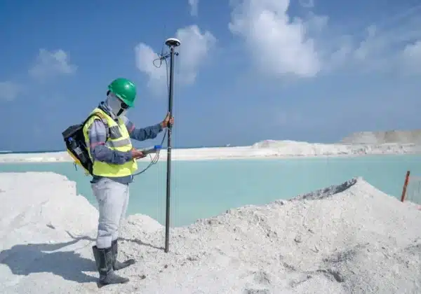
Planning and designing a site requires careful consideration and understanding of the land you’re working with. One crucial element of this process is the property survey. In this blog, we’ll explore what property surveys are and how they significantly influence the planning and design phases of a site to ensure successful development.
What Is a Property Survey?
A property survey provides a detailed overview of the boundaries and features of a piece of land. This vital document outlines measurements, angles, and other topographical details, serving as a foundation for any further planning and development.
Property surveys are indispensable tools in the initial phase of site planning. They extend beyond mere boundary identification and offer a comprehensive map of existing natural and man-made features, enabling developers to make informed decisions.
Not only do property surveys highlight legal boundaries, they also reveal easements and rights-of-way that may affect the planned use of the land. This foresight is critical in mitigating potential conflicts with neighbors or local governing bodies.
Identifying Boundaries and Legal Rights
Understanding the exact boundaries of a property is critical. Surveys help prevent legal disputes by clearly defining property lines and ensuring compliance with zoning laws.
In today’s intricate property market, clearly marking property limits is more crucial than ever. Disputed boundaries can lead to significant delays and additional costs, which is why detailed surveys are key to a seamless development process. They imbed legal certainty into property transactions and pave the way for harmonious neighborhood development.
Moreover, legal descriptions from surveys can prevent costly disputes. Confirmation of rightful ownership and usage rights enhances project viability and secures investor confidence.
Assessing Site Features and Constraints
Surveys reveal important natural features and potential constraints like slopes, water bodies, and vegetation. These factors must be considered to optimize design and functionality.
The integration of site-specific data into the planning phase is what crafts a truly effective site design. Surveyors collect extensive data on everything from trees to topology. Recognizing these elements early on can help in adapting designs that not only fit but thrive in the local environment.
Features such as steep slopes or wetlands revealed by a thorough survey may necessitate strategic planning solutions like terracing or buffer zones, which are essential for sustainable and resilient development. By using the information garnered from surveys, planners can ensure that a project is well-suited to its location and compliant with environmental regulations.
Ensuring Compliance with Local Regulations
Local regulations often dictate the use and development of land. Surveys ensure that site plans adhere to these rules, avoiding costly fines and project delays.
Regulations may include zoning laws, which suggest what can and cannot be built in an area. Through surveys, stakeholders gain vital knowledge ensuring the site development respects every decree from municipal to federal levels, thus preempting any bureaucratic hurdles.
The value of surveys in regulatory compliance is indisputable. Developers can navigate smoothly through planning approvals by demonstrating that their plans respect existing zoning ordinances, ultimately fostering an environment conducive to efficient project execution and completion.
Mitigating Risks and Unforeseen Challenges
Uncovering potential risks such as flood zones or unstable soil early in the process can save both time and money. Surveys provide the critical data needed to address these challenges proactively.
Property surveys not only highlight environmental risks but also draw attention to legal restrictions, such as protected areas or historical sites which could impede development. Identifying these challenges ahead of time through surveys allows developers to amend plans accordingly, ensuring a smoother build process.
Imagine the costs avoided by adjusting design plans now rather than reacting to unforeseen issues mid-construction. From soil tests indicating poor load capacity to flood predictions warranting water management installations, property surveys arm projects with foresight, reducing risks substantially.
Why Property Surveys Are Essential for Successful Site Development
Incorporating property surveys into site planning and design is not just beneficial—it’s essential. They provide crucial data that supports informed decision-making, ensuring compliance with regulations and mitigating risks. By understanding contours, boundaries, and potential hazards, developers can create designs that are both practical and sustainable. For more insights into optimizing your site planning, visit our homepage.


