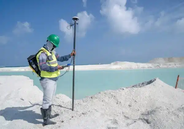
Construction surveying is a vital component of successful infrastructure projects, acting as the foundation for precise planning and execution. With its roots grounded in historical practice and modern techniques, construction surveying involves the measurement and mapping of the environment. This ensures that all construction processes run smoothly, are accurately planned, and executed with precision. This blog explores the fundamental aspects of construction surveying, aiming to provide a comprehensive understanding of its importance and the methodologies employed.
The Role of Construction Surveying
Construction surveying establishes precise reference points and markers that guide construction as engineers and architects visualize and bring projects to life. It is pivotal for ensuring buildings are constructed in their correct locations and meet design specifications. By setting these benchmarks, construction surveyors provide a crucial link between design and physical execution, ensuring that the projects progress according to plan. Whether it’s ensuring that a new skyscraper sits perfectly aligned or that a highway curves precisely as designed, construction surveying is the invisible force that ensures everything fits together seamlessly. This process has evolved from simple tools like compasses and chains to more sophisticated instruments, yet the fundamental objective remains consistent — transforming concepts into reality with absolute accuracy.
Surveying is intricately tied into every stage of construction, from the feasibility studies and design phases through to completion and maintenance of a project. It allows for the efficient use of resources by providing necessary data that informs decision-making processes. For example, before any ground is broken, a land survey can determine potential zoning issues or natural features that require consideration 15 Reasons Land Surveying is Crucial. Without this step, projects might face legal battles or environmental challenges that could have been mitigated with proper foreknowledge. This proactive approach not only prevents delays but also guarantees a seamless transition from blueprint to build, thus safeguarding project investments.
Moreover, construction surveying aids in ensuring compliance with regulations and standards 7 Common Construction Surveying Mistakes. This is increasingly vital as urban developments demand adherence to strict safety and environmental protocols. Surveyors’ precise data collection helps architects and civil engineers design infrastructures that not only meet aesthetic demands but also sustain functional reliability. Whether dealing with the complexities of boundary disputes or the nuances of slopes and gradients, surveyors ensure that all statutory and safety aspects are adhered to, thus avoiding potential pitfalls and legal entanglements during or post-construction.
Key Techniques and Tools
There are several tools and techniques involved in construction surveying. Traditional tools like theodolites, total stations, and levels have been staples of the profession due to their durability and reliability. Theodolites, for instance, are crucial for measuring angles with precision, which is essential in laying out accurate structures and determining boundary lines What Tools Are Used in Construction Surveying?. Total stations combine electronic distance measurement with angle recording, enabling surveyors to capture a site’s topographical details efficiently. Their ability to store data digitally reduces human error and enhances accuracy during field operations.
In recent years, advancements in technology have introduced modern tools such as GPS systems and drones that significantly enhance surveying practices. GPS technology allows for pinpoint accuracy in location data, proving invaluable for large-scale projects like roadways and urban developments, where precise geolocation is critical Survey Control For Construction. Meanwhile, drones provide aerial views, enabling surveyors to map and analyze vast areas from vantage points previously unattainable safely or feasibly. Such technology not only speeds up the surveying process but also allows for data capture in environments that might otherwise be deemed too hazardous for traditional surveying methods.
Additionally, software like CAD (Computer-Aided Design) and GIS (Geographic Information Systems) have become essential in construction surveying. These platforms facilitate the interpretation of collected data into detailed maps and models, ensuring that intricacies of spatial data are understood and applied effectively. CAD software allows for the creation of detailed 3D designs that can influence project costs and timelines by predicting potential issues early on. GIS provides a spatial understanding that is crucial in assessing land use and planning sustainable developments Construction Surveying – Mistakes and Techniques.
The Cornerstone of Modern Construction
In conclusion, construction surveying is an indispensable element in the field of construction that ensures the accurate execution of projects. By understanding the foundational principles and methodologies of construction surveying, stakeholders can better appreciate its value and necessity in executing flawless construction projects. Its careful integration into planning and design underscores the importance of accuracy and precision in building enduring structures. As technology evolves, the practices for surveying will continue to advance, further enhancing the efficiency and effectiveness of construction projects worldwide.


